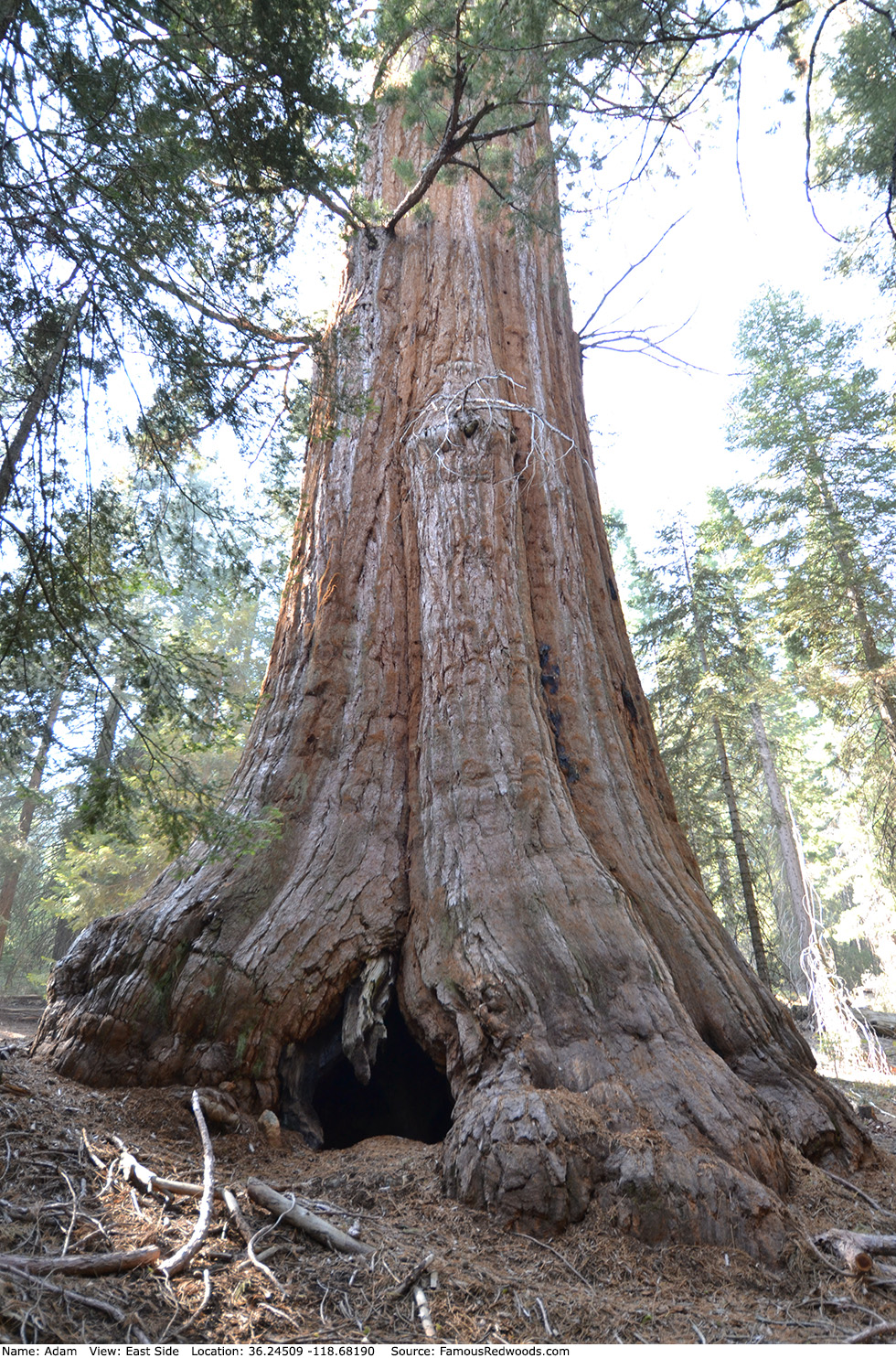
| Height: | 247.40+ ft | (75.41+ m) | Elevation: | 6,755 ft (2,059 m) | GPS Latitude: | 36.24509 |
| Volume: | 35,017 ft3 | (992 m3) | River: | North Fork Middle Fork Tule River | GPS Longitude: | -118.68190 |
| Width: | 22.95 ft | (7.00 m) | Grove: | Mountain Home Grove | Discovery Date: | 1884 |
| Age: | Park: | Giant Sequoia NM | Discovered By: | Jesse Hoskins |
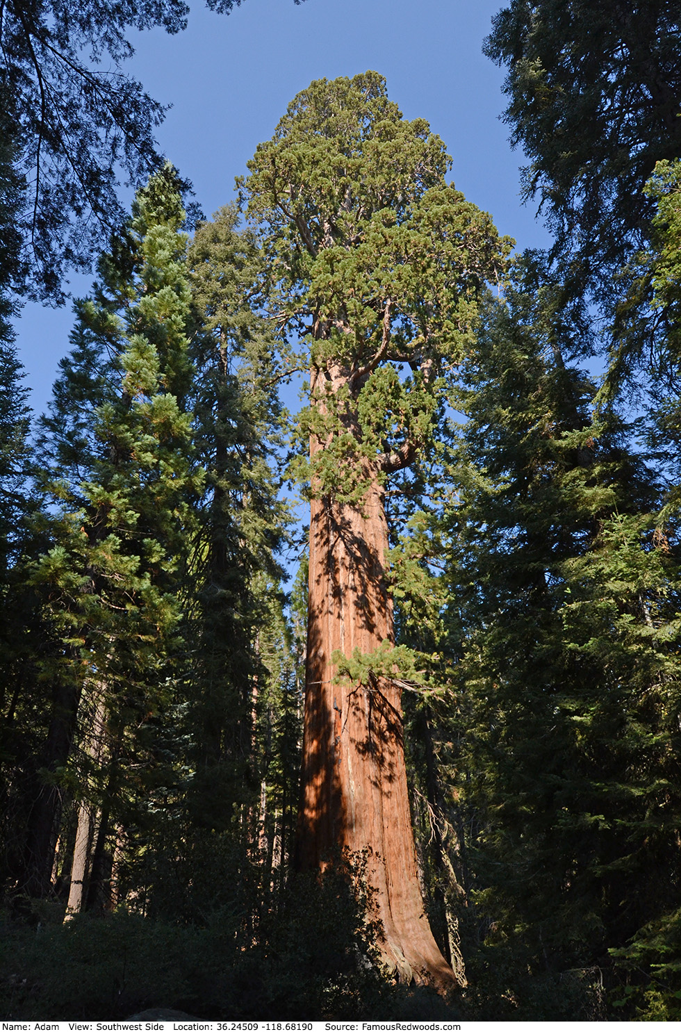
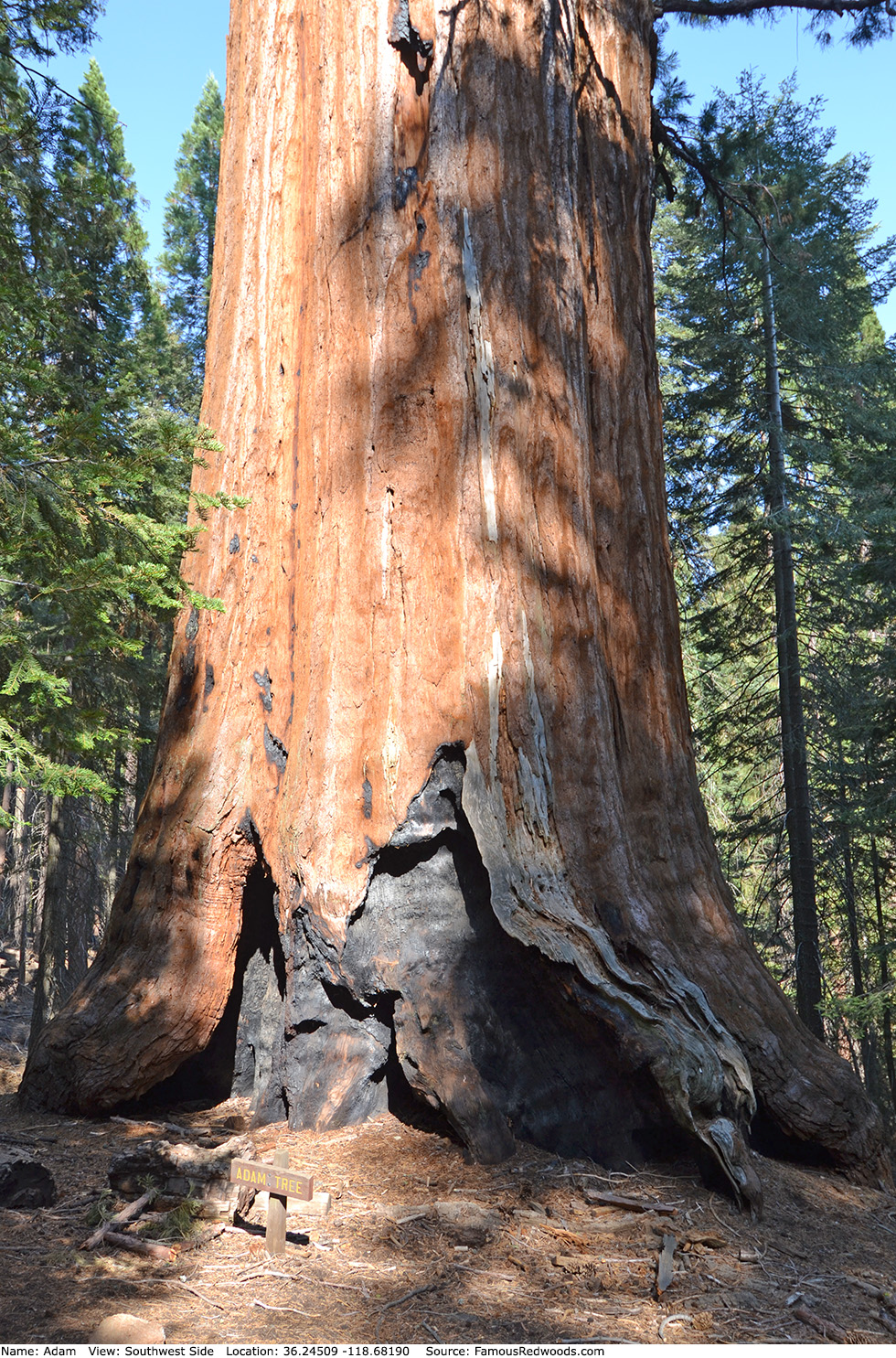
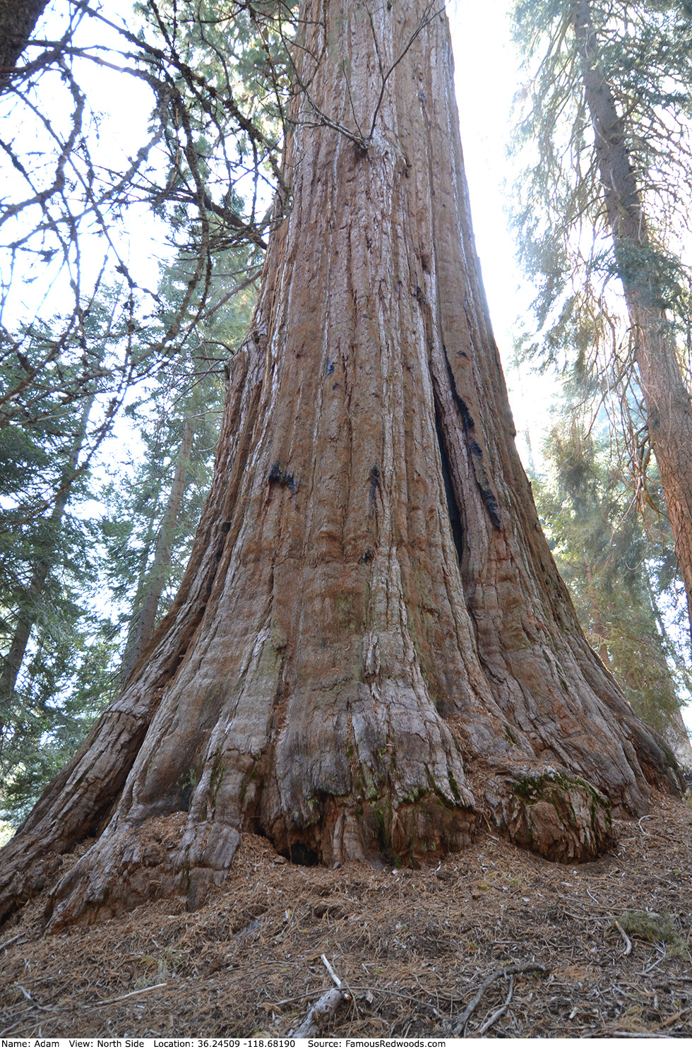
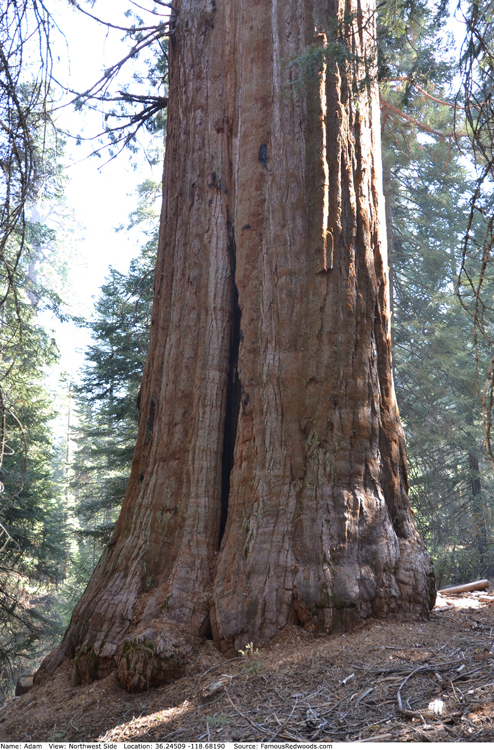
Notes: Adam is the world's 21st largest tree, the 19th largest giant redwood, the 5th largest tree in Giant Sequoia National Monument, and the 2nd largest tree in Mountain Home Grove. Rancher Jesse Hoskins named the tree after Adam, the first man on Earth and father of humankind, from the Book of Genesis in the Old Testament.
Drive: Adam is 232 mi (373 km) southeast of San Francisco near the city of Porterville.
Northbound: From U.S. Interstate 5 North, transfer to California State Route 99 North. From California State Route 99 North just north of Bakersfield, transfer to California State Route 65 North toward Porterville. Near Porterville, transfer to California State Route 190 East.
Southbound: From U.S. Interstate 5 South in Sacramento, transfer to U.S. Highway 50 East toward South Lake Tahoe. Drive east 1.7 mi (2.7 km) on U.S. Highway 50 and transfer to California State Highway 99 South. Near Tipton, transfer to California State Route 190 East toward Porterville.
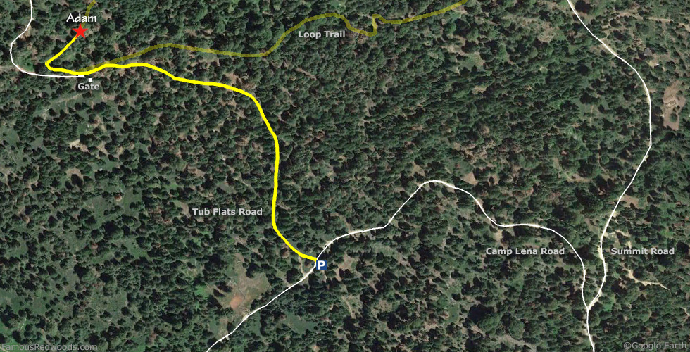
From Porterville, drive east 17 mi (27 km) on California State Route 190 toward Springville. Just past Springfield, turn left onto Balch Park Road toward Scicon, Balch Park, and Mountain Home State Forest. Drive north 3.4 mi (5.5 km) on Balch Park Road and turn right onto Bear Creek Road toward Scicon, Balch Park, and Mountain Home Demonstration State Forest. Drive east 15 mi (24 km) on Bear Creek Road, past Methuselah Group Campground, and veer right at the next fork in the road onto Summit Road toward Shake Camp Campground. Drive north 2.6 mi (4.2 mi) on Summit Road, past Oliver Twist and Summit Road trees, and veer left onto Camp Lena Road toward Centennial Stump. Drive west 0.4 mi (0.6 km) on Camp Lena Road to the parking spot, near 36.24169 -118.67783, at the intersection with Tub Flats Road.
Road Warning: Tub Flats Road is a narrow, bumpy, unpaved road. Low-clearance 2-wheel-drive vehicles are not recommended. Use a high-clearance truck or sport utility vehicle instead or park near the intersection with Camp Lena Road and walk north on Tub Flats Road toward Adam.
Navigation System Warning: Many computer, smartphone, and car navigation systems instruct you to turn left/north onto Rancheria Fire Road (a gated, narrow, and unpaved road) from Bear Creek Road to get to Mountain Home Demonstration State Forest. Ignore those instructions and continue driving on Bear Creek Road instead. Those same navigation systems may also instruct you to bypass Bear Creek Road altogether and to take Balch Park Road to the northern entrance of Mountain Home Demonstration State Forest. Avoid that route from Springville because it adds more than 6 mi (10 km) and 30 min of driving one-way.

Hike: From the parking spot, hike north 0.4 mi (0.6 km) on Tub Flats Road toward Adam, past a gated road on your left, to the point where Loop Trail meets the road on your right near 36.24445 -118.68213. Leave the road here and hike west and then north 0.1 mi (0.2 km) on Loop Trail, across a small creek, to Adam.
| Rating: | Easy | One-Way Distance: | 0.5 mi | (0.8 km) | Ascent: | 47 ft | (14 m) |
| Time: | 15 min | Off-Trail: | 0 mi | (0 km) | Descent: | 183 ft | (56 m) |
View Adam Tree location in Google Maps
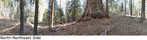
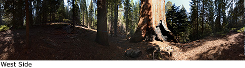
Panoramas: Click panoramas to take a virtual tour of Adam Tree
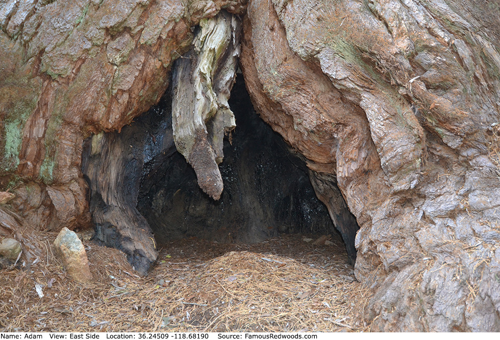
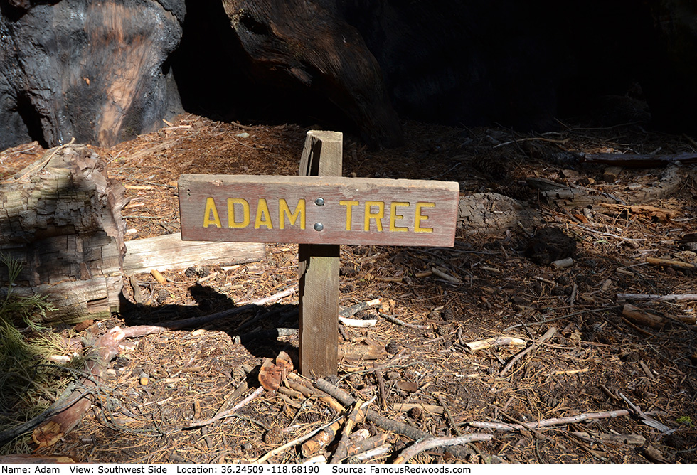
Photos: Pictures of Adam Tree taken from different sides