| Height: | Elevation: | 402 ft (123 m) | GPS Latitude: | 41.40381 | ||
| Volume: | Creek: | Prairie Creek | GPS Longitude: | -124.03178 | ||
| Width: | Grove: | Goethe Grove | Discovery Date: | April 1, 2012 | ||
| Age: | Park: | Prairie Creek Redwoods SP | Discovered By: |
Notes: Oympian, also known as The Emissary, is a multi-stem coast redwood with a combined basal diameter of nearly 42 ft (13 m).
Drive: Olympian is 265 mi (426 km) north of San Francisco near the community of Orick.
From U.S. Highway 101 just north of Orick, take exit 753 Newton B. Drury Scenic Parkway. Drive north 4.4 mi (7.1 km) on Newton B. Drury Scenic Parkway, past Gamato, and park near the sign for Edward C. Wagner Memorial Grove on the left/west side of the road.
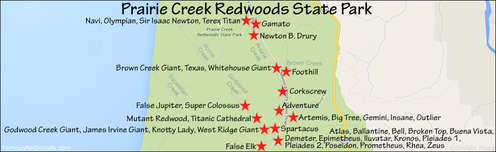
Hike: From the Edward C. Wagner Memorial Grove sign, walk past the Prairie Creek north sign and follow the trail to the junction with Karl Knapp Trail (formerly known as Prairie Creek Trail). Turn left at the trail junction and hike south 0.4 mi (0.6 km) on Karl Knapp Trail to the trail exit point near 41.40398 -124.03107. Turn right/west here to catch a first glimpse of Olympian then hike west/uphill 170 ft (52 m) off-trail to the tree.
| Rating: | Easy | One-Way Distance: | 0.5 mi | (0.8 km) | Ascent: | 169 ft | (52 m) |
| Time: | 10 min | Off-Trail: | 170 ft | (52 m) | Descent: | 10 ft | (3 m) |

View Olympian Tree location in Google Maps
Panorama: Click panorama to take a virtual tour of Olympian Tree

Photos: Pictures of Olympian Tree taken from different sides


