
| Height: | Elevation: | 154 ft (47 m) | GPS Latitude: | 41.78448 | ||
| Volume: | Creek: | Jordan Creek | GPS Longitude: | -124.14020 | ||
| Width: | Grove: | Metcalf Grove | Discovery Date: | |||
| Age: | Park: | Jedediah Smith Redwoods SP | Discovered By: |
Notes: Mojo is a coast redwood with an irregular, burl-covered base similar to that of Mutant Redwood in Praire Creek Redwoods State Park.
Nearby famous redwoods include Boy ScoutBuffalo ChipChesty PullerChurch TreeDel Norte TitanElk HerdEl Viejo del NorteFeslerHail StormHowland Hill GiantJuggernautJupiterLost MonarchNew HopeSacagaweaScreaming TitansStout
Drive: Mojo is 291 mi (468 km) north of San Francisco near Crescent City.
Northbound: From U.S. Highway 101, just south of Crescent City, turn right onto Humboldt Road. Drive north 1.5 mi (2.4 km) on Humboldt Road and turn right onto Howland Hill Road. Drive east 3.1 mi (5.0 km) on Howland Hill Road, past Howland Hill Giant, to the Boyscout Tree Trailhead, located at 41.76856, -124.11022.


Southbound: From U.S. Highway 101, just south of Crescent City, turn left onto Elk Valley Road. Drive east 1.1 mi (1.8 km) on Elk Valley Road and turn right onto Howland Hill Road. Drive east 3.6 mi (5.8 km) on Howland Hill Road, past Howland Hill Giant, to the Boyscout Tree Trailhead, located at 41.76856, -124.11022.


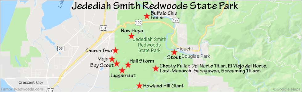
Hike: From the trailhead, hike northwest 2.6 mi (4.2 km) on Boy Scout Tree Trail to Fern Falls. Near Fern Falls, Hike uphill/northwest 175 ft (53 m) to Mojo.

| Rating: | Easy | One-Way Distance: | 2.6 mi | (4.2 km) | Ascent: | 359 ft | (109 m) |
| Time: | 1 hr 20 min | Off-Trail: | 175 ft | (53 m) | Descent: | 554 ft | (169 m) |

View Mojo Tree location in Google Maps
Photos: Pictures of Mojo Tree taken from different sides


