| Height: | 356.40+ ft | (108.63+ m) | Elevation: | 400 ft (122 m) | GPS Latitude: | 41.80079 |
| Volume: | Creek: | Clarks Creek | GPS Longitude: | -124.11913 | ||
| Width: | 15.91 ft | (4.85 m) | Grove: | National Tribute Grove | Discovery Date: | April 1998 |
| Age: | Park: | Jedediah Smith Redwoods SP | Discovered By: | Stephen C. Sillett | ||
| Michael W. Taylor |
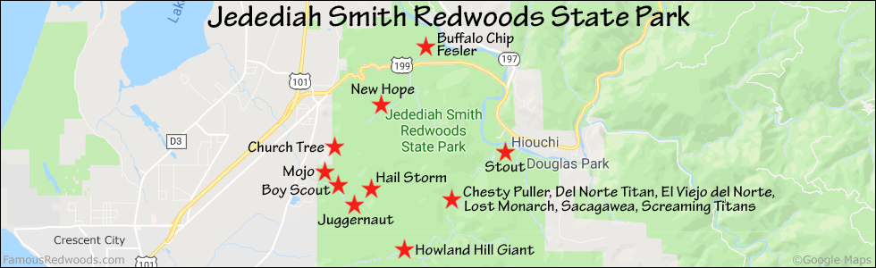
Notes: New Hope is the tallest tree in Jedediah Smith Redwoods State Park. Cal Poly Humboldt forestry professor Stephen C. Sillett and naturalist Michael W. Taylor named the tree New Hope because, when discovered, it offered new hope of finding other redwood titans nearby. One month later, on May 11, 1998, Sillett and Taylor discovered the Grove of Titans, near Mill Creek, less than 2 mi (3 km) southeast of New Hope.
Drive: New Hope is 292 mi (470 km) north of San Francisco near Crescent City.
Northbound: From U.S. Highway 101, 5 mi (8 km) north of Crescent City, take exit 794 to U.S. Highway 199. Drive east 2.6 mi (4.2 km) on U.S. Highway 199.
Southbound: From U.S. Highway 101, 5 mi (8 km) north of Crescent City, turn left onto Elk Valley Cross Road. Drive southeast 0.3 mi (0.5 km) on Elk Valley Cross Road and turn left onto U.S. Highway 199. Drive east 2.1 mi (3.4 km) on U.S. Highway 199.
Park at a turnout on the left/north side of the road, near 41.81026 -124.11156, just past the bridge over Clarks Creek and 0.2 mi (0.3 km) west of the intersection with Walker Road.
Hike: GPS-assisted navigation is recommended for this hike. From the turnout, hike west 300 ft (91 m) along U.S. Highway 199, across the bridge over Clarks Creek, to the road exit point near 41.80991 -124.11257. Turn left/south here, and, using a GPS device, hike south 0.8 mi (1.3 km) off-trail, following the western side of Clarks Creek past Jupiter, to New Hope. After visiting New Hope, hike northeast 0.4 mi (0.6 km) off-trail to Jupiter.
| Rating: | Difficult | One-Way Distance: | 0.9 mi | (1.4 km) | Ascent: | 265 ft | (81 m) |
| Time: | 2 hr | Off-Trail: | 0.8 mi | (1.3 km) | Descent: | 159 ft | (48 m) |

View New Hope Tree location in Google Maps
Photos: Pictures of New Hope Tree taken from different sides

