| Height: | 299.21+ ft | (91.20+ m) | Elevation: | 180 ft (55 m) | GPS Latitude: | 41.36683 |
| Volume: | 25,557 ft3 | (724 m3) | Creek: | Boyes Creek | GPS Longitude: | -124.01611 |
| Width: | 22.34 ft | (6.81 m) | Grove: | Atlas Grove | Discovery Date: | 1991 |
| Age: | 1,272 y | Park: | Prairie Creek Redwoods SP | Discovered By: | Michael W. Taylor |
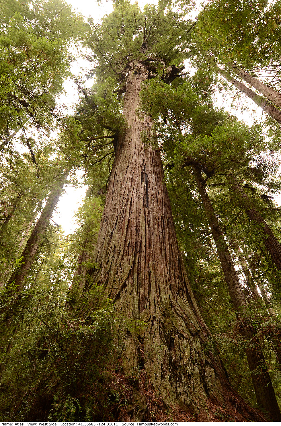
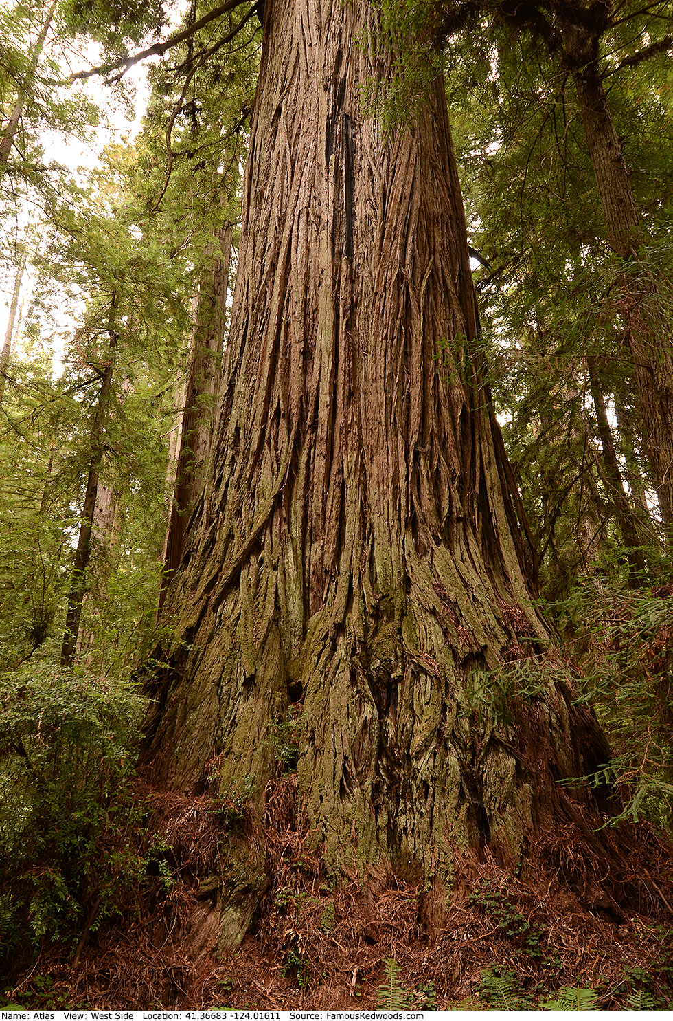
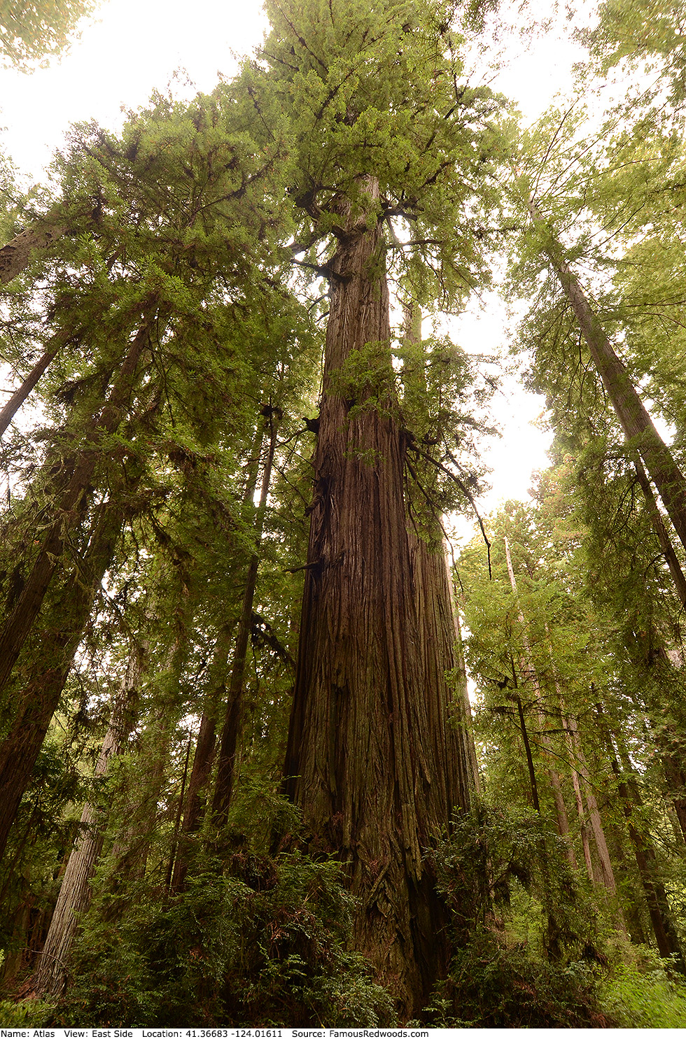
Notes: Atlas is the 26th largest coast redwood, the 14th largest tree in Prairie Creek Redwoods State Park, and the 2nd largest tree in Atlas Grove. Atlas is also the 2nd fastest-growing redwood yet measured; it gained an average of 1,698 lb (770 kg) aboveground biomass each year during a recent decade.
Cal Poly Humboldt forestry professor Stephen C. Sillett named the tree after the Greek Titan Atlas, god of astronomy and navigation, brother of Epimetheus and Prometheus, and father of The Pleiades, who held the Heavens on his shoulders. The main trunk of Atlas splits into three enormous branches 190 ft (58 m) above ground, and the crotch in-between supports a soil mat over 3 ft (1 m) thick.
University of Washington forestry assistant professor Robert Van Pelt published an orthographic illustration of Atlas.
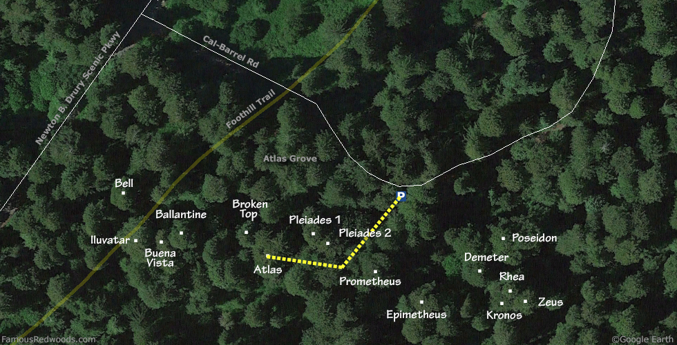
Drive: Atlas is 262 mi (422 km) north of San Francisco near the community of Orick.
From U.S. Highway 101 just north of Orick, take exit 753 Newton B. Drury Scenic Parkway. Drive north 1.5 mi (2.4 km) on Newton B. Drury Scenic Parkway to Cal-Barrel Road. Turn right onto Cal-Barrel Road, drive east 650 ft (198 m), and park just before the road turns left through a gate.
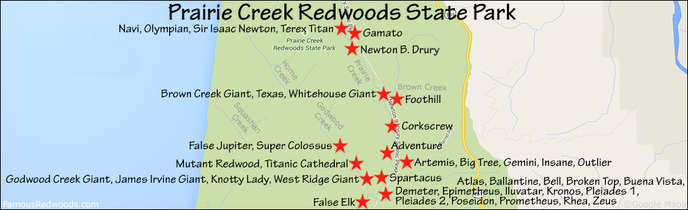
Hike: From the parking area, hike southwest 260 ft (79 m) off-trail to Atlas.
| Rating: | Easy | One-Way Distance: | 260 ft | (79 m) | Ascent: | 0 ft | (0 m) |
| Time: | 5 min | Off-Trail: | 260 ft | (79 m) | Descent: | 0 ft | (0 m) |
View Atlas Tree location in Google Maps
Panorama: Click panorama to take a virtual tour of Atlas Tree
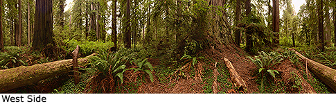
Photos: Pictures of Atlas Tree taken from different sides