| Height: | 160.00+ ft | (48.77+ m) | Elevation: | 6,358 ft (1,938 m) | GPS Latitude: | 36.11623 |
| Volume: | 25,180 ft3 | (713 m3) | Creek: | West Fork Wilson Creek | GPS Longitude: | -118.67518 |
| Width: | 19.10 ft | (5.82 m) | Grove: | Black Mountain Grove | Discovery Date: | 1983 |
| Age: | Park: | Giant Sequoia NM | Discovered By: | Wendell D. Flint | ||
| Michael M. Law |
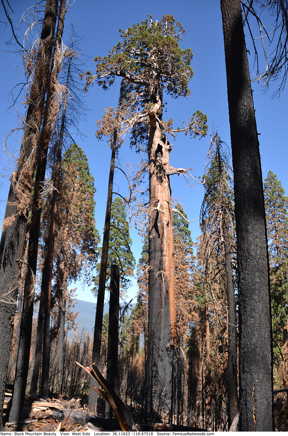
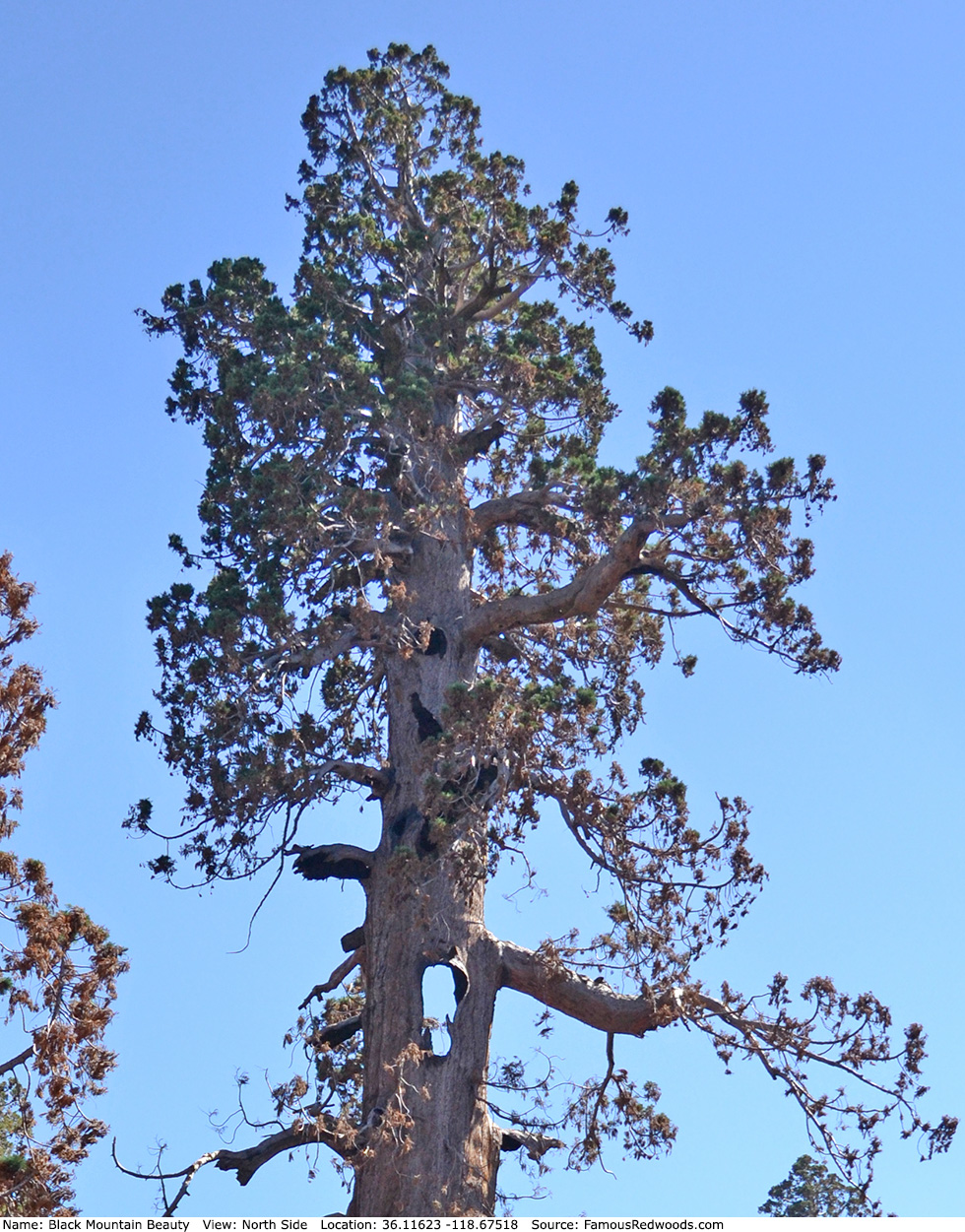
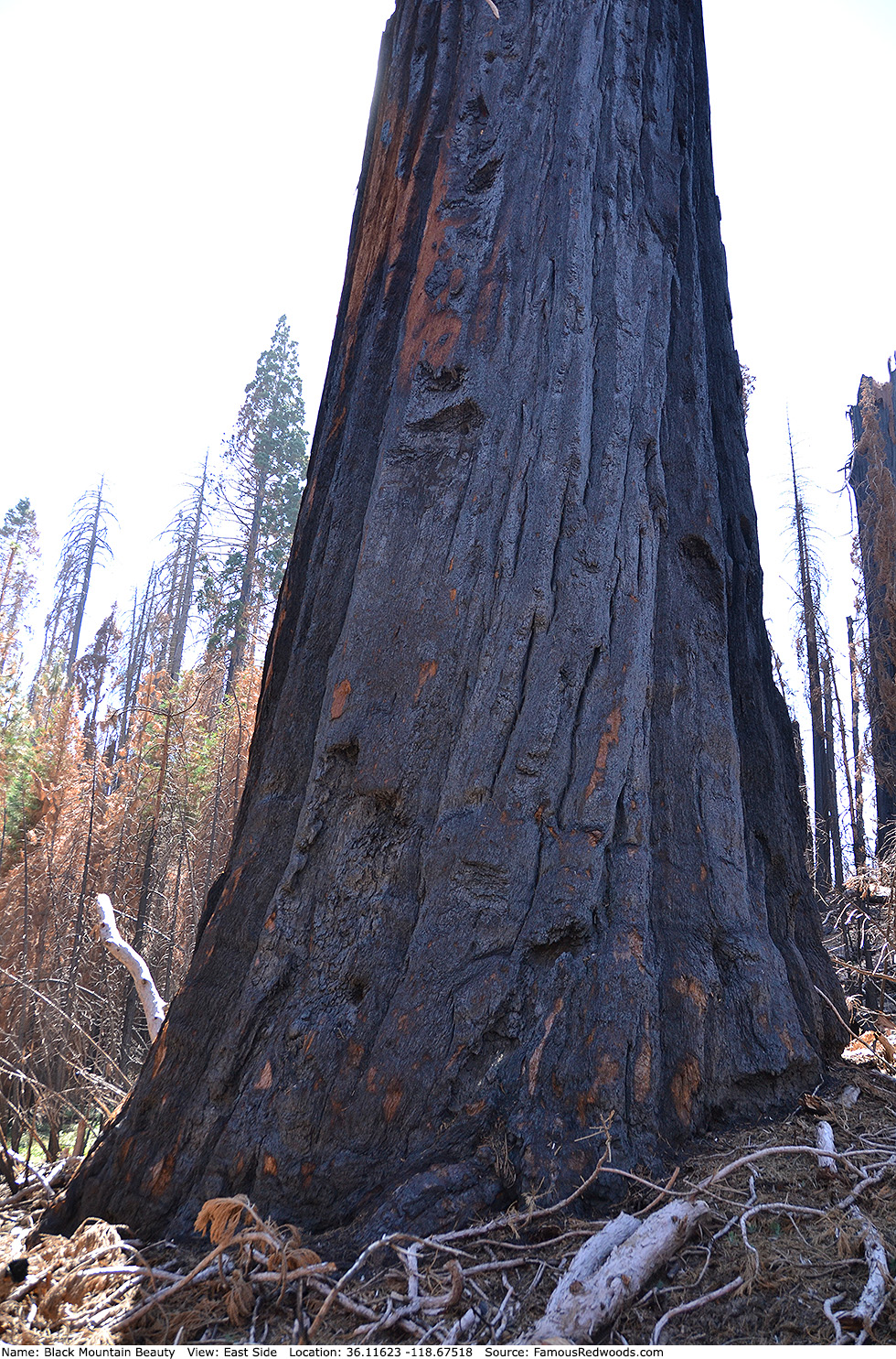
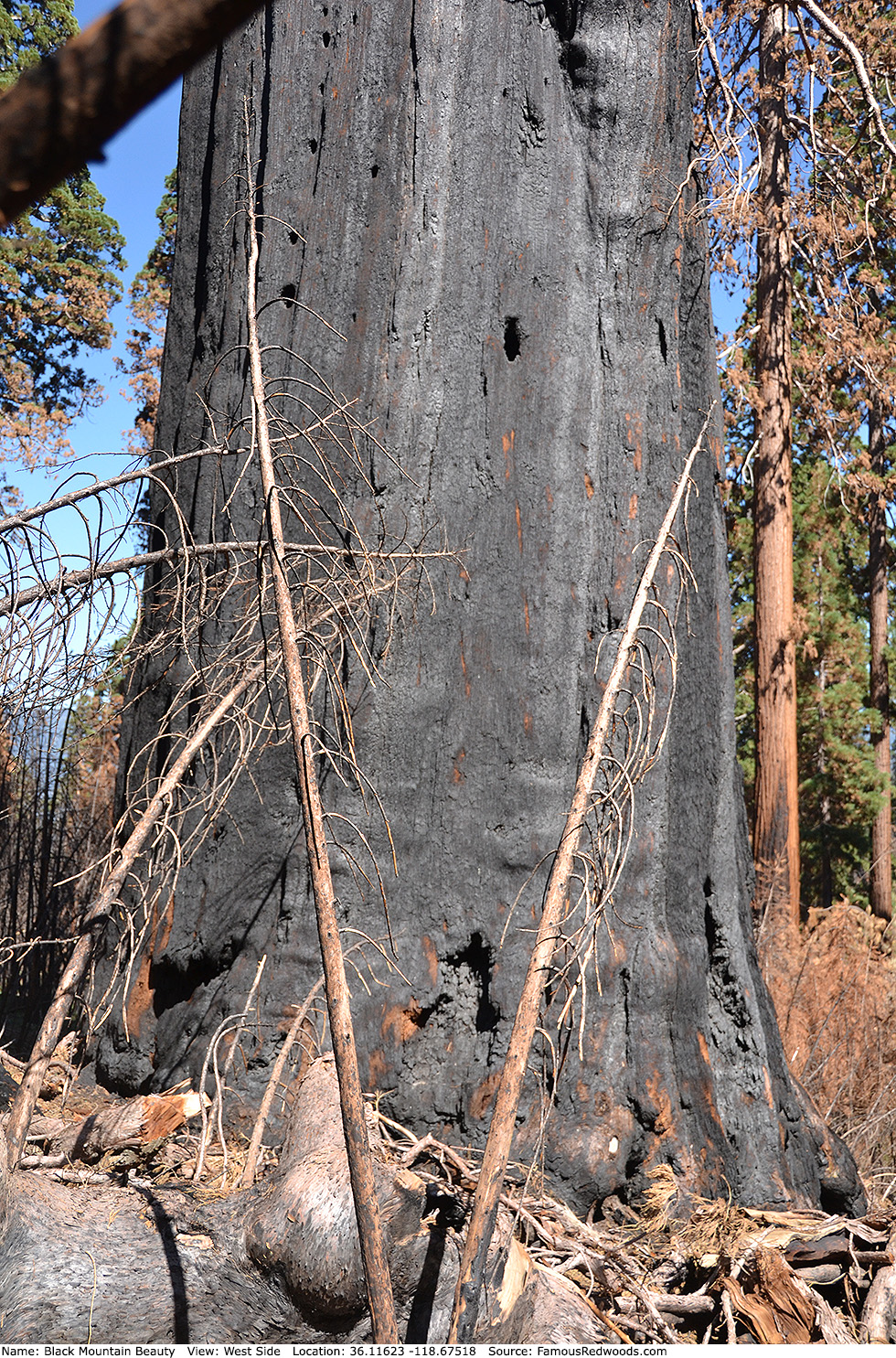
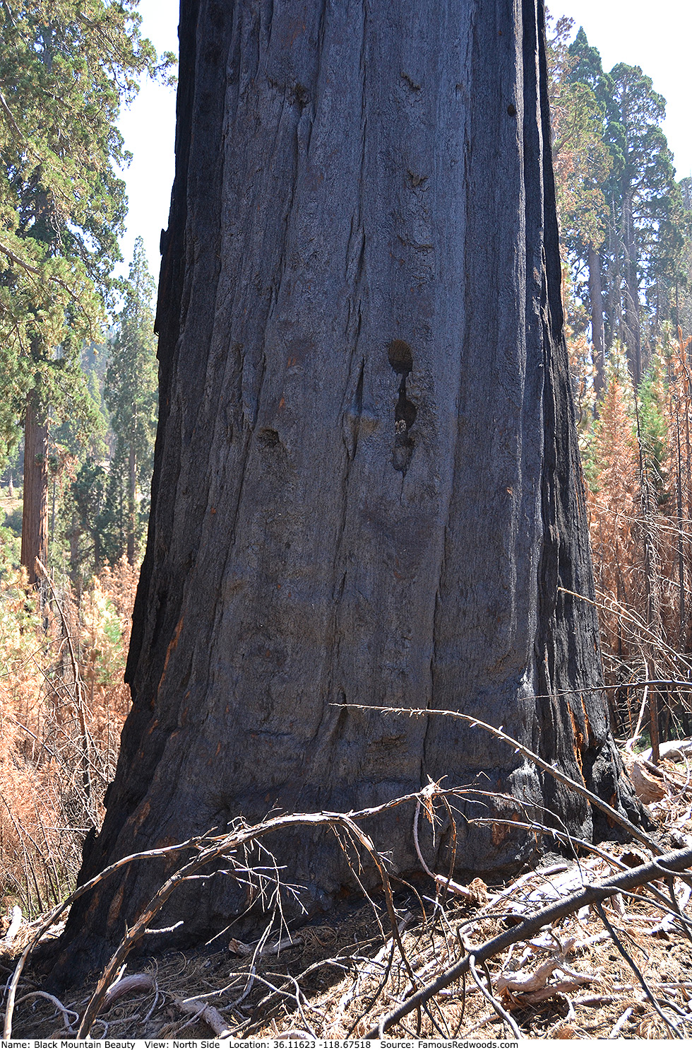
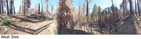
Notes: Before the 2017 Pier Fire, Black Mountain Beauty, also known as Black Mountain Shaft, was the 19th largest tree in Giant Sequoia National Monument and the largest tree in Black Mountain Grove. The trunk lost 103 ft (31 m) in height and 7,044 ft3 (199 m3) in volume after it burned, and Black Mountain Beauty no longer ranks among the 30 largest giant redwoods in Giant Sequoia National Monument.
Drive: Black Mountain Beauty is 237 mi (381 km) southeast of San Francisco near the city of Porterville.
Northbound: From U.S. Interstate 5 North, transfer to California State Route 99 North. From California State Route 99 North just north of Bakersfield, transfer to California State Route 65 North toward Porterville. Near Porterville, transfer to California State Route 190 East.
Southbound: From U.S. Interstate 5 South in Sacramento, transfer to U.S. Highway 50 East toward South Lake Tahoe. Drive east 1.7 mi (2.7 km) on U.S. Highway 50 and transfer to California State Highway 99 South. Near Tipton, transfer to California State Route 190 East toward Porterville.
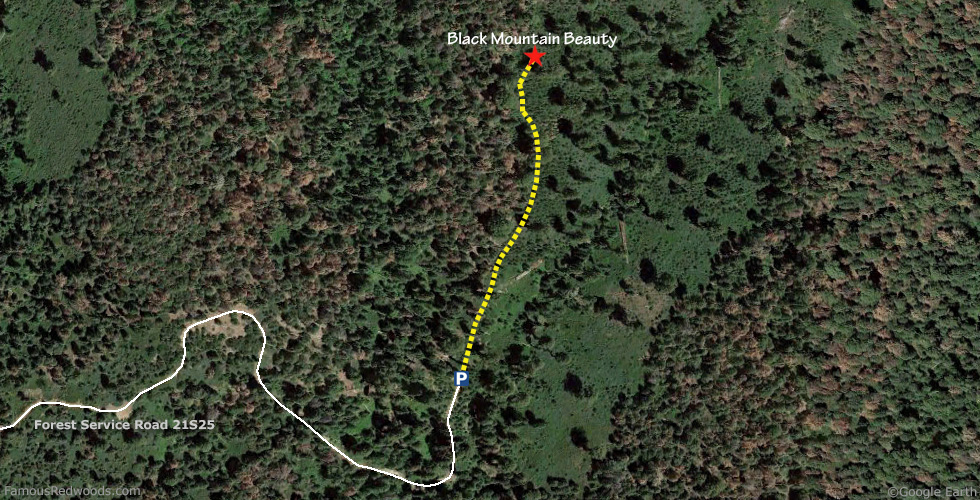
From Porterville, drive east 32 mi (51 km) on California State Route 190 toward Camp Nelson and turn right onto Nelson Drive toward Camp Nelson and Coy Flat. Continue straight onto Coy Flat Drive (Forest Service Road 21S94) toward Coy Flat. Drive south 6.1 mi (9.8 km) on Coy Flat Drive (Forest Service Road 21S94), past Coy Flat Campground, and turn right onto Forest Service Road 21S12 (Solo Peak Road). Drive northwest 6.8 mi (10.9 km) on Forest Service Road 21S12 (Solo Peak Road), past the intersection with Forest Service Road 21S12B, and veer left onto Forest Service Road 21S25. Drive south and then east 2.1 mi (3.4 km) on Forest Service Road 21S25, past the intersections with Forest Service Roads 21S25A and 21S25B, to the parking spot at the end of the road.

Hike: From the parking spot, hike downhill/north 0.2 mi (0.3 km), following an old logging road along the ridgeline, to Black Mountain Beauty which stands beside the road on your right.
| Rating: | Easy | One-Way Distance: | 0.2 mi | (0.3 km) | Ascent: | 22 ft | (7 m) |
| Time: | 10 min | Off-Trail: | 0.2 mi | (0.3 km) | Descent: | 89 ft | (27 m) |
View Black Mountain Beauty Tree location in Google Maps
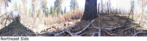
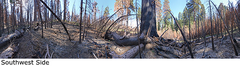
Panoramas: Click panoramas to take a virtual tour of Black Mountain Beauty Tree
Photos: Pictures of Black Mountain Beauty Tree taken from different sides