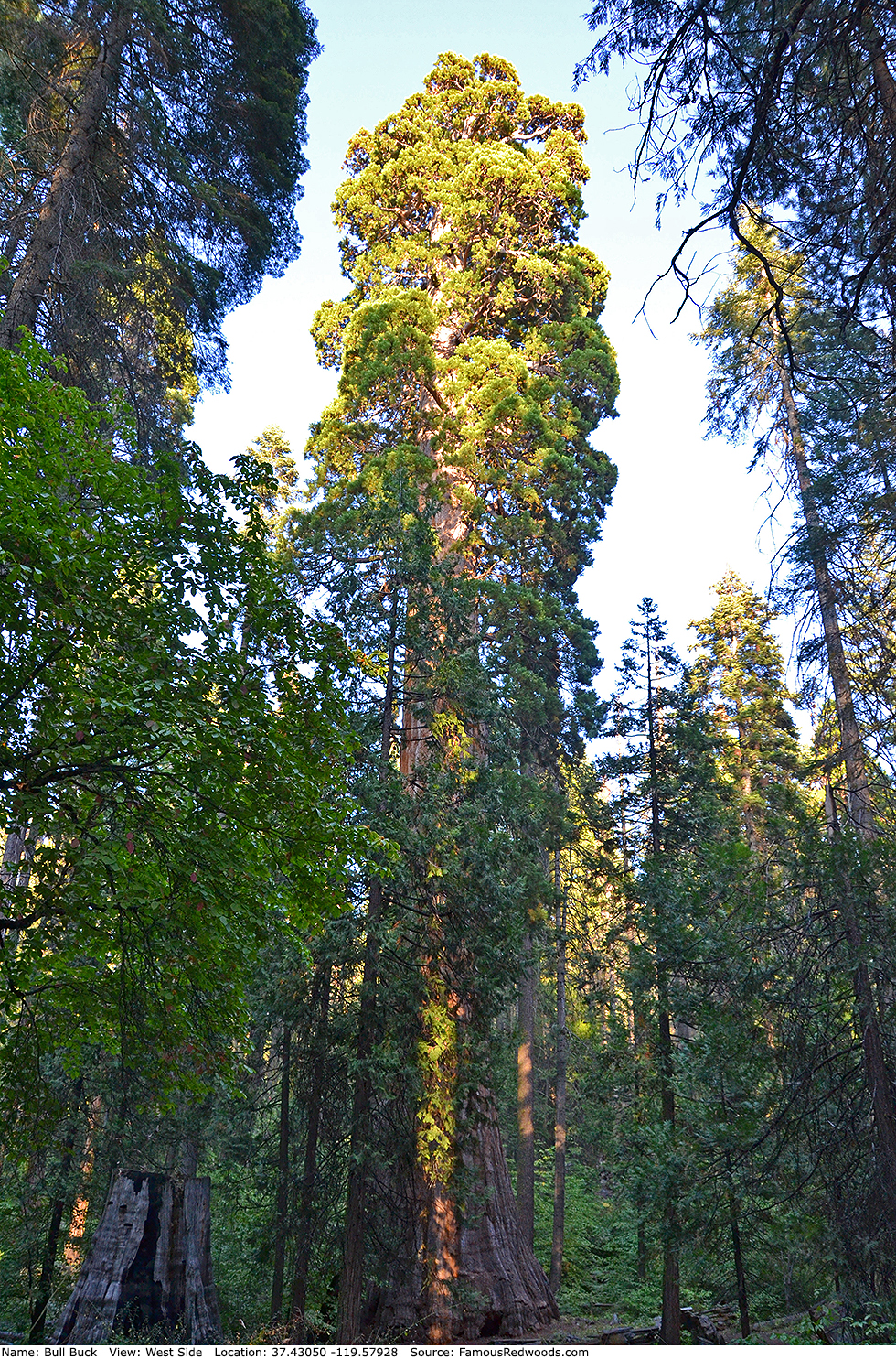
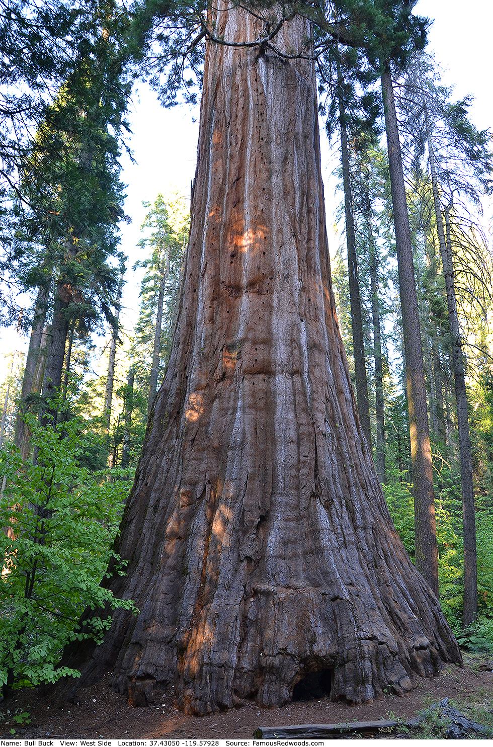
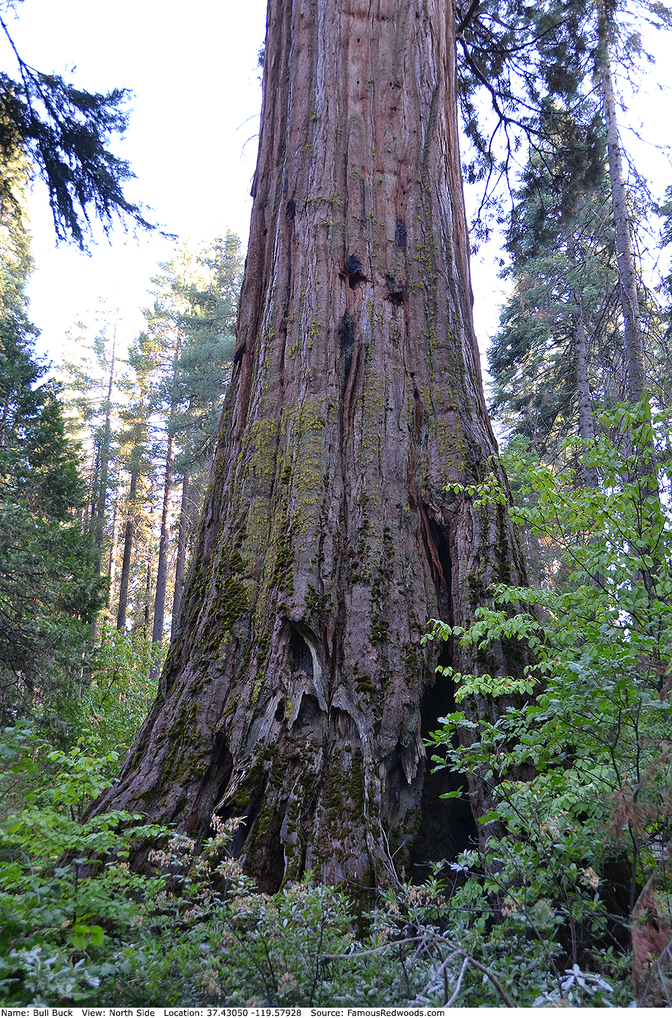
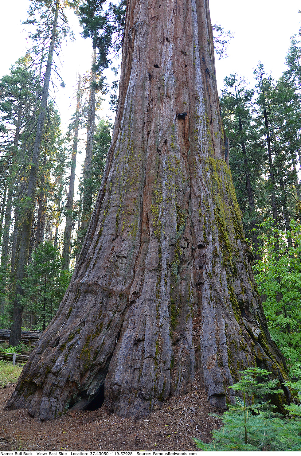
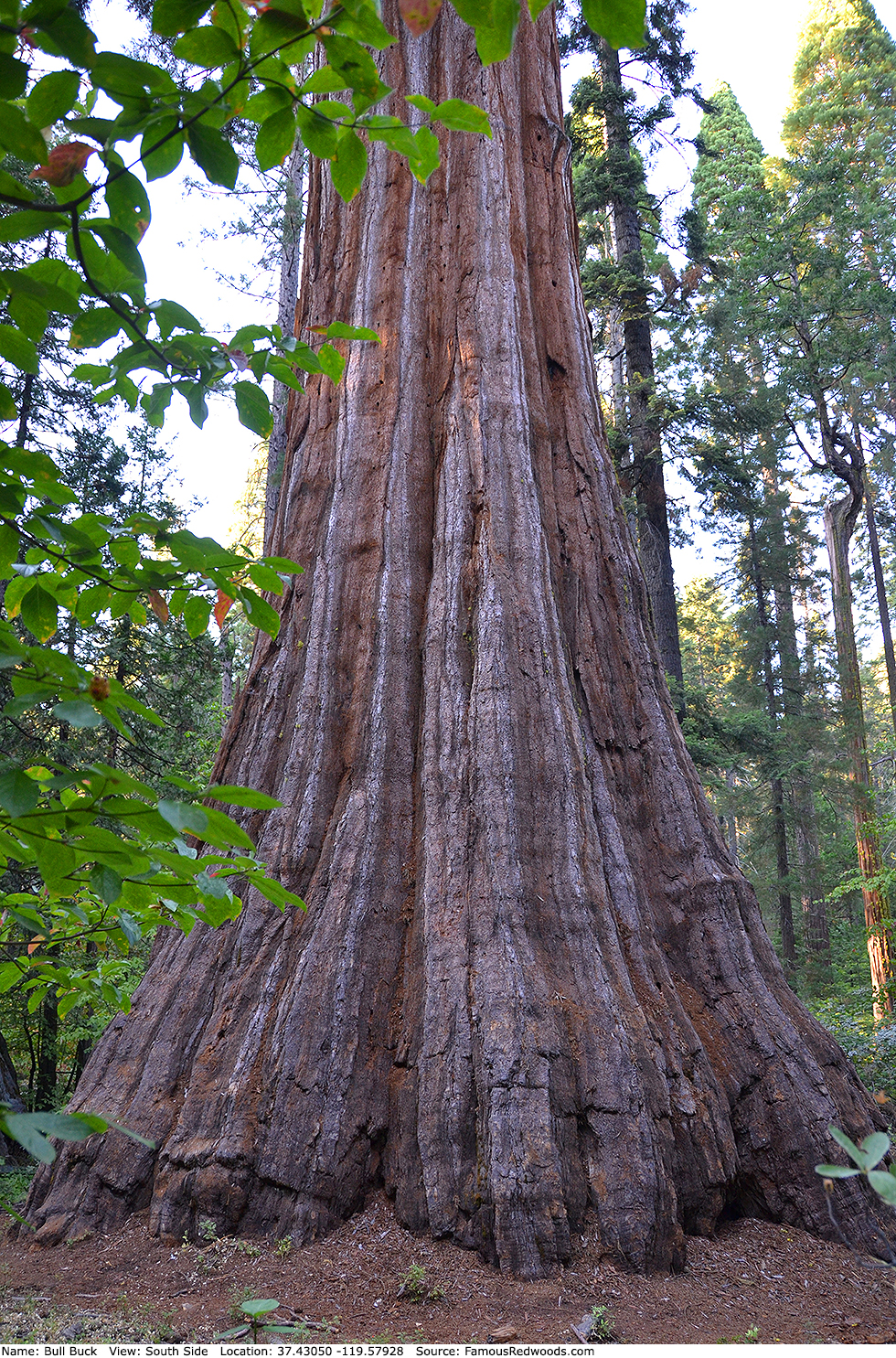
| Height: | 246.10+ ft | (75.01+ m) | Elevation: | 5,377 ft (1,639 m) | GPS Latitude: | 37.43050 |
| Volume: | 27,383 ft3 | (775 m3) | Creek: | California Creek | GPS Longitude: | -119.57928 |
| Width: | 26.80 ft | (8.17 m) | Grove: | Nelder Grove | Discovery Date: | |
| Age: | 2,700 y | Park: | Sierra NF | Discovered By: |
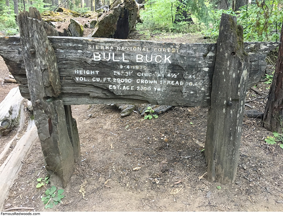
Notes: Bull Buck is the 3rd largest tree in Sierra National Forest and the 3rd largest tree in Nelder Grove. The naming of Bull Buck remains controversial. Some suggest the tree was named to honor a felling and bucking foreman (also known as the bull buck or woods boss) who reportedly instructed his crew to spare the tree during logging operations in the 1880s. Others claim the tree was so named because its enormous size makes it appear to be the boss of the woods. Bull Buck is 1.2 ft (0.4 m) shorter and 1,707 ft3 (48 m3) smaller than a nearby sign indicates: 247.31 ft (75.38 m) and 29,090 ft3 (824 m3) on September 4, 1975.
Videographer Matt Wood published an aerial flyover of Bull Buck. Arborist Jeffrey S. Opar documented his climb of Bull Buck.
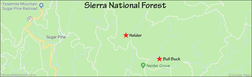
Drive: Bull Buck is 157 mi (253 km) east of San Francisco near the city of Oakhurst.
Northbound: From U.S. Interstate 5 North, transfer to California State Highway 41 North toward Kettleman City. Drive north 110 mi (161 km) on California State Highway 41 to Oakhurst.
Southbound: From U.S. Interstate 5 South in Sacramento, transfer to U.S. Highway 50 East toward South Lake Tahoe. Drive east 1.7 mi (2.7 km) on U.S. Highway 50 and transfer to California State Highway 99 South. Near Merced, transfer to California State Highway 140 East. Drive east 36 mi (58 km) on California State Highway 140 to Mariposa and transfer to California State Highway 49 East. Drive east 26 mi (42 km) on California State Highway 49 to Oakhurst and transfer to California State Highway 41 North.
From Oakhurst, drive north 4.1 mi (6.6 km) on California State Highway 41 to County Road 632 (Sky Ranch Road). Turn right and drive north 6.6 mi (10.6 km) on County Road 632 (Sky Ranch Road) to Forest Service Road 6S47Y. Turn left and drive north 1.2 mi (1.9 km) on Forest Service Road 6S47Y to Forest Service Road 6S90. Continue straight onto Forest Service Road 6S90, toward Nelder Grove and Soquel Meadow, and drive north 0.3 mi (0.5 km) to Forest Service Road 5S19. Turn left, toward Nelder Grove Campground, and drive north 0.5 mi (0.8 km) on Forest Service Road 5S19, past the Interpretive Center and Biledo Meadow Cabins, toward the campground. Veer right at the fork in the road and then turn right into the Bull Buck trailhead parking lot.
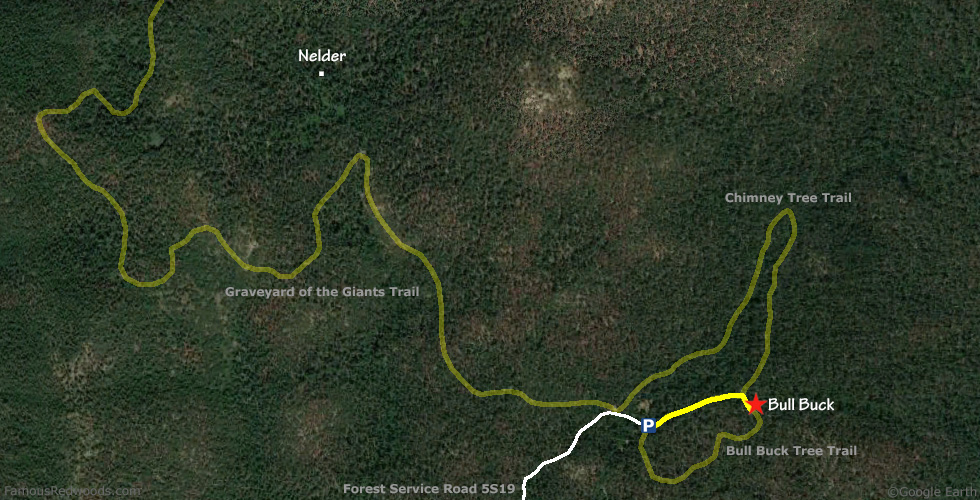
Road Warning: Forest Service Road 5S19 is a narrow, rough, and unpaved road which remains closed (with a locked gate) during winter. Low-clearance vehicles are not recommended. If you drive a low-clearance vehicle or if the gate is closed when you visit, park on Forest Service Road 6S90 and walk down Forest Service Road 5S19, around the gate, to the trailhead.
Hike: From the trailhead, hike east 0.3 mi (0.5 km) on the northern half of Bull Buck Tree Trail loop, around a gate and past the junction with Chimney Tree Trail, to Bull Buck which stands beside the trail on your left.
| Rating: | Easy | One-Way Distance: | 0.3 mi | (0.5 km) | Ascent: | 154 ft | (47 m) |
| Time: | 8 min | Off-Trail: | 0 ft | (0 m) | Descent: | 35 ft | (11 m) |
View Bull Buck Tree location in Google Maps
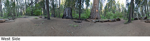
Panorama: Click panorama to take a virtual tour of Bull Buck Tree
Photos: Pictures of Bull Buck Tree taken from different sides