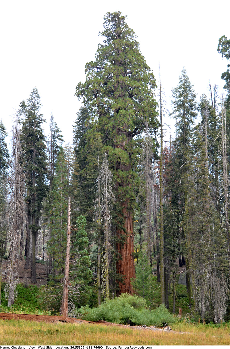
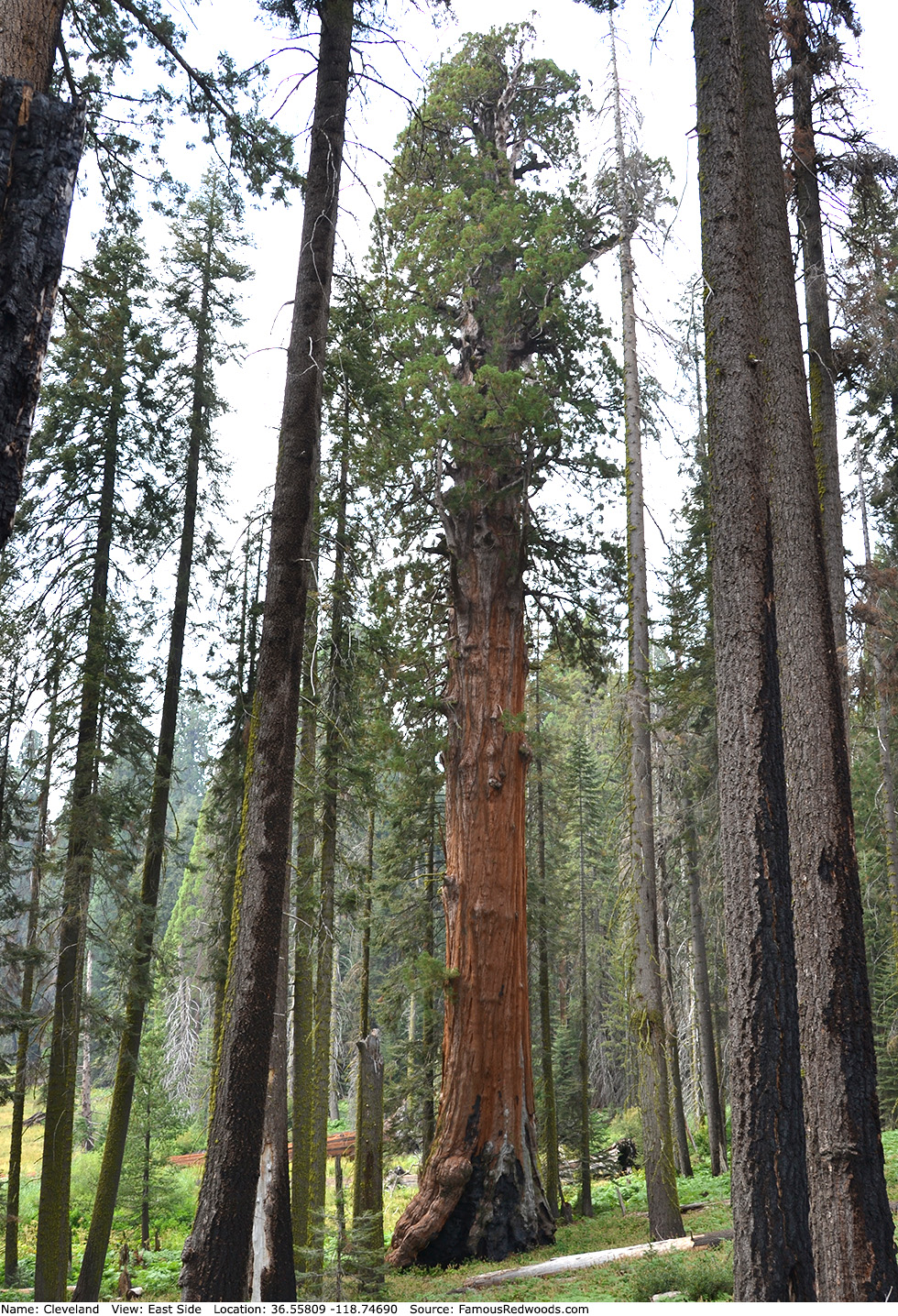
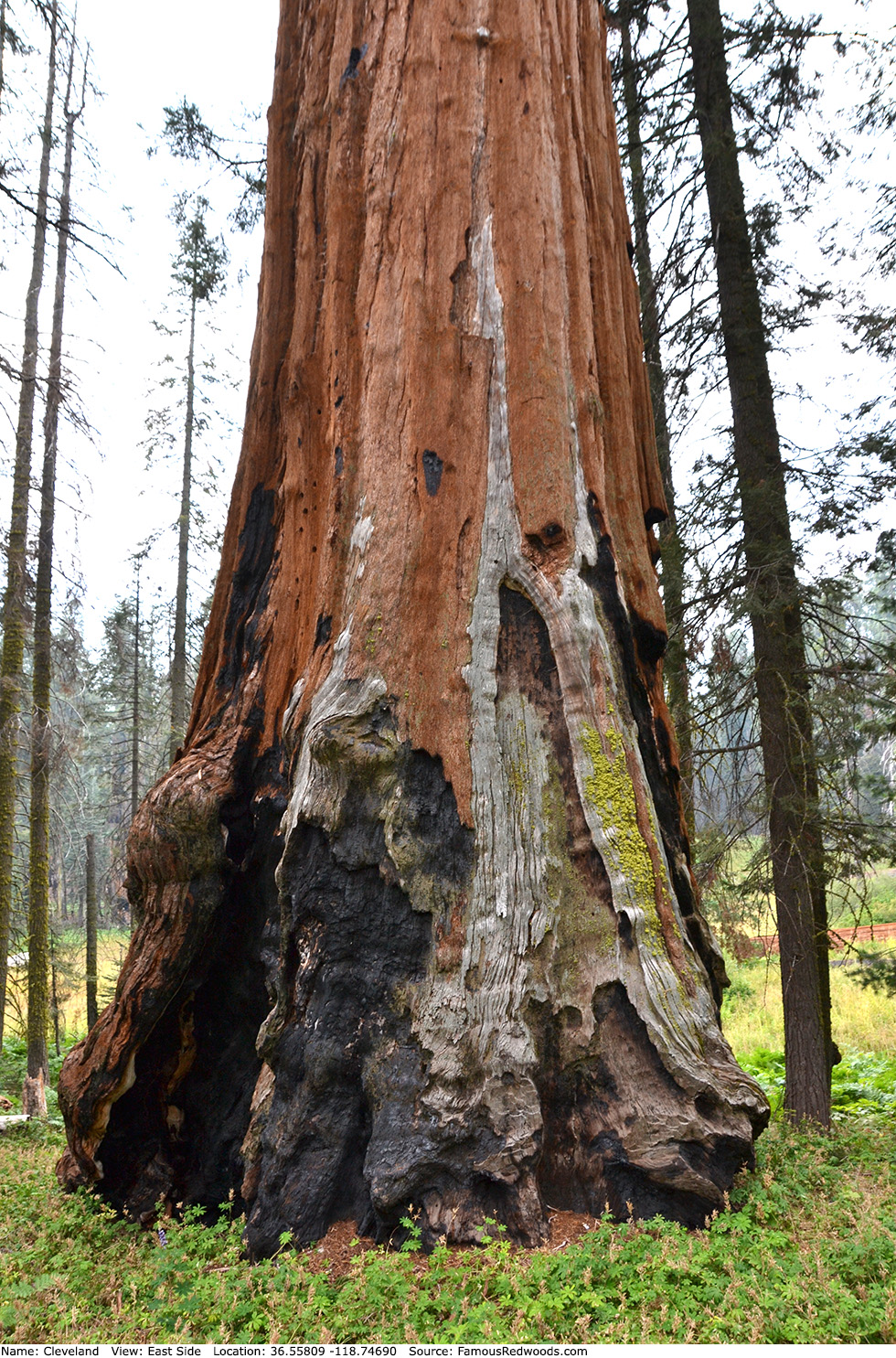
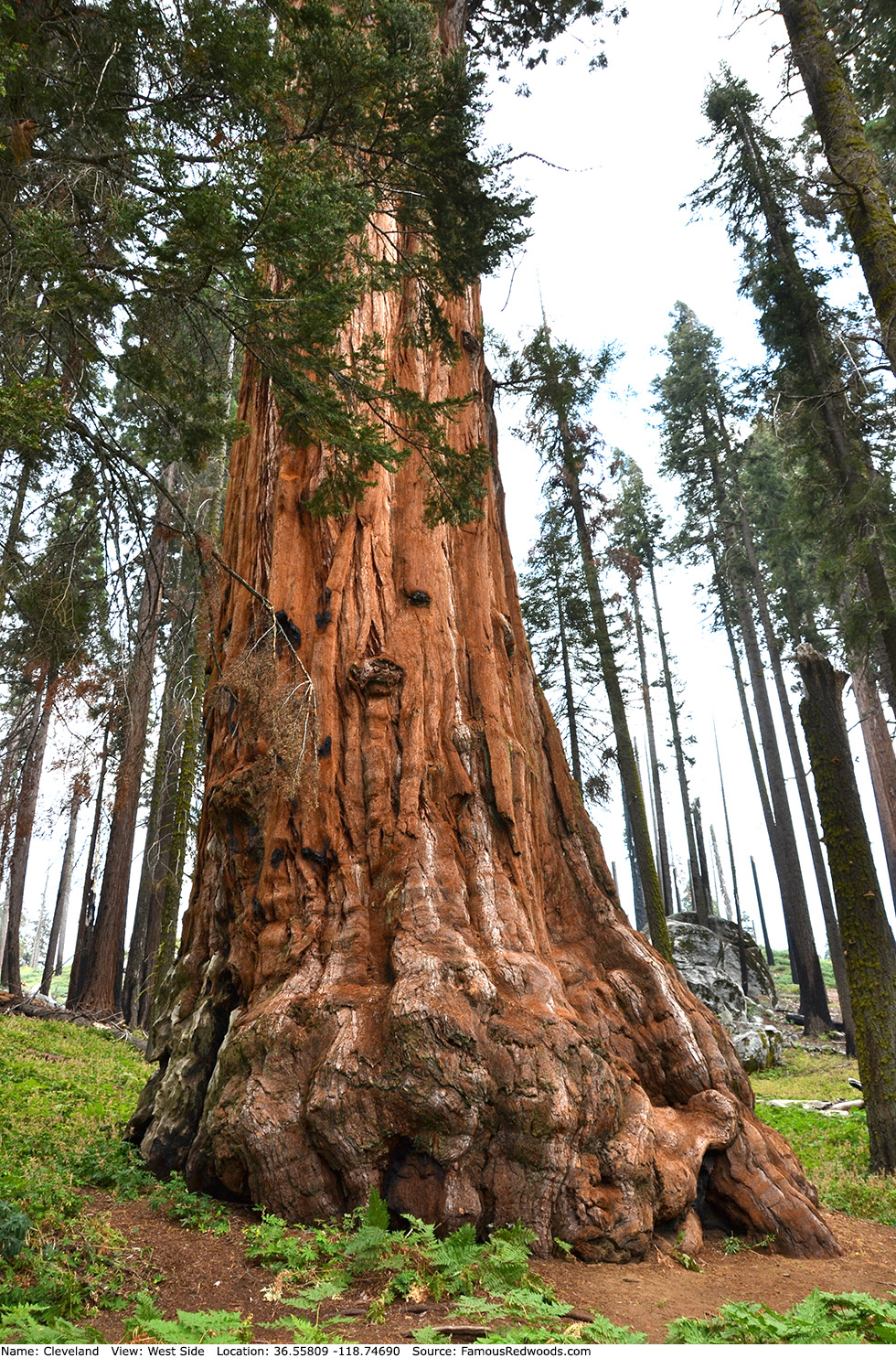
| Height: | 250.50+ ft | (76.35+ m) | Elevation: | 6,740 ft (2,054 m) | GPS Latitude: | 36.55809 |
| Volume: | 31,336 ft3 | (887 m3) | Creek: | Crescent Creek | GPS Longitude: | -118.74690 |
| Width: | 22.92 ft | (6.99 m) | Grove: | Giant Forest | Discovery Date: | 1902 |
| Age: | 2,914 y | Park: | Sequoia NP | Discovered By: | John Broder |
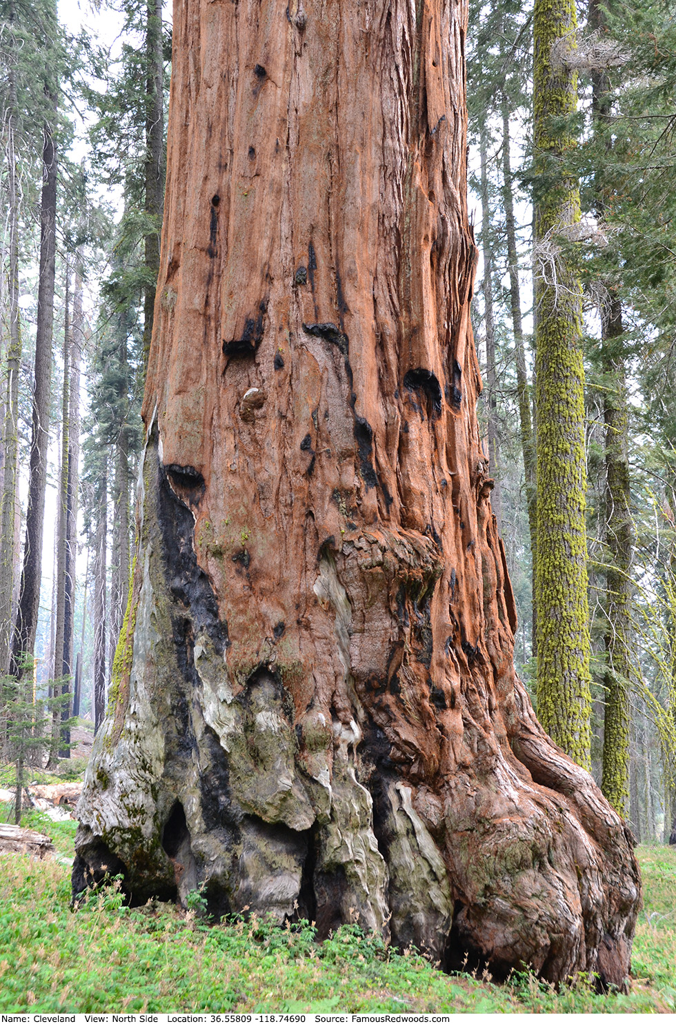
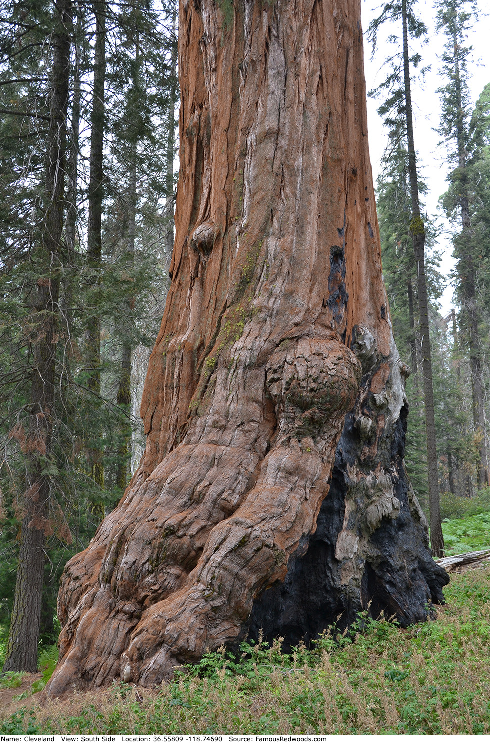
Notes: Cleveland is the 22nd largest tree in Sequoia National Park and the 16th largest tree in Giant Forest. In 1902, Sequoia National Park concessionaire John Broder named the tree to honor Grover Cleveland, the 22nd President of the United States.
Cleveland should not be confused with Grover Cleveland tree which grows in Mariposa Grove in Yosemite National Park.
Drive: Cleveland is is 219 mi (352 km) southeast southeast of San Francisco near Fresno.
Northbound: From U.S. Interstate 5 North, transfer to California State Route 99 North toward Bakersfield. Drive north 97 mi (156 km) on California State Route 99 and transfer to California State Route 198 East toward Visalia. Drive east 57 mi (92 km) on California State Route 198 (Generals Highway), past Four Guardsmen, and turn right onto Crescent Meadow Road.
Southbound: From U.S. Interstate 5 South in Sacramento, transfer to U.S. Highway 50 East toward South Lake Tahoe. Drive east 1.7 mi (2.7 km) on U.S. Highway 50 and transfer to California State Highway 99 South. Near Fresno, transfer to California State Route 180 East. Drive east 56 mi (90 km) on California State Route 180, and turn right onto California State Route 198 West. Drive south 29 mi (47 km) on California State Route 198 (Generals Highway) and turn left onto Crescent Meadow Road.
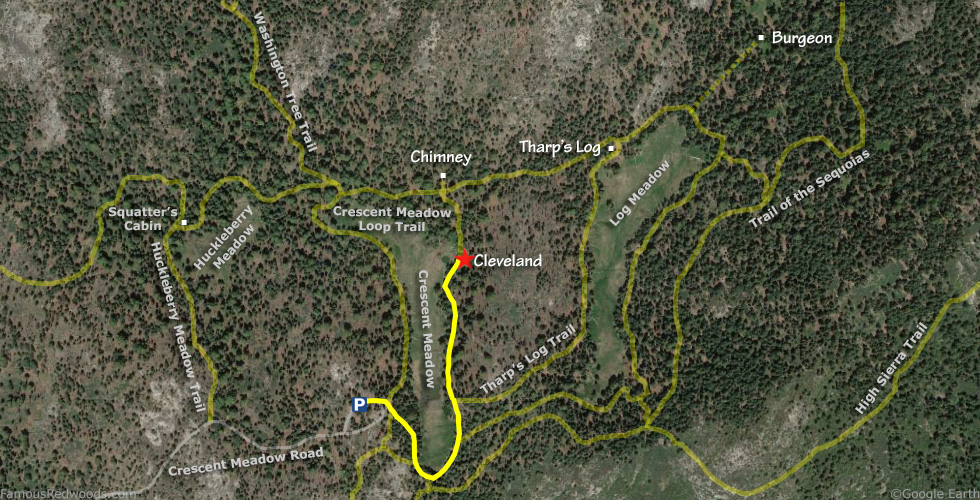
Drive southeast 2.5 mi (4.0 km) on Crescent Meadow Road, past Booker T. Washington, Auto Log, Crescent Meadow Road Tree, Jefferson, Tunnel Log, and Near Tunnel Log, to the Crescent Meadow parking lot.
Road Warning: Crescent Meadow Road is open from late May to early November depending on snow levels. During summer (late May to early September) Sequoia Shuttle bus operations, Crescent Meadow Road is closed to private vehicles on weekends and holidays from 9:00 AM through late afternoon. When Crescent Meadow Road is closed, park in the lot near Giant Forest Museum and walk Crescent Meadow Road or take the free Sequoia Shuttle (Gray Route 2) from Giant Forest Museum to the Crescent Meadow parking lot.

Hike: From the parking lot, hike east to the trailhead. Turn right at the trailhead and hike southeast 0.1 mi (0.2 km) to the junction with High Sierra Trail. Veer left/north at the trail junction and hike north 0.2 mi (0.3 km) on Crescent Meadow Loop Trail to the junction with Tharp's Log Trail. Veer left at the trail junction and hike north 0.2 mi (0.3 km) on Crescent Meadow Loop Trail to Cleveland which stands beside the trail on your right.
| Rating: | Easy | One-Way Distance: | 0.5 mi | (0.8 km) | Ascent: | 145 ft | (44 m) |
| Time: | 15 min | Off-Trail: | 0 ft | (0 m) | Descent: | 101 ft | (31 m) |
View Cleveland Tree location in Google Maps
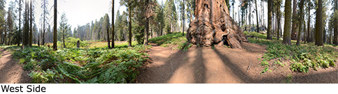
Panorama: Click panorama to take a virtual tour of Cleveland Tree
Photos: Pictures of Cleveland Tree taken from different sides