| Height: | 243.80+ ft | (74.31+ m) | Elevation: | 6,624 ft (2,019 m) | GPS Latitude: | 36.57824 |
| Volume: | 37,295 ft3 | (1,056 m3) | Creek: | Sherman Creek | GPS Longitude: | -118.75450 |
| Width: | 23.30 ft | (7.10 m) | Grove: | Giant Forest | Discovery Date: | 1950 |
| Age: | Park: | Sequoia NP | Discovered By: | Wendell D. Flint |
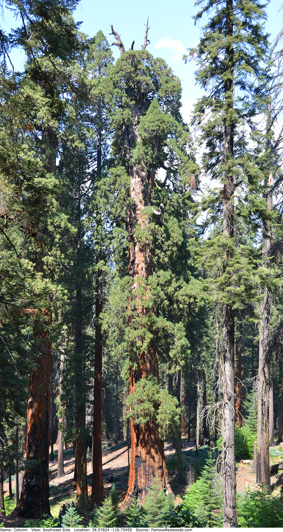
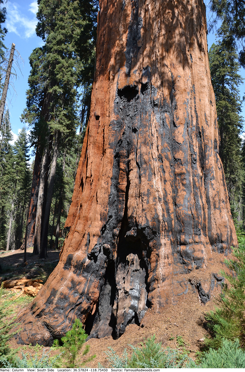
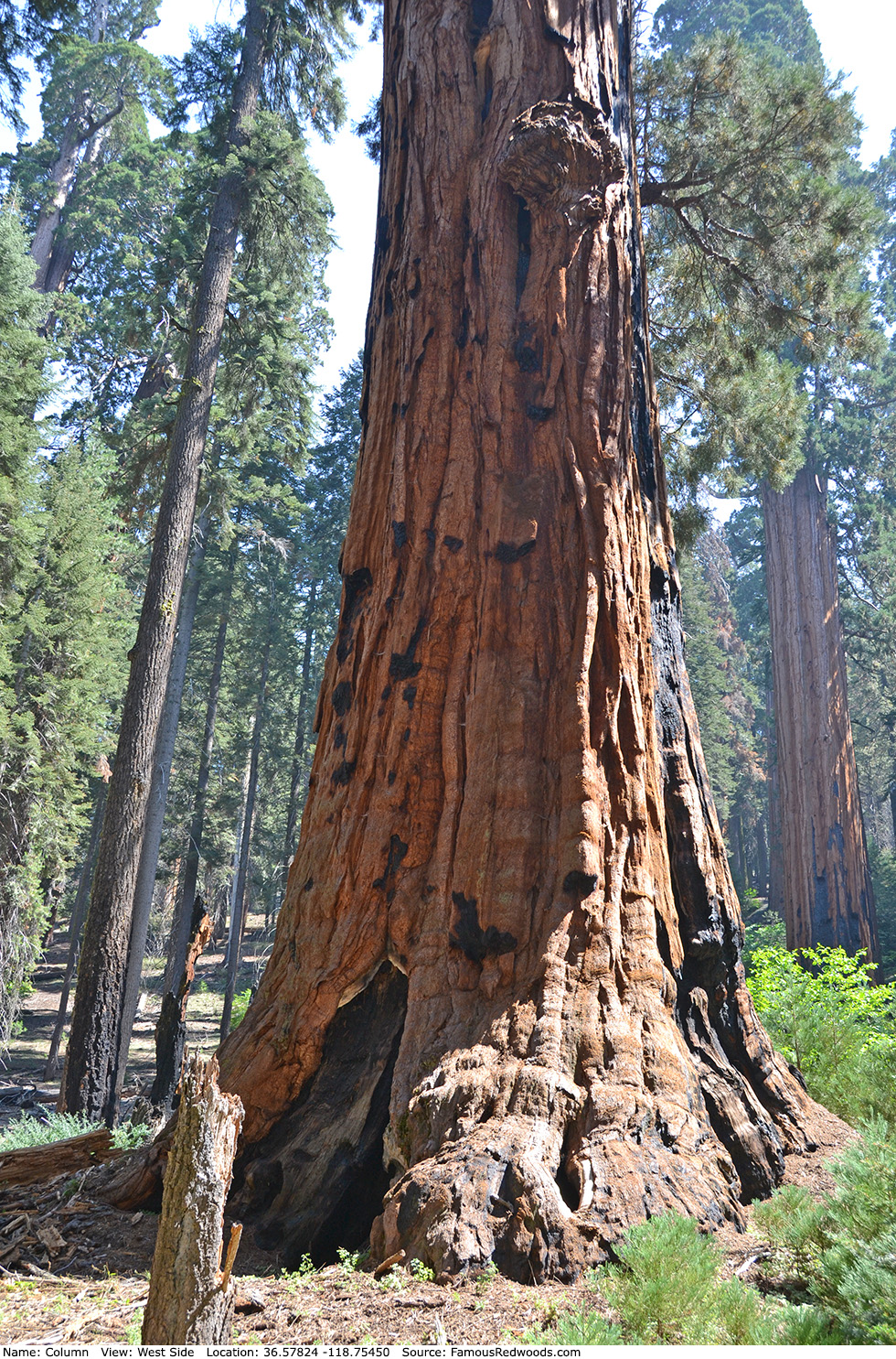
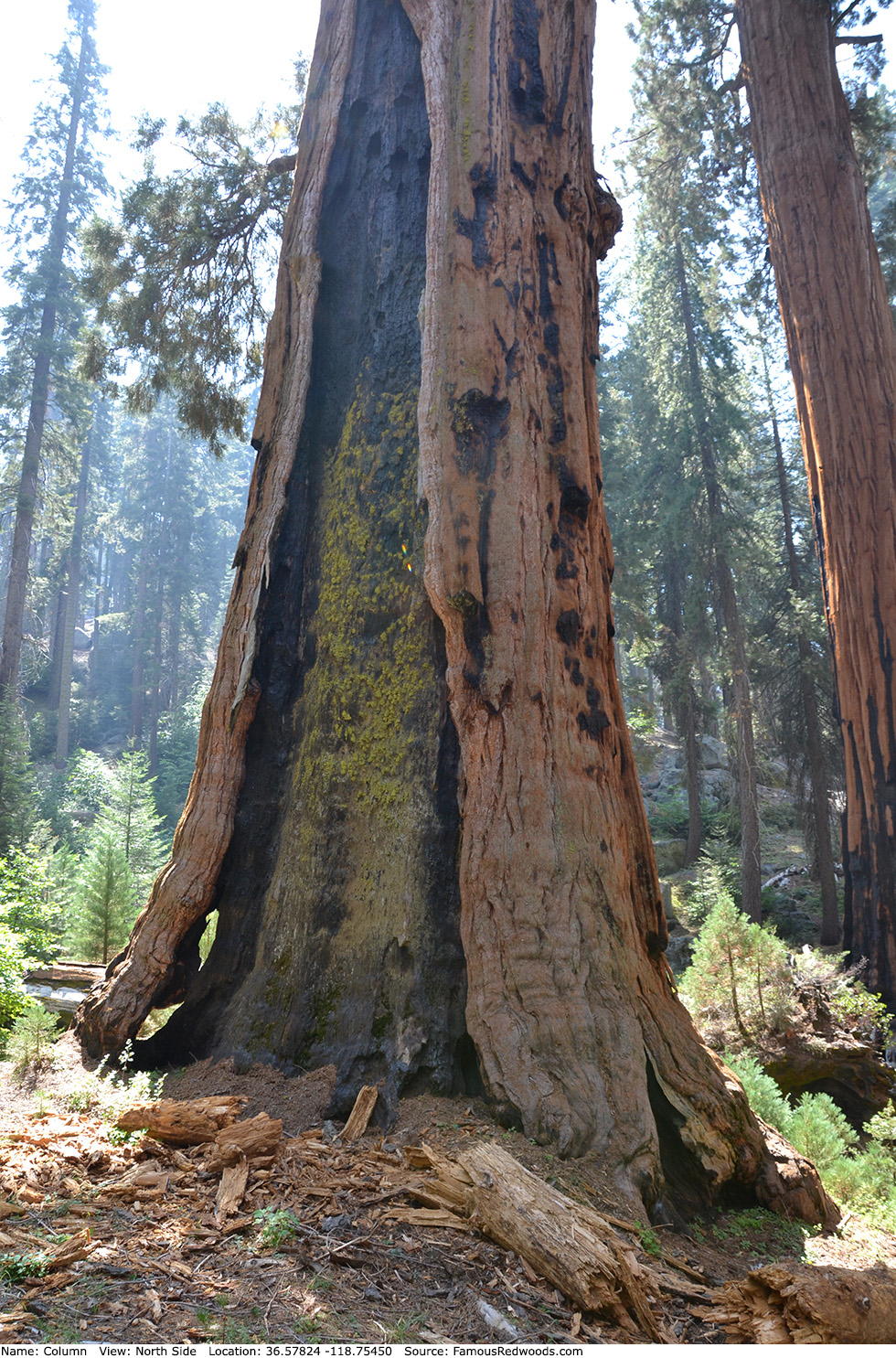
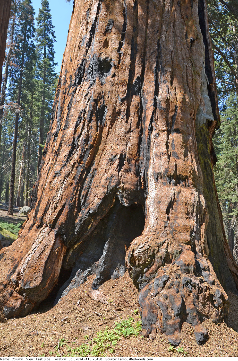
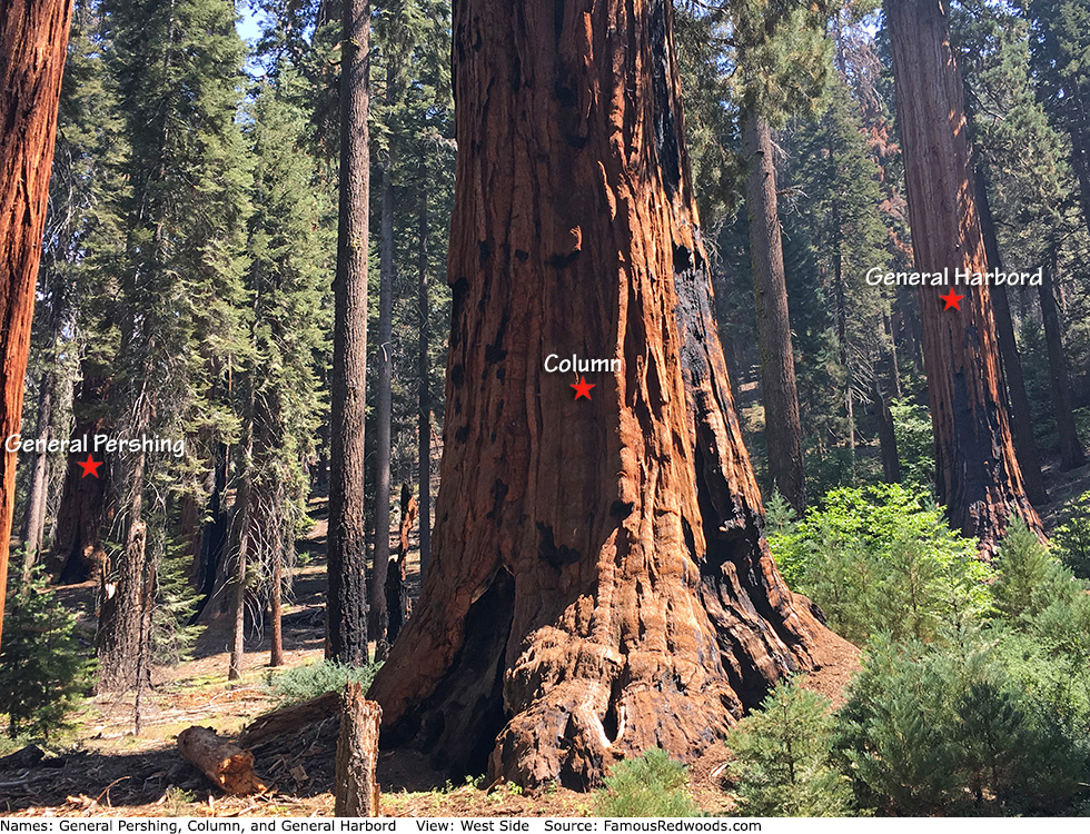
Notes: Column, also known as Near Pershing (Column is 350 ft (107 m) southwest of General Pershing), is the world's 15th largest tree, the 13th largest giant redwood, the 9th largest tree in Sequoia National Park, and the 7th largest tree in Giant Forest. Naturalists Wendell D. Flint and Michael M. Law named the tree Column because they believed the trunk resembles a massive, wooden column.
Drive: Column is 218 mi (351 km) southeast of San Francisco near Fresno.
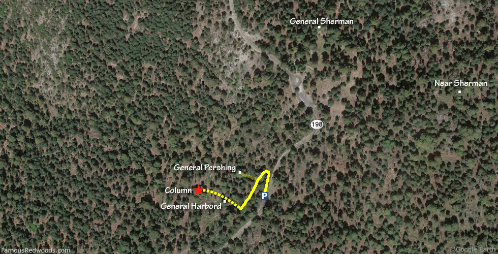
Northbound: From U.S. Interstate 5 North, transfer to California State Route 99 North toward Bakersfield. Drive north 97 mi (156 km) on California State Route 99 and transfer to California State Route 198 East toward Visalia. Drive east 59 mi (95 km) on California State Route 198 (Generals Highway), past Four Guardsmen, and park at a turnout, located at 36.57818 -118.75286, on the left/west side of the road 0.2 mi (0.3 km) south of the Sherman Tree accessible parking lot.
Southbound: From U.S. Interstate 5 South in Sacramento, transfer to U.S. Highway 50 East toward South Lake Tahoe. Drive east 1.7 mi (2.7 km) on U.S. Highway 50 and transfer to California State Highway 99 South. Near Fresno, transfer to California State Route 180 East. Drive east 56 mi (90 km) on California State Route 180, and turn right onto California State Route 198 West. Drive south 27 mi (43 km) on California State Route 198 (Generals Highway) and park at a turnout, located at 36.57823 -118.75283, on the right/west side of the road 0.2 mi (0.3 km) south of the Sherman Tree accessible parking lot.

Hike: From the turnout, walk north 200 ft (61 m) on California State Route 198 (Generals Highway) to connect to an abandoned trail just west of the road. Hike southwest 350 ft (107 m) on the abandoned trail, turn right, and hike northwest/downhill 360 ft (110 m) off-trail, past General Harbord, to Column. After visiting Column, hike southeast/uphill 200 ft (61 m) off-trail to General Harbord or hike northeast 350 ft (107 m) off-trail to General Pershing.
| Rating: | Easy | One-Way Distance: | 360 ft | (110 m) | Ascent: | 0 ft | (0 m) |
| Time: | 3 min | Off-Trail: | 360 ft | (110 m) | Descent: | 143 ft | (44 m) |
View Column Tree location in Google Maps
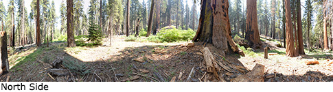
Panorama: Click panorama to take a virtual tour of Column Tree
Photos: Pictures of Column Tree taken from different sides