| Height: | 274.50+ ft | (83.67+ m) | Elevation: | 6,774 ft (2,065 m) | GPS Latitude: | 36.63162 |
| Volume: | 31,065 ft3 | (880 m3) | River: | North Fork Kaweah River | GPS Longitude: | -118.83670 |
| Width: | 20.82 ft | (6.35 m) | Grove: | Muir Grove | Discovery Date: | |
| Age: | Park: | Sequoia NP | Discovered By: |
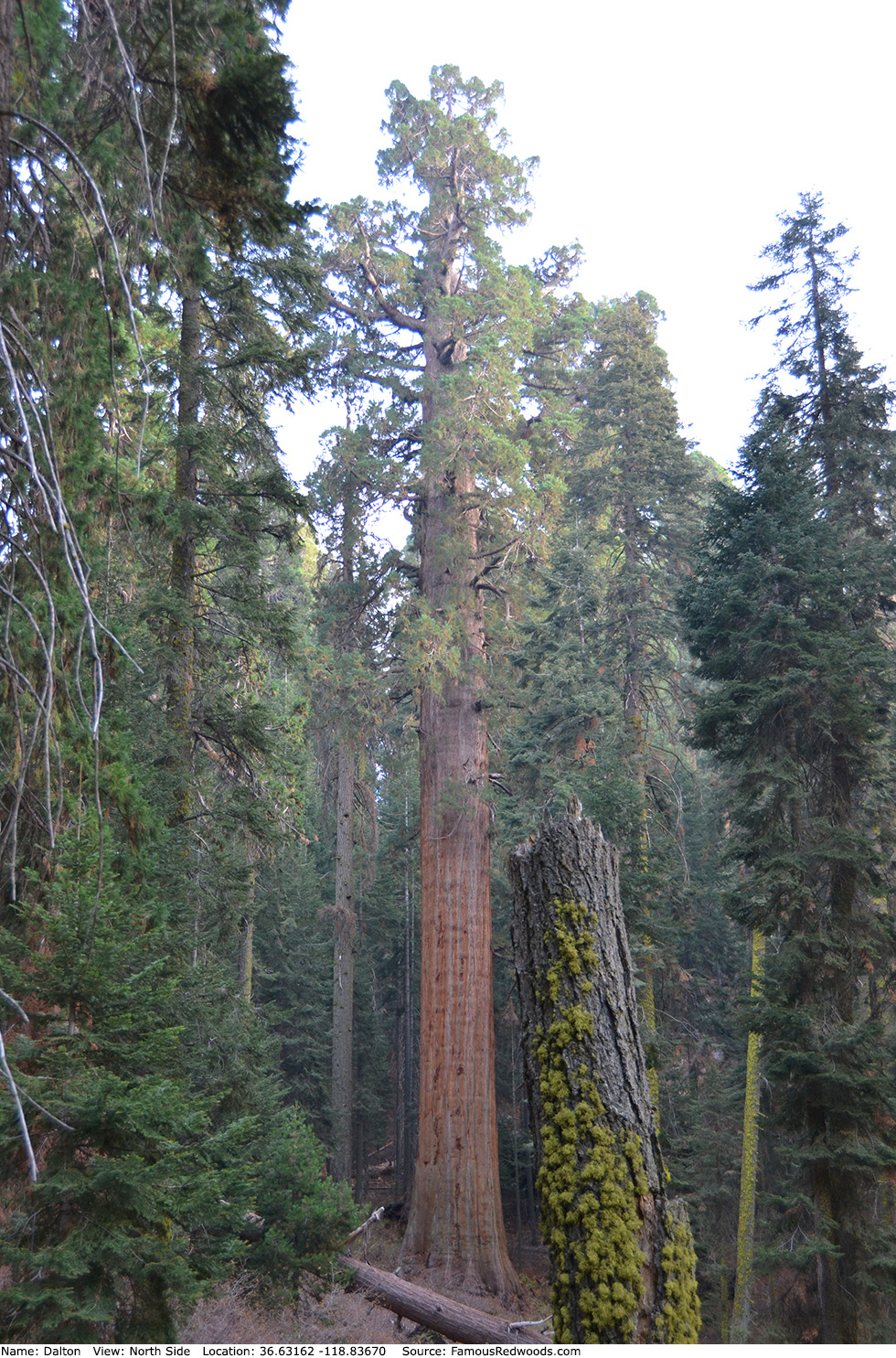
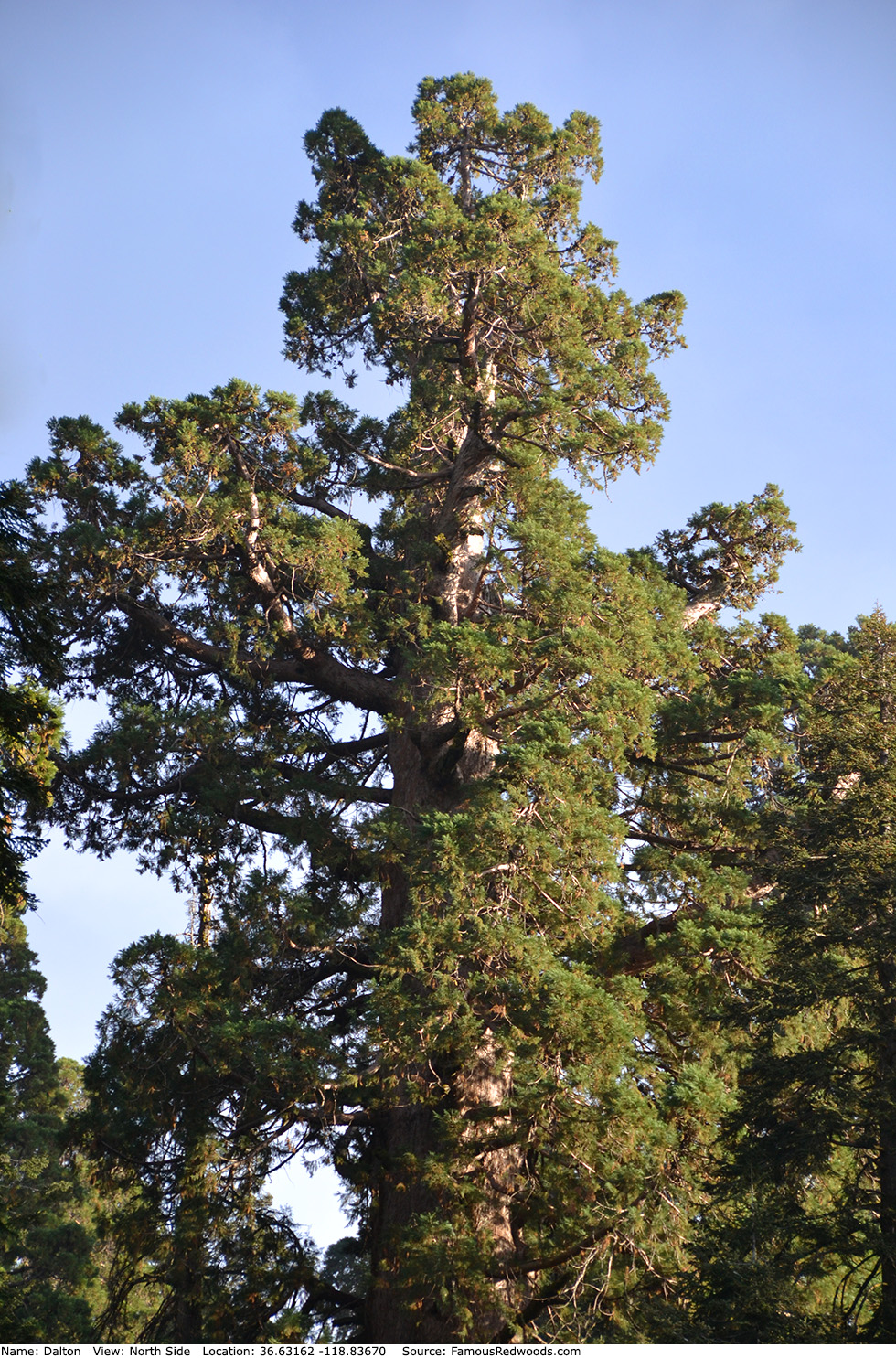
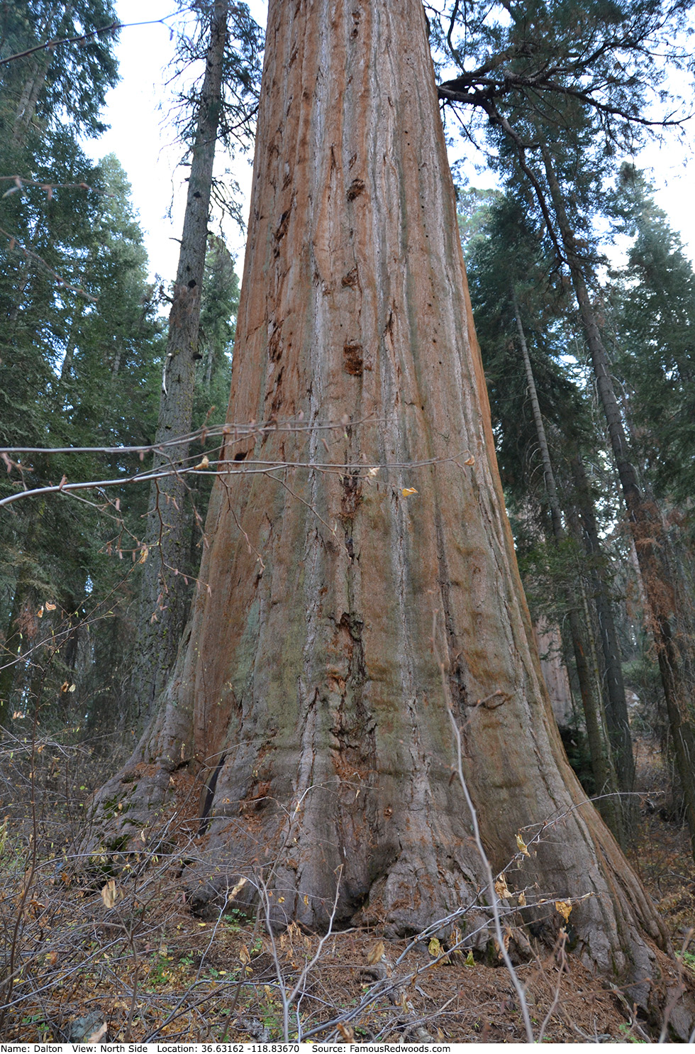
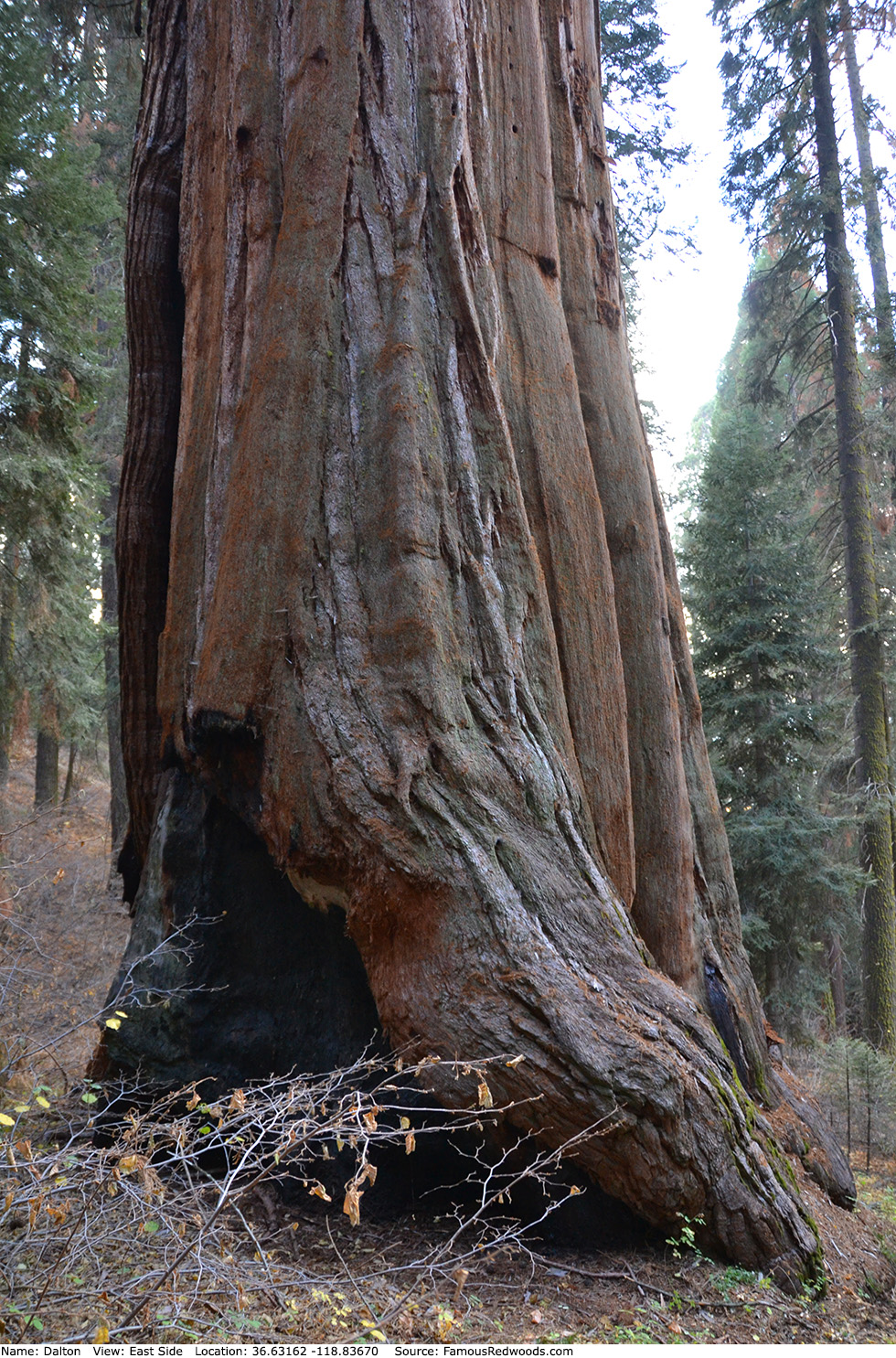
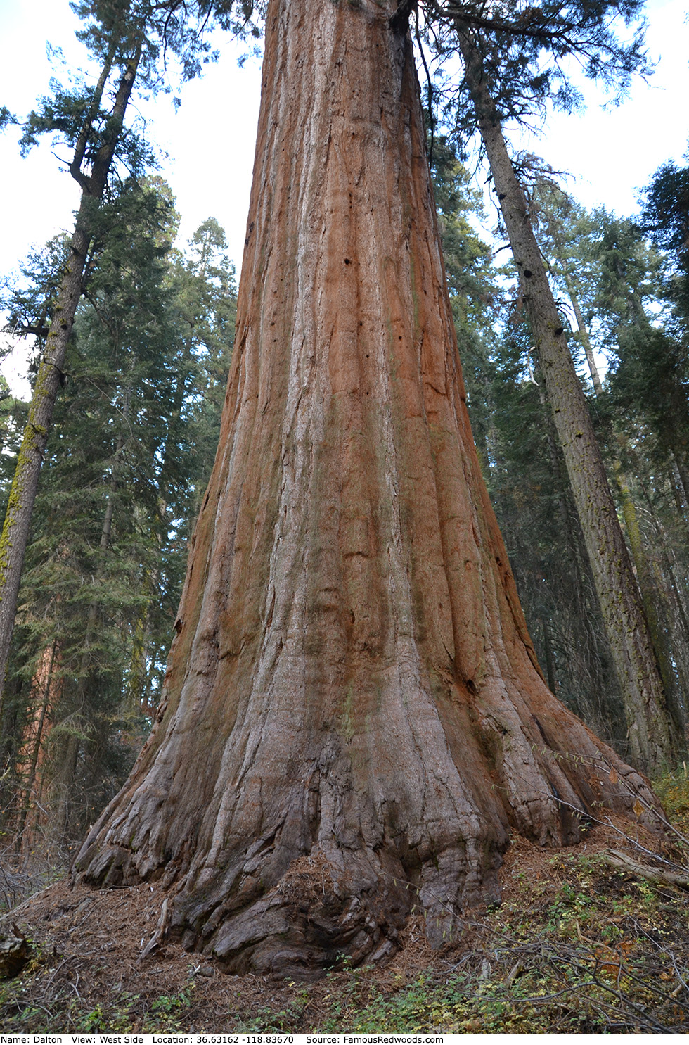
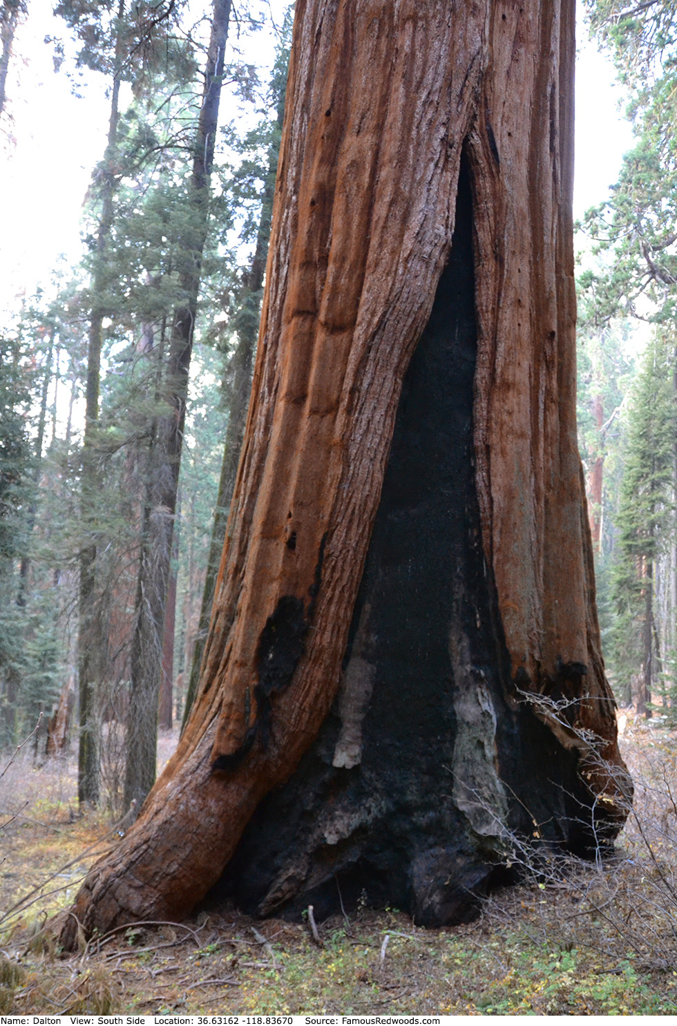
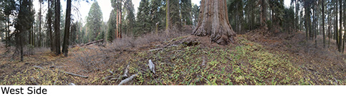
Notes: Dalton, also known as Giant of Muir Grove, is the 24th largest tree in Sequoia National Park and the largest tree in Muir Grove.
Drive: Dalton is 212 km (341 km) southeast of San Francisco near Fresno.
Northbound: From U.S. Interstate 5 North, transfer to California State Route 99 North toward Bakersfield. Drive north 97 mi (156 km) on California State Route 99 and transfer to California State Route 198 East toward Visalia. Drive east 70 mi (113 km) on California State Route 198 (Generals Highway), past Four Guardsmen, and turn left at the entrance to Dorst Creek Campground.
Southbound: From U.S. Interstate 5 South in Sacramento, transfer to U.S. Highway 50 East toward South Lake Tahoe. Drive east 1.7 mi (2.7 km) on U.S. Highway 50 and transfer to California State Highway 99 South. Near Fresno, transfer to California State Route 180 East. Drive east 56 mi (90 km) on California State Route 180, and turn right onto California State Route 198 West. Drive south 16 mi (26 km) on California State Route 198 (Generals Highway) and turn right at the entrance to Dorst Creek Campground.
Drive west 0.8 mi (1.4 km) on the campground road and turn right into the parking area for Group Camp Area A-E. Veer right onto the one-way loop road, drive 0.2 mi (0.4 km), and turn left into the parking lot.

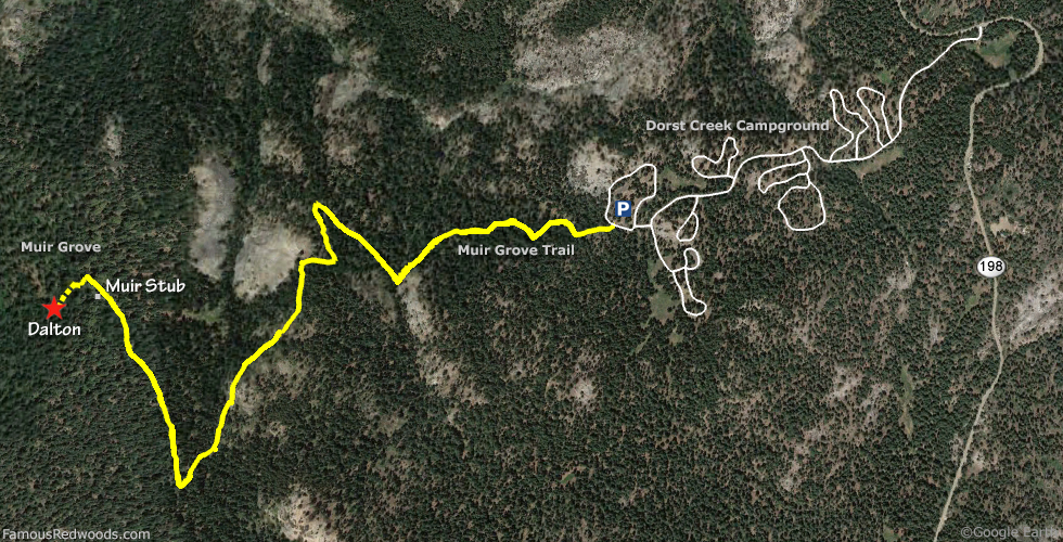
Hike: From the parking area, hike west across the loop road to the trailhead then hike west 1.9 mi (3.1 km) on Muir Grove Trail to Muir Stub at the edge of Muir Grove. Just past Muir Stub, veer left/west at the fork in the trail and hike west 260 ft (79 m) through a cluster of giant redwoods. Turn left at the next fork in the trail, just beyond the redwood cluster, and hike south/downhill 260 ft (79 m) to another cluster of giant redwoods and your first view of Dalton. Leave the trail here and hike southwest 300 ft (91 m) off-trail to Dalton. After visiting Dalton, return to the trail and hike east 0.1 mi (0.2 km) on Muir Grove Trail to Muir Stub.
| Rating: | Easy | One-Way Distance: | 2.0 mi | (3.0 km) | Ascent: | 635 ft | (194 m) |
| Time: | 1 hr | Off-Trail: | 300 ft | (91 m) | Descent: | 594 ft | (181 m) |
View Dalton Tree location in Google Maps
Panoramas: Click panoramas to take a virtual tour of Dalton Tree
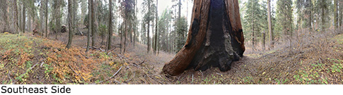
Photos: Pictures of Dalton Tree taken from different sides