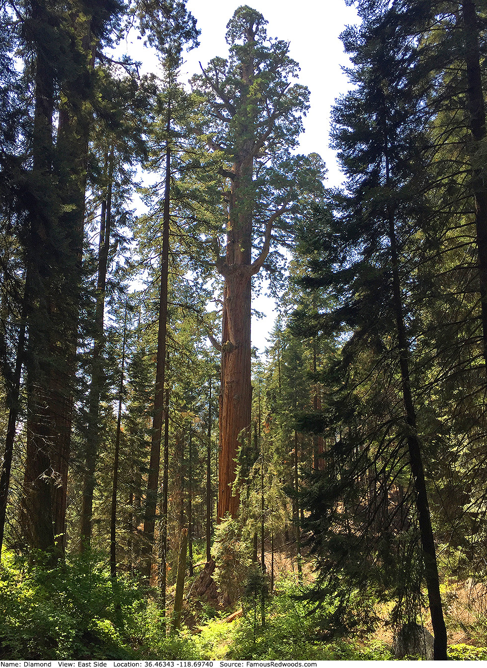
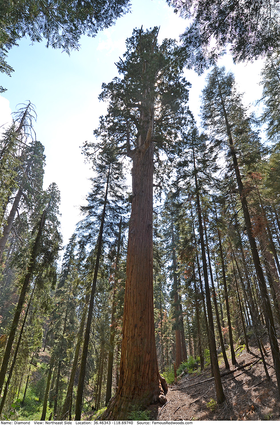
| Height: | 286.00+ ft | (87.17+ m) | Elevation: | 7,150 ft (2,179 m) | GPS Latitude: | 36.46343 |
| Volume: | 35,292 ft3 | (999 m3) | Creek: | Redwood Creek | GPS Longitude: | -118.69740 |
| Width: | 18.43 ft | (5.62 m) | Grove: | Atwell Mill Grove | Discovery Date: | 1983 |
| Age: | Park: | Sequoia NP | Discovered By: | Dennis Coggins | ||
| Wendell D. Flint | ||||||
| Michael M. Law |
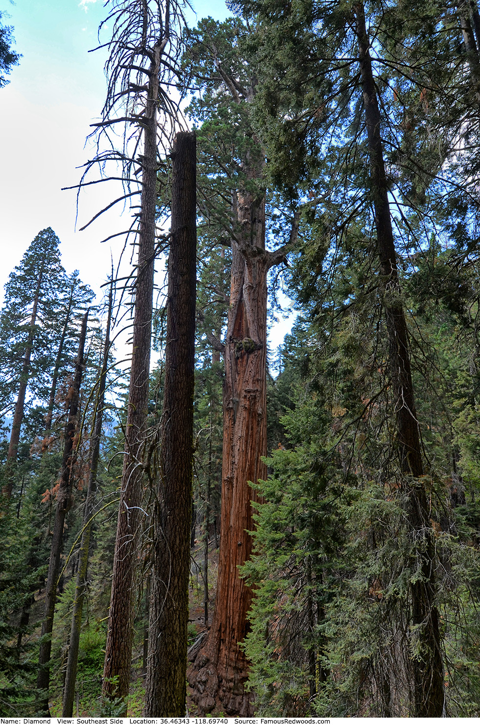
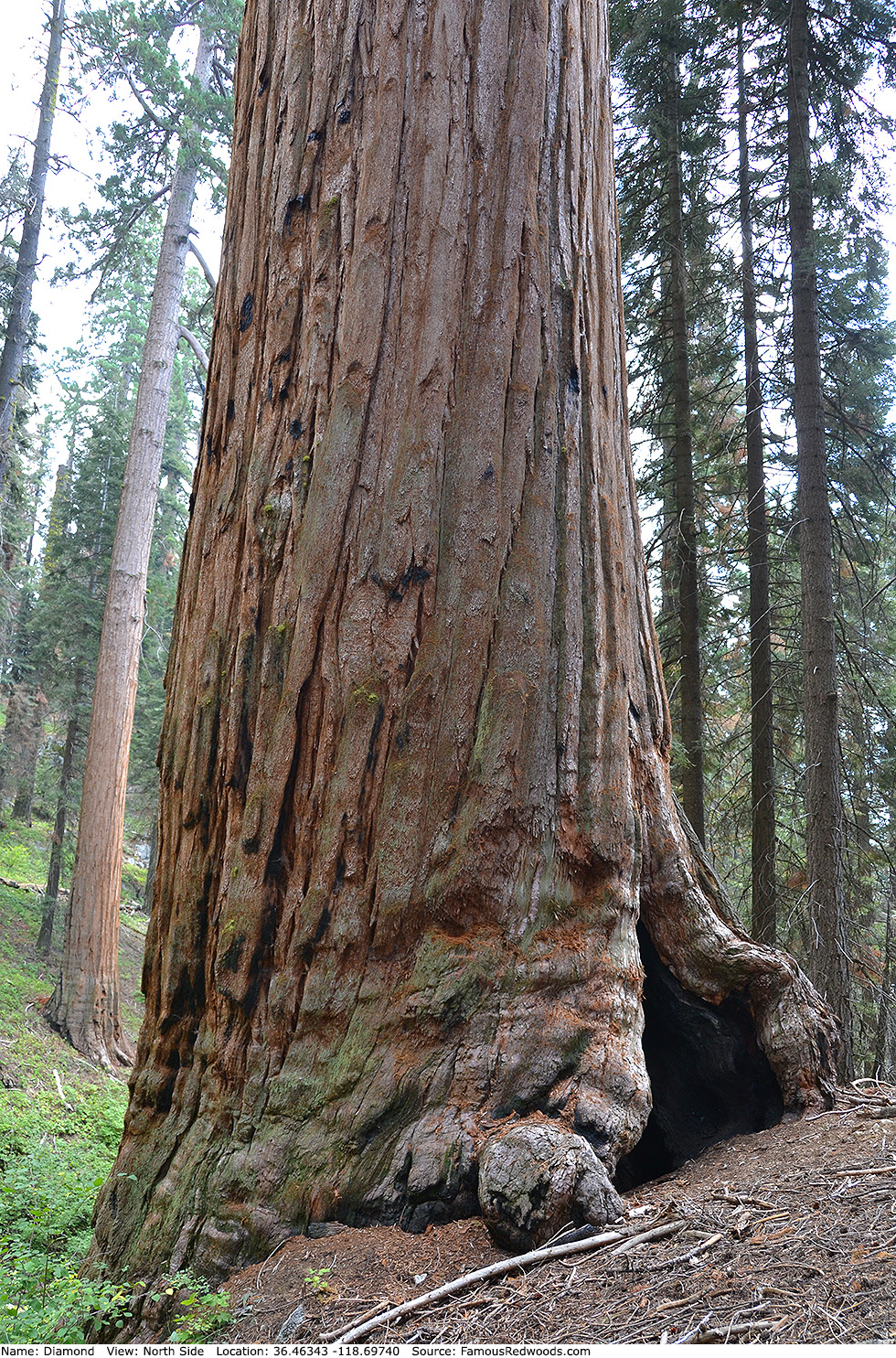
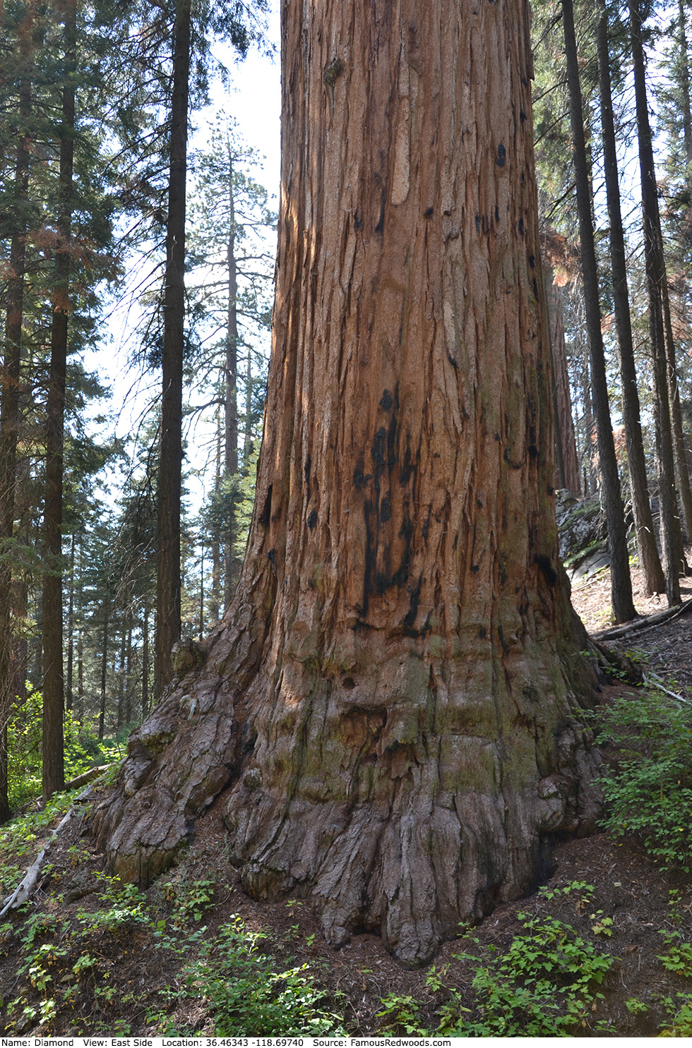
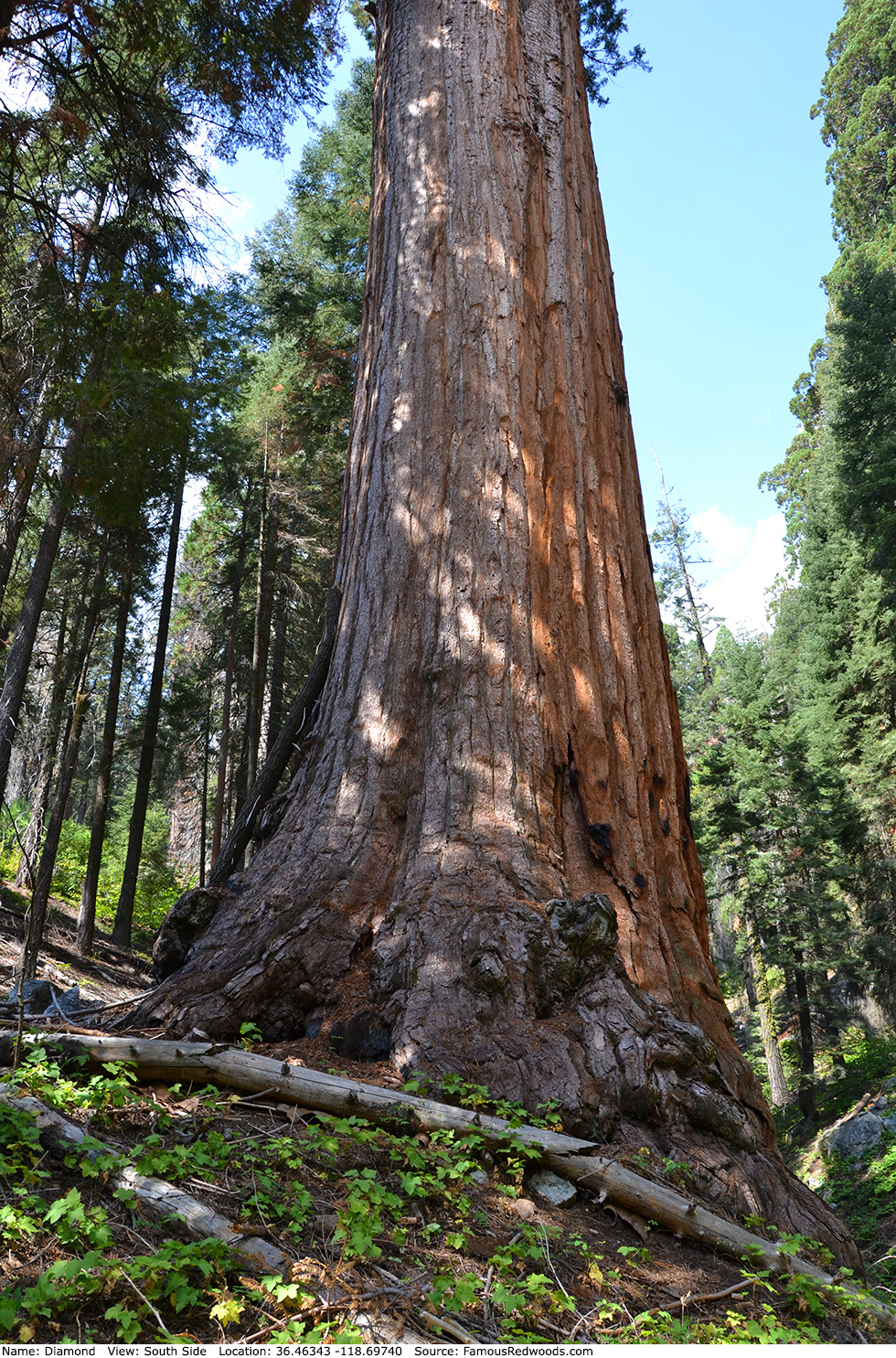
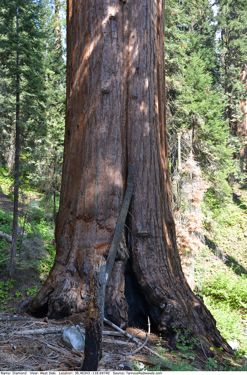
Notes: Before the 2021 KNP Complex Fire, Diamond was the world's 20th largest tree, the 18th largest giant redwood, the 11th largest tree in Sequoia National Park, and the largest tree in Atwell Mill Grove. The trunk lost significant volume after it burned, and, pending updated volume estimates, Diamond likely no longer ranks among the 30 largest giant redwoods.
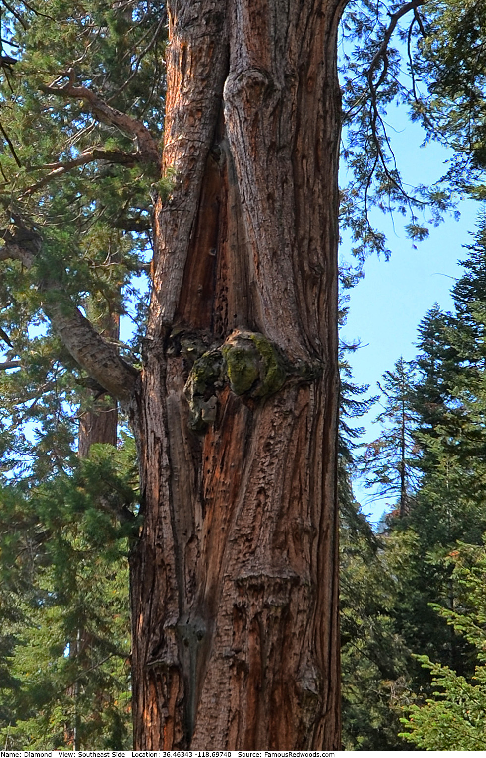
Naturalists Dennis Coggins, Wendell D. Flint, and Michael M. Law named the tree Diamond for the large, diamond-shaped scar present on the southeast side of the trunk.
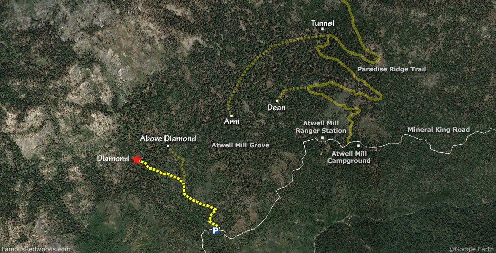
Drive: Diamond is 224 mi (360 km) southeast of San Francisco near the community of Three Rivers.
Northbound: From U.S. Interstate 5 North, transfer to California State Route 99 North toward Bakersfield. Drive north 97 mi (156 km) on California State Route 99 and transfer to California State Route 198 East toward Visalia.
Southbound: From U.S. Interstate 5 South in Sacramento, transfer to U.S. Highway 50 East toward South Lake Tahoe. Drive east 1.7 mi (2.7 km) on U.S. Highway 50 and transfer to California State Highway 99 South. Drive south 201 mi (323 km) on California State Highway 99 South and transfer to California State Route 198 East toward Visalia.
Drive east 38 mi (61 km) on California State Route 198, past Visalia and Three Rivers, and turn right onto Mineral King Road. Drive east 18 mi (29 km) on Mineral King Road to the parking spot, located at 36.45617 -118.68837, on the left/north side of the road.
Road Warning: Mineral King Road is closed (with a locked gate) during winter. Depending on weather conditions, Mineral King Road is usually open from the Wednesday before Memorial Day through the last Wednesday in October. Though paved to Silver City, Mineral King Road is extremely narrow and winding. Oversized vehicles and trailers are not recommended.

Hike: GPS-assisted navigation is recommended for this hike. From the parking spot, follow an abandoned dirt road uphill 0.5 mi (0.8 km) toward the former site of Camp Conifer. Using a GPS device, hike northwest 0.7 mi (1.1 km) off-trail, over the ridge which separates the Atwell Creek and Redwood Creek watersheds, to Diamond. After visiting Diamond, hike northeast/uphill 0.3 mi (0.5 km) off-trail to Above Diamond.
| Rating: | Difficult | One-Way Distance: | 1.2 mi | (1.9 km) | Ascent: | 1,059 ft | (323 m) |
| Time: | 2 hr | Off-Trail: | 1.2 mi | (1.9 km) | Descent: | 267 ft | (81 m) |
View Diamond Tree location in Google Maps
Panoramas: Click panoramas to take a virtual tour of Diamond Tree
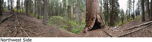
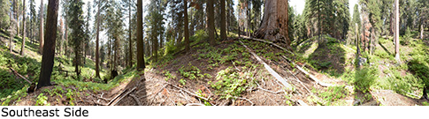
Photos: Pictures of Diamond Tree taken from different sides