| Height: | 323.82+ ft | (98.70+ m) | Elevation: | 155 ft (47 m) | GPS Latitude: | 41.77852 |
| Volume: | 30,784 ft3 | (872 m3) | Creek: | Mill Creek | GPS Longitude: | -124.10065 |
| Width: | 22.10 ft | (6.74 m) | Grove: | Grove of Titans | Discovery Date: | May 11, 1998 |
| Age: | 1,726 y | Park: | Jedediah Smith Redwoods SP | Discovered By: | Stephen C. Sillett | |
| Michael W. Taylor |
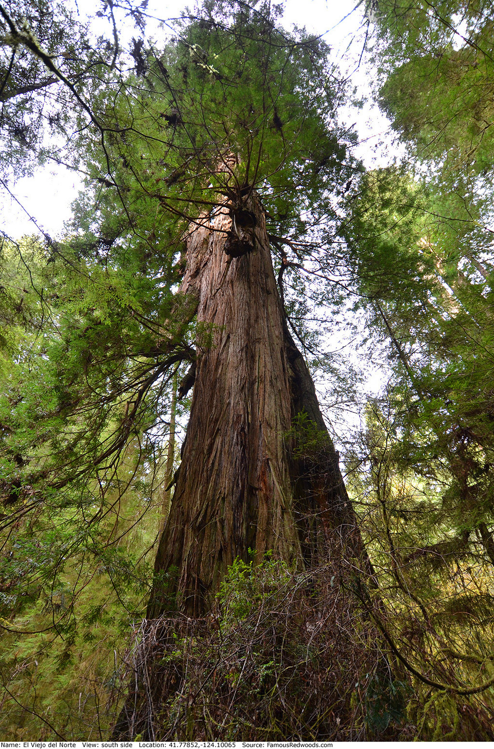
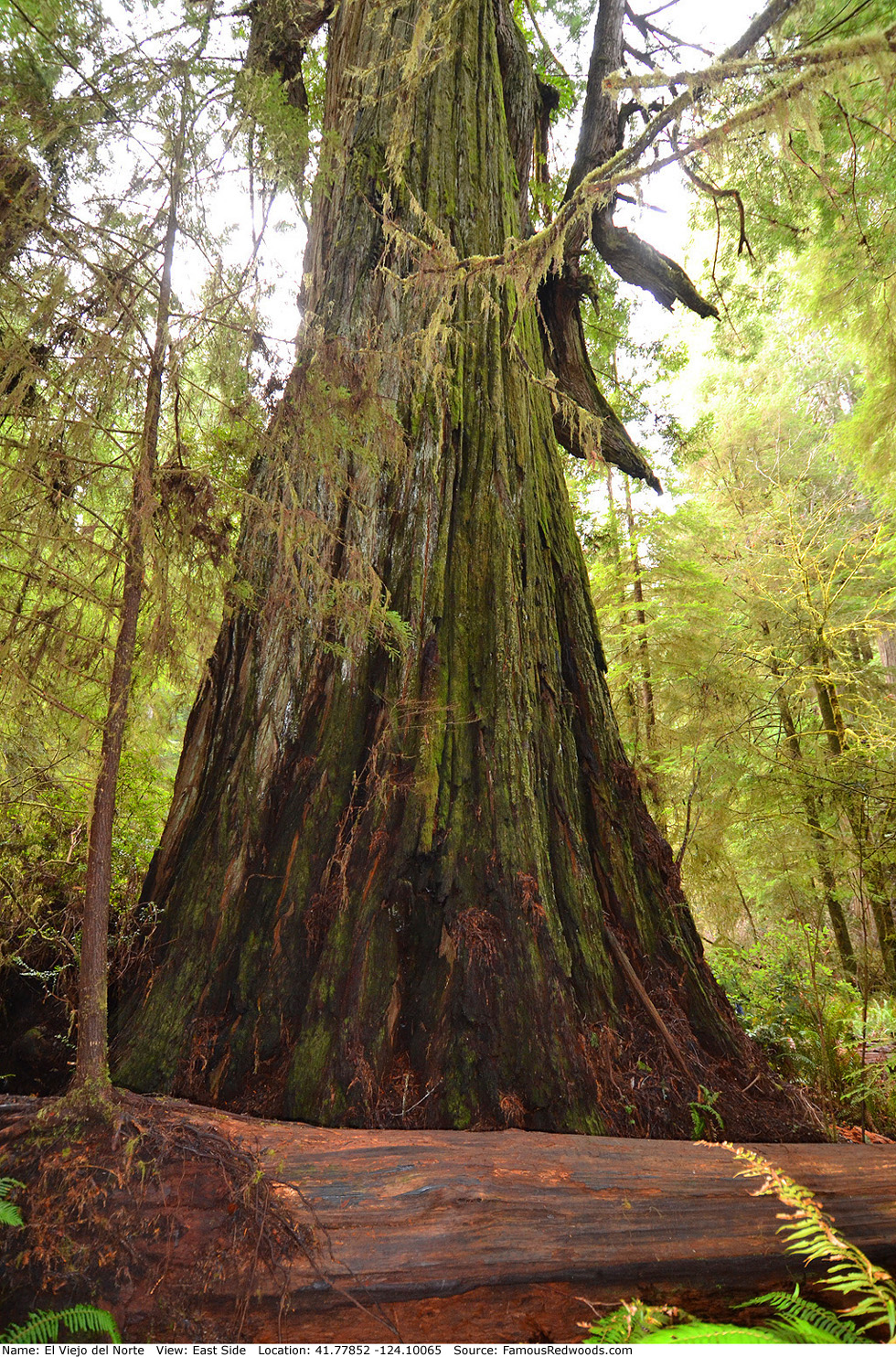
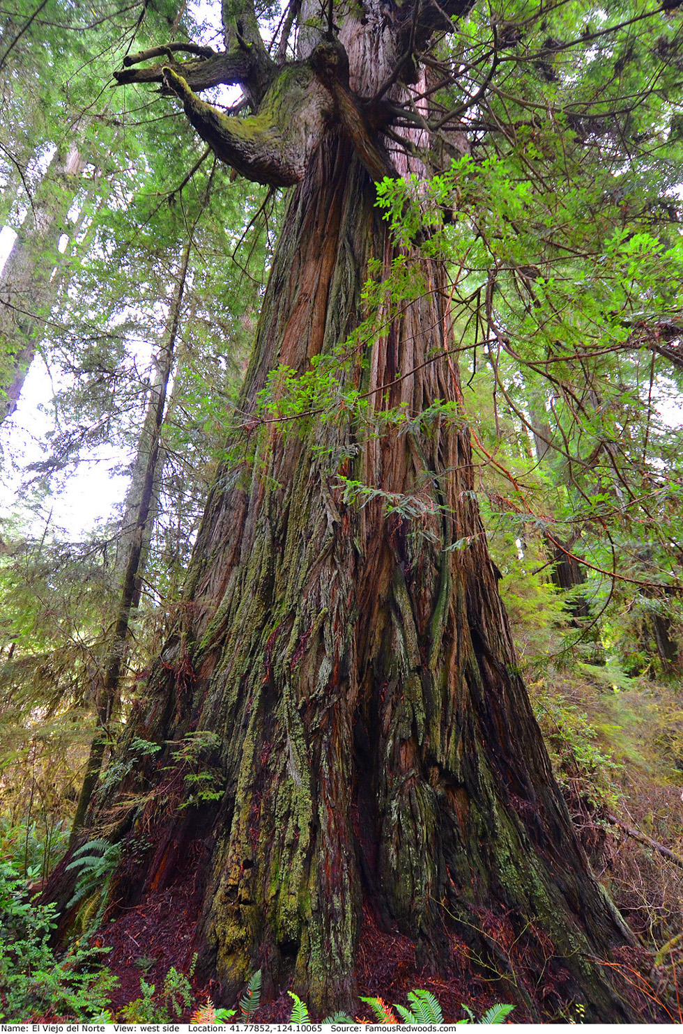
Notes: El Viejo del Norte, Spanish for the old man of the north,
is the
11th largest coast redwood, the 6th largest tree in Jedediah Smith Redwoods State Park, the 4th largest tree in
National Tribute Grove, and the 3rd largest tree in the Grove of Titans. Cal Poly
Humboldt forestry professor Stephen C. Sillett and naturalist Michael W. Taylor named the tree El Viejo del Norte given its gnarled appearance.
El Viejo del Norte has the widest branch (9.19 ft (2.80 m)) of any coast redwood and contains one of the largest arboreal fern mats 25 ft (8 m) long, 6 ft (2 m) wide, and 3 ft (1 m) thick nearly 260 ft (79 m) above ground.
Videographer Arnold D. Cooper published an aerial flyover of El Viejo del Norte. Cal Poly Humboldt forestry professor Stephen C. Sillett photographed the crown of Lost Monarch and the crown of Screaming Titans from El Viejo del Norte. University of Washington forestry affiliate assistant professor Robert Van Pelt published an orthographic illustration of El Viejo del Norte (shown 2nd from left). El Viejo del Norte is featured in the BBC Radio 4 Nature program James and the Giant Redwoods.
Drive: El Viejo del Norte is 290 mi (467 km) north of San Francisco near Crescent City.
Northbound: From U.S. Highway 101, just south of Crescent City, turn right onto Humboldt Road. Drive north 1.5 mi (2.4 km) on Humboldt Road and turn right onto Howland Hill Road. Drive east 3.8 mi (6.1 km) on Howland Hill Road, past Howland Hill Giant, to the Grove of Titans Trailhead located at 41.77243 -124.09940.
Southbound: From U.S. Highway 101, just north of Crescent City, turn left onto California State Route 197 (North Bank Road). Drive south 6.7 mi (10.8 km) on California State Route 197 (North Bank Road) and turn left onto U.S. Highway 199. Drive east 2.8 mi (4.5 km) on U.S. Highway 199 and turn right onto County Road 427 (South Fork Road). Drive south 0.5 mi (0.8 km) on County Road 427 (South Fork Road) and turn right onto Douglas Park Drive. Drive West 1.3 mi (2.1 km) on Douglas Park Drive to the intersection with Pacomo Camp Drive. Continue straight onto Howland Hill Road and drive west 2.5 mi (4.0 km) to the Grove of Titans Trailhead located at 41.77243 -124.09940.
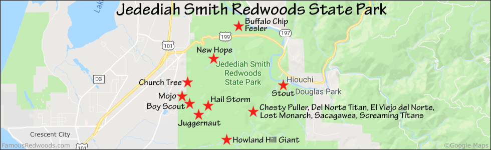
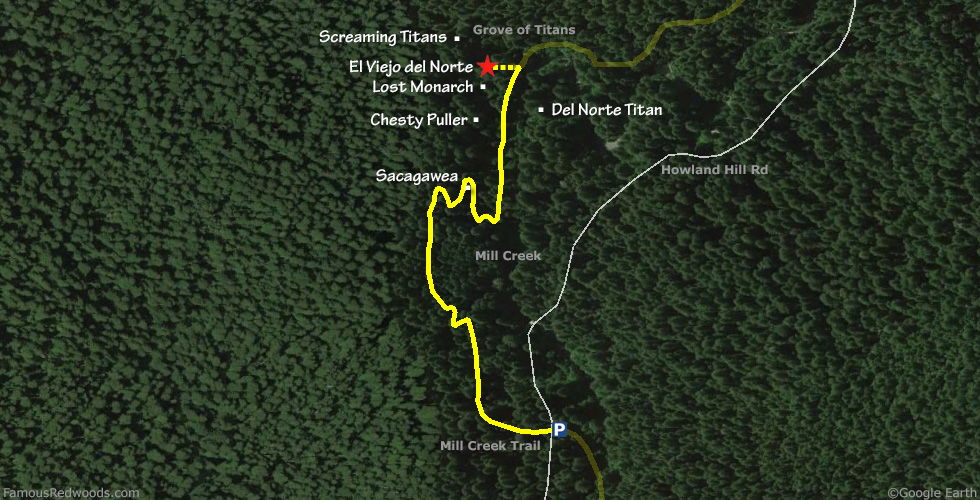
Hike: From the trailhead, hike north 0.7 mi (1.1 km) on Mill Creek Trail, past Sacagawea, Chesty Puller, and Lost Monarch, to El Viejo del Norte which stands beside the trail on your right.
| Rating: | Easy | One-Way Distance: | 0.7 mi | (1.1 km) | Ascent: | 151 ft | (46 m) |
| Time: | 40 min | Off-Trail: | 0 ft | (0 m) | Descent: | 177 ft | (54 m) |
View El Viejo del Norte Tree location in Google Maps
Panorama: Click panorama to take a virtual tour of El Viejo del Norte Tree

Photos: Pictures of El Viejo del Norte Tree taken from different sides