| Height: | 272.70+ ft | (83.12+ m) | Elevation: | 6,435 ft (1,961 m) | GPS Latitude: | 36.22949 |
| Volume: | 36,122 ft3 | (1,023 m3) | Creek: | Coburn Creek | GPS Longitude: | -118.67776 |
| Width: | 20.30 ft | (6.19 m) | Grove: | Mountain Home Grove | Discovery Date: | 1989 |
| Age: | Park: | Giant Sequoia NM | Discovered By: | Wendell D. Flint | ||
| Robert Walker |
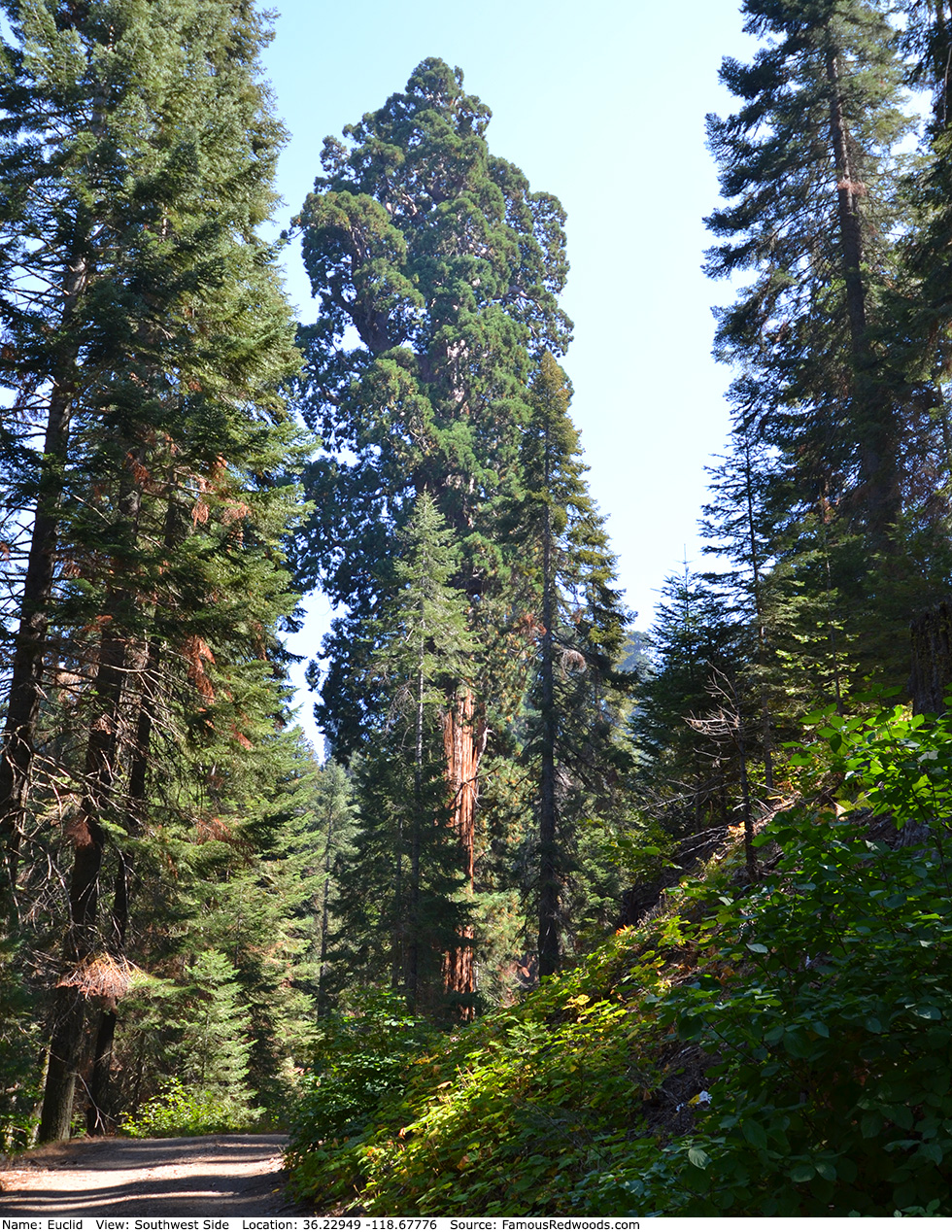
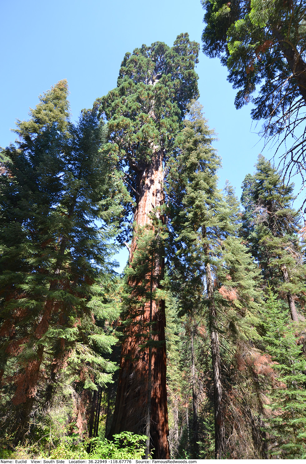
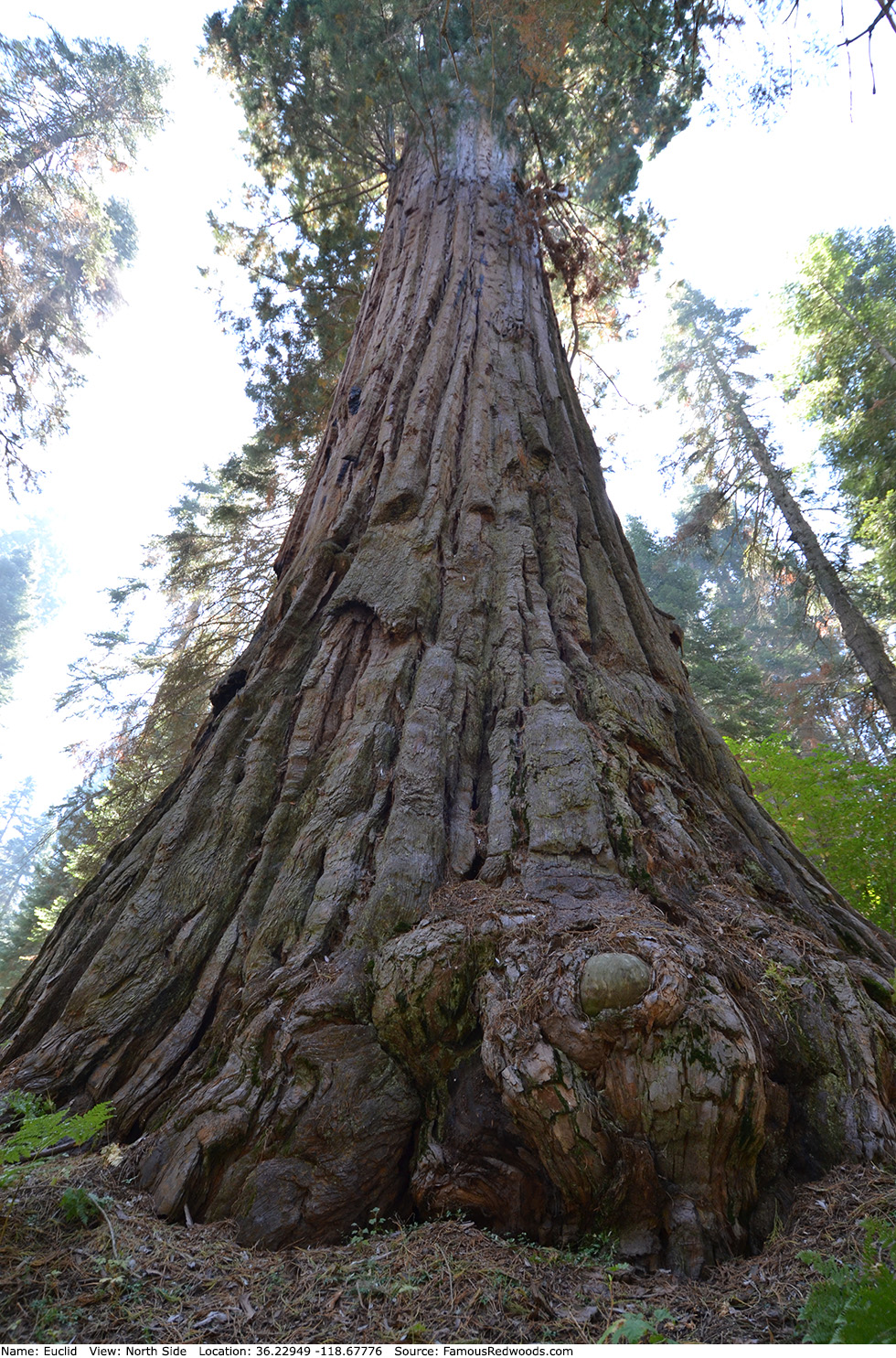
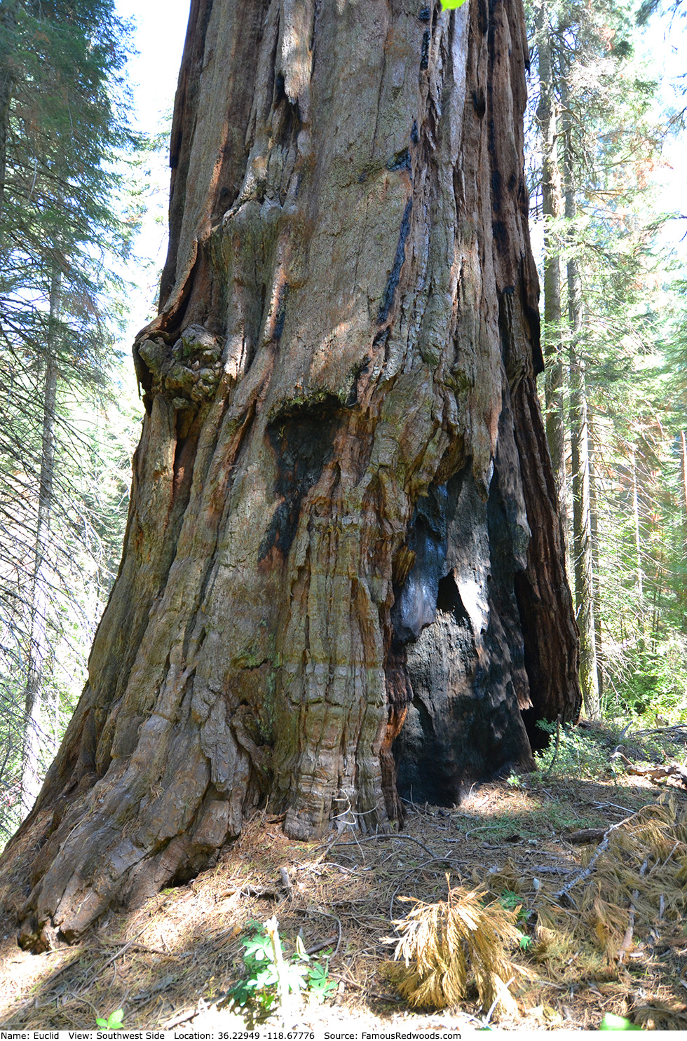
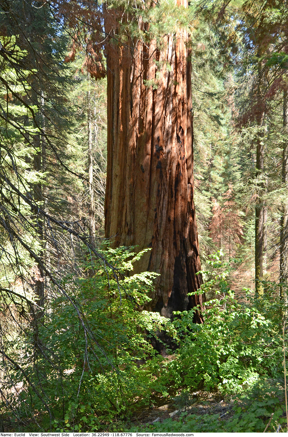
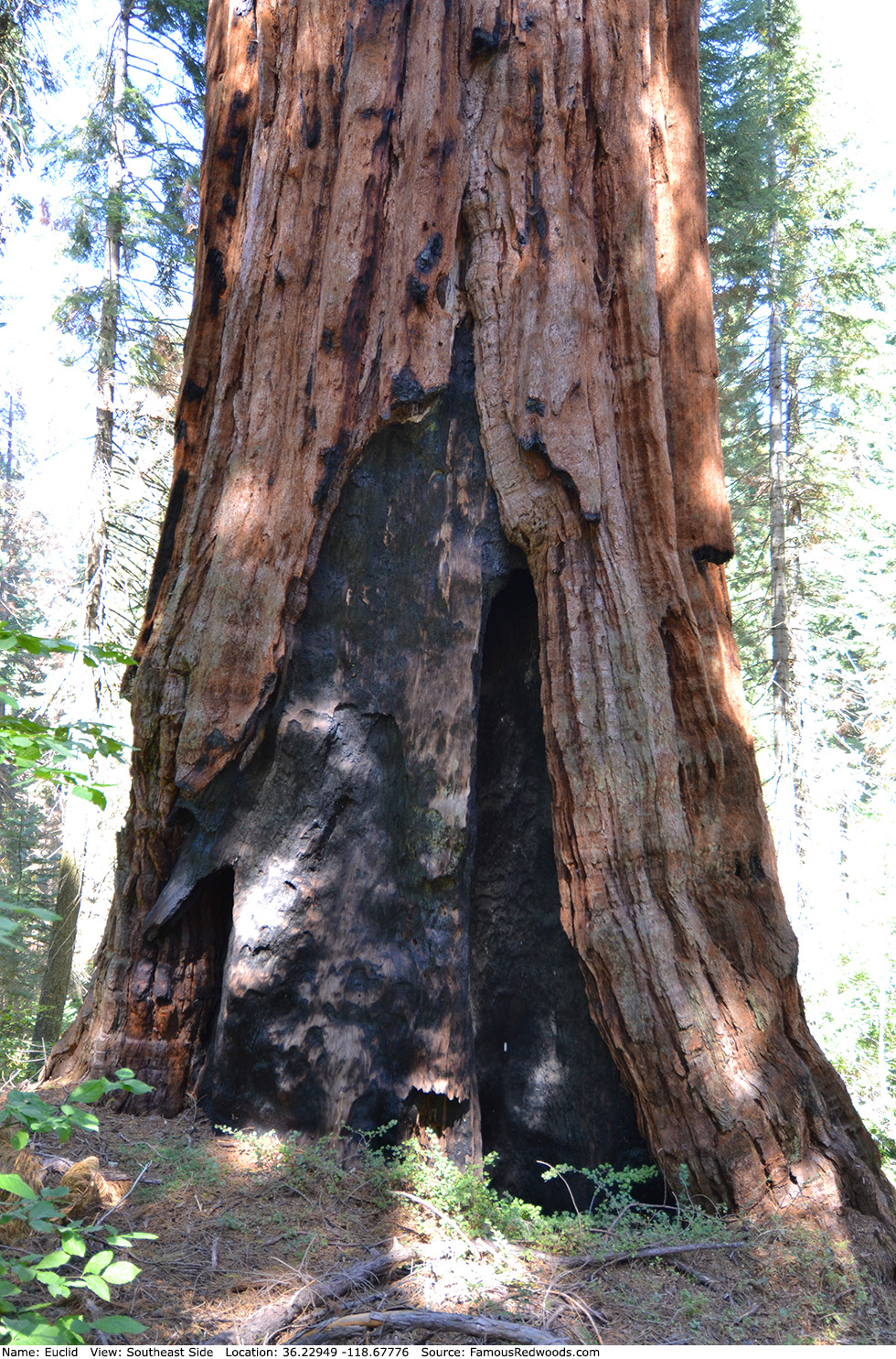
Notes: Euclid the the world's 16th largest tree, the 14th largest giant redwood, the 3rd largest tree in Giant Sequoia National Monument, and the largest tree in Mountain Home Grove. Naturalists Wendell D. Flint and Robert Walker named the tree Euclid to honor the Greek mathematician Euclid, the father of geometry.
Drive: Euclid is 233 mi (375 km) southeast of San Francisco near the city of Porterville.
Northbound: From U.S. Interstate 5 North, transfer to California State Route 99 North. From California State Route 99 North just north of Bakersfield, transfer to California State Route 65 North toward Porterville. Near Porterville, transfer to California State Route 190 East.
Southbound: From U.S. Interstate 5 South in Sacramento, transfer to U.S. Highway 50 East toward South Lake Tahoe. Drive east 1.7 mi (2.7 km) on U.S. Highway 50 and transfer to California State Highway 99 South. Near Tipton, transfer to California State Route 190 East toward Porterville.
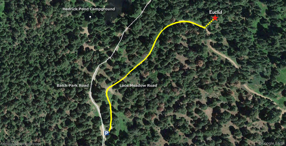
From Porterville, drive east 17 mi (27 km) on California State Route 190 toward Springville. Just past Springfield, turn left onto Balch Park Road toward Scicon, Balch Park, and Mountain Home State Forest. Drive north 3.4 mi (5.5 km) on Balch Park Road and turn right onto Bear Creek Road toward Scicon, Balch Park, and Mountain Home Demonstration State Forest. Drive east 15 mi (24 km) on Bear Creek Road, past Methuselah Group Campground, and veer left at the next fork in the road onto Balch Park Road toward Balch Park. Drive north 0.8 mi (1.3 km) on Balch Park Road, past Balch Park Campground, and veer right onto Lace Meadow Road south of Hedrick Pond. Drive north 100 ft (30 m) on Lace Meadow Road and park near the gate.
Navigation System Warning: Many computer, smartphone, and car navigation systems instruct you to turn left/north onto Rancheria Fire Road (a gated, narrow, and unpaved road) from Bear Creek Road to get to Mountain Home Demonstration State Forest. Ignore those instructions and continue driving on Bear Creek Road instead. Those same navigation systems may also instruct you to bypass Bear Creek Road altogether and to take Balch Park Road to the northern entrance of Mountain Home Demonstration State Forest. Avoid that route from Springville because it adds more than 6 mi (10 km) and 30 min of driving one-way.

Hike: From the parking spot, hike northeast 0.2 mi (0.3 km) on Lace Meadow Road to Euclid which stands next to the left/north side of the road.
| Rating: | Easy | One-Way Distance: | 0.2 mi | (0.3 km) | Ascent: | 181 ft | (55 m) |
| Time: | 5 min | Off-Trail: | 0 ft | (0 m) | Descent: | 110 ft | (34 m) |
View Euclid Tree location in Google Maps
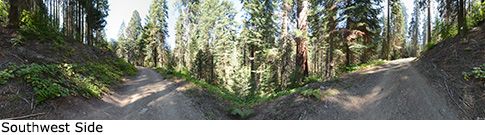
Panorama: Click panorama to take a virtual tour of Euclid Tree
Photos: Pictures of Euclid Tree taken from different sides