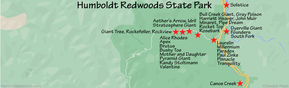
| Height: | 325.00+ ft | (99.06+ m) | Elevation: | 160 ft (49 m) | GPS Latitude: | 40.35192 |
| Volume: | 10,417 ft3 | (295 m3) | River: | South Fork Eel River | GPS Longitude: | -123.92389 |
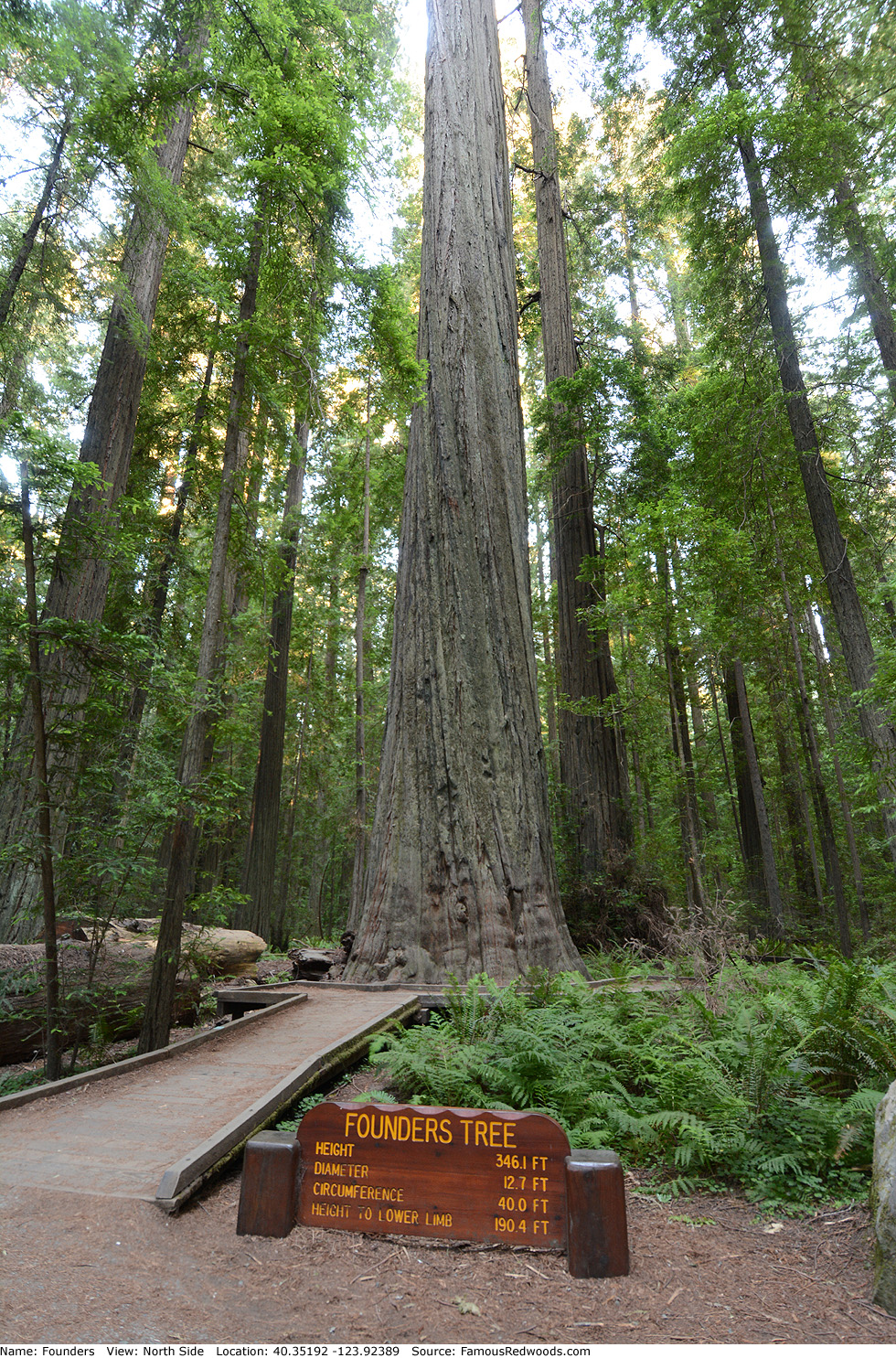
| Width: | 12.70 ft | (3.87 m) | Grove: | Founders Grove | Discovery Date: | 1931 |
| Age: | 1,400 y | Park: | Humboldt Redwoods SP | Discovered By: | Frederick R. Burnham | |
| Madison Grant |
Notes: Founders, also known as Fifth Tallest Tree (1963), was named to honor paleontologist John Campbell Merriam, attorney Madison Grant, and geologist/paleontologist Henry Fairfield Osborn who founded Save the Redwoods League in 1918. Founders held the title of world's tallest tree from 1931 until 1957 when Humboldt State University forestry professor Gerald L. Partain discovered Rockefeller in Humboldt Redwoods State Park.
Founders is 21.1 ft (6.4 m) shorter than a nearby sign indicates: 346.1 ft (105.5 m) in 1968. In 1931, surveyors measured a height of 364 ft (111 m) and proclaimed Founders the world's tallest known tree. However, in 1964, National Geographic Society senior scientist Paul A. Zahl measured a height of 352.6 ft (107.5 m), and, in 1968, Humboldt State University forestry professor Rudolf W. Becking obtained a height of 346.3 ft (105.6 m). Some claim the tree lost 18 ft (5.5 m) of height during a storm while others suspect the 1931 measurement was erroneous (or perhaps someone transposed the last two digits of 346) and that Founders was never world's tallest.
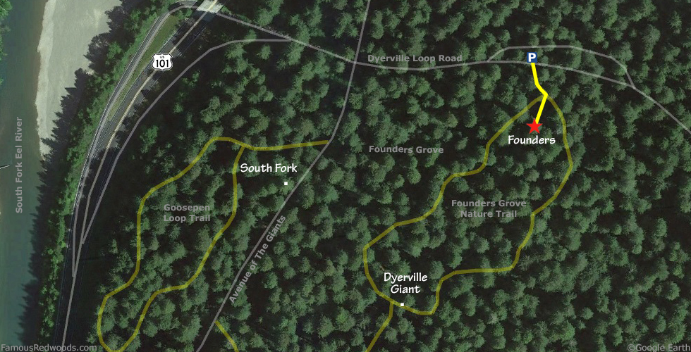
Drive: Founders Tree is 195 mi (314 km) north of San Francisco near the community of Weott.
Northbound: From U.S. Highway 101 just north of Weott, take exit 663 South Fork Honeydew. Continue straight, across California State Route 254 (Avenue of the Giants), onto Dyerville Loop Road.
Southbound: From U.S. Highway 101 just north of Weott, take Exit 663 South Fork Honeydew. Turn left onto Mattole Road, under the bridge, and turn right onto California State Route 254 (Avenue of the Giants). Drive south 0.2 mi (0.3 km) on California State Route 254 (Avenue of the Giants) and turn left onto Dyerville Loop Road.
Drive east 500 ft (152 m) on Dyerville Loop Road and turn left into the parking lot.
Hike: From the trailhead sign, hike south 250 ft (76 m) on Founders Grove Nature Trail to Founders.
| Rating: | Easy | One-Way Distance: | 250 ft | (76 m) | Ascent: | 29 ft | (9 m) |
| Time: | 2 min | Off-Trail: | 0 ft | (0 m) | Descent: | 0 ft | (0 m) |
View Founders Tree location in Google Maps
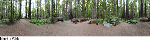
Panoramas: Click panoramas to take a virtual tour of Founders Tree
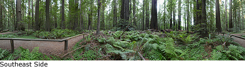
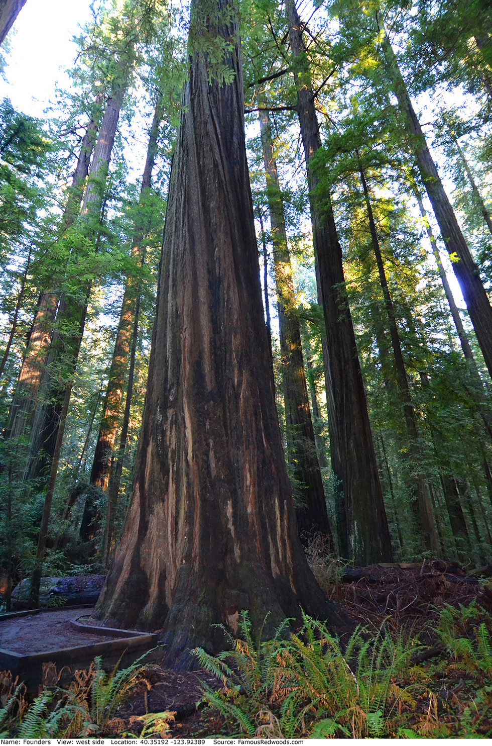
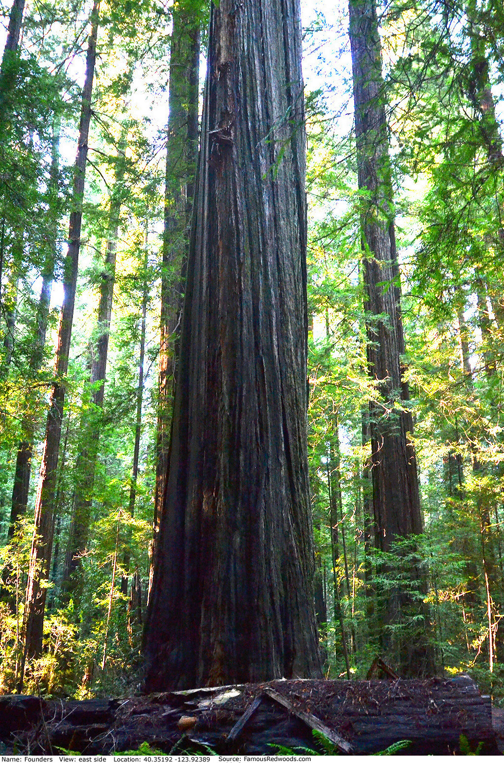
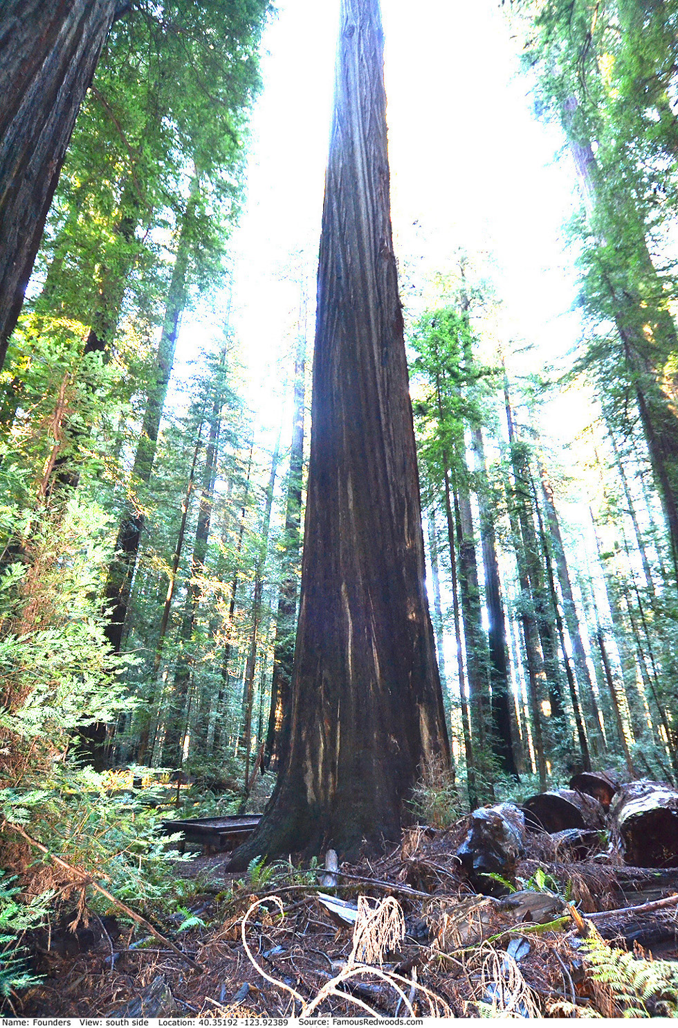
Photos: Pictures of Founders Tree taken from different sides