| Height: | Elevation: | 6,929 ft (2,112 m) | GPS Latitude: | 36.57206 | ||
| Volume: | Creek: | Little Deer Creek | GPS Longitude: | -118.75397 | ||
| Width: | Grove: | Giant Forest | Discovery Date: | |||
| Age: | Park: | Sequoia NP | Discovered By: |
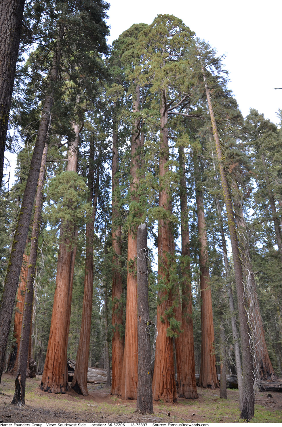
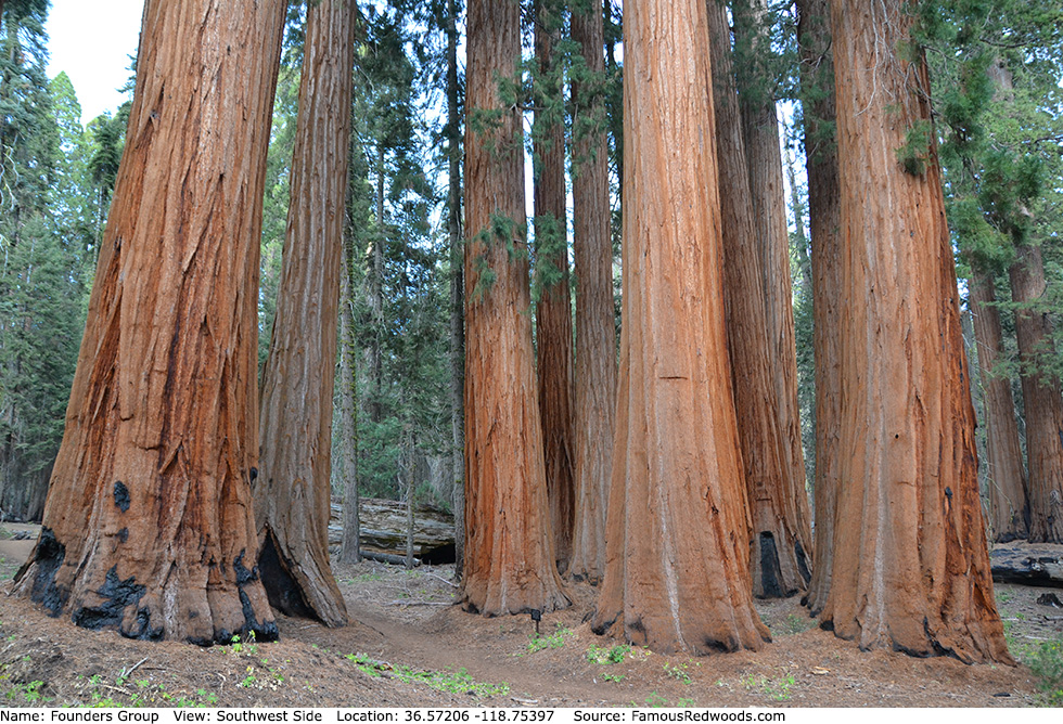
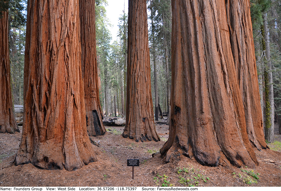
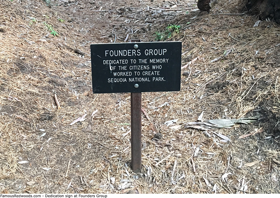
Notes: Founders Group, also known as Entente Allies, is a cluster of giant redwoods located between Adams and Room
in Giant Forest. On July 8, 1931, Sequoia National Park superintendent Colonel John R. White
dedicated Founders Group to honor park founders Henry E. Barbour, Tipton Lindsey, John F. Miller,
George W. Stewart (known as The Father of Sequoia National Park
, John Tuohy, William Vandever, Frederick H. Wales, Frank J. Walker, William B. Wallace, and Daniel K. Zumwalt whose determination to preserve
giant redwoods in Fresno and Tulare counties led to the establishment of Sequoia National Park.
Drive: Founders Group is 218 mi (351 km) southeast of San Francisco near Fresno.
Northbound: From U.S. Interstate 5 North, transfer to California State Route 99 North toward Bakersfield. Drive north 97 mi (156 km) on California State Route 99 and transfer to California State Route 198 East toward Visalia. Drive east 58 mi (93 km) on California State Route 198 (Generals Highway), past Four Guardsmen, and turn left into the Pinewood Picnic Area parking lot.
Southbound: From U.S. Interstate 5 South in Sacramento, transfer to U.S. Highway 50 East toward South Lake Tahoe. Drive east 1.7 mi (2.7 km) on U.S. Highway 50 and transfer to California State Highway 99 South. Near Fresno, transfer to California State Route 180 East. Drive east 56 mi (90 km) on California State Route 180, and turn right onto California State Route 198 West. Drive south 28 mi (45 km) on California State Route 198 (Generals Highway) and turn right into the Pinewood Picnic Area parking lot.

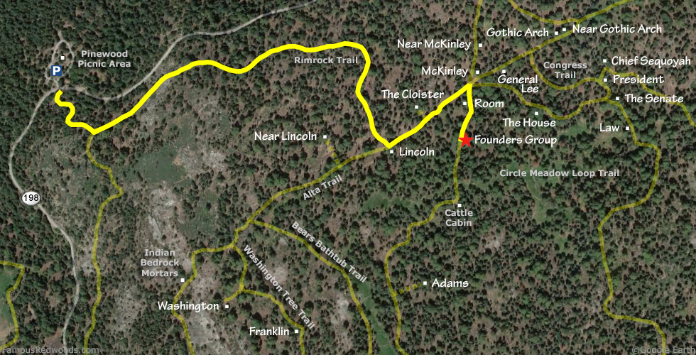
Hike: From the parking lot, walk south across California State Route 198 (Generals Highway) to an unpaved road marked
Authorized Vehicles Only.
Hike uphill/south 0.2 mi (0.3 km) on the unpaved road to the junction with Rimrock Trail. Turn left at the trail
junction and hike east 0.7 mi (1.1 km) on Rimrock Trail to Lincoln at the
junction with Alta Trail. Turn left at the trail junction and hike northeast 0.2 mi (0.3 km) on Alta Trail to
McKinley trail junction. Turn right at the trail junction and hike south 0.1 mi (0.2 km) on the western half of Circle Meadow Loop Trail, past
Room, to Founders Group which stands beside the trail on your left.
| Rating: | Easy | One-Way Distance: | 1.2 mi | (1.9 km) | Ascent: | 612 ft | (187 m) |
| Time: | 35 min | Off-Trail: | 0 ft | (0 m) | Descent: | 287 ft | (87 m) |
View Founders Group Trees location in Google Maps
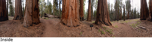
Panorama: Click panorama to take a virtual tour of Founders Group Trees
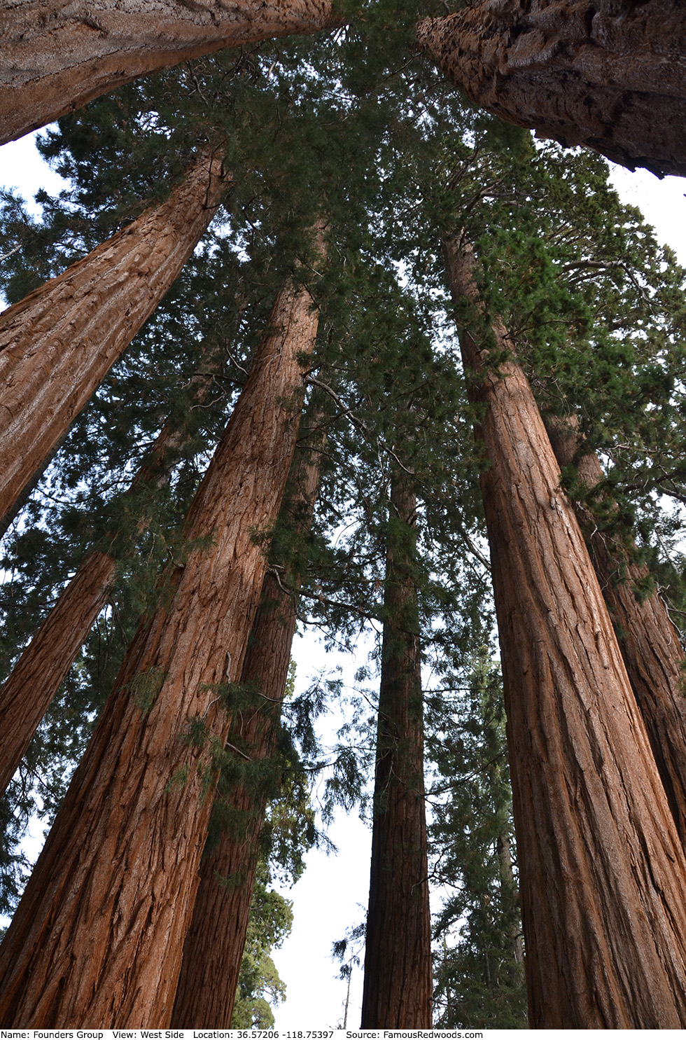
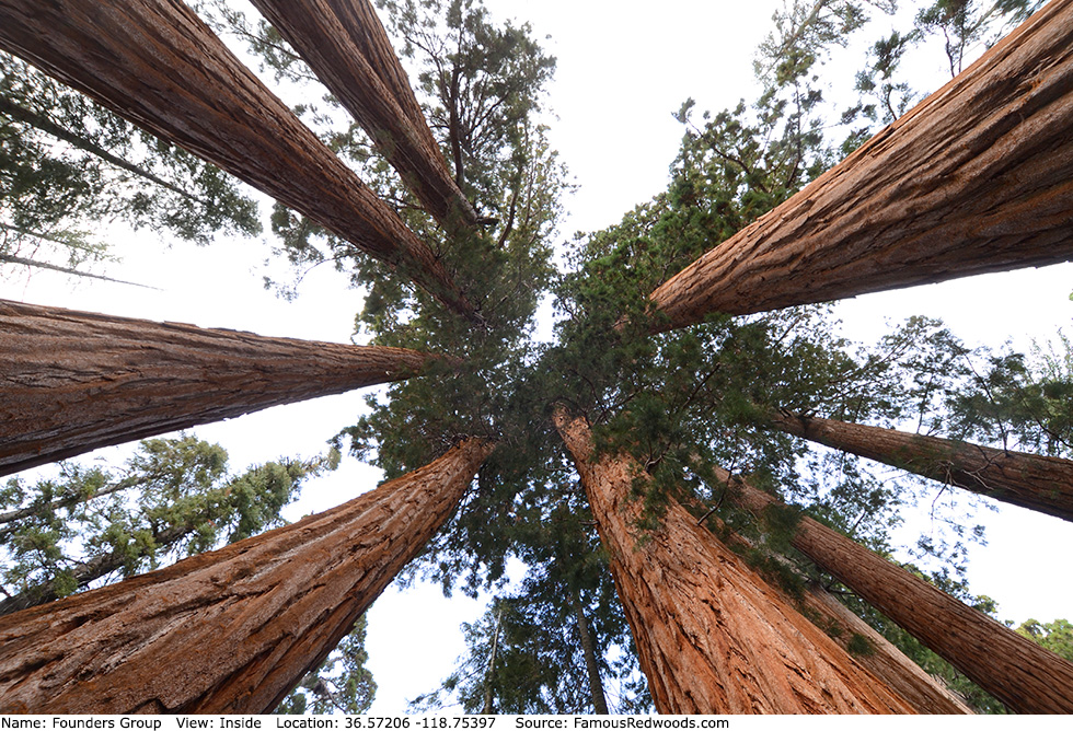
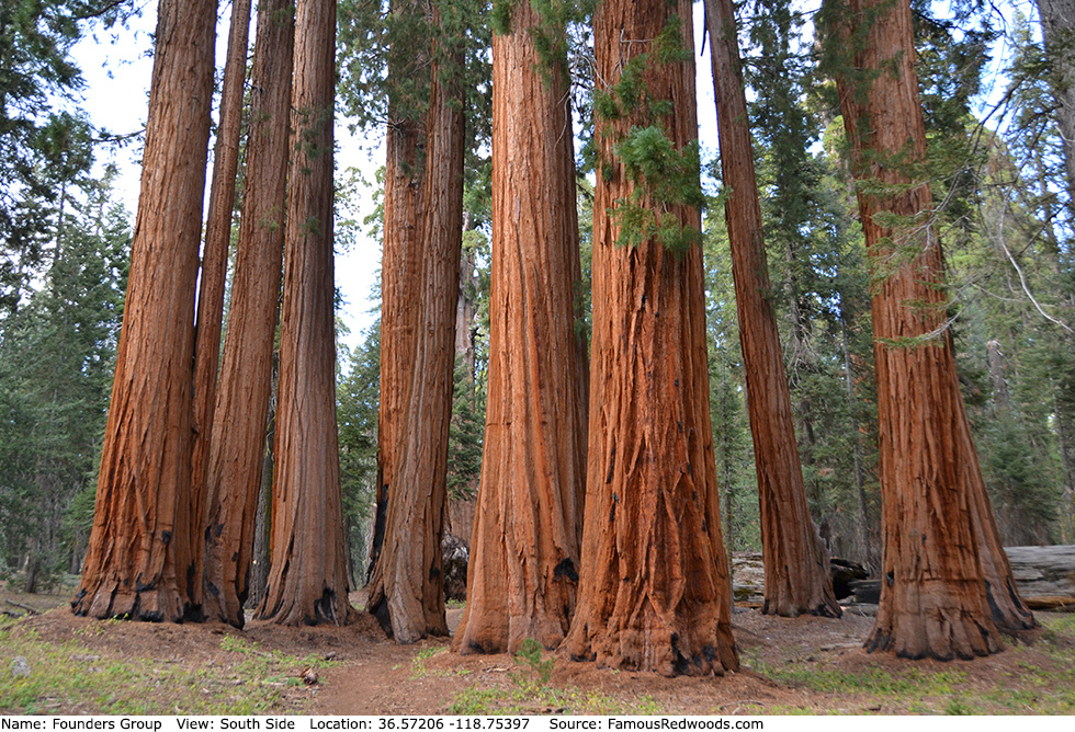
Photos: Pictures of Founders Group Trees taken from different sides