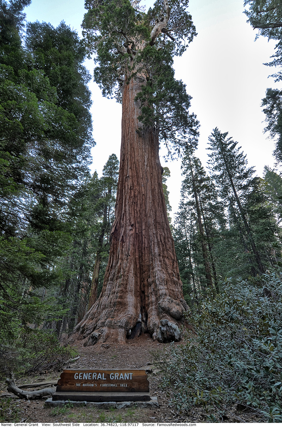
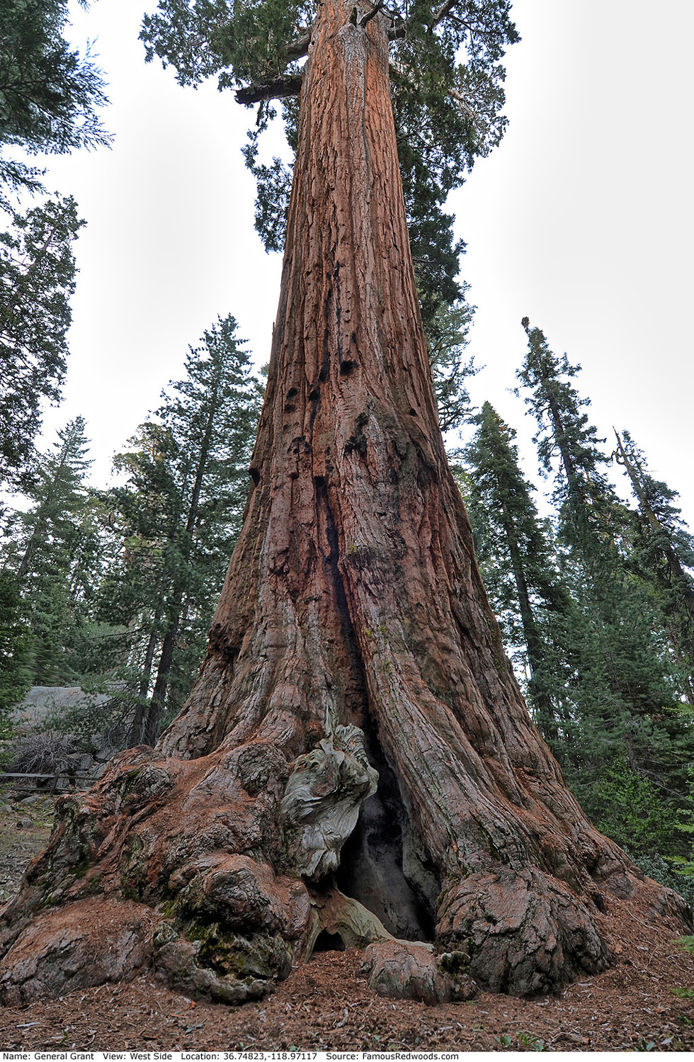
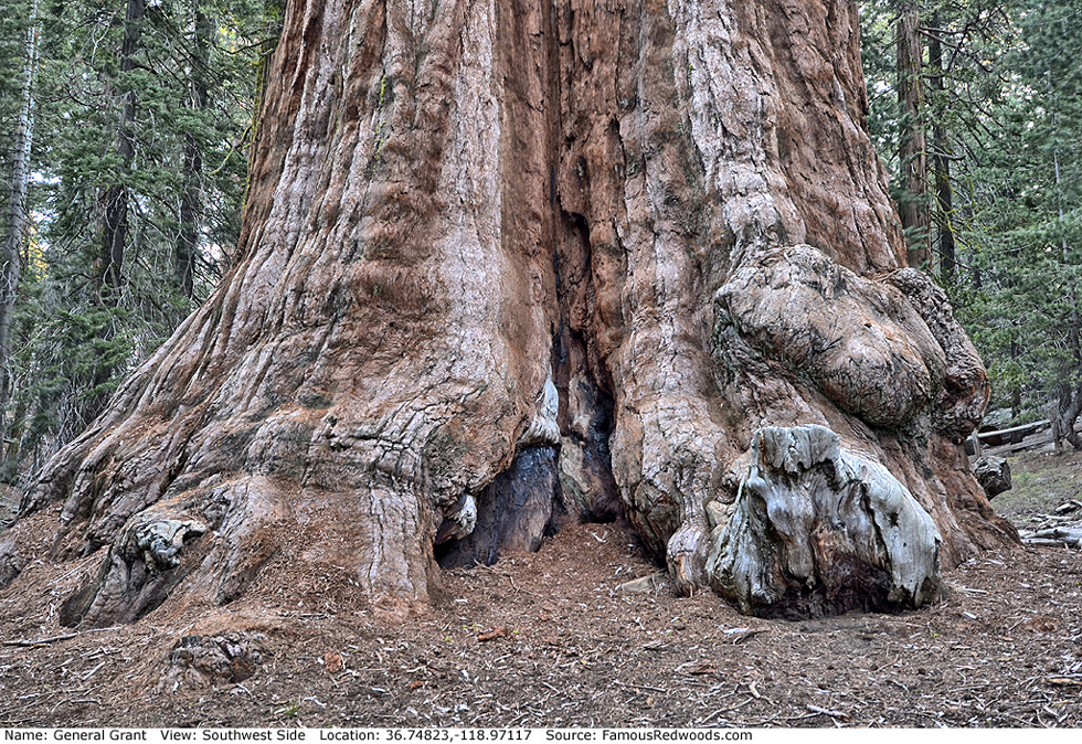
| Height: | 268.10+ ft | (81.72+ m) | Elevation: | 6,350 ft (1,935 m) | GPS Latitude: | 36.74823 |
| Volume: | 47,930 ft3 | (1,357 m3) | Creek: | Big Tree Creek | GPS Longitude: | -118.97117 |
| Width: | 29.02 ft | (8.85 m) | Grove: | General Grant Grove | Discovery Date: | 1862 |
| Age: | 2,271 y | Park: | Kings Canyon NP | Discovered By: | Joseph Hardin Thomas |
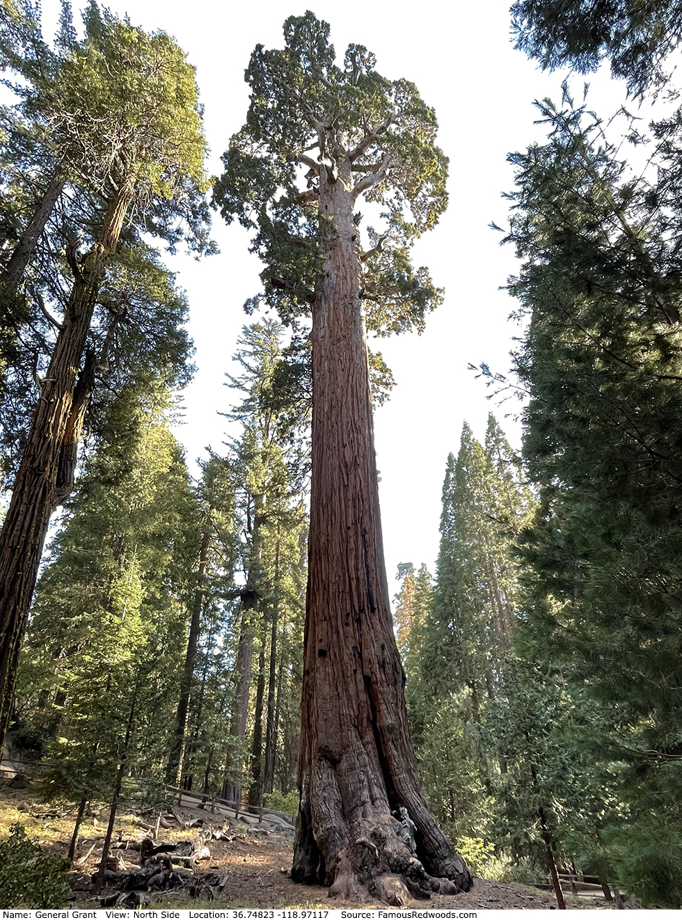
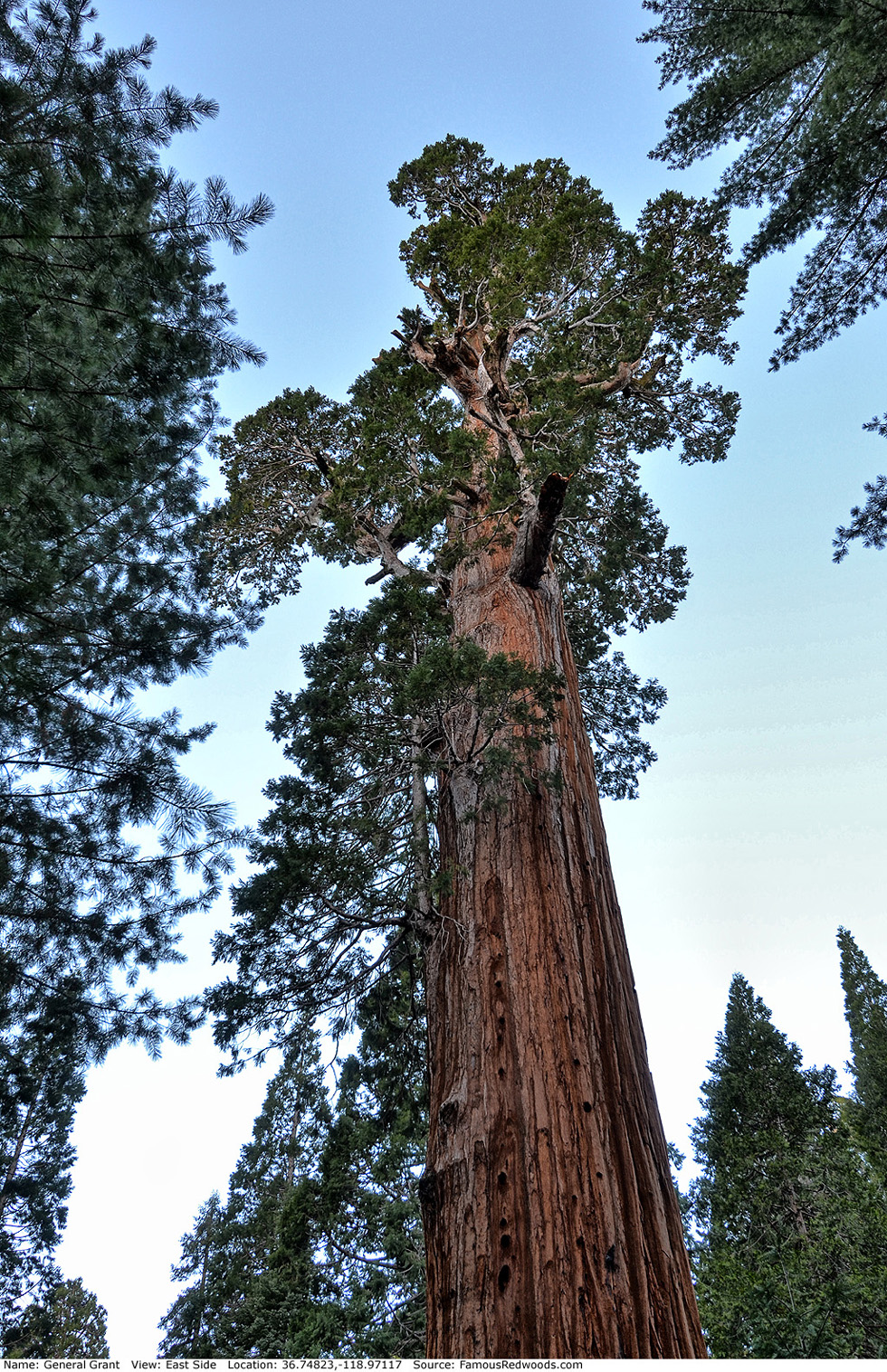
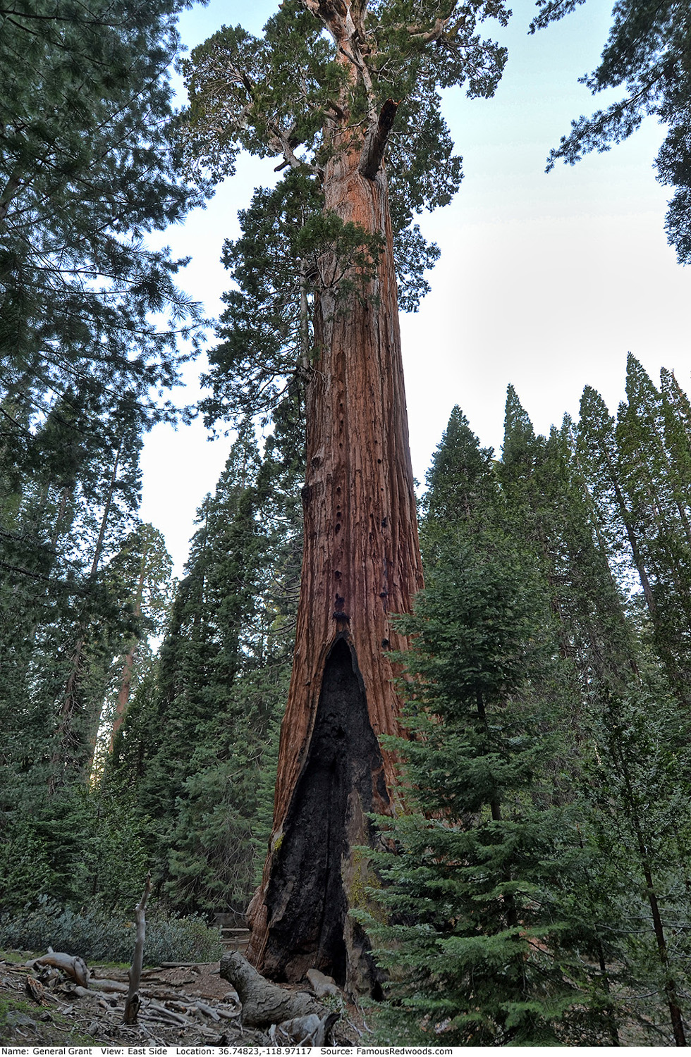
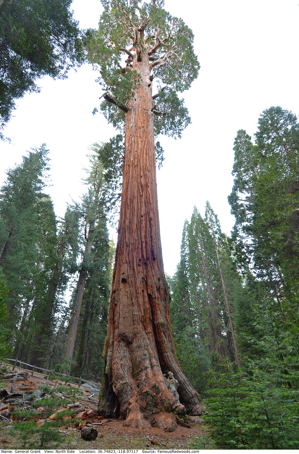
Notes: General Grant, named to honor Ulysses S. Grant, Commanding General of the United States Army and 18th President of the United States, is the world's 2nd largest tree, the widest and 2nd largest giant redwood, and the largest tree in Kings Canyon National Park.
Once considered the world's largest tree, General Grant was identified as 2nd largest in 1931 when a team of engineers, led by J. W. Jourdan of the San Joaquin Light and Power Corporation, measured the four then-largest-known redwoods (Boole, Hart, General Grant, and General Sherman) and determined that General Sherman was the true size champion.
The naming of General Grant remains controversial. Lumberman Joseph Hardin Thomas discovered the tree in 1862 and claimed to have named it to honor then-General Grant. However, most park historians credit the naming to pioneer Lucretia P. Baker of Porterville who camped near the tree with her family on August 20, 1867. Although President Grant's letter to Mrs. Baker, thanking her for the honor, suggests Baker named the tree, lumberman Hudson D. Barton's assertion that the tree was already named General Grant, when measured in 1866, supports Thomas' claim.
At noon on Christmas Day in 1925, R. J. Senior and Charles E. Lee, President and Secretary, respectively, of the Sanger District Chamber of Commerce, held the first yuletide service beneath the tree. On April 28,
1926, President Calvin Coolidge, at Lee's urging, designated General Grant the Nation's Christmas Tree. Every year thereafter, at 2:30 pm on the second Sunday in December, the Sanger District Chamber of Commerce,
in cooperation with the National Park Service, has sponsored the
Trek to the Nation's Christmas Tree, a holiday celebration in which
people gather to sing, pray, and pay tribute to this wonder of nature.
On March 29, 1956, President Dwight D. Eisenhower signed legislation which declared the tree a national shrine (the only living thing so designated) to honor members of the Armed Forces who fought and died to preserve American heritage and freedom. On Veterans Day, November 11, 1956, Fleet Admiral Chester W. Nimitz, representing President Eisenhower, formally dedicated General Grant as a national shrine during a ceremony beside the tree.
General Grant should not be confused with another General Grant tree which grows in Mariposa Grove in Yosemite National Park.
The I Can Fly Videos film The Giants includes aerial footage of General Grant. University of Washington forestry affiliate assistant professor Robert Van Pelt published an orthographic illustration of General Grant (shown 2nd from right).
General Grant is directly in the path of the May 3, 2106 total solar eclipse.
Drive: General Grant is 203 mi (327 km) southeast of San Francisco near Fresno.
Northbound: From U.S. Interstate 5 North, transfer to California State Route 99 North toward Bakersfield. Drive north 97 mi (156 km) on California State Route 99 and transfer to California State Route 198 East toward Visalia. Drive east 86 mi (138 m) on California State Route 198, past Four Guardsmen, and turn right onto California State Route 180 East toward General Grant Grove. Drive north 1.6 mi (2.6 km) on California State Route 180, past the Kings Canyon Visitor Center and General Grant Grove Cabins, and turn left onto Grant Tree Road.
Southbound: From U.S. Interstate 5 South in Sacramento, transfer to U.S. Highway 50 East toward South Lake Tahoe. Drive east 1.7 mi (2.7 km) on U.S. Highway 50 and transfer to California State Highway 99 South. Near Fresno, transfer to California State Route 180 East. Drive east 58 mi (93 km) on California State Route 180 toward General Grant Grove, past the Kings Canyon Visitor Center and General Grant Grove Cabins, and turn left onto Grant Tree Road.
Drive west 0.8 mi (1.2 km) on Grant Tree Road to the General Grant Tree parking lot.
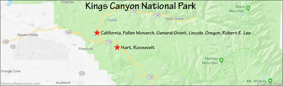
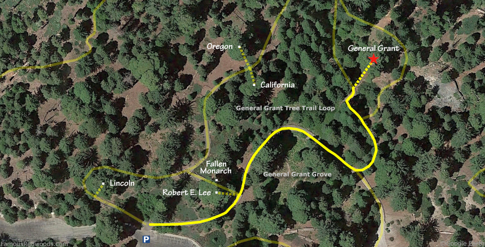
Hike: At the northern edge of the parking lot, turn right/northeast at the trailhead and hike northeast 0.1 mi (0.2 km) on the eastern half of General Grant Tree Trail Loop, past Robert E. Lee and Fallen Monarch, to an unmarked trail junction. Veer left at the trail junction and continue north 260 ft (79 m) on the eastern half of General Grant Tree Trail Loop, past another trail junction, to General Grant which stands beside the trail on your right.
| Rating: | Easy | One-Way Distance: | 0.2 mi | (0.3 km) | Ascent: | 75 ft | (23 m) |
| Time: | 5 min | Off-Trail: | 0 ft | (0 m) | Descent: | 0 ft | (0 m) |
View General Grant Tree location in Google Maps
Panoramas: Click panoramas to take a virtual tour of General Grant Tree
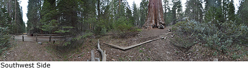
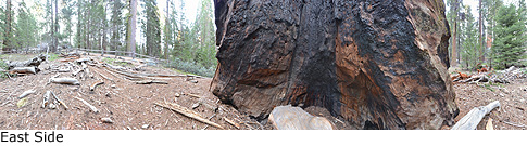
Photos: Pictures of General Grant Tree taken from different sides