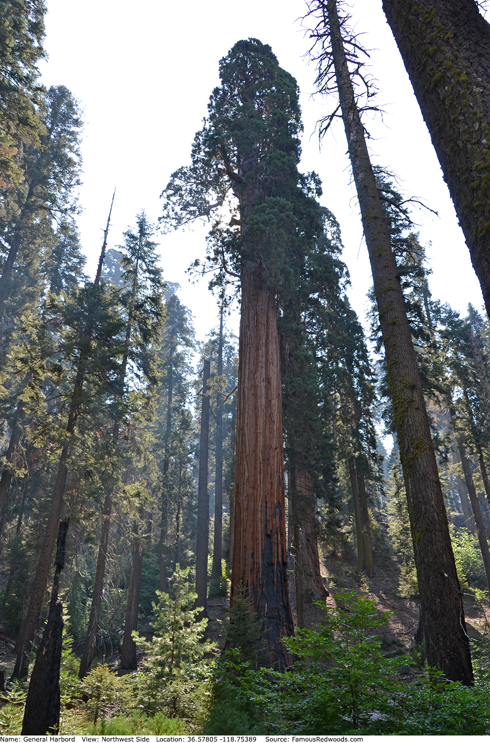
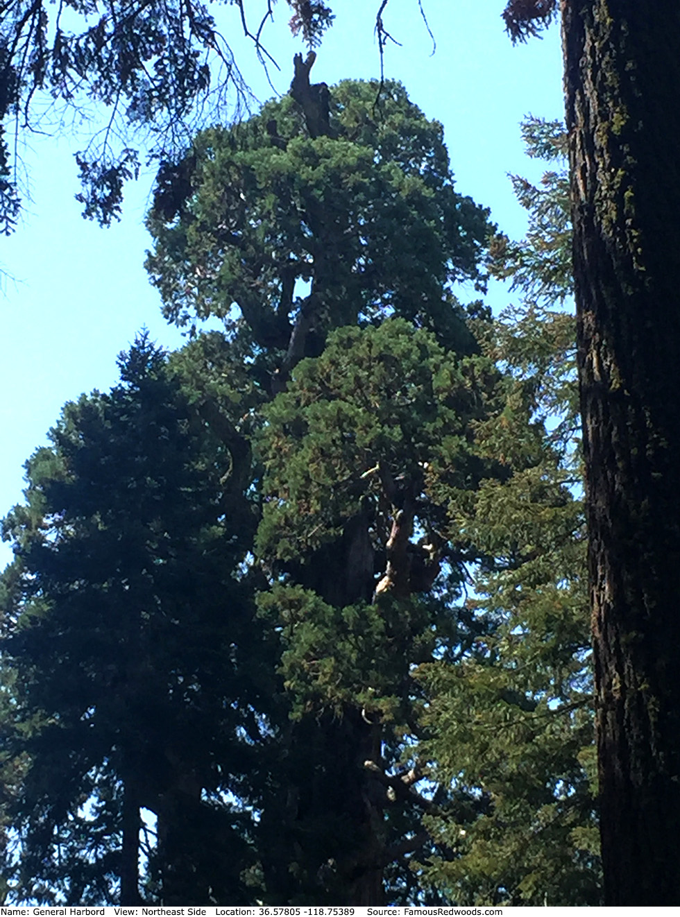
| Height: | 267.60+ ft | (81.56+ m) | Elevation: | 6,667 ft (2,032 m) | GPS Latitude: | 36.57805 |
| Volume: | 25,798 ft3 | (731 m3) | Creek: | Sherman Creek | GPS Longitude: | -118.75389 |
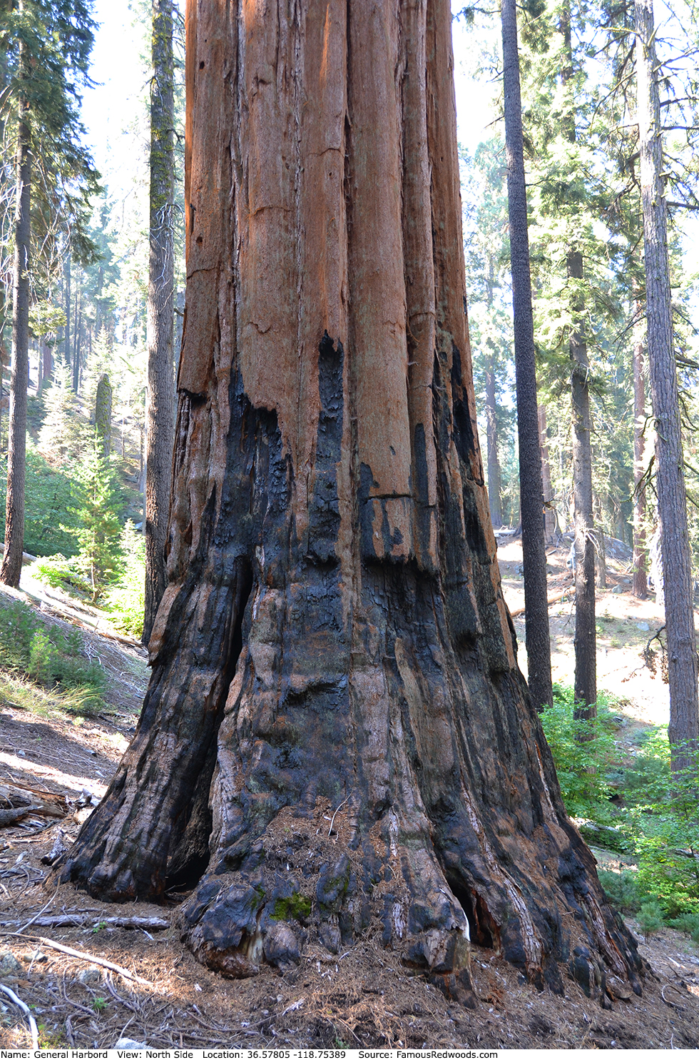
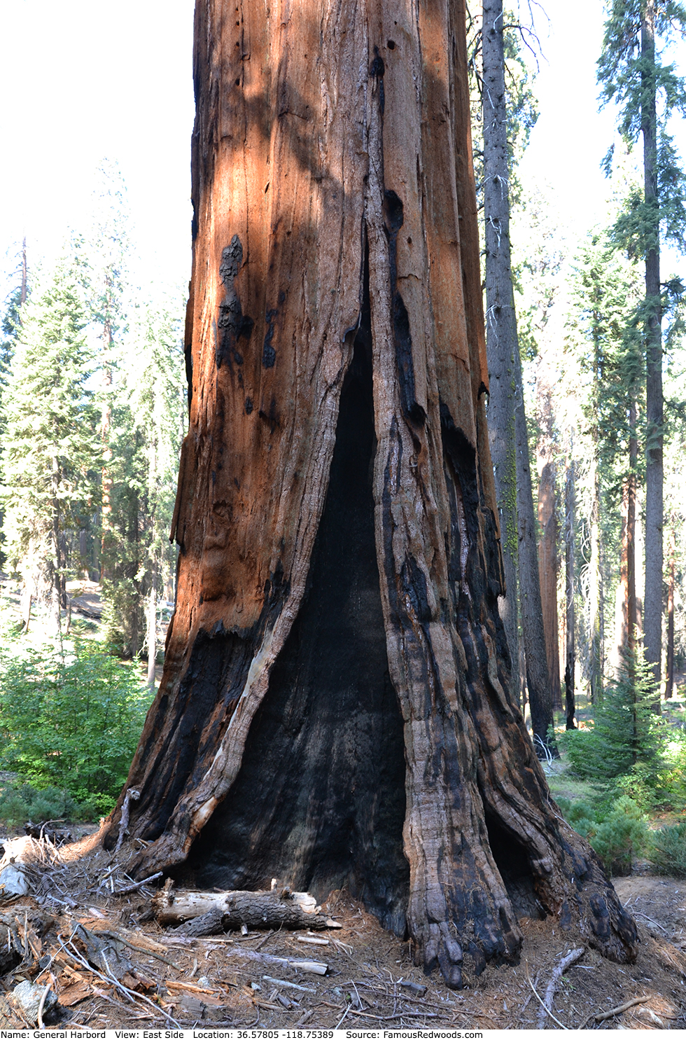
| Width: | 20.12 ft | (6.13 m) | Grove: | Giant Forest | Discovery Date: | |
| Age: | Park: | Sequoia NP | Discovered By: |
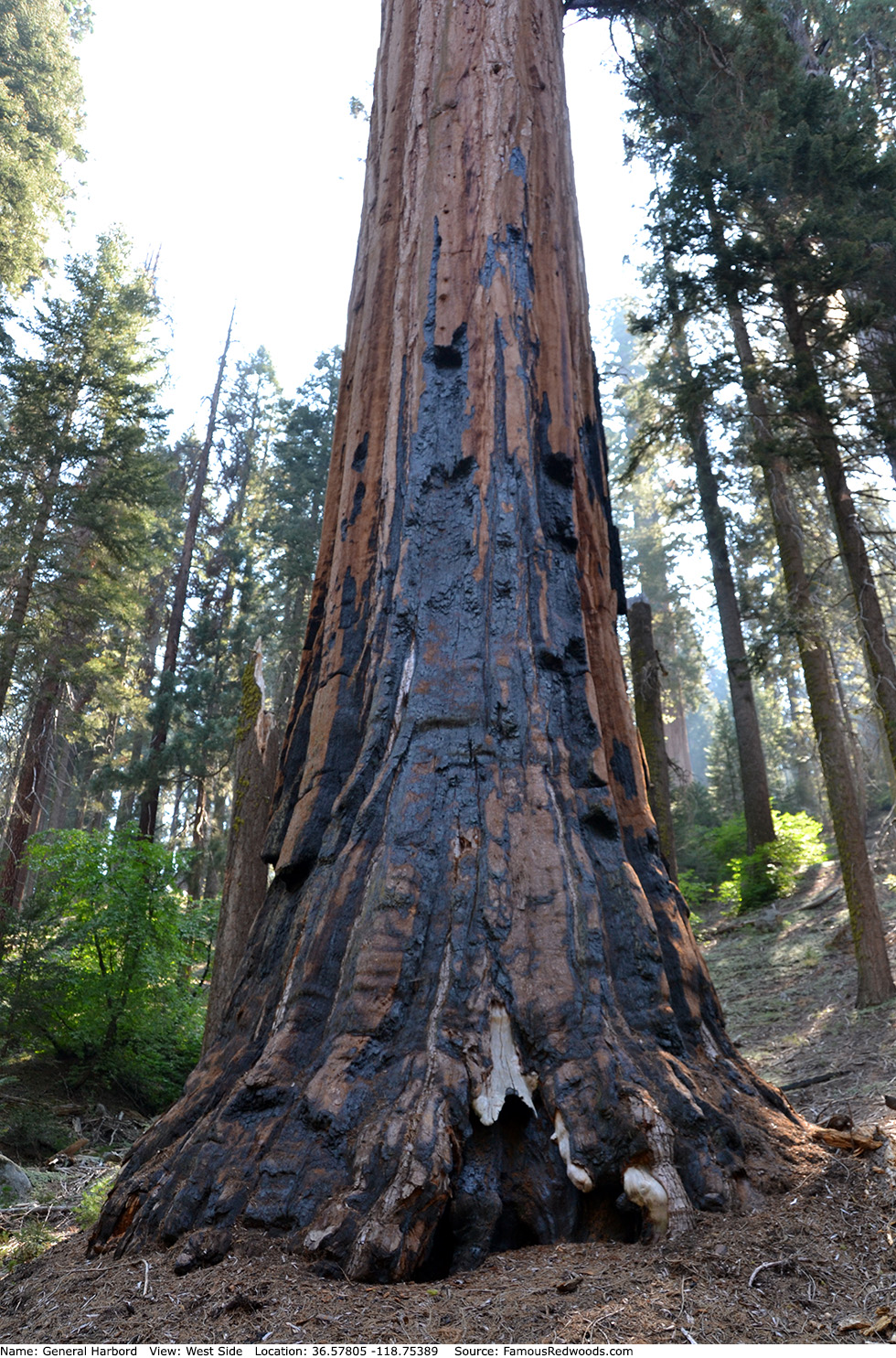
Notes: In 1926, Sequoia National Park superintendent Colonel John R. White dedicated General Harbord tree to honor General James G. Harbord who served as Chief of Staff for General John J. Pershing, Commander of the American Expeditionary Force, during World War 1.
Drive: General Harbord is 218 mi (351 km) southeast of San Francisco near Fresno.
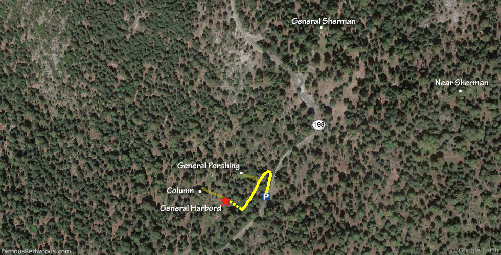
Northbound: From U.S. Interstate 5 North, transfer to California State Route 99 North toward Bakersfield. Drive north 97 mi (156 km) on California State Route 99 and transfer to California State Route 198 East toward Visalia. Drive east 59 mi (95 km) on California State Route 198 (Generals Highway), past Four Guardsmen, and park at a turnout, located at 36.57818 -118.75286, on the left/west side of the road 0.2 mi (0.3 km) south of the Sherman Tree accessible parking lot.
Southbound: From U.S. Interstate 5 South in Sacramento, transfer to U.S. Highway 50 East toward South Lake Tahoe. Drive east 1.7 mi (2.7 km) on U.S. Highway 50 and transfer to California State Highway 99 South. Near Fresno, transfer to California State Route 180 East. Drive east 56 mi (90 km) on California State Route 180, and turn right onto California State Route 198 West. Drive south 27 mi (43 km) on California State Route 198 (Generals Highway) and park at a turnout, located at 36.57823 -118.75283, on the right/west side of the road 0.2 mi (0.3 km) south of the Sherman Tree accessible parking lot.

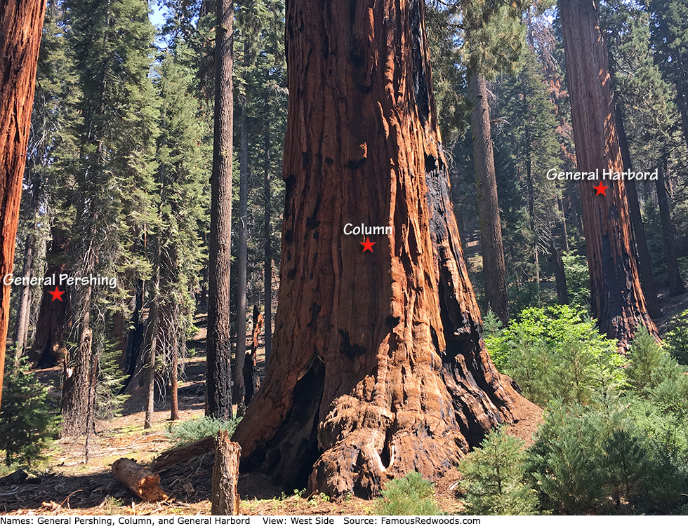
Hike: From the turnout, walk north 200 ft (61 m) on California State Route 198 (Generals Highway) to connect to an abandoned trail just west of the road. Hike southwest 350 ft (107 m) on the abandoned trail, turn right, and hike northwest/downhill 160 ft (49 m) off-trail to General Harbord. After visiting General Harbord, hike northwest/downhill 200 ft (61 m) off-trail to Column or hike northeast 270 ft (82 m) off-trail to General Pershing.
| Rating: | Easy | One-Way Distance: | 160 ft | (49 m) | Ascent: | 3 ft | (1 m) |
| Time: | 3 min | Off-Trail: | 160 ft | (49 m) | Descent: | 103 ft | (31 m) |
View General Harbord Tree location in Google Maps
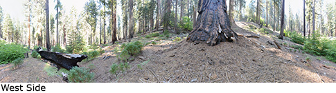
Panorama: Click panorama to take a virtual tour of General Harbord Tree
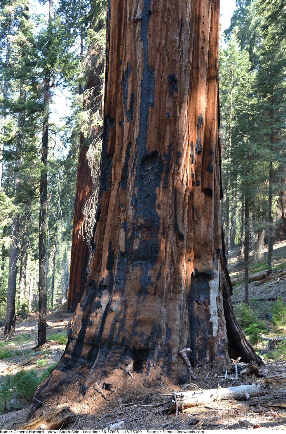
Photos: Pictures of General Harbord Tree taken from different sides