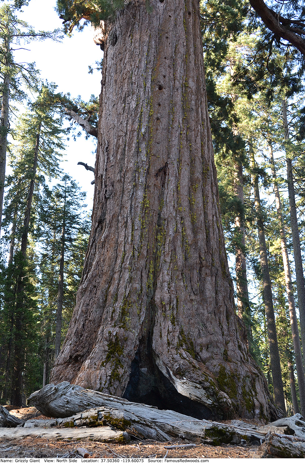
| Height: | 208.33+ ft | (63.50+ m) | Elevation: | 5,917 ft (1,804 m) | GPS Latitude: | 37.50360 |
| Volume: | 31,501 ft3 | (892 m3) | Creek: | Big Trees Creek | GPS Longitude: | -119.60075 |
| Width: | 25.40 ft | (7.74 m) | Grove: | Mariposa Grove | Discovery Date: | 1857 |
| Age: | 2,964 y | Park: | Yosemite NP | Discovered By: | Galen Clark |
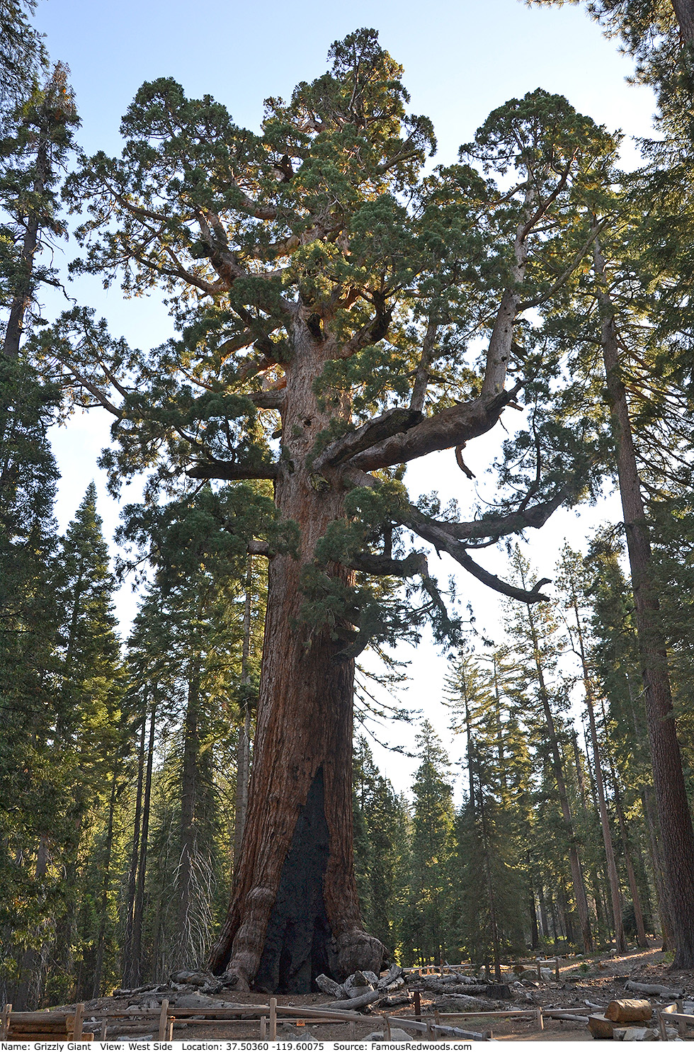
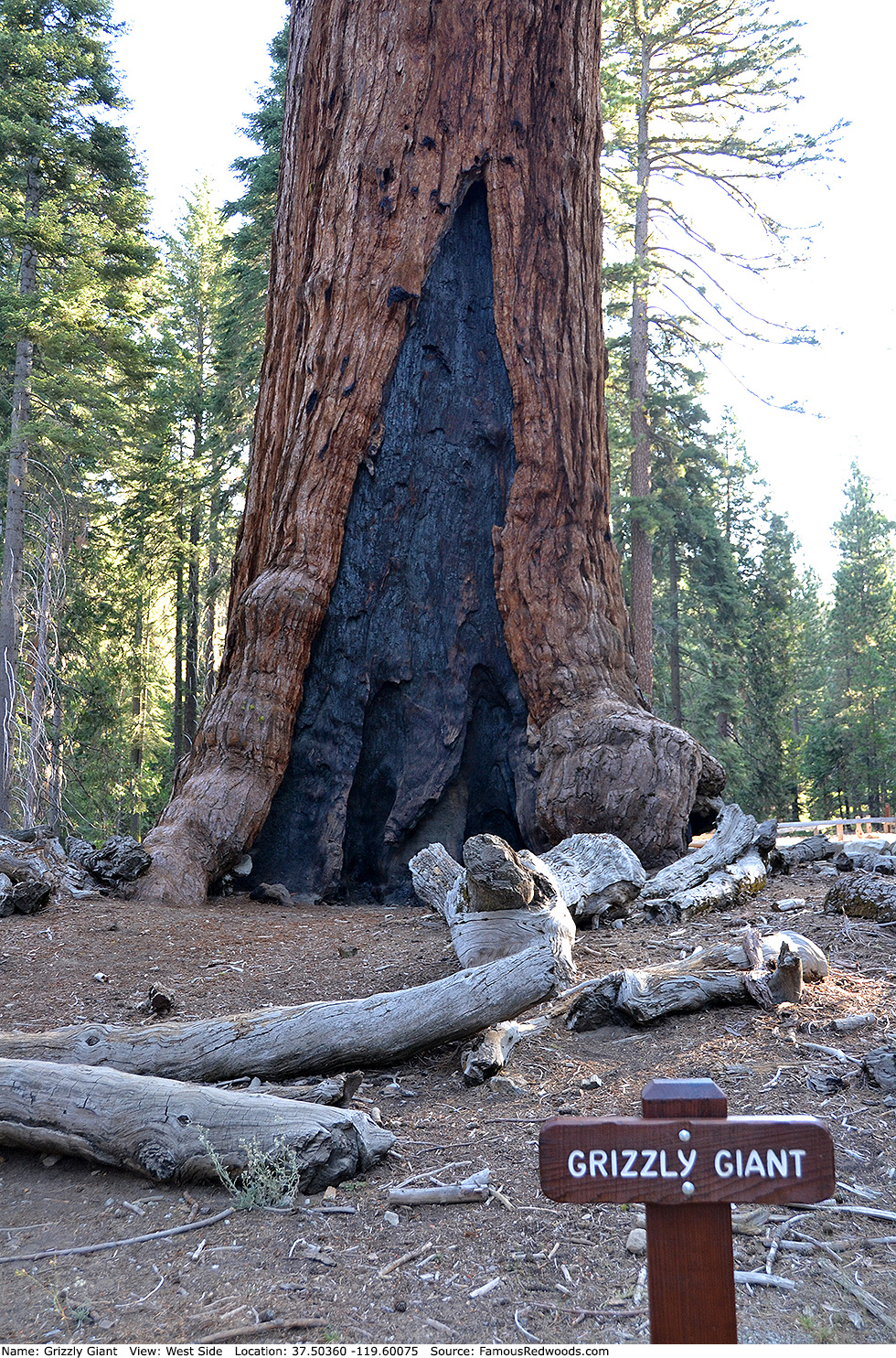
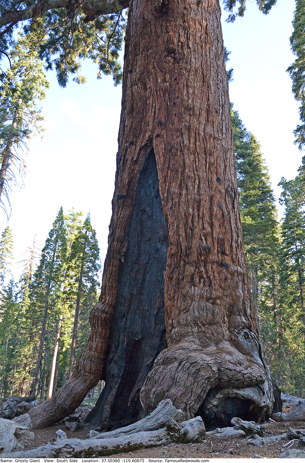
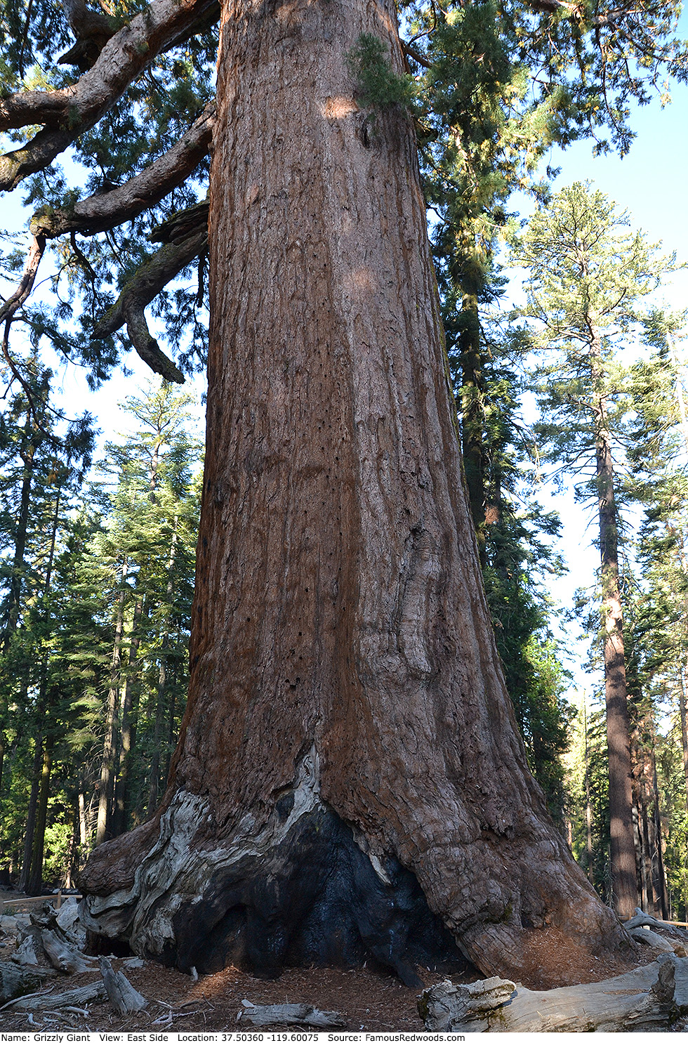
Notes: Grizzly Giant, formerly known as Grizzled Giant, is the 3rd largest tree in Yosemite National Park, the 3rd largest tree in Mariposa Grove, and the 3rd oldest living redwood. Publisher James M. Hutchings, at the suggestion of naturalist Galen Clark, named the tree Grizzled Giant in 1859. The tree was renamed Grizzly Giant sometime later.
The crown contains nearly two billion leaves and forty-nine thousand cones. The treetop leans from vertical 4.8 degrees (17.5 ft or 5.3 m) southward and 1.5 degrees (5.5 ft or 1.7 m) westward. In 1904, a California State Highway Commissioner recommended that cables be installed to support Grizzly Giant, but park officials ignored his recommendation, and the cables proved unnecessary.
Clark posed for a photograph at the base of Grizzly Giant in 1861. President Theodore Roosevelt and naturalist John Muir posed for a photograph at the base of Grizzy Giant in 1903.
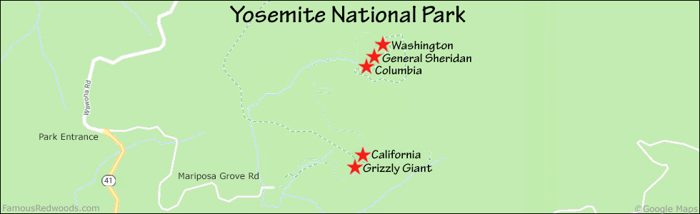
Drive: Grizzly Giant is 155 mi (249 km) east of San Francisco near the city of Oakhurst.
Northbound: From U.S. Interstate 5 North, transfer to California State Highway 41 North toward Kettleman City. Drive north 110 mi (161 km) on California State Highway 41 to Oakhurst.
Southbound: From U.S. Interstate 5 South in Sacramento, transfer to U.S. Highway 50 East toward South Lake Tahoe. Drive east 1.7 mi (2.7 km) on U.S. Highway 50 and transfer to California State Highway 99 South. Near Merced, transfer to California State Highway 140 East. Drive east 36 mi (58 km) on California State Highway 140 to Mariposa and transfer to California State Highway 49 East. Drive east 26 mi (42 km) on California State Highway 49 to Oakhurst and transfer to California State Highway 41 North.
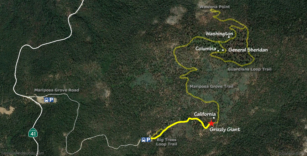
From Oakhurst, drive north 17 mi (27 km) on California State Highway 41 to the southern entrance station of Yosemite National Park (entrance fee and occasional peak-hours reservation required). Turn right onto Mariposa Grove Road, drive east 275 ft (84 m), and turn right into the Mariposa Grove Welcome Plaza parking lot.
Ride a free shuttle bus or hike east 2 mi (3 km) on Washburn Trail from the Mariposa Grove Welcome Plaza to the Mariposa Grove Arrival Area. Buses depart from the Welcome Plaza every 15 minutes from 8 AM to 7 PM April 15 (possibly later depending on road and weather conditions) through September 2, from 8 AM to 5:30 PM September 3 through November 2, and from 8 AM to 3:30 PM from November 3 through November 30. No shuttle service is available from December 1 through April 15 (possibly later depending on road and weather conditions).
Road Warning: Mariposa Grove Road is closed (with a locked gate) during winter. Depending on weather conditions, Mariposa Grove Road usually remains open from April through November. However, during that time, the road is open only to shuttle buses, vehicles with disability placards, bicycles, and pedestrians. Accessible parking is available at the Mariposa Grove Arrival Area and at the Grizzly Giant Accessible Parking Area.
Shortcut: Take this shortcut to visit Grizzly Giant whenever Mariposa Grove Road is closed or to avoid park entrance and peak-hours reservation fees. From California State Highway 41 just north of Fish Camp, 0.1 mi (0.2 km) north of the Yosemite National Park sign and 0.6 mi (1.0 km) south of the Yosemite National Park entrance station, turn right onto Forest Service Road 5S06 (Mount Raymond Road). Drive east 2.7 mi (4.3 km) on Forest Service Road 5S06 (Mount Raymond Road), past the turnoff to Goat Meadow Trailhead and Snowplay Area and the intersections with Forest Service Road 5S43 (Star Lake Road) and Forest Service Road 5S37 (Rainer Creek Road), to the intersection with Mariposa Grove Access Road near 37.49399 -119.60026. Turn left here and park near the gate.
Road Warning: Forest Service Road 5S06 (Mount Raymond Road) is unpaved beyond the turnoff to Goat Meadow Trailhead and Snowplay Area and is narrow, rutted, and unsuitable for low-clearance/oversized vehicles beyond the intersection with Forest Service Road 5S37 (Rainer Creek Road). If driving a low-clearance vehicle, park at the stable near the intersection with Forest Service Road 5S43 (Star Lake Road) and walk along Forest Service Road 5S06 (Mount Raymond Road) to Mariposa Grove Access Road.
Visit nps.gov/yose for updates and more information.
Hike: From the trailhead, hike northeast/uphill 0.15 mi (0.24 km) on Big Trees Loop Trail, past Fallen Monarch, to the junction with Grizzly Giant Loop Trail. Turn right at the trail junction and hike northeast/uphill 0.5 mi (0.8 km) on Grizzly Giant Loop Trail, past Bachelor and Three Graces, to the junction with Grizzly Giant Accessible Trail.
Shortcut: From the parking spot, hike north 0.6 mi (1.0 km) on Mariposa Grove Access Road, across Big Trees Creek, to the junction with Perimeter Trail. Turn left at the trail junction and hike west 0.2 mi (0.3 km) on Perimeter Trail to the Grizzly Giant Accessible Parking Area. From the parking lot, hike northeast 0.1 mi (0.2 km) on Grizzly Giant Accessible Trail to the junction with Grizzly Giant Loop Trail.
Continue straight at the trail junction and hike northeast 260 ft (79 m) on Grizzly Giant Loop Trail to Grizzly Giant.
| Rating: | Easy | One-Way Distance: | 0.7 mi | (1.0 km) | Ascent: | 325 ft | (99 m) |
| Time: | 25 min | Off-Trail: | 0 ft | (0 m) | Descent: | 40 ft | (12 m) |
View Grizzly Giant Tree location in Google Maps
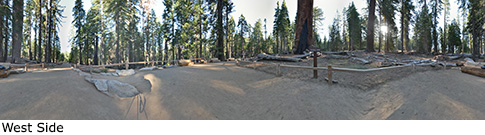
Panorama: Click panorama to take a virtual tour of Grizzly Giant Tree
Photos: Pictures of Grizzly Giant Tree taken from different sides