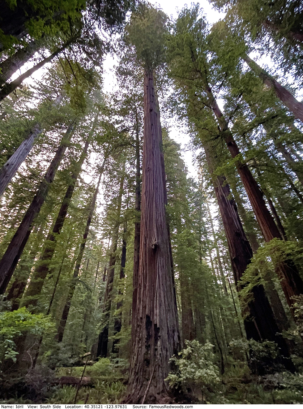
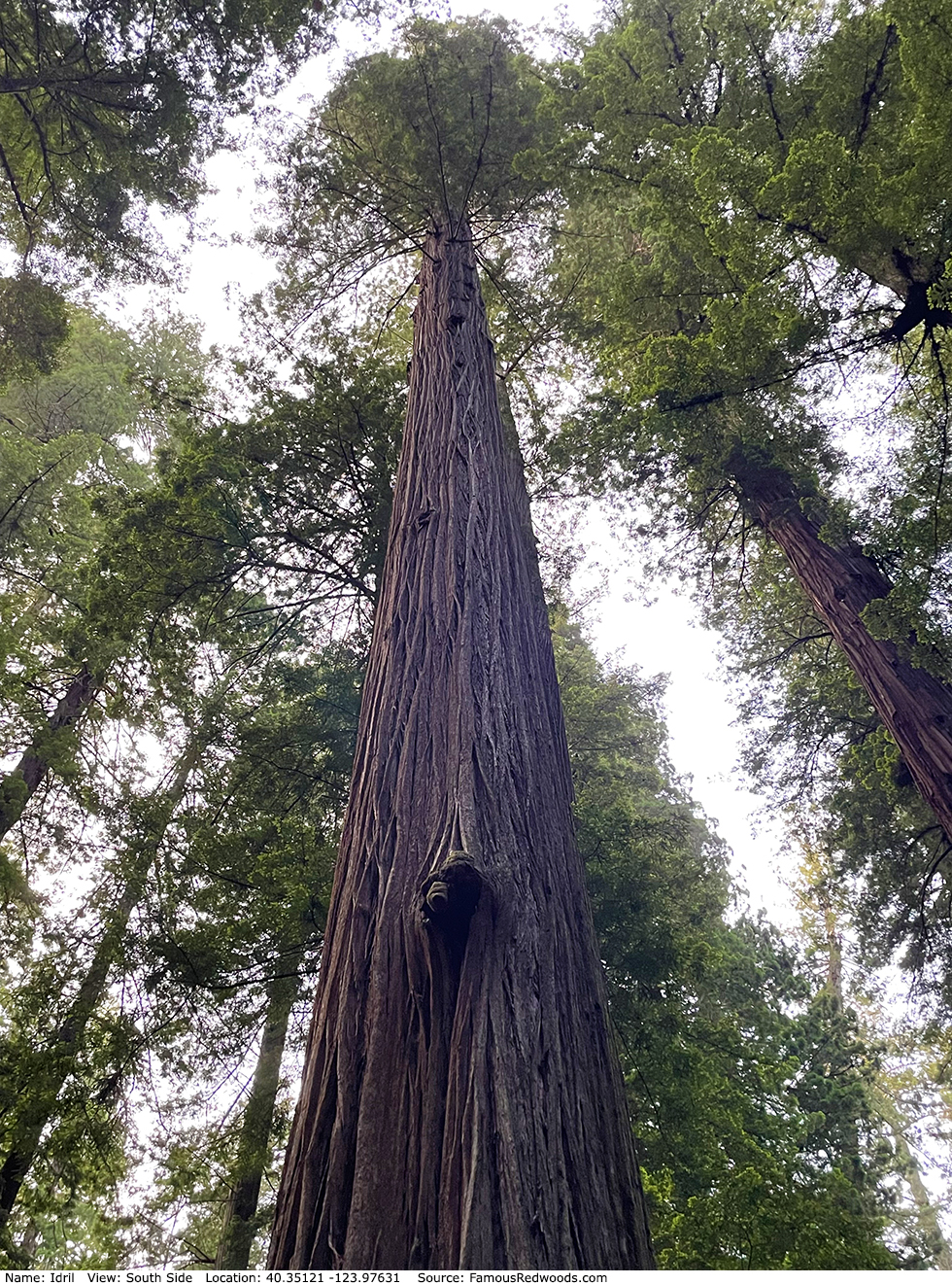
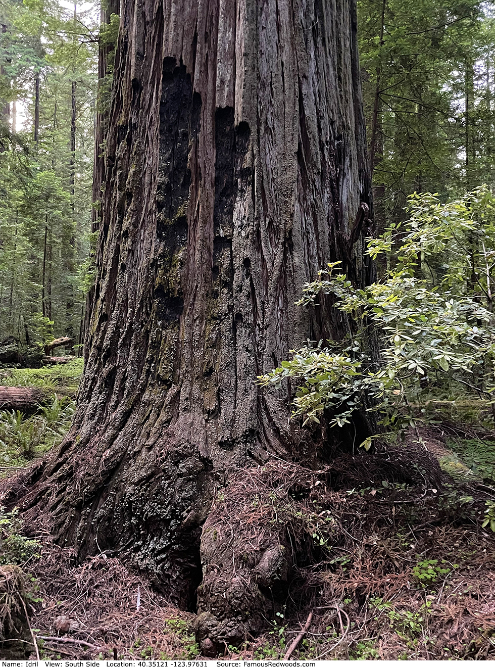
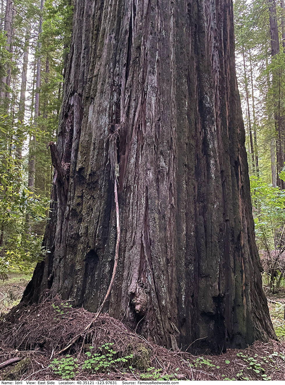
| Height: | 359.19+ ft | (109.48+ m) | Elevation: | 255 ft (78 m) | GPS Latitude: | 40.35121 |
| Volume: | Creek: | Bull Creek | GPS Longitude: | -123.97631 | ||
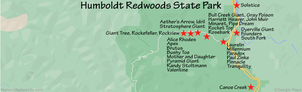
| Width: | 11.71 ft | (3.57 m) | Grove: | Calf Creek Flat | Discovery Date: | |
| Age: | Park: | Humboldt Redwoods SP | Discovered By: |
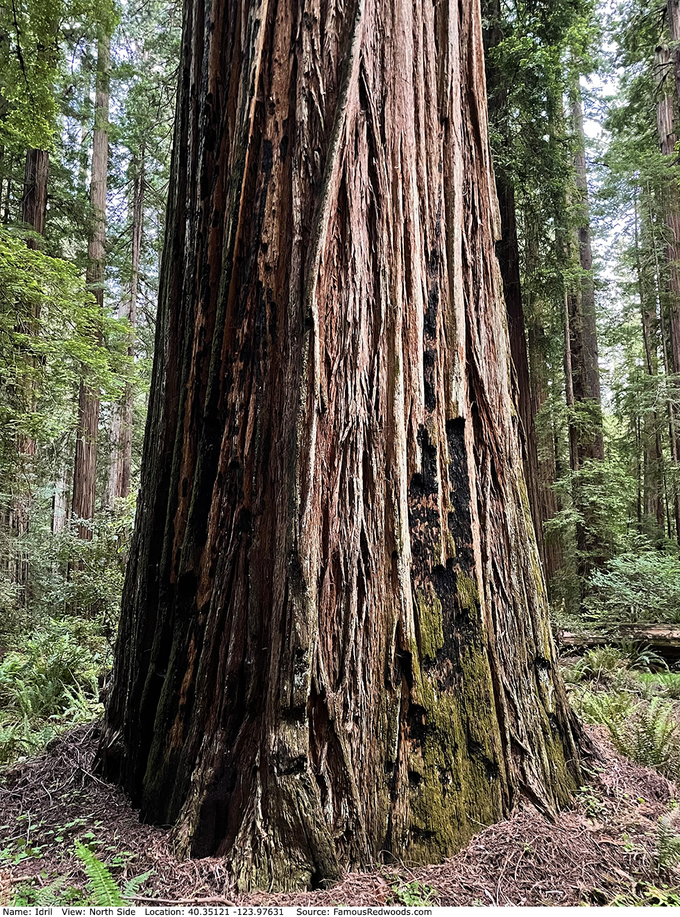
Notes: Idril, also known as Alluvium, is the 3rd tallest tree on Calf Creek Flat. Cal Poly Humboldt forestry professor Stephen C. Sillett named the tree after J. R. R. Tolkien's Idril Celebrindal, an elvish princess and mother of E�rendil the Mariner. Botanist Marie E. Antoine photographed Sillett and author Richard M. Preston near the top of Idril. Preston photographed Antoine and Sillett at the top of Idril.
Drive: Idril is 233 mi (375 km) north of San Francisco near the community of Weott.
Northbound: From U.S. Highway 101 just north of Weott, take exit 663 South Fork Honeydew and turn left onto California State Route 254 (Avenue of the Giants). Drive north 0.2 mi (0.3 km) on California State Route 254 (Avenue of the Giants) and turn left, under the bridge, onto Mattole Road.
Southbound: From U.S. Highway 101 just north of Weott, take exit 663 South Fork Honeydew and turn right onto Mattole Road.
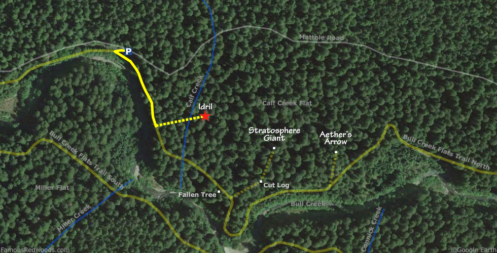
Drive west 3.4 mi (5.5 km) on Mattole Road to the Calf Creek parking area, on your right, near a small Calf Creek sign. Immediately across the street, to your left, is a Bull Creek State Wilderness sign.
Hike: GPS-assisted navigation is recommended for this hike. From the parking area, walk west 0.1 mi (0.2 km) on Mattole Road to a
turnout on the left/south side of the road near a small sign which reads
Trail - No dogs except service dogs.
This sign marks the connection to Bull Creek Flats Trail North which veers left/south following Bull Creek.
Hike south 0.1 mi (0.2 km) on Bull Creek Flats Trail North to the trail exit point near 40.35104 -123.97776. Turn left, leave the trail here, and hike east 400 ft (123 m) off-trail to Idril. After visiting Idril, hike southeast 0.1 mi (0.2 km) off-trail to Stratosphere Giant and then hike east another 0.1 mi (0.2 km) off-trail to Aether's Arrow.
| Rating: | Easy | One-Way Distance: | 0.24 mi | (0.4 km) | Ascent: | 20 ft | (6 m) |
| Time: | 8 min | Off-Trail: | 400 ft | (123 m) | Descent: | 107 ft | (33 m) |
View idril Tree location in Google Maps
Panorama: Click panorama to take a virtual tour of Idril Tree
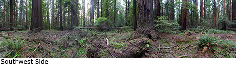
Photos: Pictures of Idril Tree taken from different sides