| Height: | 228.00 ft | (69.49 m) | Elevation: | 6,395 ft (1,949 m) | GPS Latitude: | 36.76143 |
| Volume: | 19,000 ft3 | (538 m3) | Creek: | Kennedy Creek | GPS Longitude: | -118.81062 |
| Width: | 25.86 ft | (7.88 m) | Grove: | Kennedy Grove | Discovery Date: | 1993 |
| Age: | Park: | Giant Sequoia NM | Discovered By: | Dwight M. Willard |
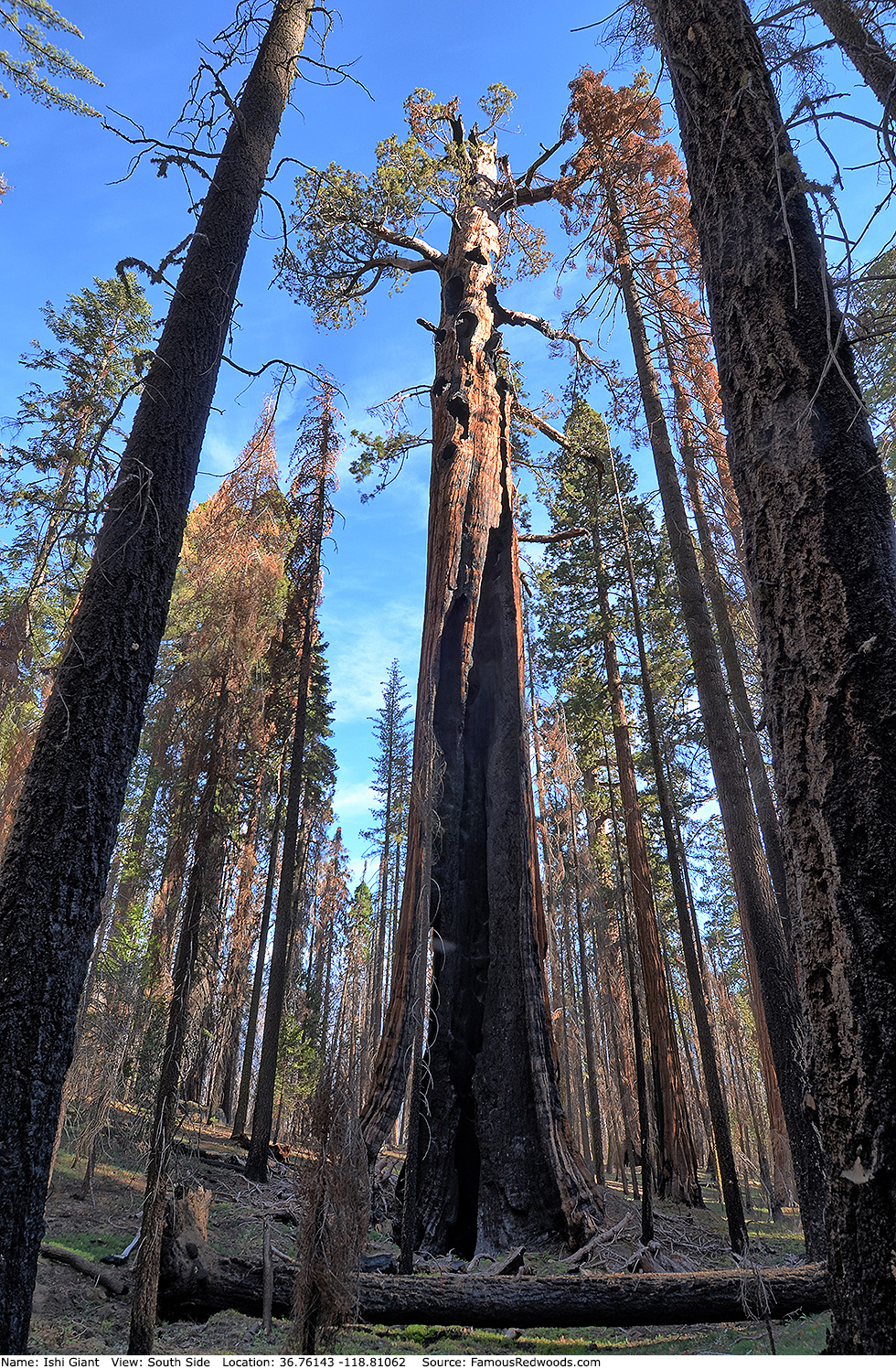
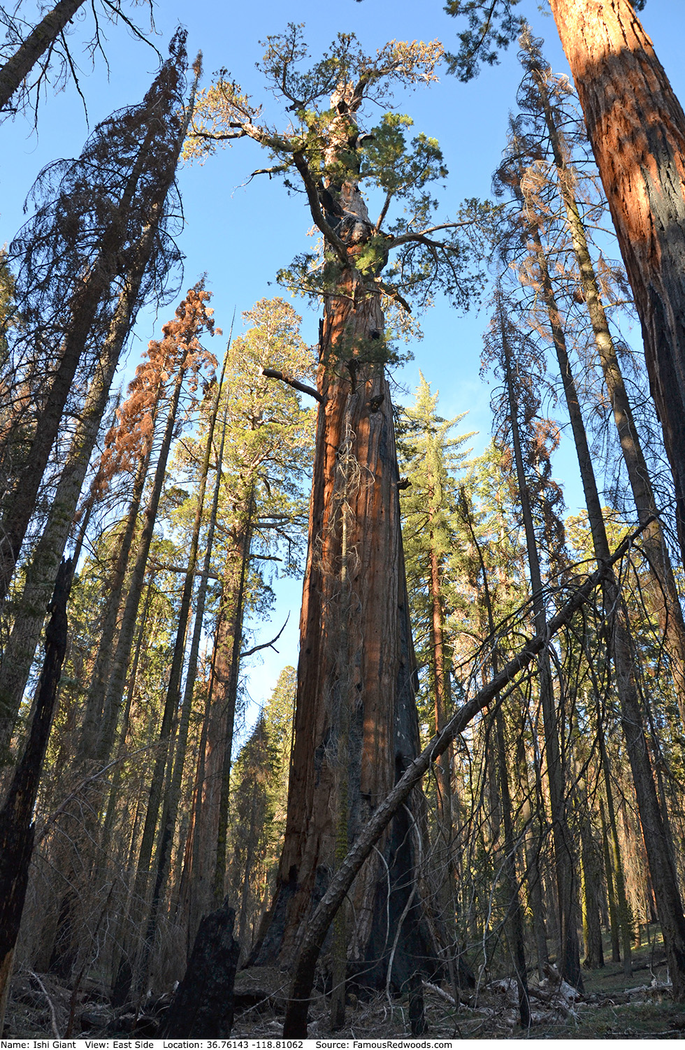
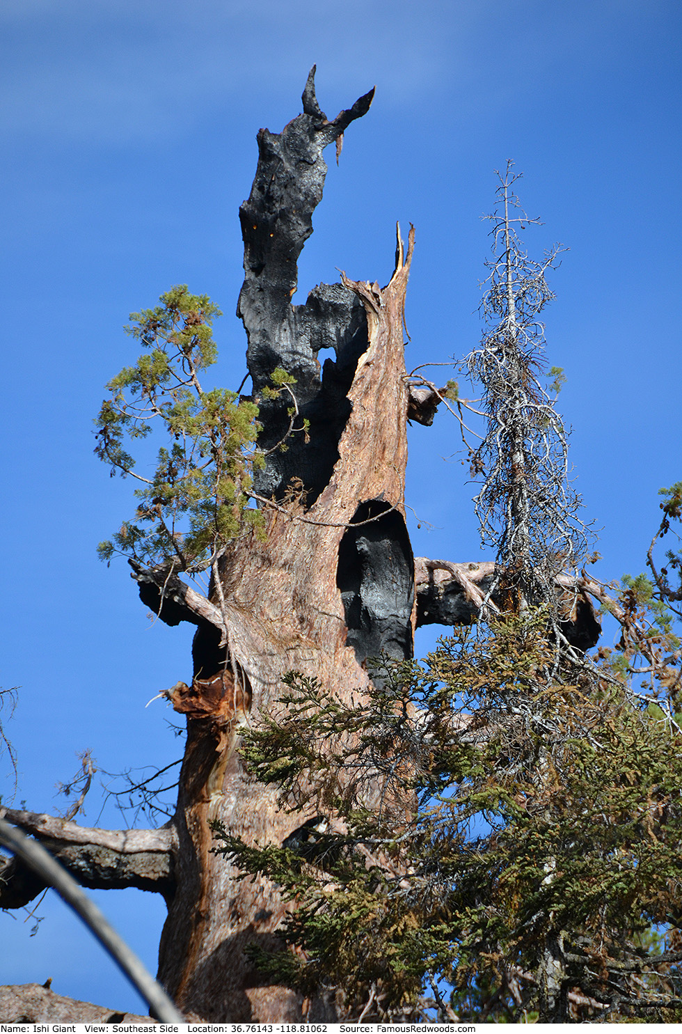
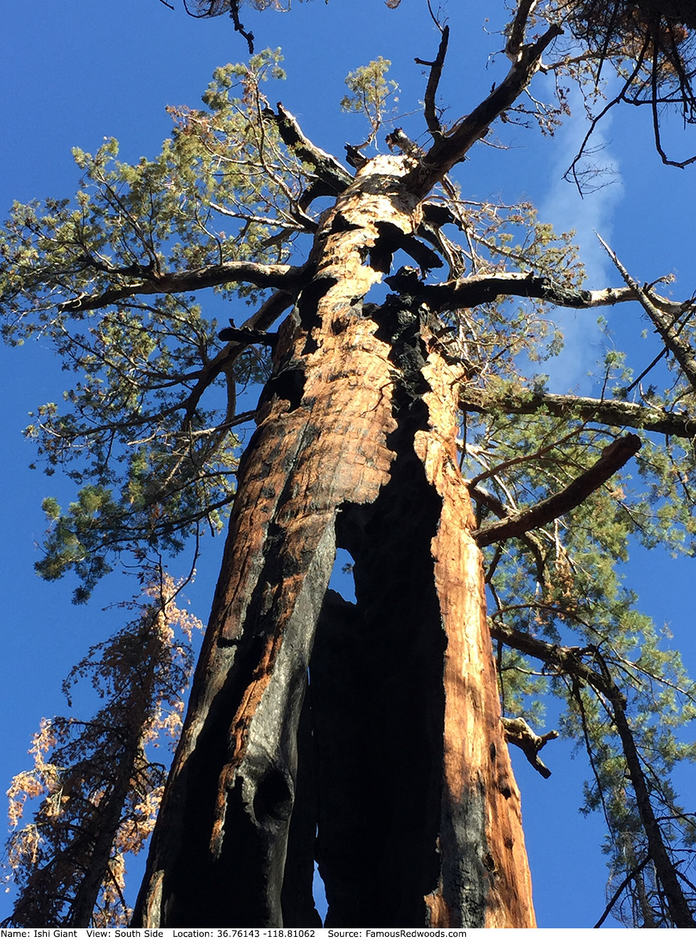
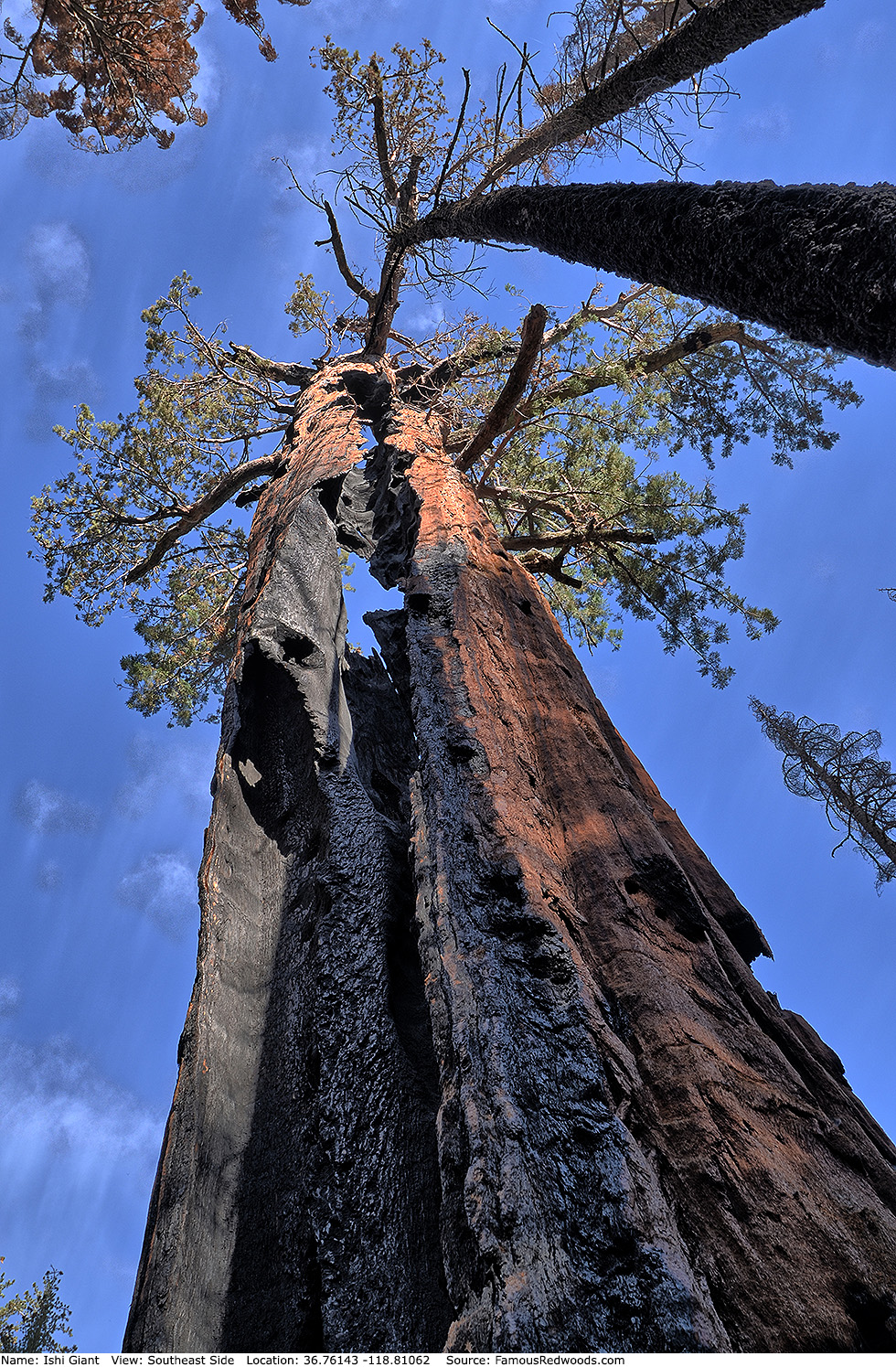
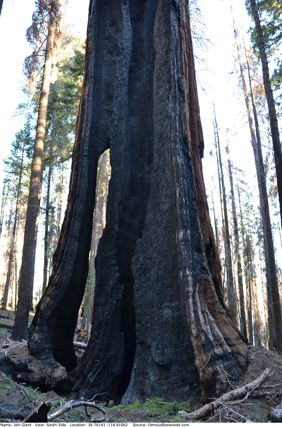
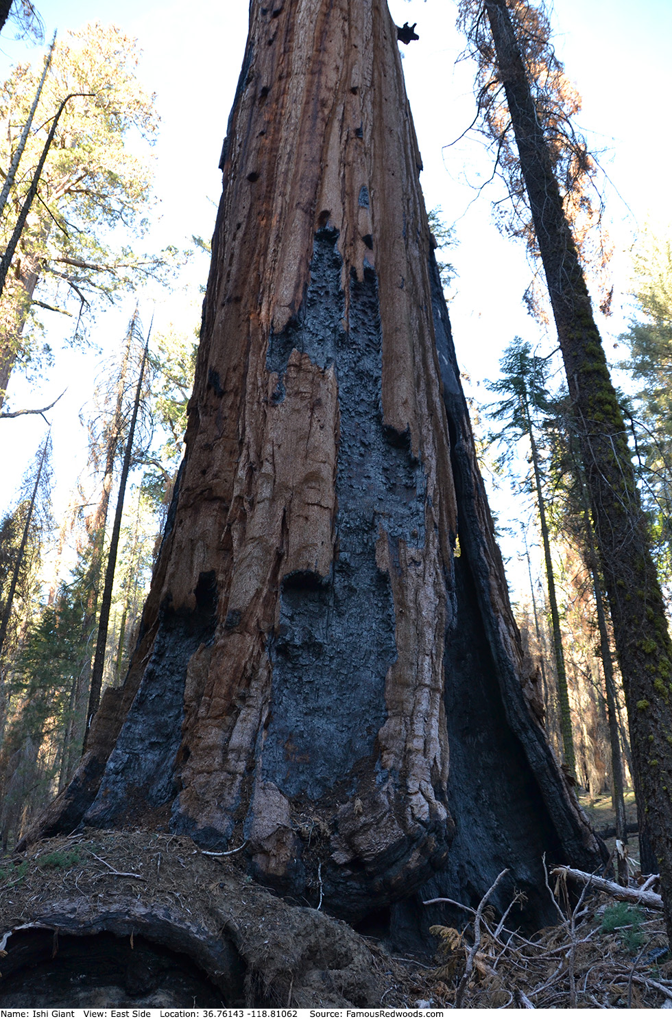
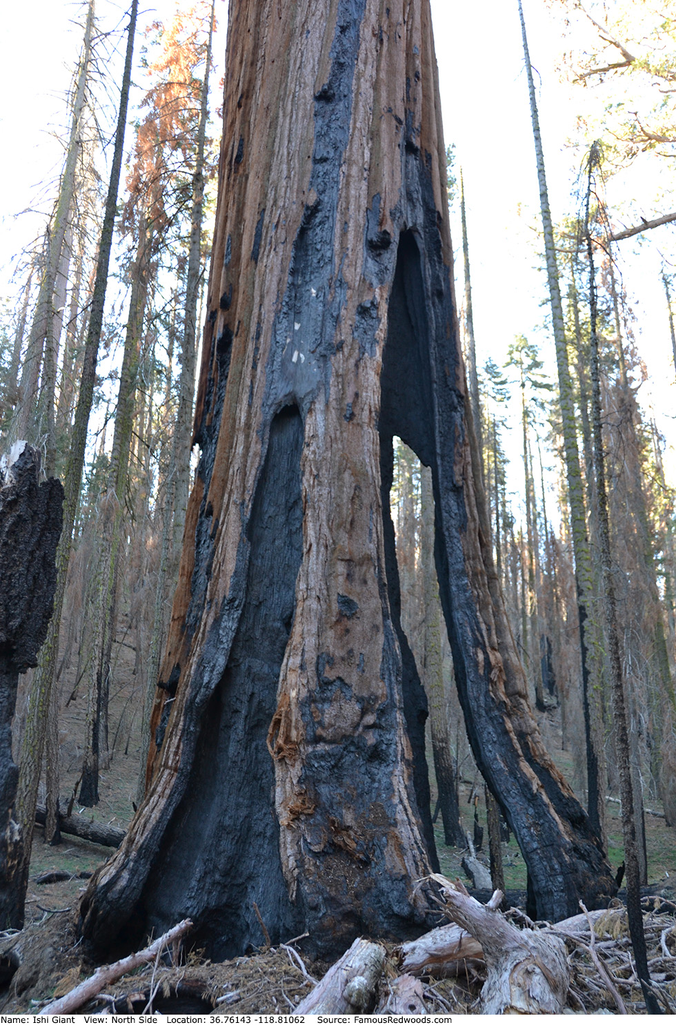
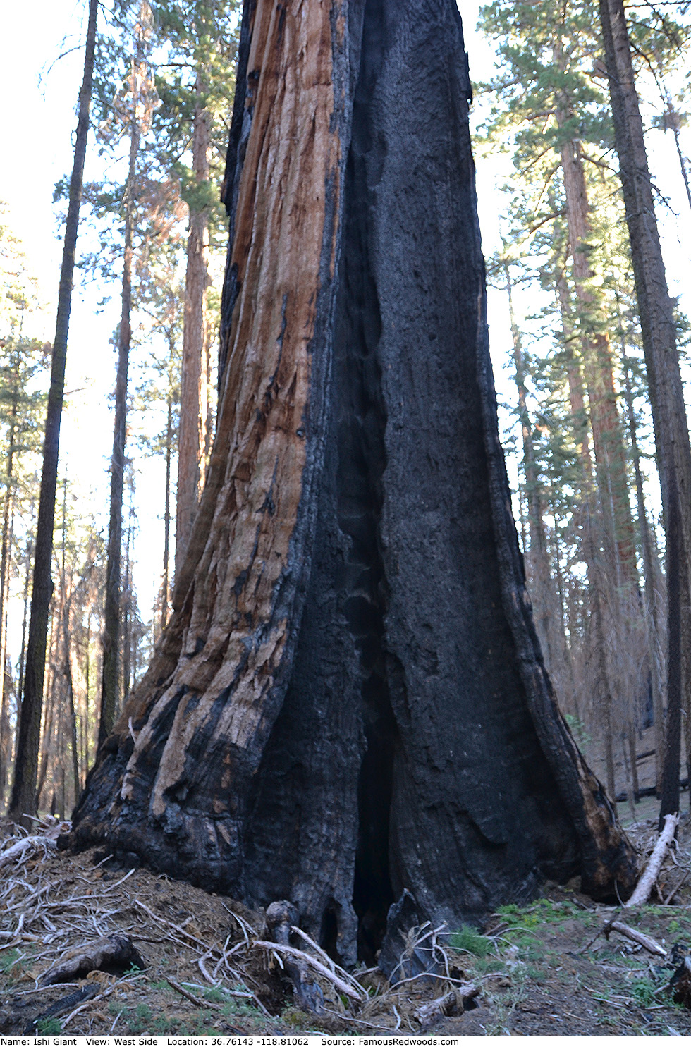
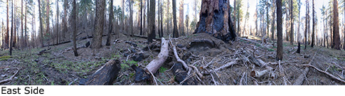
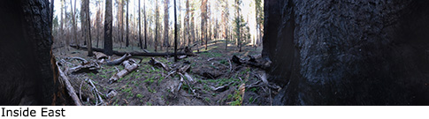
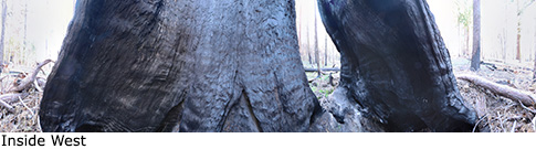
Notes: Before the 2015 Rough Fire, Ishi Giant was the world's 15th largest tree, the 13th largest giant redwood, and the largest tree in Kennedy Grove. The trunk lost over 20,000 ft3 (566 m3) in volume and over 27 ft (8 m) in height after it burned, and Ishi Giant no longer ranks among the 30 largest giant redwoods.
Naturalist Dwight M. Willard discovered Ishi Giant in 1993, nearly a century after most colossal giant redwoods had been discovered, and named the tree to honor Ishi, the last surviving Yahi Native American,
once considered the last wild Indian
in America. Naturalist Wendell D. Flint suggested Willard name the tree Calavera (Spanish for skull) after the men discovered a human skull (the only remnants of
two teenagers who had vanished in the grove sometime earlier) beside the tree later that same year. Willard chose the name Ishi Giant instead. Flint noted carvings on the trunk which dated back to 1940.
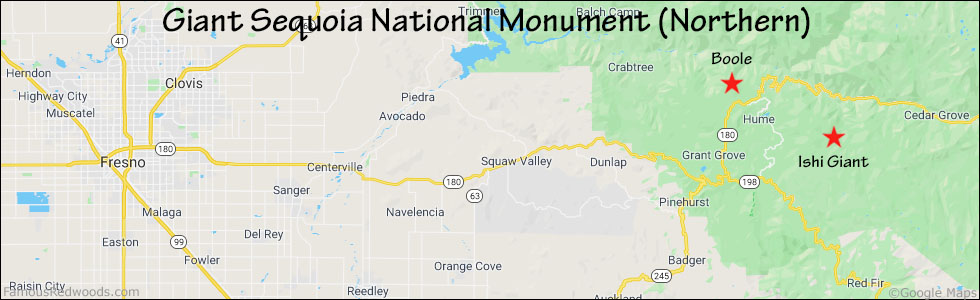
Drive: Ishi Giant is is 211 mi (340 km) southeast of San Francisco near Fresno.
Northbound: From U.S. Interstate 5 North, transfer to California State Route 99 North toward Bakersfield. Drive north 97 mi (156 km) on California State Route 99 and transfer to California State Route 198 East toward Visalia. Drive east 82 mi (132 km) on California State Route 198 (Generals Highway), past the Sequoia National Park entrance station (entrance fee required) and Four Guardsmen, and turn right/north onto Forest Service Road 13S09 (Ten Mile Road) toward Quail Flat and Hume Lake.
Southbound: From U.S. Interstate 5 South in Sacramento, transfer to U.S. Highway 50 East toward South Lake Tahoe. Drive east 1.7 mi (2.7 km) on U.S. Highway 50 and transfer to California State Highway 99 South. Near Fresno, transfer to California State Route 180 East. Drive east 56 mi (90 km) on California State Route 180, past the Kings Canyon National Park entrance station (entrance fee required), and turn right onto California State Route 198 West. Drive south 4 mi (6 km) on California State Route 198 (Generals Highway) and turn left/north onto Forest Service Road 13S09 (Ten Mile Road) toward Quail Flat and Hume Lake.
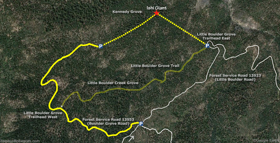
Drive north 225 ft (68 m) on Forest Service Road 13S09 (Ten Mile Road) and veer right onto Forest Service Road 14S02 (Burton Road) toward Burton Meadow. Drive northeast 8.3 mi (13.4 km) on Forest Service Road 14S02 (Burton Road), past the intersections with Forest Service Roads 13S26 and 13S04, and turn left onto Forest Service Road 13S23 (Little Boulder Road) toward Boulder Creek. Drive northeast 2.3 mi (3.7 km) on Forest Service Road 13S23 (Little Boulder Road), past the intersection with Forest Service Road 13S53, to the parking spot at Little Boulder Grove Trailhead (East), located at 36.75723 -118.80267, on the left/west side of the road.
Alternate route: Take this longer route to visit Ishi Giant if Little Boulder Creek is impassable. From Forest Service Road 13S23 (Little Boulder Road), turn left onto Forest Service Road 13S53 (Boulder Grove Road). Drive north 2 mi (3 km) on Forest Service Road 13S53 (Boulder Grove Road), past Little Boulder Grove Trailhead (West) and two (1, 2) perennial mud patches, to the end of the road.
Road warning: Forest Service Road 13S53 (Boulder Grove Road) is narrow, winding, rutted, and unsuitable for low-clearance/oversized vehicles. If driving a low-clearance vehicle, park near the intersection of Forest Service Roads 13S23 (Little Boulder Road) and 13S53 (Boulder Grove Road) and walk north 2 mi (3 km) on Forest Service Road 13S53 (Boulder Grove Road) to the end of the road.
Hike: GPS-assisted navigation is recommended for this hike. From the trailhead, hike northwest/downhill 0.2 mi (0.3 km) off-trail, across Forest Service Road 13S23E, to Little Boulder Creek. Cross the creek and, using a GPS device, hike northwest 0.3 mi (0.5 km), over a ridge, to Ishi Giant.
Alternate Route: From the end of Forest Service Road 13S53 (Boulder Grove Road) and using a GPS device, hike northeast 0.6 mi (1.0 km) off-trail to Ishi Giant.
| Rating: | Moderate | One-Way Distance: | 0.5 mi | (0.8 km) | Ascent: | 308 ft | (94 m) |
| Time: | 30 min | Off-Trail: | 0.5 mi | (0.8 km) | Descent: | 555 ft | (169 m) |
View Ishi Giant Tree location in Google Maps
Panoramas: Click panoramas to take a virtual tour of Ishi Giant Tree
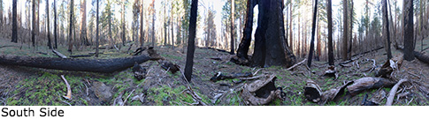
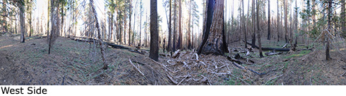
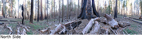
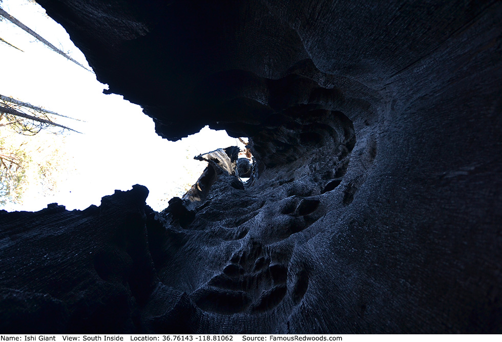
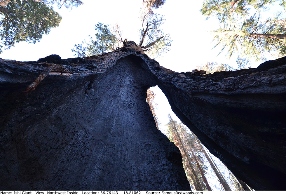
Photos: Pictures of Ishi Giant Tree taken from different sides