| Height: | 270.30+ ft | (82.39+ m) | Elevation: | 7,069 ft (2,155 m) | GPS Latitude: | 36.32838 |
| Volume: | 40,656 ft3 | (1,151 m3) | Creek: | Garfield Creek | GPS Longitude: | -118.71703 |
| Width: | 23.11 ft | (7.04 m) | Grove: | Garfield Grove | Discovery Date: | 1978 |
| Age: | Park: | Sequoia NP | Discovered By: | Gus Boik | ||
| Wendell D. Flint | ||||||
| Robert Walker |
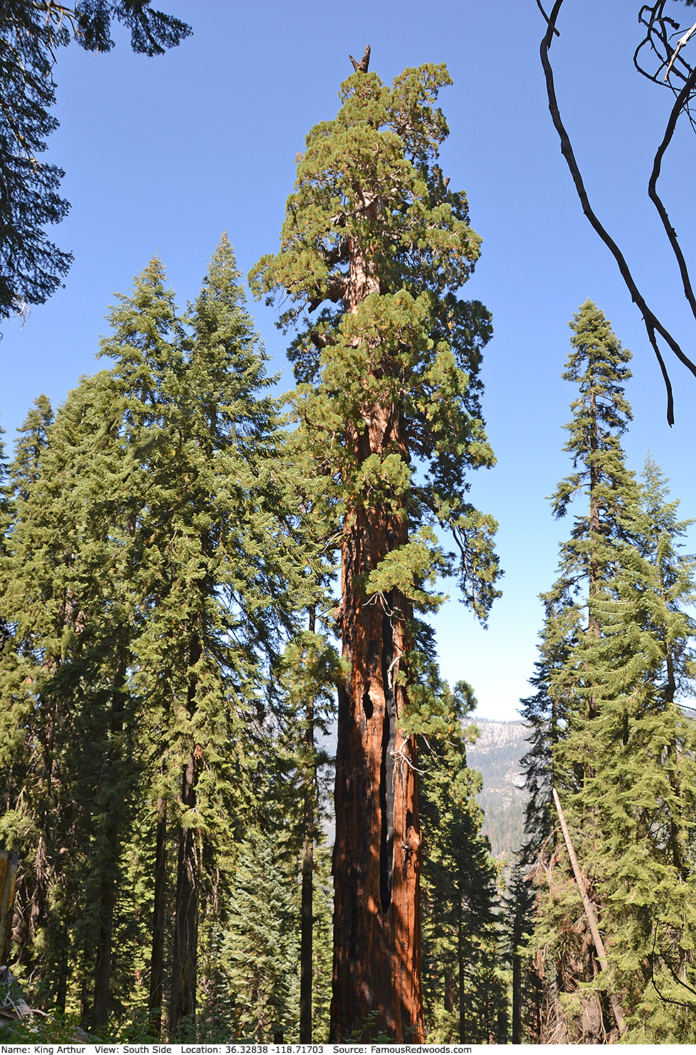
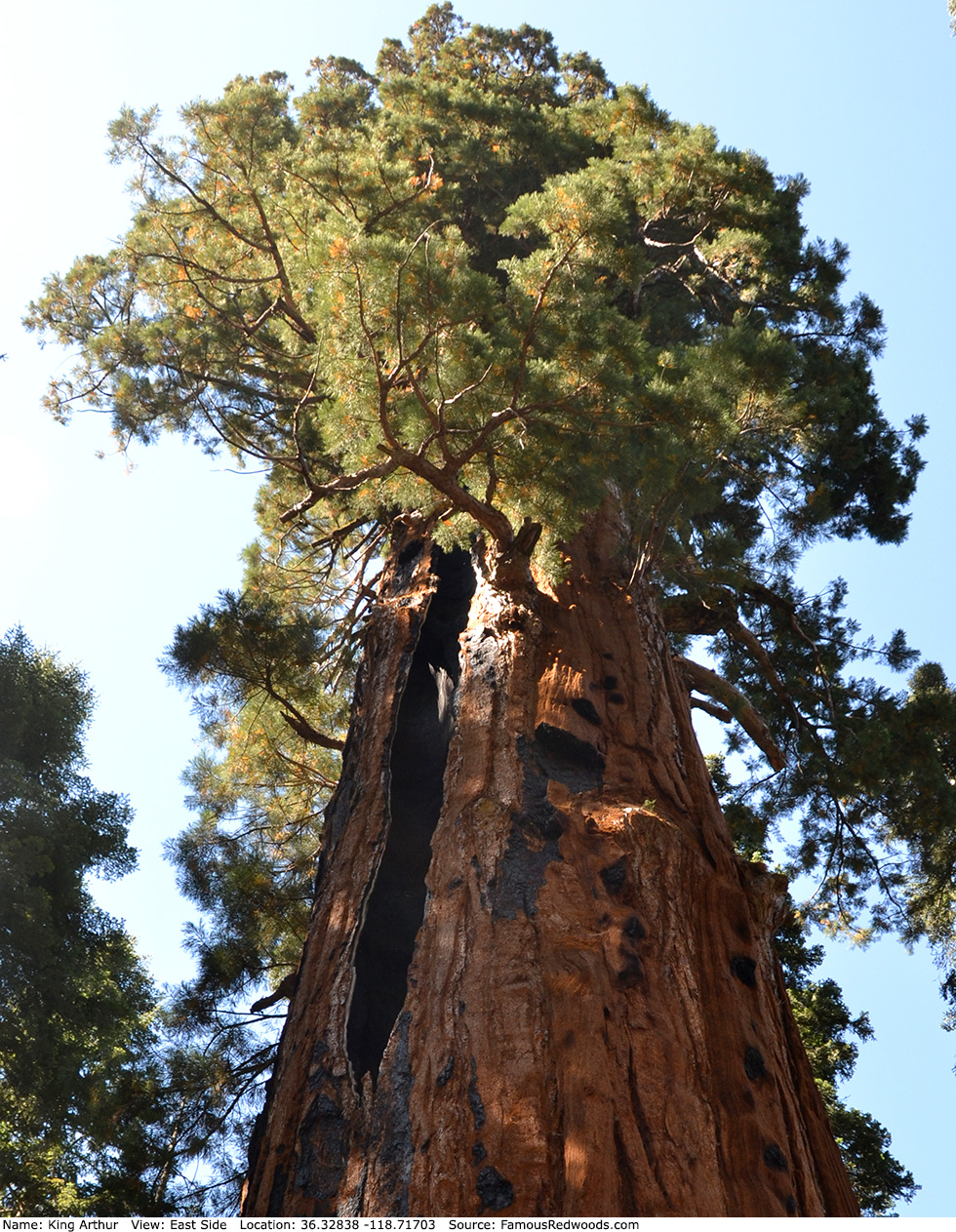
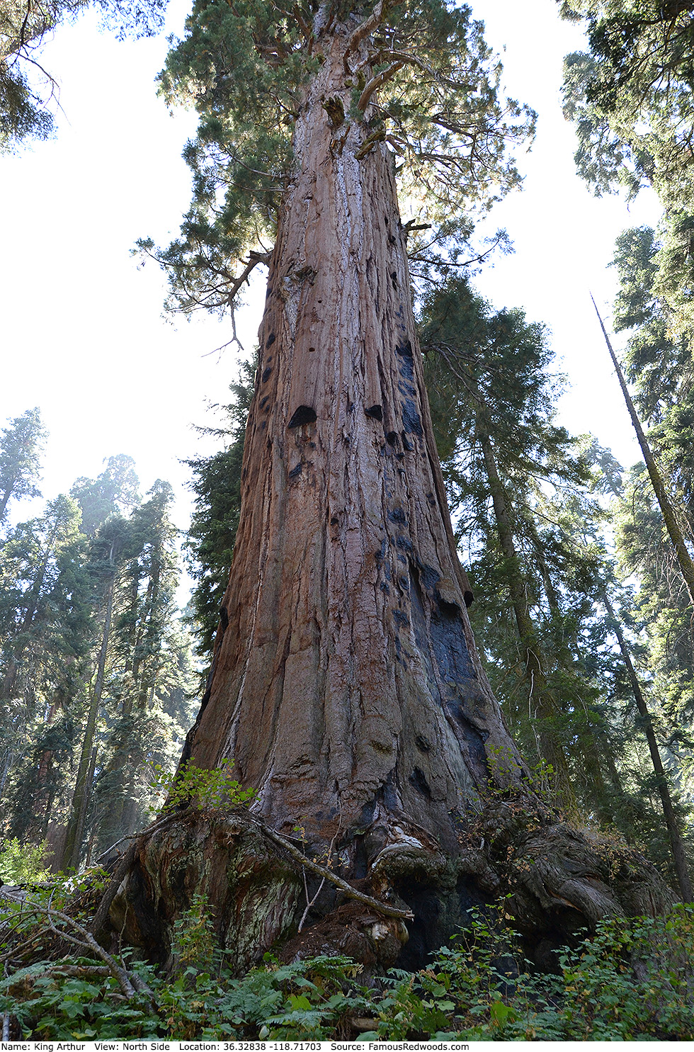
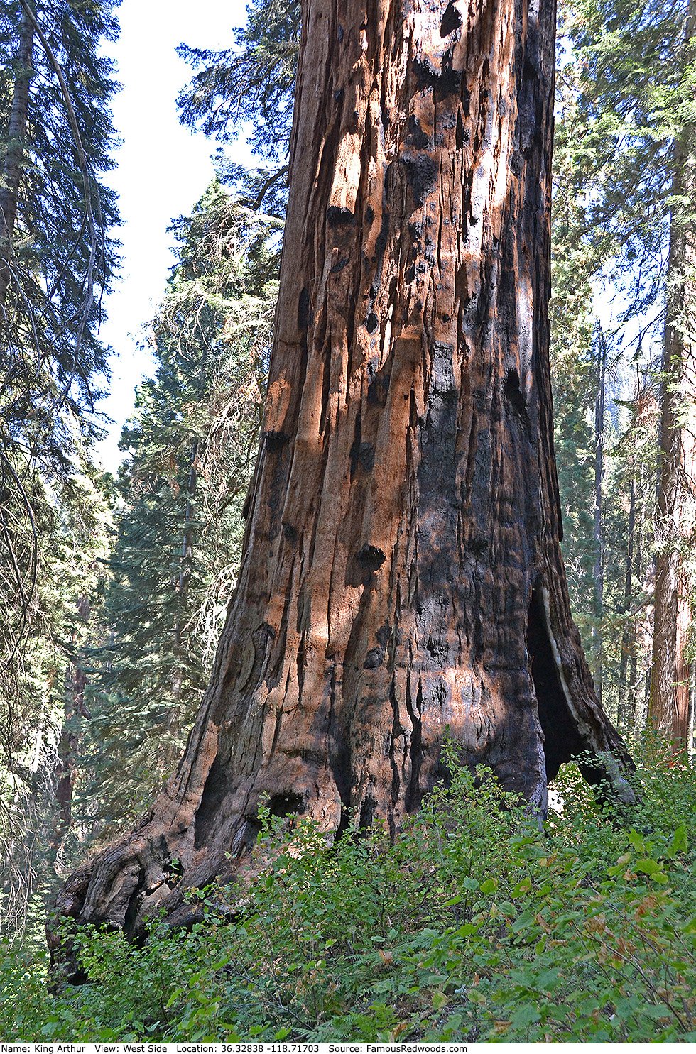
Notes: Before the 2020 Castle Fire, King Arthur, also known as California Tree and Garfield Tree, was the world's 10th largest tree, the 8th largest giant redwood, the 5th largest tree in Sequoia National Park, and the largest tree in Garfield Grove. The trunk lost significant height and volume after it burned, and, pending updated volume estimates, King Arthur likely no longer ranks among the 30 largest giant redwoods.
Drive: King Arthur is 227 mi (365 km) southeast of San Francisco near the community of Three Rivers.
Northbound: From U.S. Interstate 5 North, transfer to California State Route 99 North toward Bakersfield. Drive north 97 mi (156 km) on California State Route 99 and transfer to California State Route 198 East toward Visalia.
Southbound: From U.S. Interstate 5 South in Sacramento, transfer to U.S. Highway 50 East toward South Lake Tahoe. Drive east 1.7 mi (2.7 km) on U.S. Highway 50 and transfer to California State Highway 99 South. Drive south 201 mi (323 km) on California State Highway 99 South and transfer to California State Route 198 East toward Visalia.
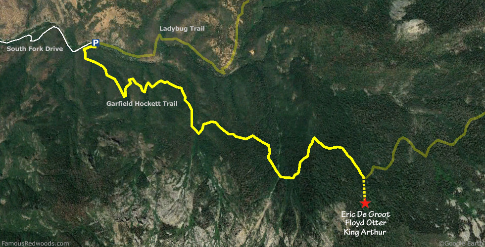
Drive east 33 mi (53 km) on California State Route 198, toward Three Rivers, and turn right/east onto Old Three Rivers Road toward Three Rivers Community Cemetery. Drive east 0.4 mi (0.6 km) on Old Three Rivers Road and veer right/east onto Blossom Drive. Drive east 0.1 mi (0.2 km) on Blossom Drive and turn right/south onto South Fork Drive. Drive southeast 12 mi (19 km) on South Fork Drive, past South Fork Campground, to the parking area at the end of the road. Walk west on South Fork Road from the parking area to the trailhead.
Road Warning: Although it remains open year-round, South Fork Drive is a rough, narrow, winding road which remains unpaved beyond the park entrance. Low-clearance/oversized vehicles and trailers are not recommended.

Hike: GPS-assisted navigation is recommended for this hike. From the trailhead, hike southeast 4.7 mi (7.6 km) on Garfield-Hockett Trail, past Bigfoot Tree, to the trail exit point near 36.33101 -118.71621. Leave the trail here and, using a GPS device, hike south/uphill 0.2 mi (0.3 km) off-trail to King Arthur. After visiting King Arthur, hike southwest/uphill 310 ft (94 m) off-trail to Eric De Groot or hike south/uphill 350 ft (107 m) off-trail to Floyd Otter.
| Rating: | Difficult | One-Way Distance: | 4.9 mi | (7.9 km) | Ascent: | 4,152 ft | (1,266 m) |
| Time: | 4 hr | Off-Trail: | 0.2 mi | (0.3 km) | Descent: | 678 ft | (207 m) |
View King Arthur Tree location in Google Maps
Photos: Pictures of King Arthur Tree taken from different sides