| Height: | 370.83+ ft | (113.03+ m) | Elevation: | 160 ft (49 m) | GPS Latitude: | 40.34290 |
| Volume: | 20,136 ft3 | (570 m3) | River: | South Fork Eel River | GPS Longitude: | -123.93478 |
| Width: | 14.90 ft | (4.54 m) | Grove: | Federation Grove | Discovery Date: | 1966 |
| Age: | 1,622 y | Park: | Humboldt Redwoods SP | Discovered By: | Alan G. Stangenberger | |
| Paul J. Zinke |
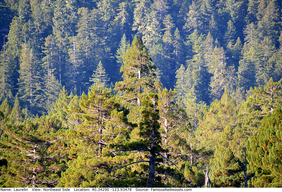
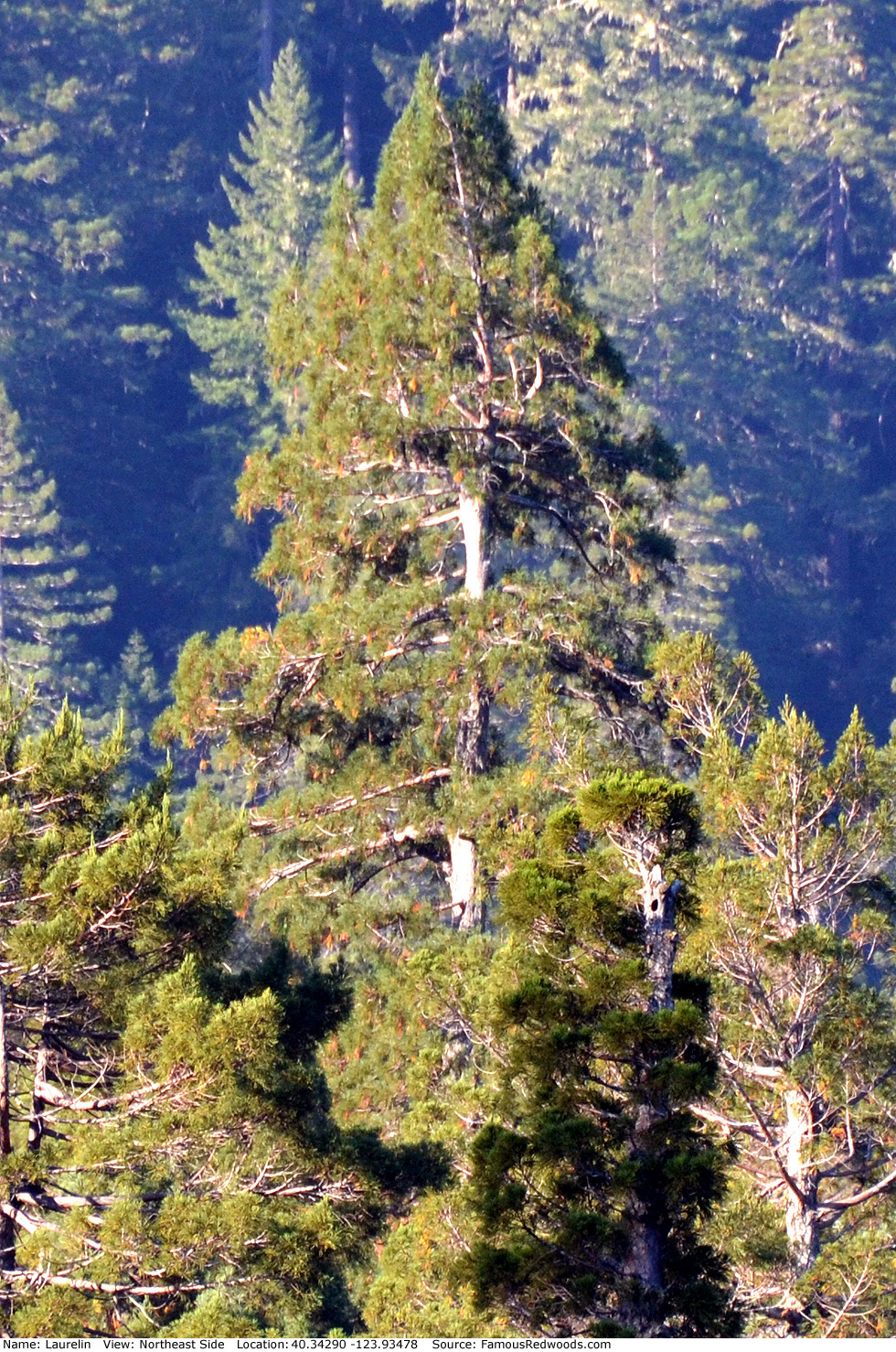
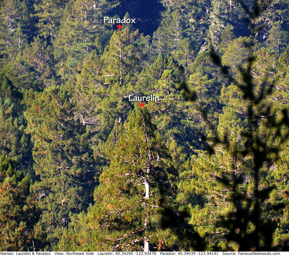
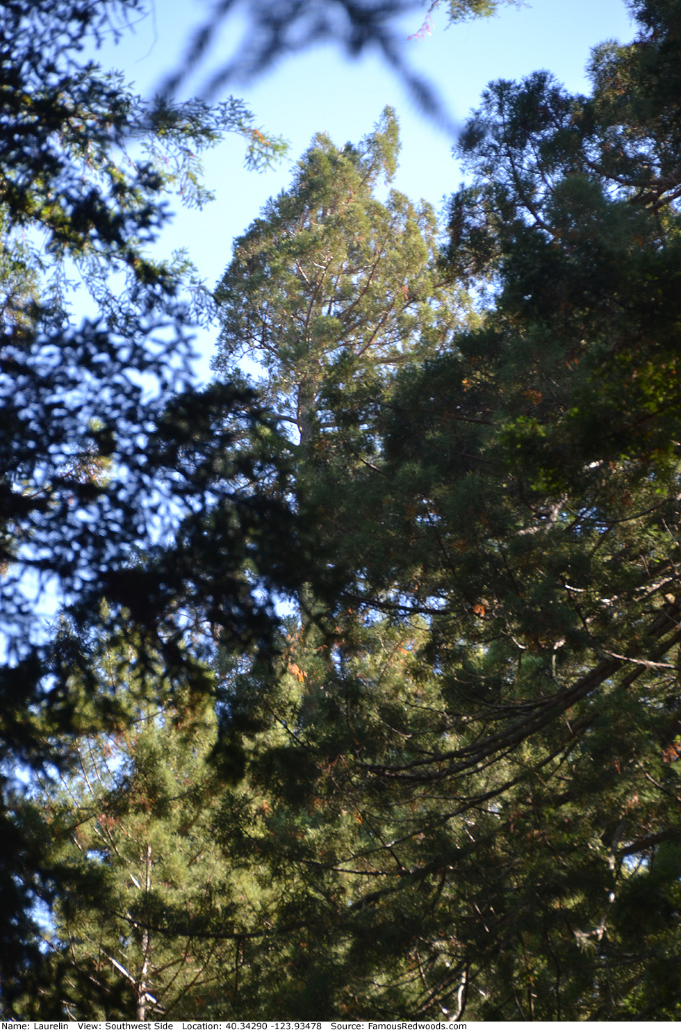
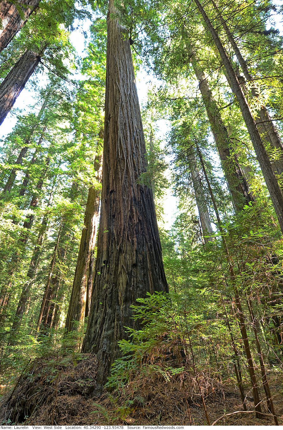
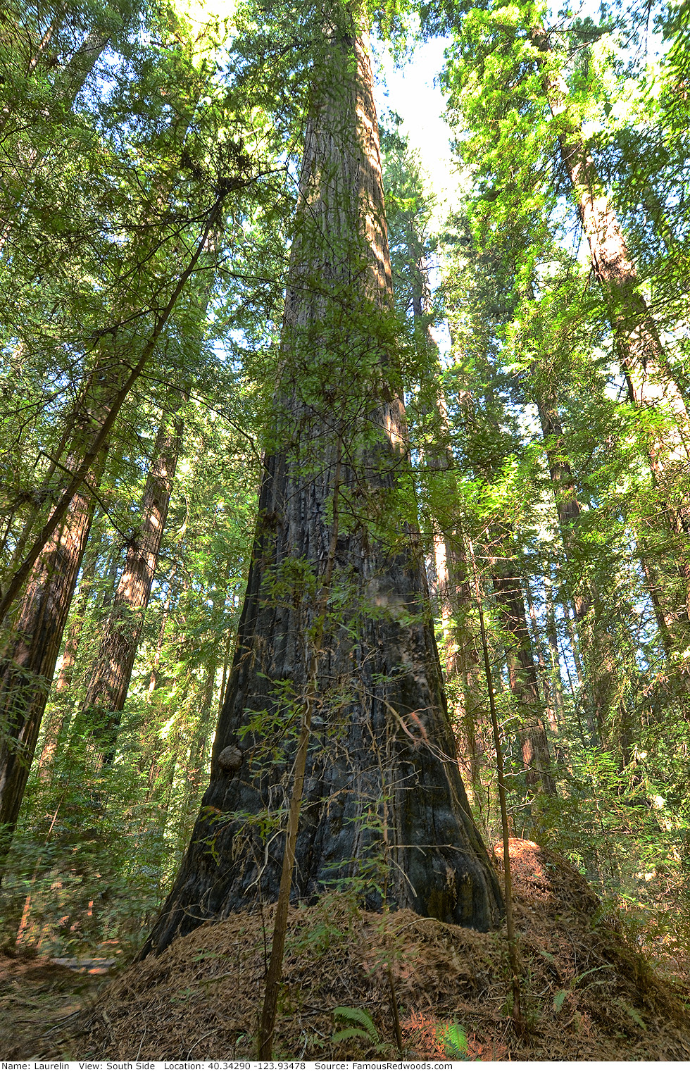
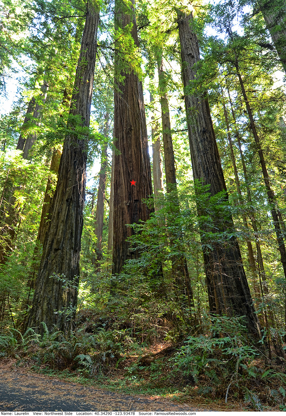
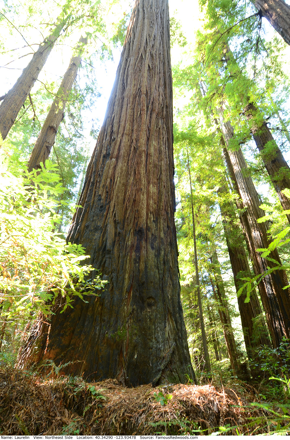
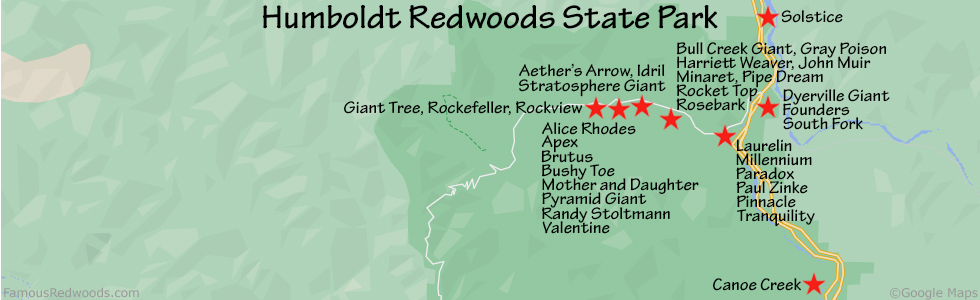
Notes: Laurelin, also known as Lauralyn and Federation Giant, is the world's 7th tallest tree, the 3rd tallest and 7th largest tree in Humboldt Redwoods State Park, and the tallest and largest tree in Federation Grove. University of California at Berkeley forestry professor Paul J. Zinke and graduate student Alan G. Stangenberger discovered Laurelin from Duckett Bluff, near Dyerville, in 1966 but did not name the tree.
In February 1993, Zinke told naturalist Michael W. Taylor where to search for his Three Peas in a Pod
(then-unnamed Laurelin, Paradox, and Telperion) which,
Zinke suspected, were the world's tallest trees. When Taylor found Laurelin later, he named it Federation Giant after Federation Grove. Federation Grove is also known as California Federation of Women's Clubs
Grove. Cal Poly Humboldt forestry professor Stephen C. Sillett renamed the tree after J. R. R. Tolkien's Laurelin, the Golden Tree of of Valinor.
The film In Search of the Tallest: A Redwoods Adventure includes a segment about Laurelin.
Drive: Laurelin is 195 mi (314 km) north of San Francisco near the community of Weott.
Northbound: From U.S. Route 101 just north of Weott, take exit 663 South Fork Honeydew and turn right onto California State Route 254 (Avenue of the Giants). Drive south 0.7 mi (1.1 km) on California State Route 254 (Avenue of the Giants), past South Fork, to the entrance of California Federation of Women's Clubs Grove on your right.
Southbound: From U.S. Highway 101 just north of Weott, take Exit 663 South Fork Honeydew. Turn left onto Mattole Road, under the bridge, and turn right onto California State Route 254 (Avenue of the Giants). Drive south 1.0 mi (1.6 km) on California State Route 254 (Avenue of the Giants), past South Fork, to the entrance of California Federation of Women's Clubs Grove on your right.
Drive 430 ft (131 m) into California Federation of Women's Clubs Grove to the parking spot on the left/south side of the road.
Road warning: The California Federation of Women's Clubs Grove road may be closed (with a locked gate) during winter. To visit Laurelin whenever the road is closed, park on California State Route 254 (Avenue of the Giants) near the grove entrance and walk past the gate, 430 ft (131 m) on the road, to Laurelin.
Hike: Hike 40 ft (12 m) off-trail from the parking spot to Laurelin, a large, leaning tree on the left/southeast side of the road.
| Rating: | Easy | One-Way Distance: | 40 ft | (12 m) | Ascent: | 5 ft | (2 m) |
| Time: | 14 sec | Off-Trail: | 40 ft | (12 m) | Descent: | 0 ft | (0 m) |
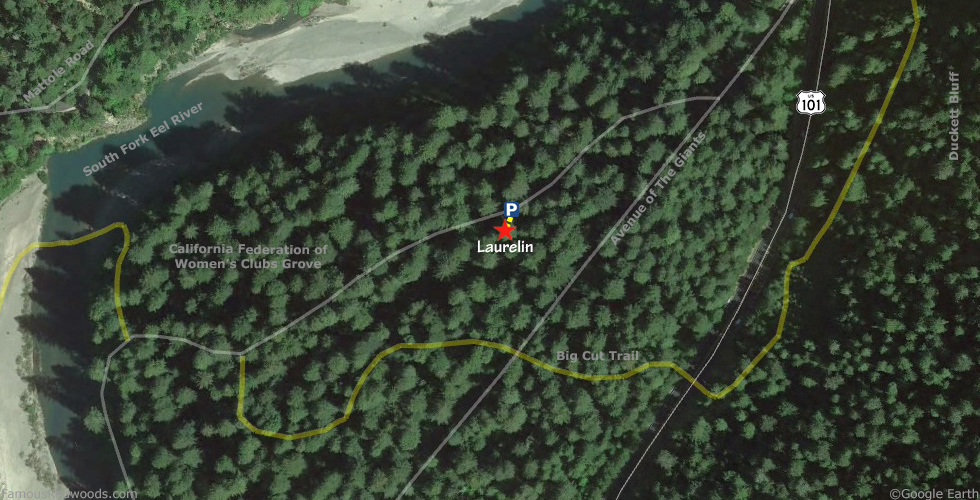
View Laurelin Tree location in Google Maps
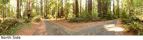
Panoramas: Click panoramas to take a virtual tour of Laurelin Tree
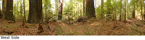
Photos: Pictures of Laurelin Tree taken from different sides