| Height: | 321.00+ ft | (97.84+ m) | Elevation: | 157 ft (48 m) | GPS Latitude: | 41.77814 |
| Volume: | 34,534 ft3 | (978 m3) | Creek: | Mill Creek | GPS Longitude: | -124.10075 |
| Width: | 26.00 ft | (7.92 m) | Grove: | Grove of Titans | Discovery Date: | May 11, 1998 |
| Age: | Park: | Jedediah Smith Redwoods SP | Discovered By: | Stephen C. Sillett | ||
| Michael W. Taylor |
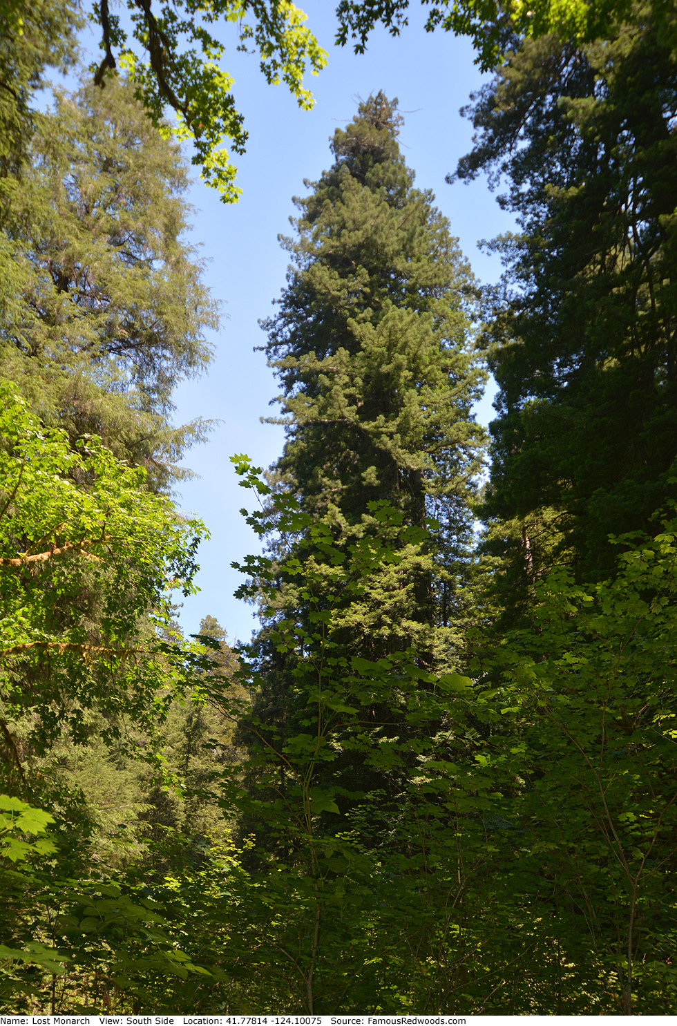
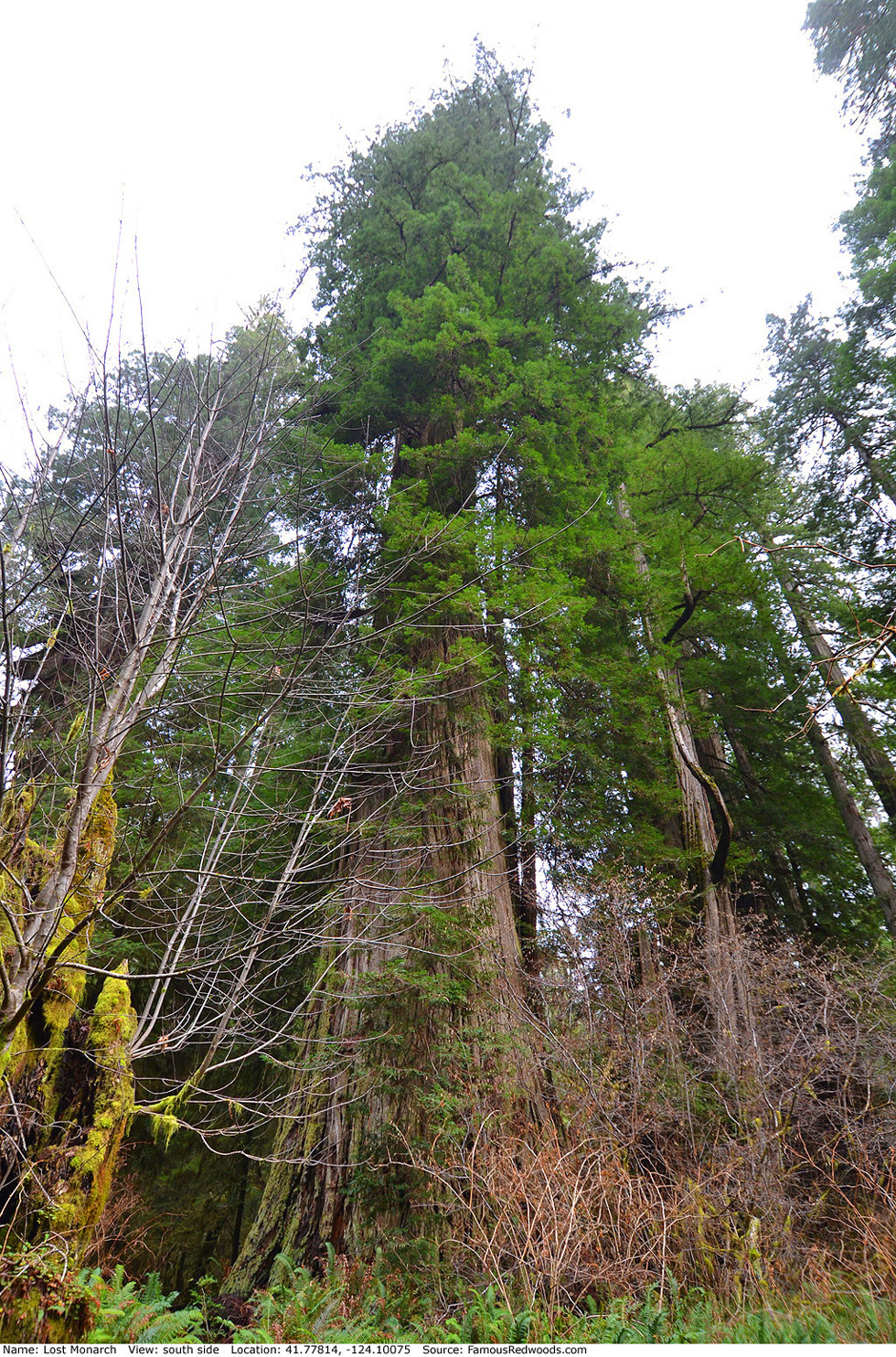
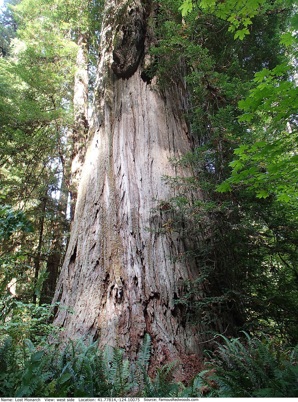
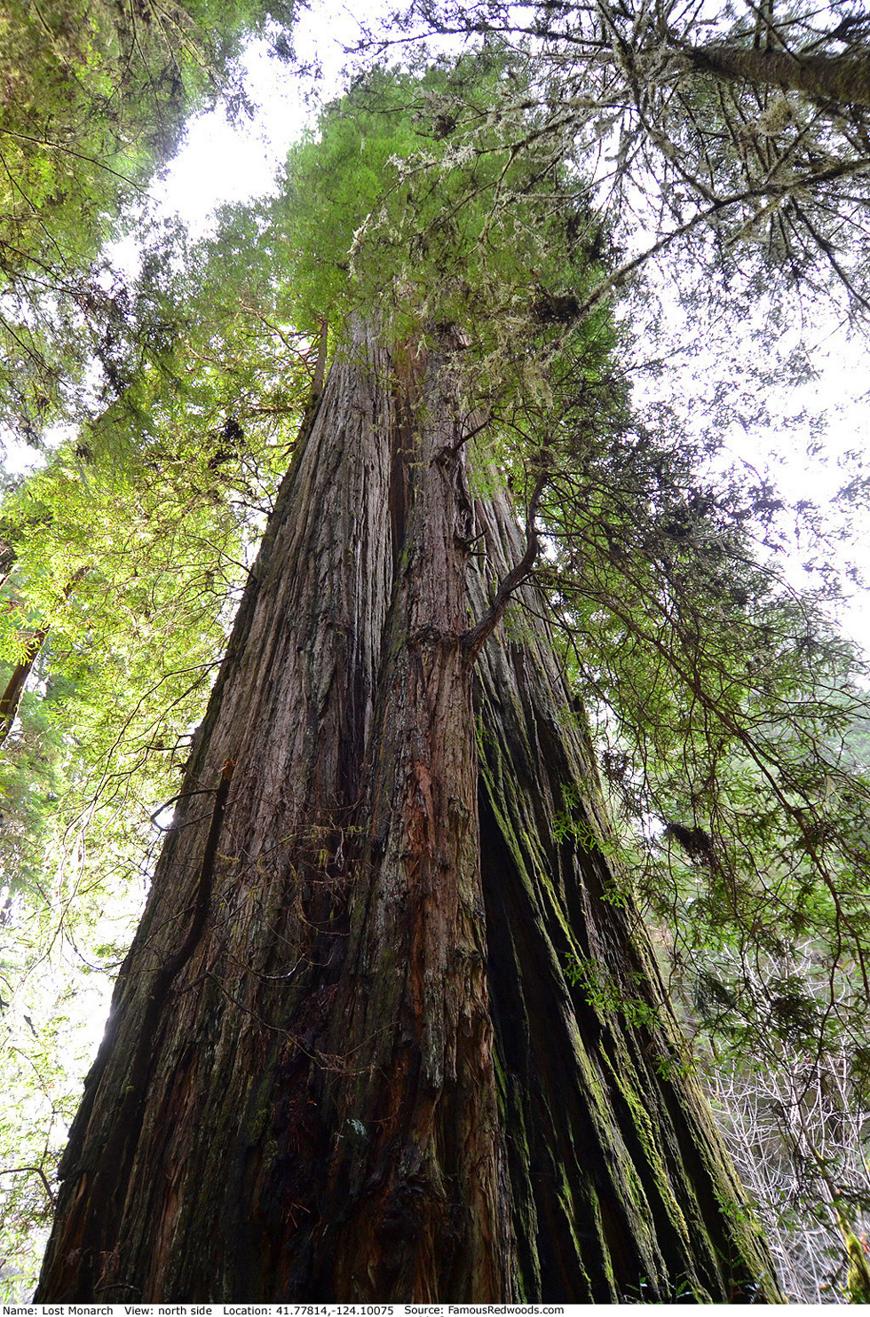
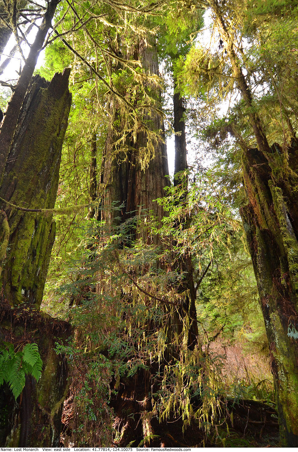
Notes: Lost Monarch, also known as S�limo, is the world's 28th largest tree, the 3rd largest coast redwood, the 3rd largest tree in Jedediah Smith Redwoods State Park, the 2nd largest tree in National Tribute Grove, and and the largest tree in the Grove of Titans. Although Lost Monarch (1,290 AF points) has been the official American Forests national champion coast redwood since 1998, Godwood Creek Giant (1,295 AF points) and Juggernaut (1,359 AF points) have since surpassed it. Trunk volume estimate excludes two large basal sprouts, 7,663 ft3 (217 m3), which emerge on the north side of the tree. These sprouts remain fused with the main trunk for nearly 20 ft (6 m) before diverging as individual stems. While Lost Monarch and its basal sprouts may be genetically identical, experts consider them separate trees which share a common root system.
Cal Poly Humboldt forestry professor Stephen C. Sillett photographed the crown of Lost Monarch from El Viejo del Norte and a Tyrolean traverse to the tree. Naturalist Michael W. Taylor photographed author Richard M. Preston standing beside Lost Monarch. Lost Monarch is featured in the BBC Radio 4 Nature program James and the Giant Redwoods.
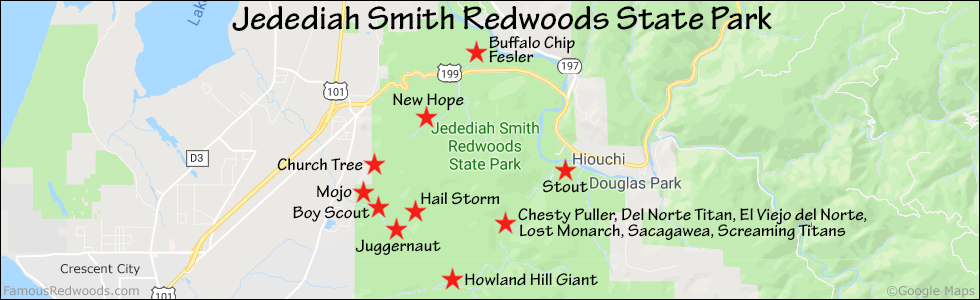
Drive: Lost Monarch is 290 mi (467 km) north of San Francisco near Crescent City.
Northbound: From U.S. Highway 101, just south of Crescent City, turn right onto Humboldt Road. Drive north 1.5 mi (2.4 km) on Humboldt Road and turn right onto Howland Hill Road. Drive east 3.8 mi (6.1 km) on Howland Hill Road, past Howland Hill Giant, to the Grove of Titans Trailhead located at 41.77243 -124.09940.
Southbound: From U.S. Highway 101, just north of Crescent City, turn left onto California State Route 197 (North Bank Road). Drive south 6.7 mi (10.8 km) on California State Route 197 (North Bank Road) and turn left onto U.S. Highway 199. Drive east 2.8 mi (4.5 km) on U.S. Highway 199 and turn right onto County Road 427 (South Fork Road). Drive south 0.5 mi (0.8 km) on County Road 427 (South Fork Road) and turn right onto Douglas Park Drive. Drive West 1.3 mi (2.1 km) on Douglas Park Drive to the intersection with Pacomo Camp Drive. Continue straight onto Howland Hill Road and drive west 2.5 mi (4.0 km) to the Grove of Titans Trailhead located at 41.77243 -124.09940.
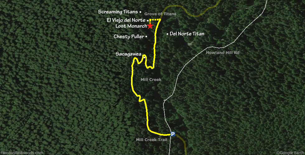
Hike: From the trailhead, hike north 0.7 mi (1.1 km) on Mill Creek Trail, past Sacagawea and Chesty Puller, to Lost Monarch which stands beside the trail on your left.
| Rating: | Easy | One-Way Distance: | 0.7 mi | (1.1 km) | Ascent: | 139 ft | (42 m) |
| Time: | 40 min | Off-Trail: | 0 ft | (0 m) | Descent: | 177 ft | (54 m) |
View Lost Monarch Tree location in Google Maps
Panorama: Click panorama to take a virtual tour of Lost Monarch Tree

Photos: Pictures of Lost Monarch Tree taken from different sides