| Height: | 368.37+ ft | (112.28+ m) | Elevation: | 830 ft (253 m) | GPS Latitude: | 39.22941 |
| Volume: | 8,317 ft3 | (235 m3) | Creek: | Montgomery Creek | GPS Longitude: | -123.38683 |
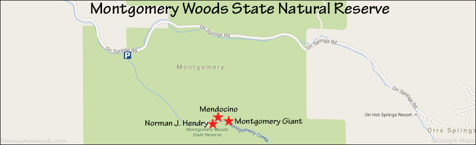
| Width: | 10.10 ft | (3.08 m) | Grove: | Montgomery Flat | Discovery Date: | June 1981 |
| Age: | 1,325 y | Park: | Montgomery Woods SNR | Discovered By: | Gerald F. Beranek |
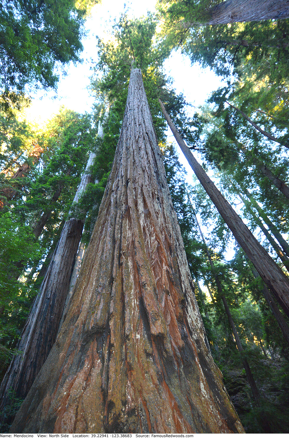
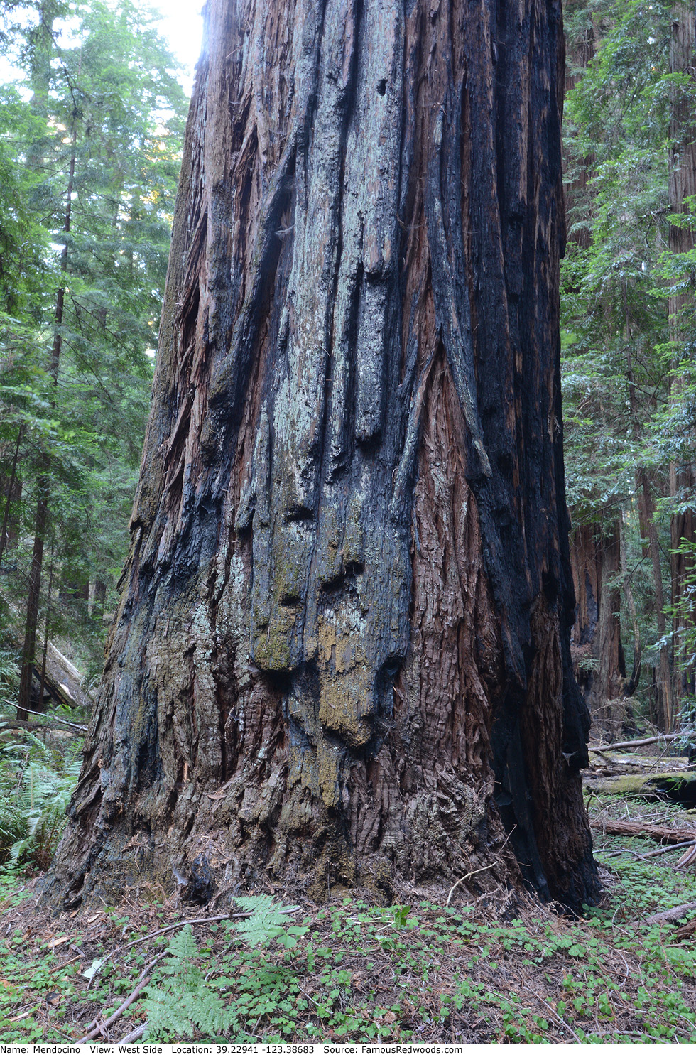
Notes: Mendocino is the world's 11th tallest tree and the tallest and 5th largest tree in Montgomery Woods State Natural Reserve. Tree climber Gerald F. Beranek discovered and photographed Mendocino from the top of Montgomery Giant in June 1981 but did not name the tree. In summer 1995, naturalists Ron Hildebrant and Michael W. Taylor determined that Mendocino was the new height champion and named it after the surrounding Mendocino County. Mendocino held the title of world's tallest tree from 1995 until July 30, 2000 when naturalist Chris K. Atkins discovered Stratosphere Giant in Humboldt Redwoods State Park. In 1999, California State Parks ranger Karl Poppelreiter posed for a photograph on the north side of Mendocino as part of a news story which made national headlines.
Drive: Mendocino is 113 mi (182 km) north of San Francisco near the city of Ukiah.
Northbound: From U.S. Highway 101 just north of Ukiah, take exit 551 North State Street, turn right onto North State Street, and drive north 0.3 mi (0.5 km) to Orr Springs Road.
Southbound: From U.S. Highway 101 just north of Ukiah, take exit 551 North State Street, turn left onto North State Street, and drive north 0.4 mi (0.6 km) to Orr Springs Road.
Turn left onto Orr Springs Road and drive west 13.7 mi (22.0 km) to Montgomery Woods State Natural Reserve. Turn left at the sign to enter the parking area.
Hike: From the parking lot, walk to the trailhead sign to get an overview of the park. Although the sign says Mendocino was the world's tallest tree from December 2000 until August 2006, the tree actually held that title from Summer 1995 until July 30, 2006 when naturalist Chris K. Atkins discovered Stratosphere Giant in Humboldt Redwoods State Park. Cross the bridge over Montgomery Creek, turn left, and hike 0.3 mi (0.5 km) south/uphill on Montgomery Creek Trail to lower Montgomery Flat. Veer left toward the Grubb Memorial Grove sign and hike southeast 0.4 mi (0.6 km) on the northern segment of the Montgomery Creek Trail loop to the base of a fallen tree. Just before you reach the fallen tree, turn right for your first view of Mendocino. Exit the trail here and hike southwest 50 ft (15 m) off-trail to Mendocino.
| Rating: | Easy | One-Way Distance: | 0.8 mi | (1.3 km) | Ascent: | 347 ft | (106 m) |
| Time: | 20 min | Off-Trail: | 50 ft | (15 m) | Descent: | 190 ft | (58 m) |
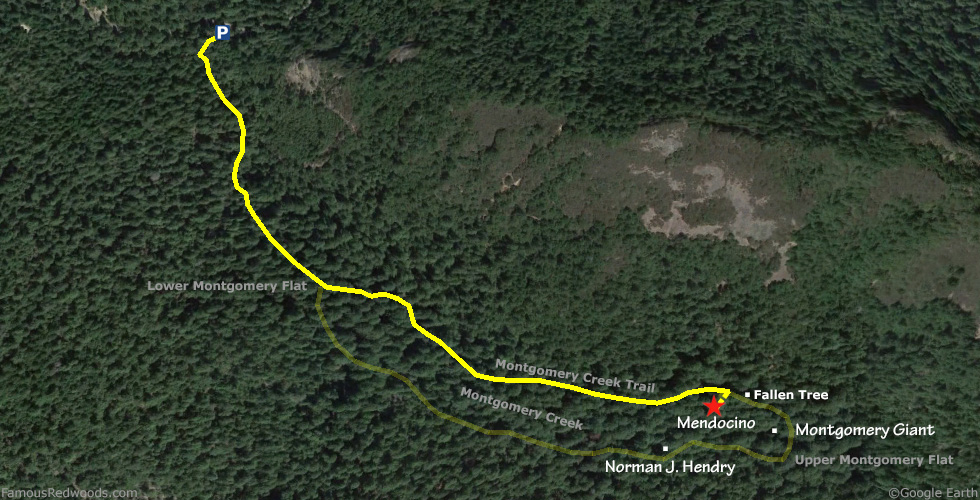
View Mendocino Tree location in Google Maps
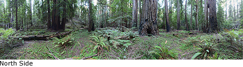
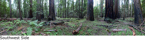
Panoramas: Click panoramas to take a virtual tour of Mendocino Tree
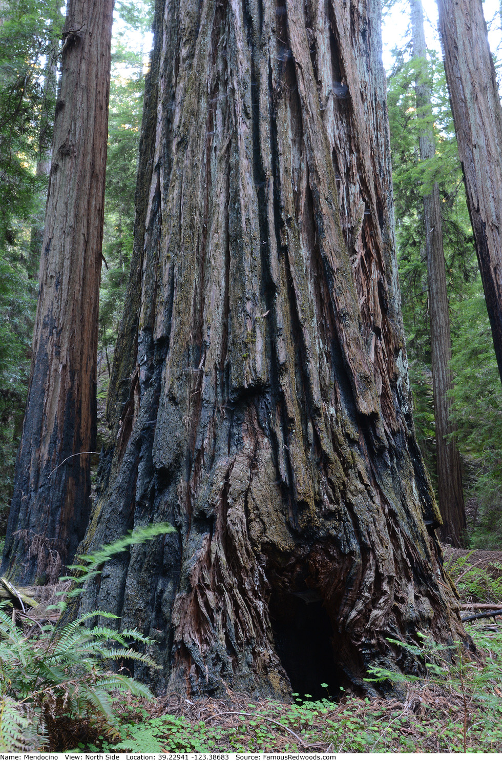
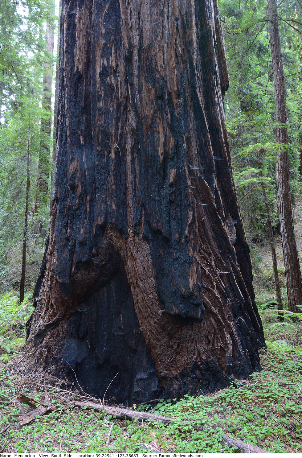
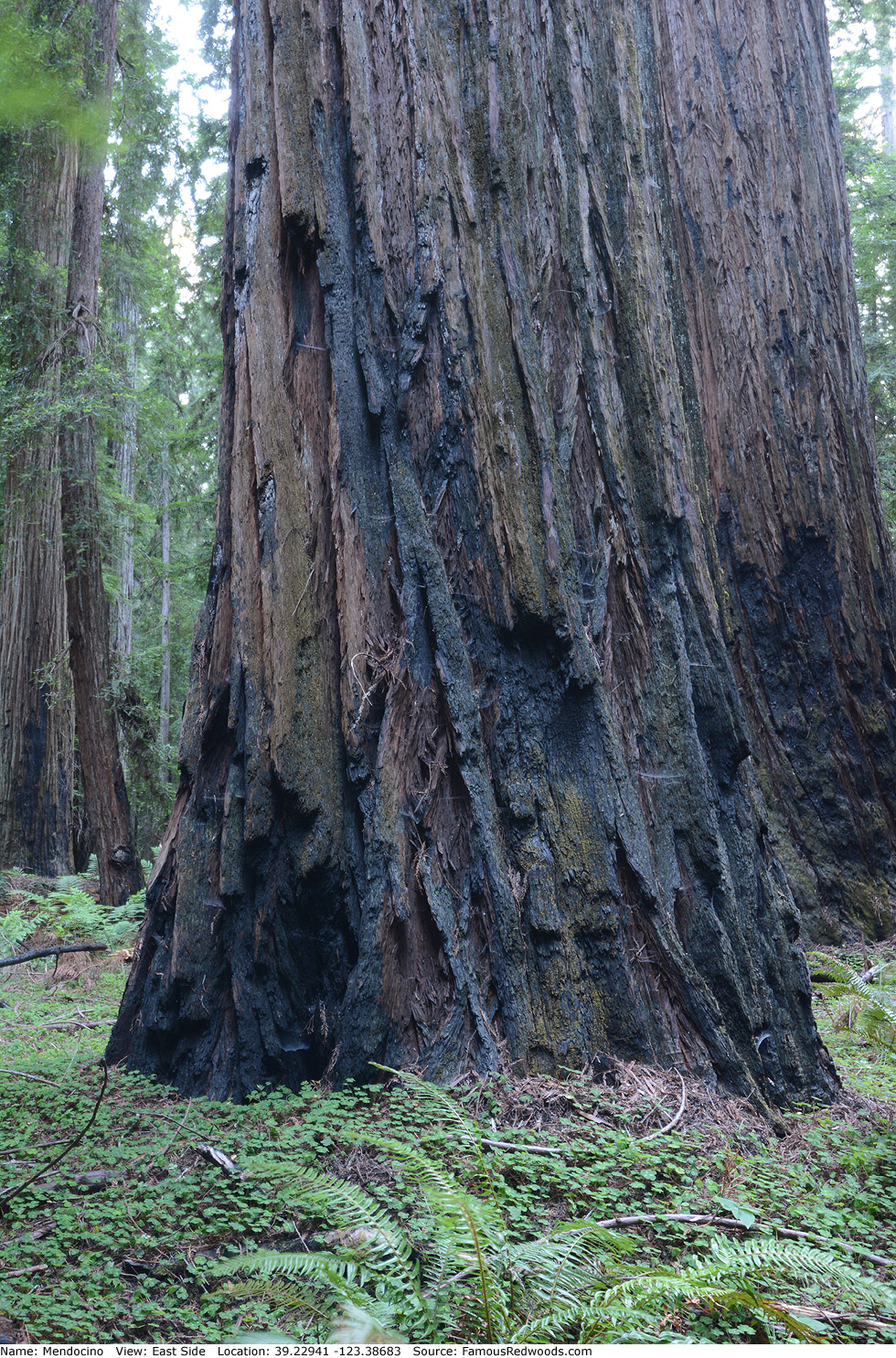
Photos: Pictures of Mendocino Tree taken from different sides