| Height: | 207.80+ ft | (63.34+ m) | Elevation: | 6,160 ft (1,878 m) | GPS Latitude: | 36.20726 |
| Volume: | 32,897 ft3 | (932 m3) | Creek: | Bear Creek | GPS Longitude: | -118.68414 |
| Width: | 24.00 ft | (7.32 m) | Grove: | Mountain Home Grove | Discovery Date: | 1884 |
| Age: | Park: | Giant Sequoia NM | Discovered By: | Jesse Hoskins |
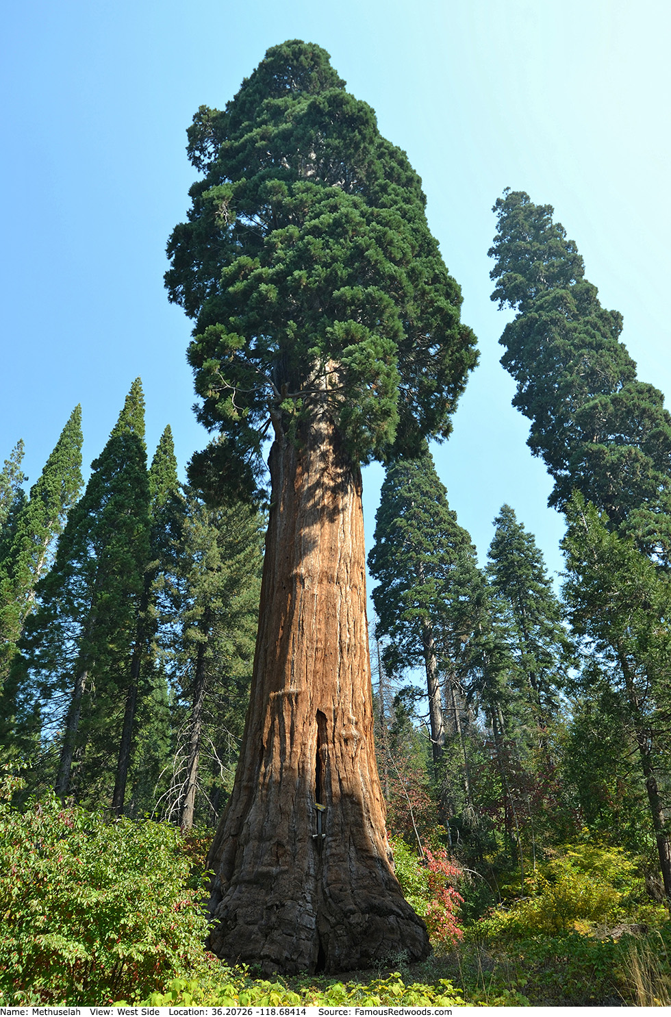
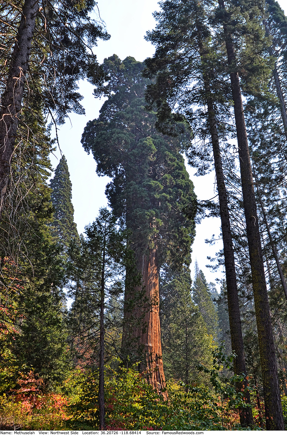
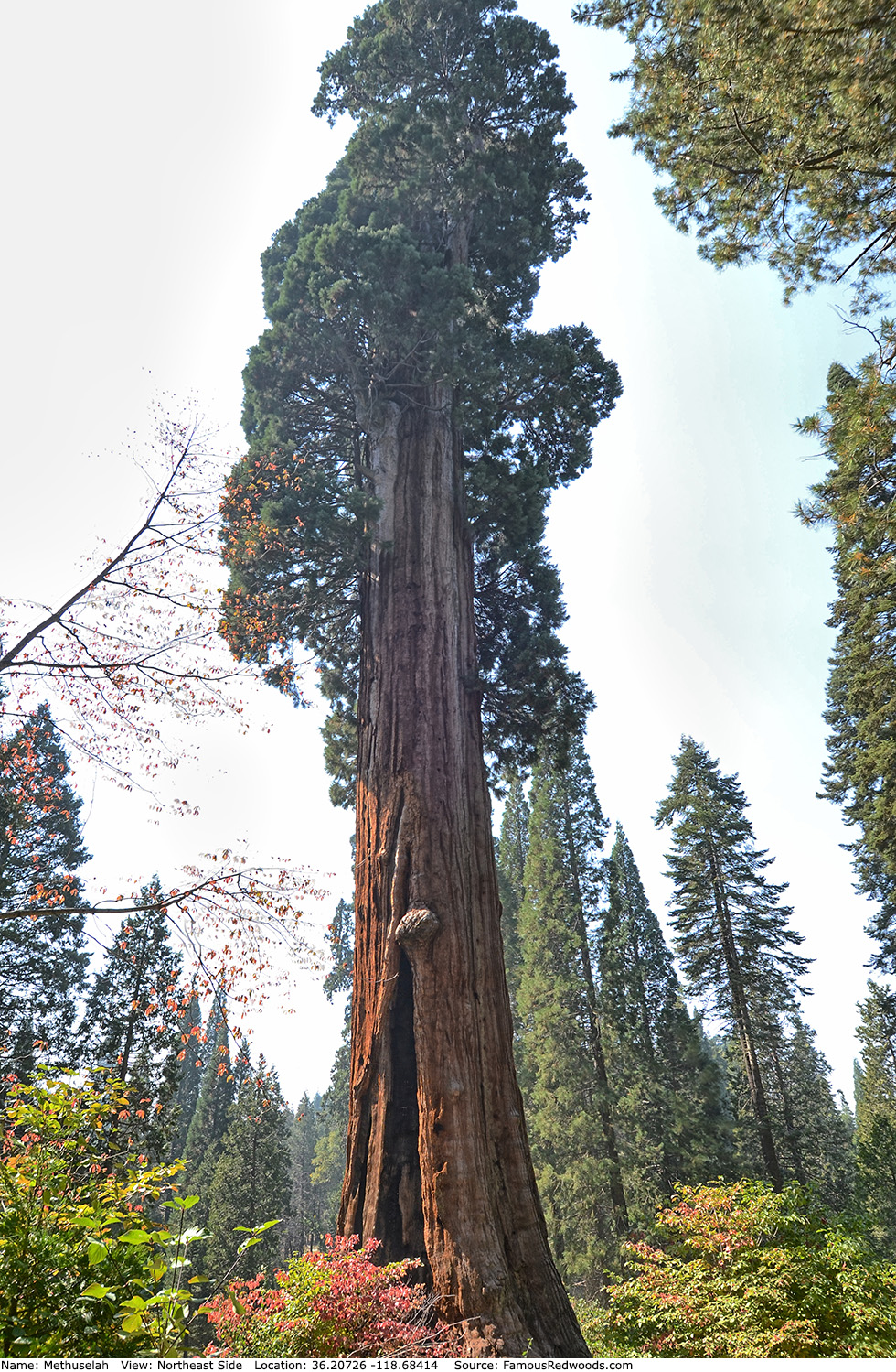
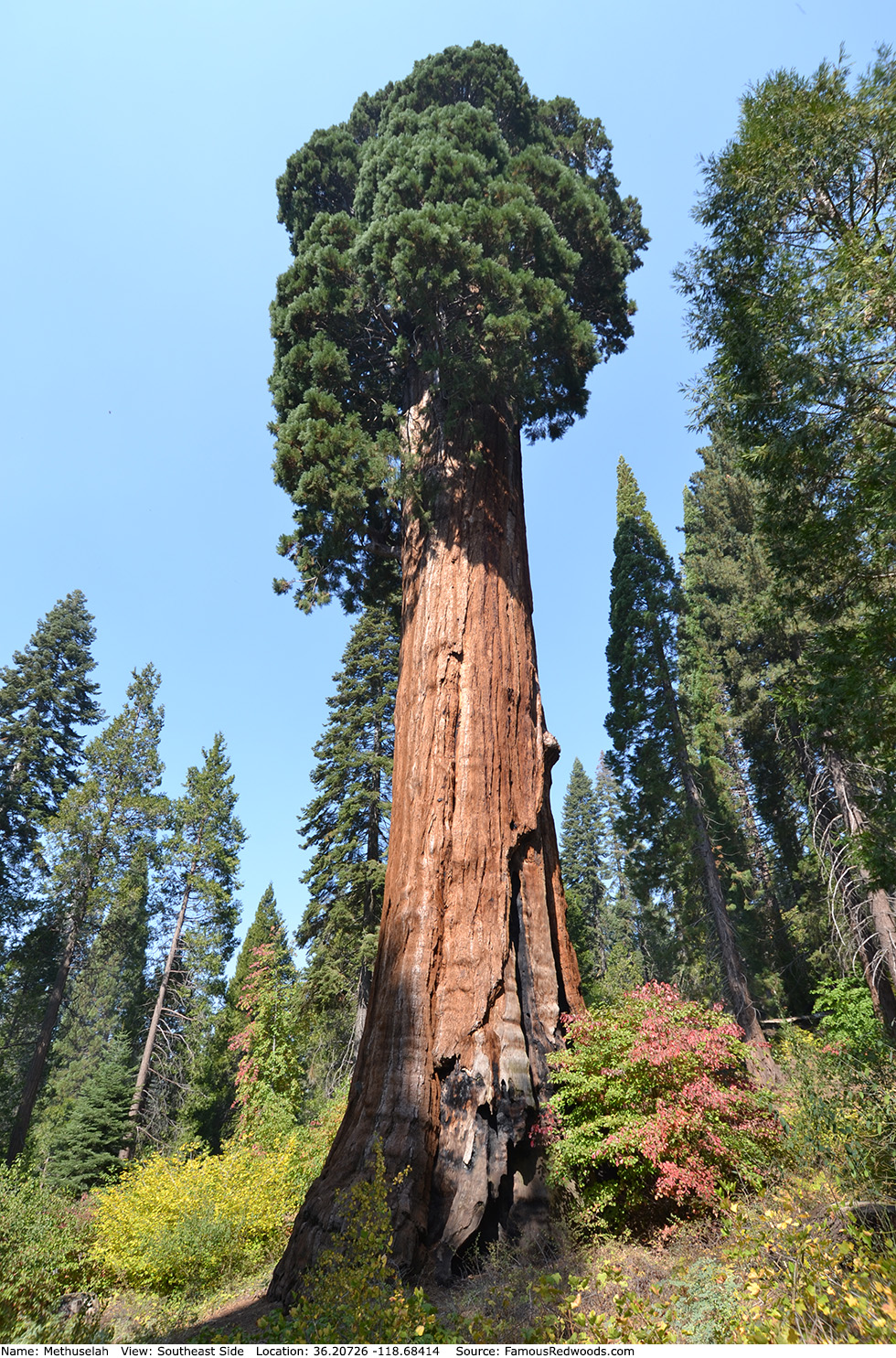
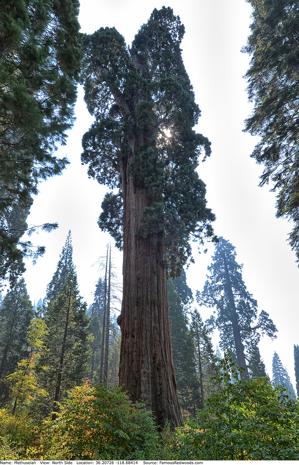
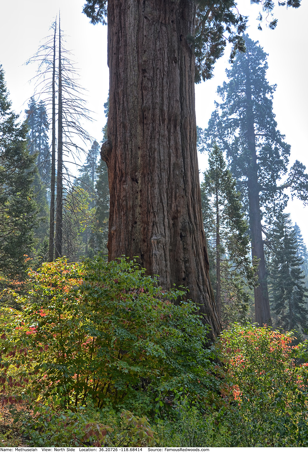
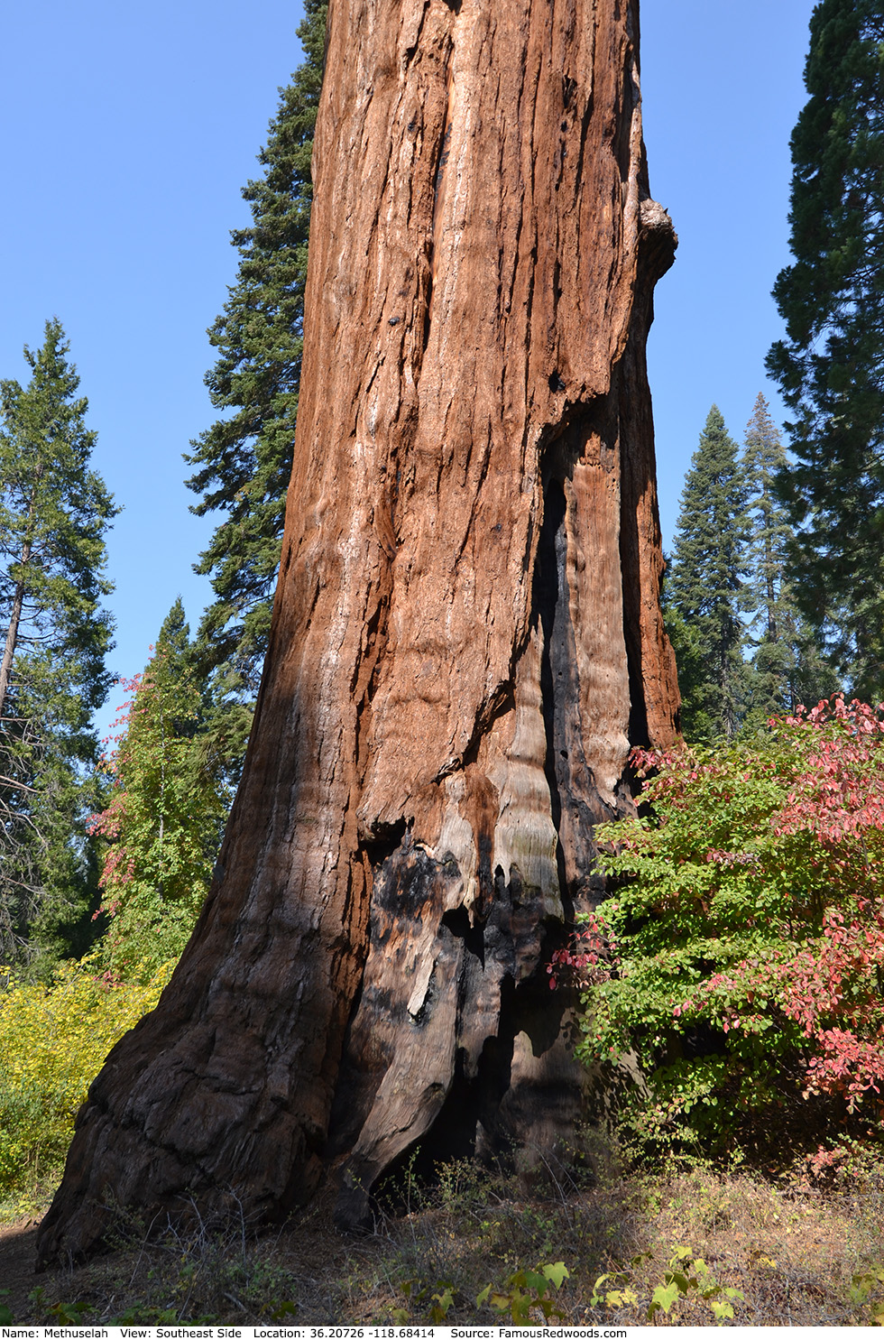
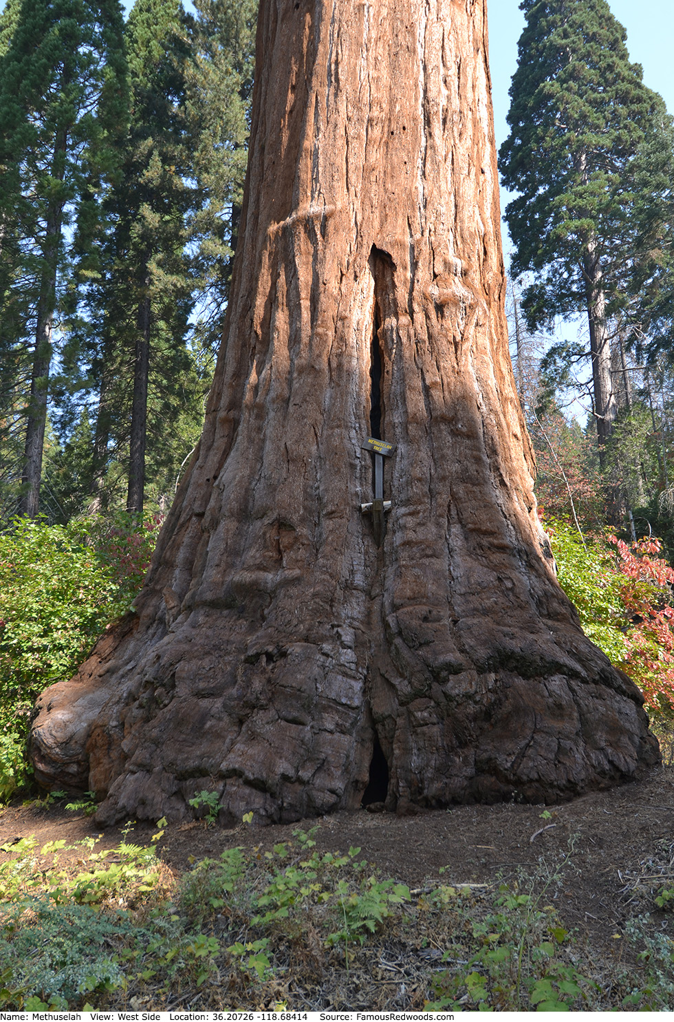
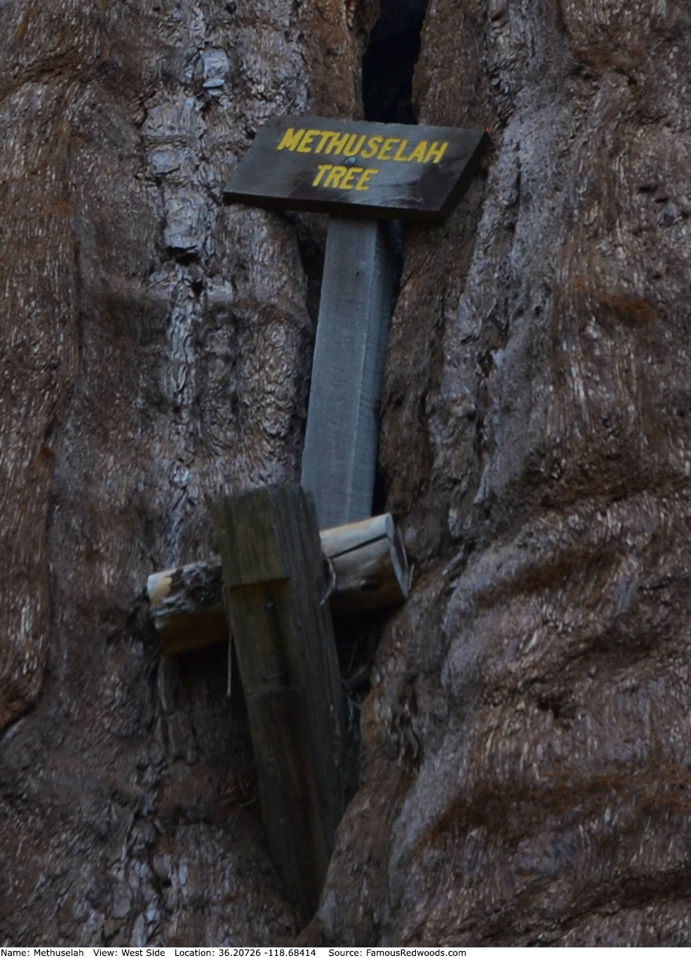
Notes: Methuselah is the 8th largest tree in Giant Sequoia National Monument and the 4th largest tree in Mountain Home Grove. Rancher Jesse Hoskins named the tree after Methuselah, the 969-year-old oldest-living human, from the Book of Genesis in the Old Testament.
Methuselah should not be confused with another Methuselah (bristlecone pine) tree which grows in Methuselah Grove in Inyo National Forest.
Drive: Methuselah is 233 mi (375 km) southeast of San Francisco near the city of Porterville.
Northbound: From U.S. Interstate 5 North, transfer to California State Route 99 North. From California State Route 99 North just north of Bakersfield, transfer to California State Route 65 North toward Porterville. Near Porterville, transfer to California State Route 190 East.
Southbound: From U.S. Interstate 5 South in Sacramento, transfer to U.S. Highway 50 East toward South Lake Tahoe. Drive east 1.7 mi (2.7 km) on U.S. Highway 50 and transfer to California State Highway 99 South. Near Tipton, transfer to California State Route 190 East toward Porterville.
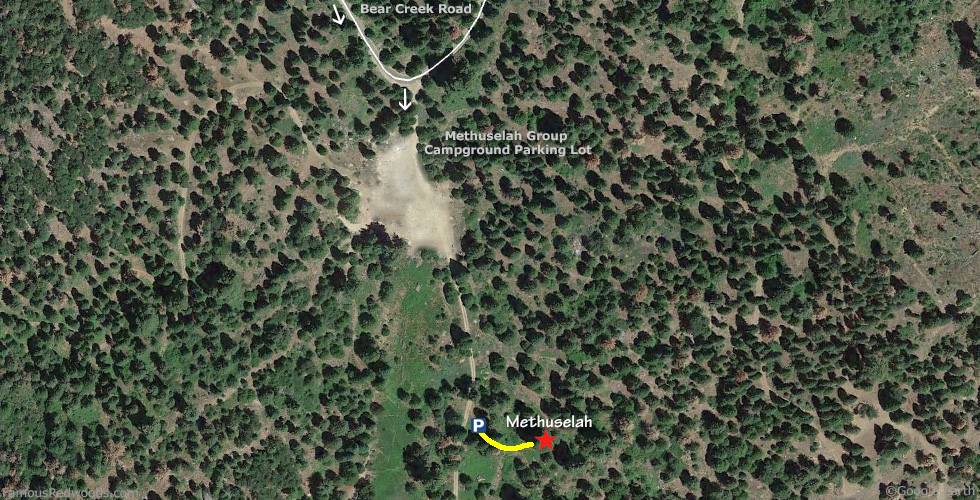
From Porterville, drive east 17 mi (27 km) on California State Route 190 toward Springville. Just past Springfield, turn left onto Balch Park Road toward Scicon, Balch Park, and Mountain Home State Forest. Drive north 3.4 mi (5.5 km) on Balch Park Road and turn right onto Bear Creek Road toward Scicon, Balch Park, and Mountain Home Demonstration State Forest. Drive east 14 mi (23 km) on Bear Creek Road to the entrance of Methuselah Group Campground. Turn right at the campground entrance and drive south 0.1 mi (0.2 km) on the campground road, past the parking lot, to the parking spot, located at 36.20742 -118.68468, on the left/east side of the road.
Navigation System Warning: Many computer, smartphone, and car navigation systems instruct you to turn left/north onto Rancheria Fire Road (a gated, narrow, and unpaved road) from Bear Creek Road to get to Mountain Home Demonstration State Forest. Ignore those instructions and continue driving on Bear Creek Road instead. Those same navigation systems may also instruct you to bypass Bear Creek Road altogether and to take Balch Park Road to the northern entrance of Mountain Home Demonstration State Forest. Avoid that route from Springville because it adds more than 6 mi (10 km) and 25 min of driving one-way.

Hike: From the parking spot, hike east 140 ft (43 m) on an unnamed trail to Methuselah.
| Rating: | Easy | One-Way Distance: | 150 ft | (46 m) | Ascent: | 13 ft | (4 m) |
| Time: | 1 min | Off-Trail: | 0 ft | (0 m) | Descent: | 31 ft | (9 m) |
View Methuselah Tree location in Google Maps
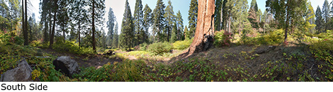
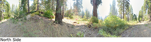
Panoramas: Click panoramas to take a virtual tour of Methuselah Tree
Photos: Pictures of Methuselah Tree taken from different sides