| Height: | 247.80+ ft | (75.53+ m) | Elevation: | 6,563 ft (2,000 m) | GPS Latitude: | 36.55710 |
| Volume: | 40,104 ft3 | (1,136 m3) | River: | Sequoia Creek | GPS Longitude: | -118.76939 |
| Width: | 23.40 ft | (7.13 m) | Grove: | Giant Forest | Discovery Date: | 1950 |
| Age: | Park: | Sequoia NP | Discovered By: | Wendell D. Flint |
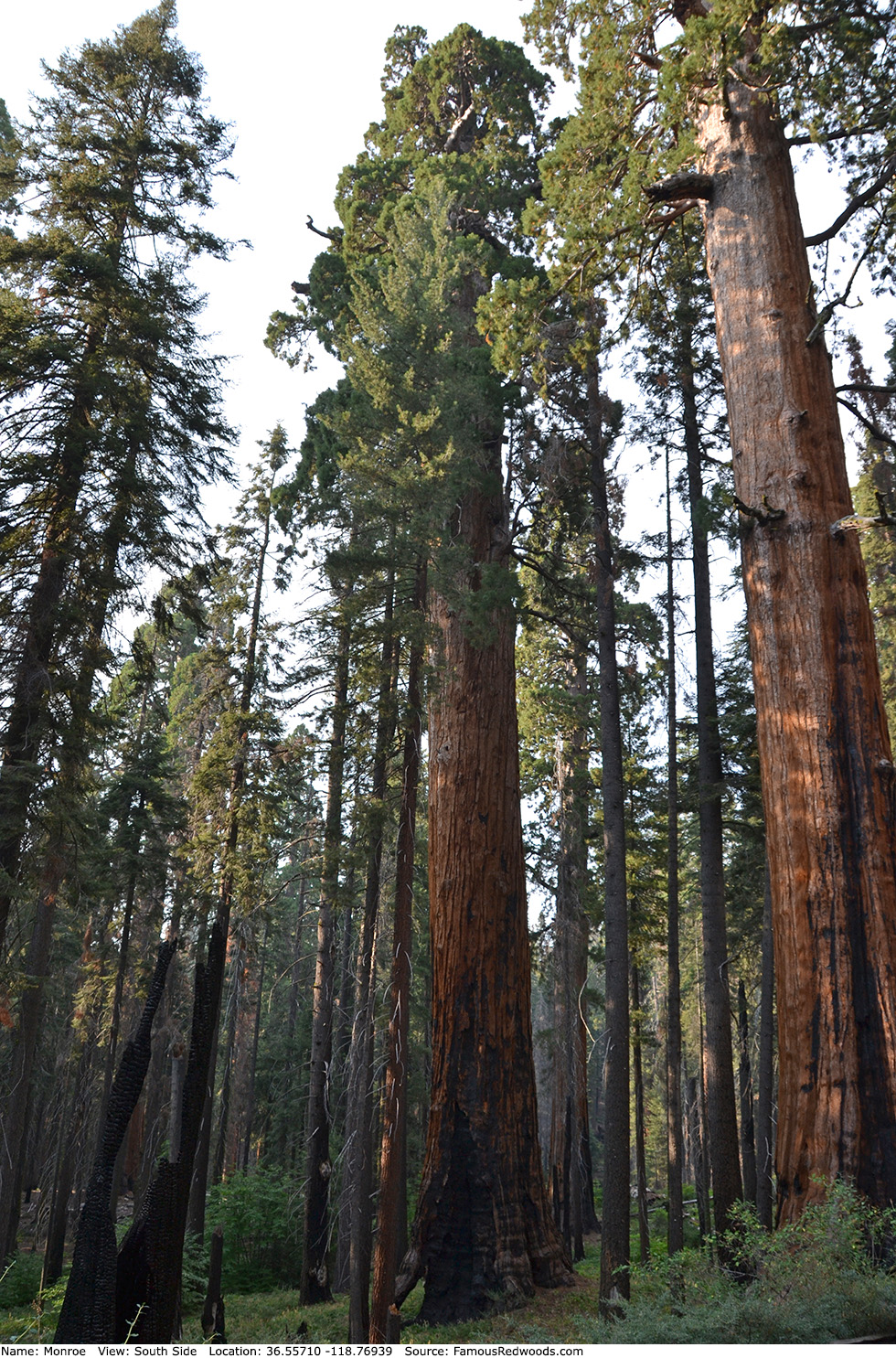
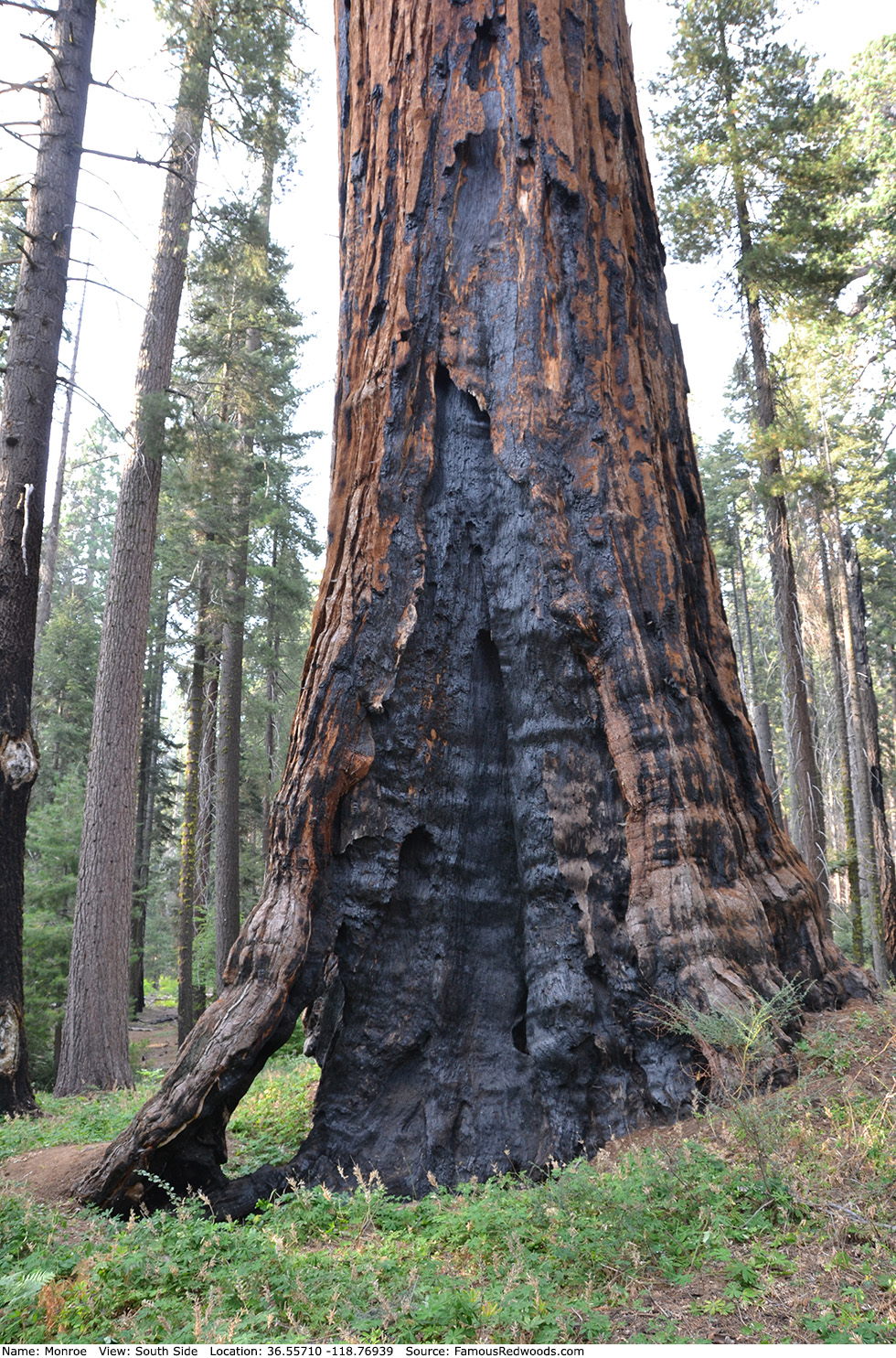
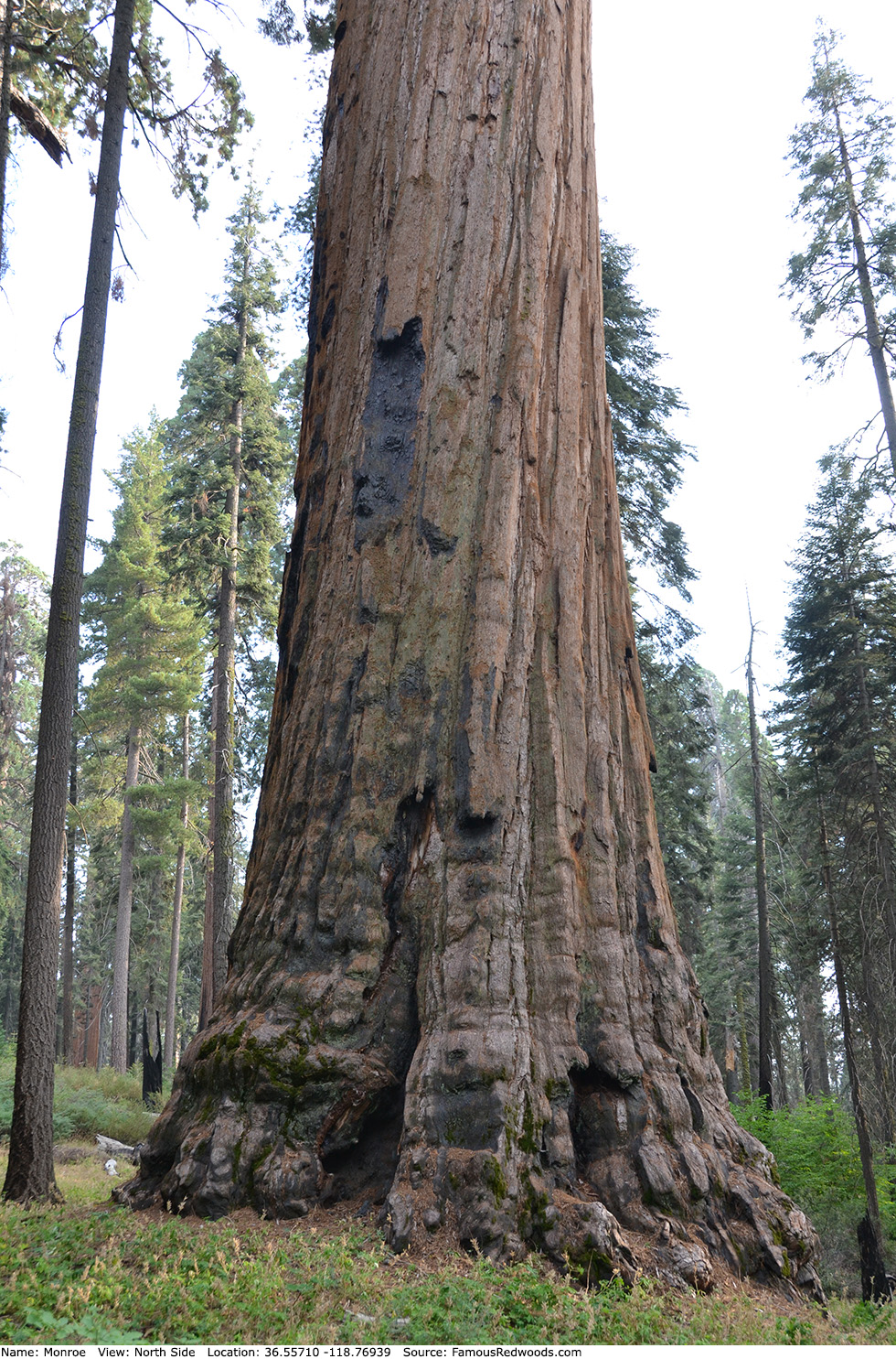
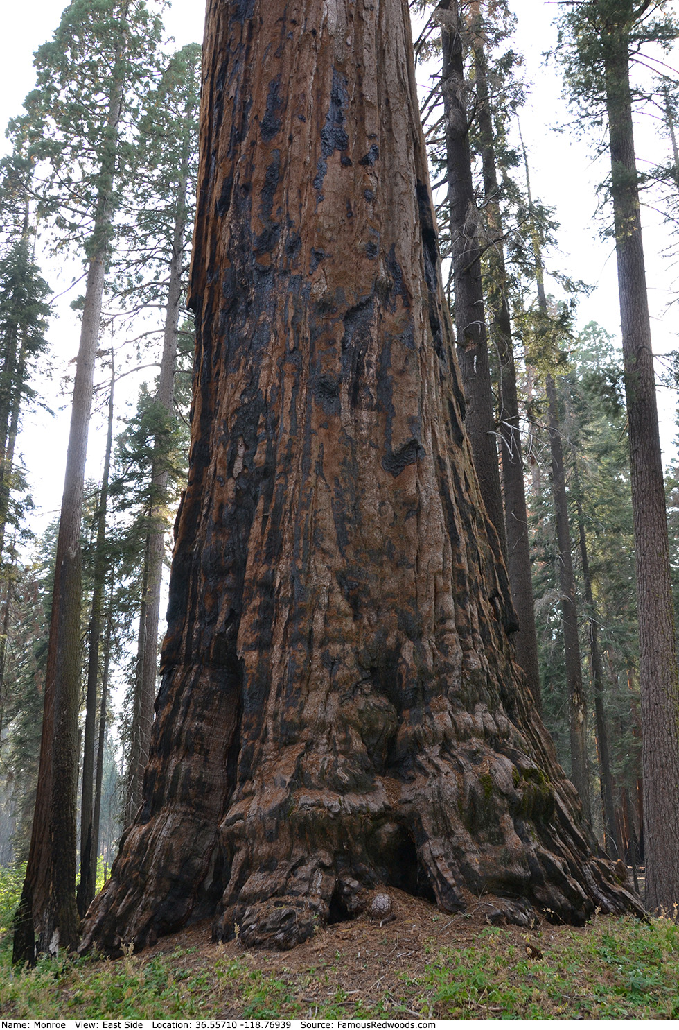
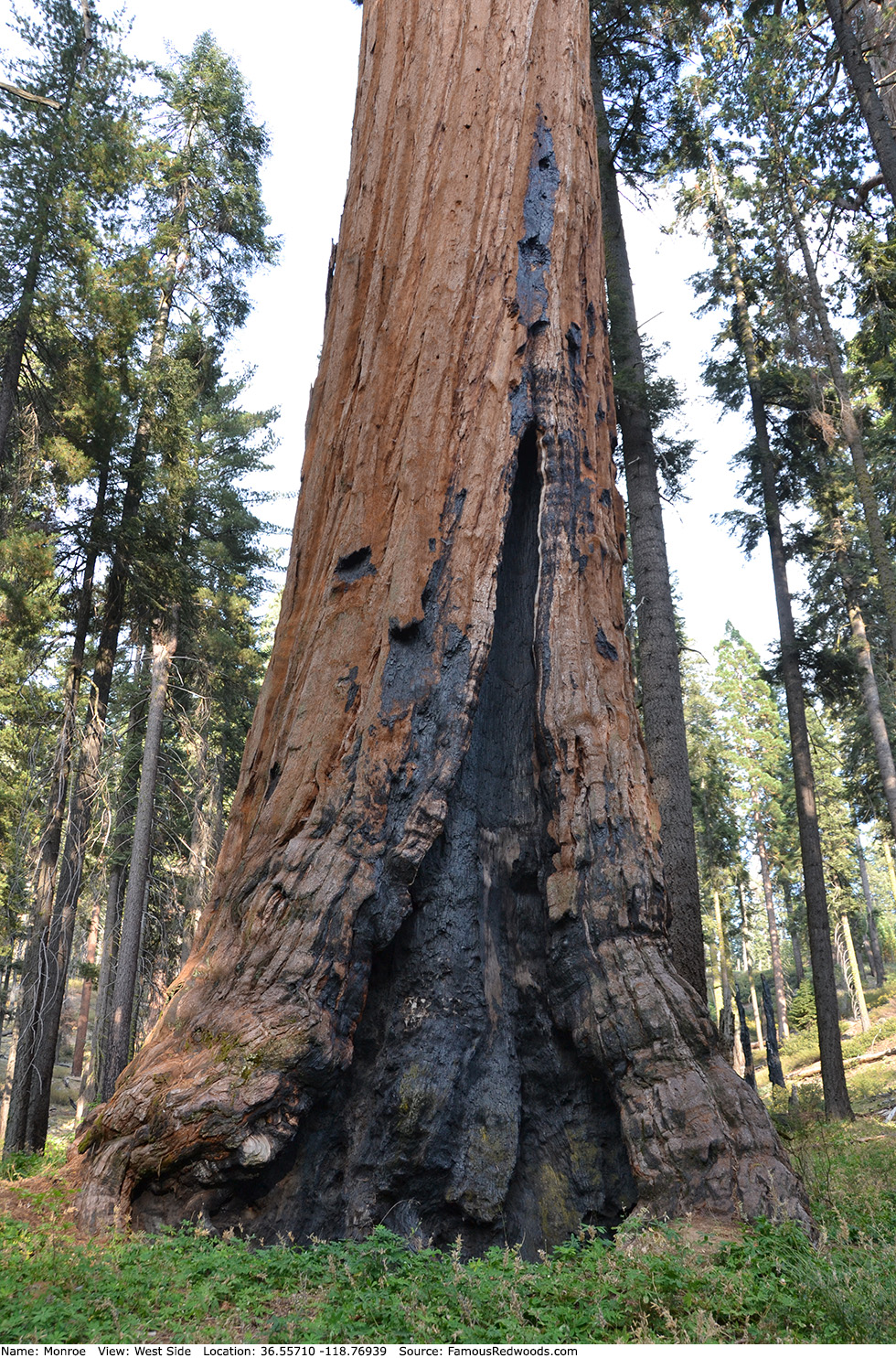
Notes: Monroe, also known as Near Auto Log (Monroe is 930 ft (283 m) north of Auto Log), is the world's 12th largest tree, the 10th largest giant redwood, the 6th largest tree in Sequoia National Park, and the 5th largest tree in Giant Forest. Volume estimate includes main trunk only (excludes basal and reiterated stems and branches). Naturalist Wendell D. Flint named the tree to honor James Monroe, 5th President of the United States.
Drive: Monroe is 218 mi (351 km) southeast of San Francisco near Fresno.
Northbound: From U.S. Interstate 5 North, transfer to California State Route 99 North toward Bakersfield. Drive north 97 mi (156 km) on California State Route 99 and transfer to California State Route 198 East toward Visalia. Drive east 57 mi (92 km) on California State Route 198 (Generals Highway), past Four Guardsmen, and turn right onto Crescent Meadow Road.
Southbound: From U.S. Interstate 5 South in Sacramento, transfer to U.S. Highway 50 East toward South Lake Tahoe. Drive east 1.7 mi (2.7 km) on U.S. Highway 50 and transfer to California State Highway 99 South. Near Fresno, transfer to California State Route 180 East. Drive east 56 mi (90 km) on California State Route 180, and turn right onto California State Route 198 West. Drive south 29 mi (47 km) on California State Route 198 (Generals Highway) and turn left onto Crescent Meadow Road.
Drive south 0.8 mi (1.3 km) on Crescent Meadow Road, past Booker T. Washington, and turn left into the Auto Log parking lot.
Road Warning: Crescent Meadow Road is open from late May to early November depending on snow levels. During summer (late May to early September) Sequoia Shuttle bus operations, Crescent Meadow Road is closed to private vehicles on weekends and holidays from 9:00 AM through late afternoon. When Crescent Meadow Road is closed, park in the lot near Giant Forest Museum and walk Crescent Meadow Road to Monroe or take the free Sequoia Shuttle (Gray Route 2) from Giant Forest Museum to the Moro Rock parking lot and hike from there to Monroe.

Hike: From the trailhead at the northern edge of the parking lot, hike north 0.1 mi (0.2 km) on an unnamed trail, past General Young, to the junction with Bear Hill Trail. Veer left at the trail junction and hike north 240 ft (73 m) on Bear Hill Trail to the trail exit point near 36.55680 -118.76861. Leave the trail here and hike northwest/downhill 250 ft (76 m) off-trail to Monroe.
| Rating: | Easy | One-Way Distance: | 0.2 mi | (0.3 km) | Ascent: | 126 ft | (38 m) |
| Time: | 5 min | Off-Trail: | 250 ft | (76 m) | Descent: | 79 ft | (24 m) |
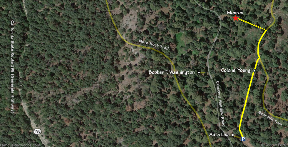
View Monroe Tree location in Google Maps
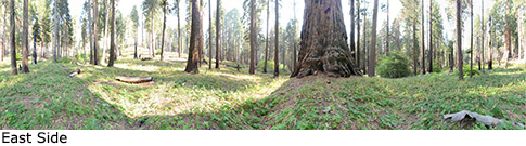
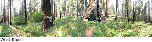
Panoramas: Click panoramas to take a virtual tour of Monroe Tree
Photos: Pictures of Monroe Tree taken from different sides