| Height: | 266.20+ ft | (81.14+ m) | Elevation: | 5,751 ft (1,753 m) | GPS Latitude: | 37.44116 |
| Volume: | 34,993 ft3 | (991 m3) | Creek: | Nelder Creek | GPS Longitude: | -119.59684 |
| Width: | 21.04 ft | (6.41 m) | Grove: | Nelder Grove | Discovery Date: | July 3, 1859 |
| Age: | Park: | Sierra NF | Discovered By: | Galen Clark | ||
| John W. Fitzhugh | ||||||
| L. A. Holmes |
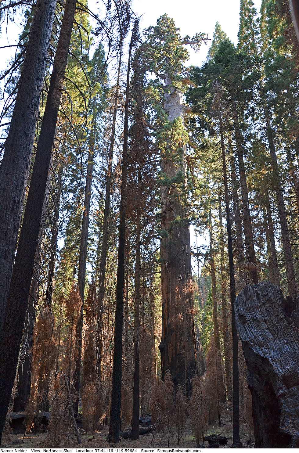
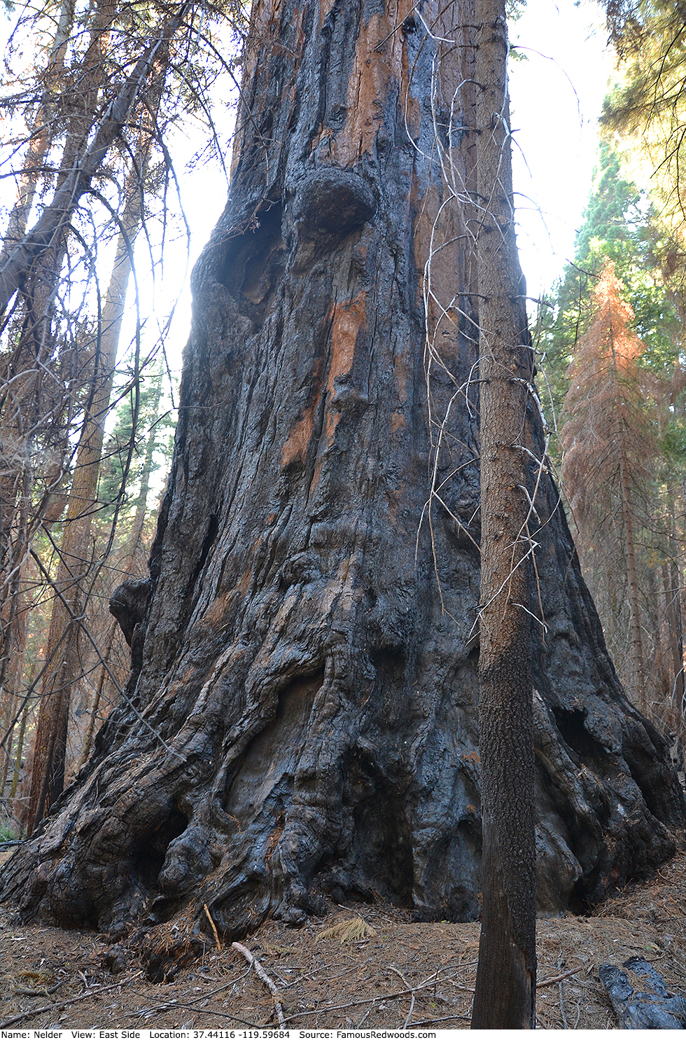
Notes: Nelder is the world's 23rd largest tree, the 21st largest giant redwood, and the largest tree in Sierra National Forest. Naturalist Galen Clark, Judge John W. Fitzhugh, and journalist L. A. Holmes, discovered the tree during a hunting expedition on July 3, 1859. Photographer John P. Soule published a photograph of the tree in 1870.
In 1875, prosepector-turned-hermit John A. Nelder Jr. built a cabin near the tree, which he considered world's largest, and met naturalist John Muir there later that same year. When Muir measured the tree, however, he determined that Grizzly Giant was larger. Yet Nelder's tree, though narrower, was taller and likely larger (by volume) than Grizzly Giant even then as it is today.
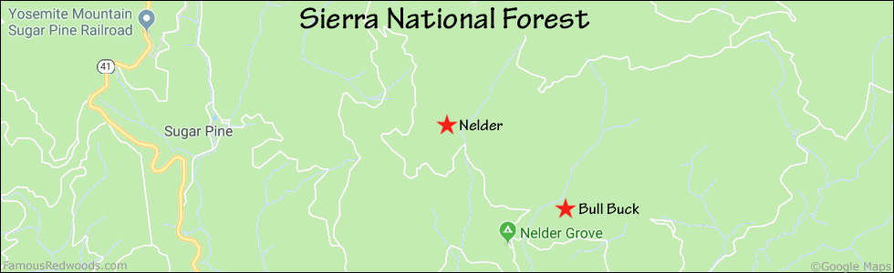
Drive: Nelder is 156 mi (251 km) east of San Francisco near the city of Oakhurst.
Northbound: From U.S. Interstate 5 North, transfer to California State Highway 41 North toward Kettleman City. Drive north 110 mi (161 km) on California State Highway 41 to Oakhurst.
Southbound: From U.S. Interstate 5 South in Sacramento, transfer to U.S. Highway 50 East toward South Lake Tahoe. Drive east 1.7 mi (2.7 km) on U.S. Highway 50 and transfer to California State Highway 99 South. Near Merced, transfer to California State Highway 140 East. Drive east 36 mi (58 km) on California State Highway 140 to Mariposa and transfer to California State Highway 49 East. Drive east 26 mi (42 km) on California State Highway 49 to Oakhurst and transfer to California State Highway 41 North.
From Oakhurst, drive north 4.1 mi (6.6 km) on California State Highway 41 to County Road 632 (Sky Ranch Road). Turn right and drive north 6.6 mi (10.6 km) on County Road 632 (Sky Ranch Road) to Forest Service Road 6S47Y. Turn left and drive north 1.2 mi (1.9 km) on Forest Service Road 6S47Y to Forest Service Road 6S90. Continue straight onto Forest Service Road 6S90, toward Nelder Grove and Soquel Meadow, and drive north 0.3 mi (0.5 km) to Forest Service Road 5S19. Turn left, toward Nelder Grove Campground, and drive north 0.5 mi (0.8 km) on Forest Service Road 5S19, past the Interpretive Center and Biledo Meadow Cabins, to the Graveyard of the Giants trailhead parking lot.
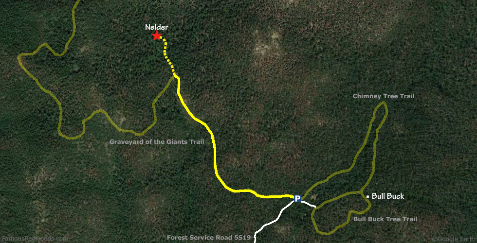
Road Warning: Forest Service Road 5S19 is a narrow, rough, and unpaved road which remains closed (with a locked gate) during winter. Low-clearance vehicles are not recommended. If you drive a low-clearance vehicle or if the gate is closed when you visit, park on Forest Service Road 6S90 and walk down Forest Service Road 5S19, around the gate, to the trailhead.
Hike: GPS-assisted navigation is recommended for this hike. From the trailhead, hike northwest 1.0 mi (1.6 km) on Graveyard of the Giants Trail, past The Leaner, to the trail exit point, near 37.43889 -119.59472, where the trail crosses Nelder Creek. Leave the trail here and, using a GPS device, hike northwest 0.2 mi (0.3 km) off-trail to Nelder.
| Rating: | Moderate | One-Way Distance: | 1.2 mi | (1.9 km) | Ascent: | 567 ft | (173 m) |
| Time: | 45 min | Off-Trail: | 0.2 mi | (0.3 km) | Descent: | 118 ft | (36 m) |
View Nelder Tree location in Google Maps
Panorama: Click panorama to take a virtual tour of Nelder Tree
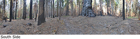
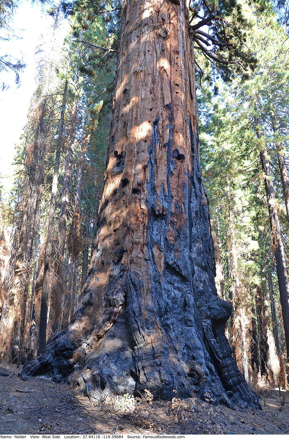
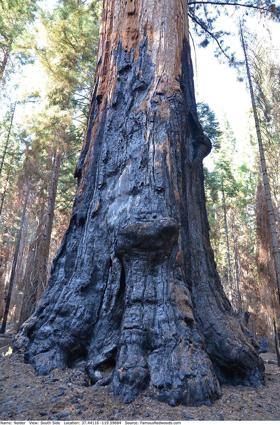
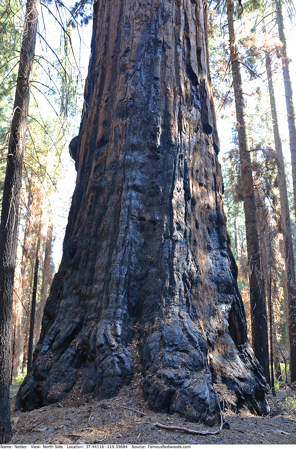
Photos: Pictures of Nelder Tree taken from different sides