| Height: | 370.34+ ft | (112.88+ m) | Elevation: | 600 ft (183 m) | GPS Latitude: | 41.25669 |
| Volume: | 14,128 ft3 | (400 m3) | Creek: | Elam Creek | GPS Longitude: | -124.03662 |
| Width: | 13.70 ft | (4.18 m) | Grove: | Orion Grove | Discovery Date: | 2007 |
| Age: | 1,911 y | Park: | Redwood NP | Discovered By: | LiDAR |
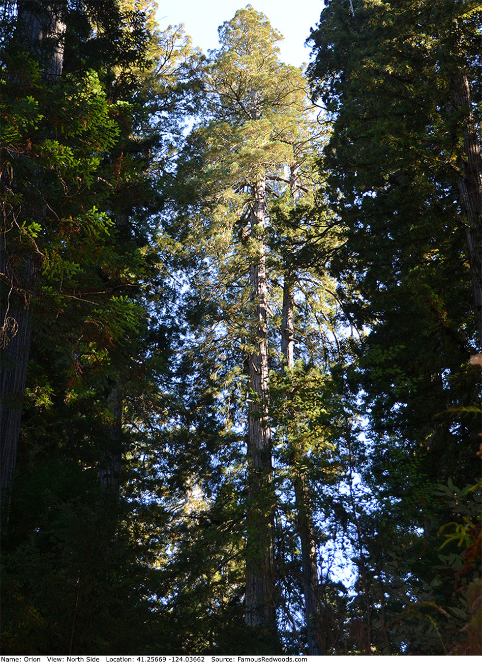
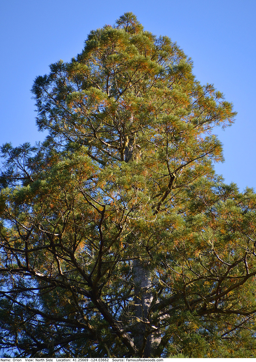
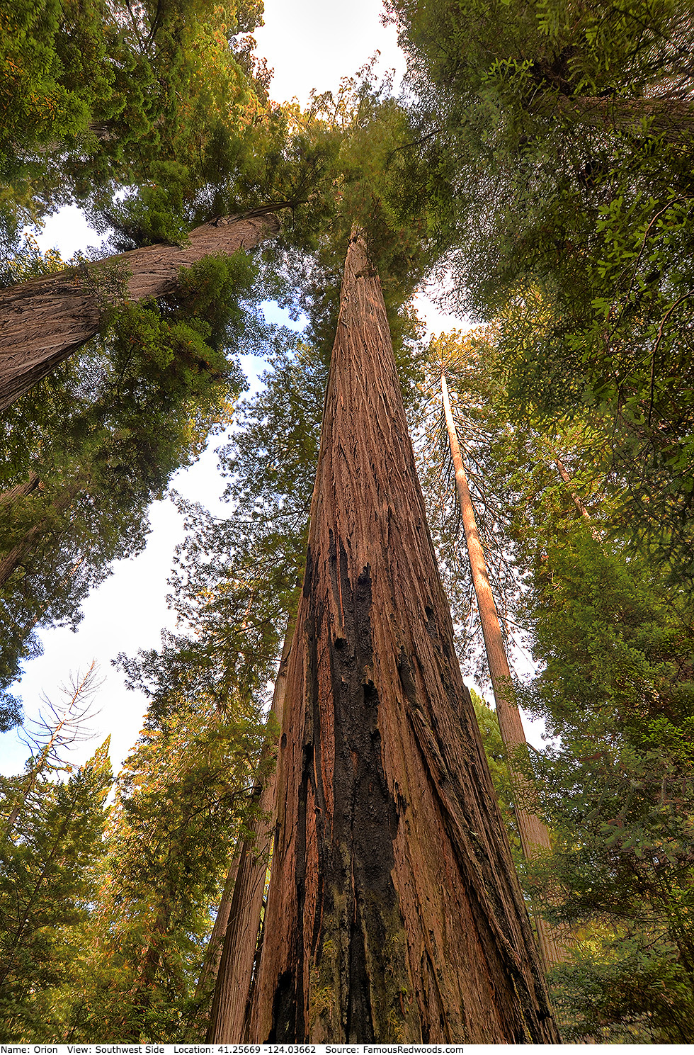
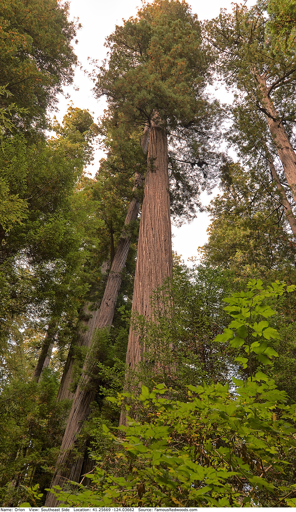
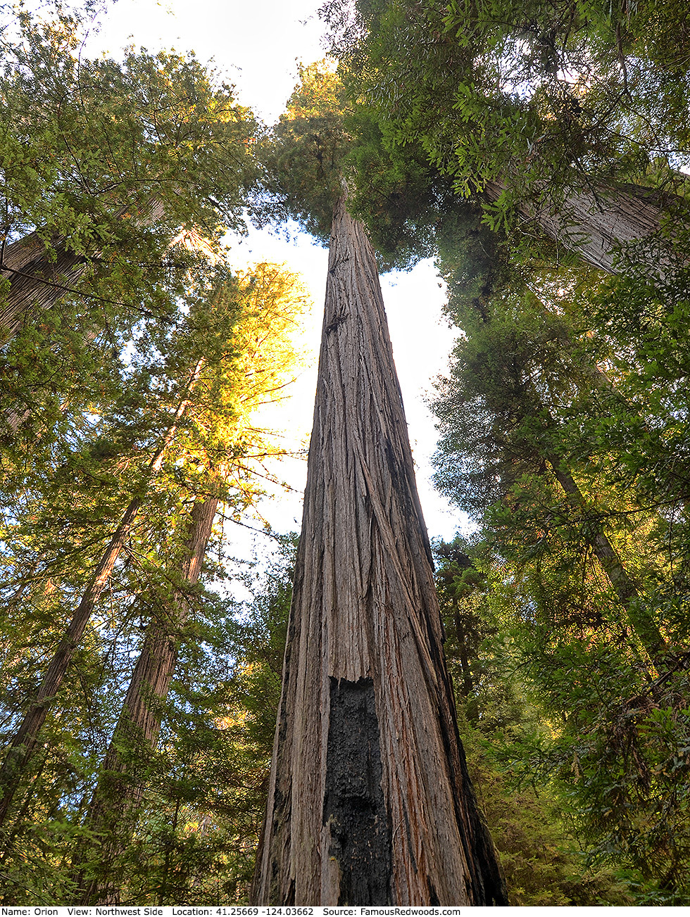
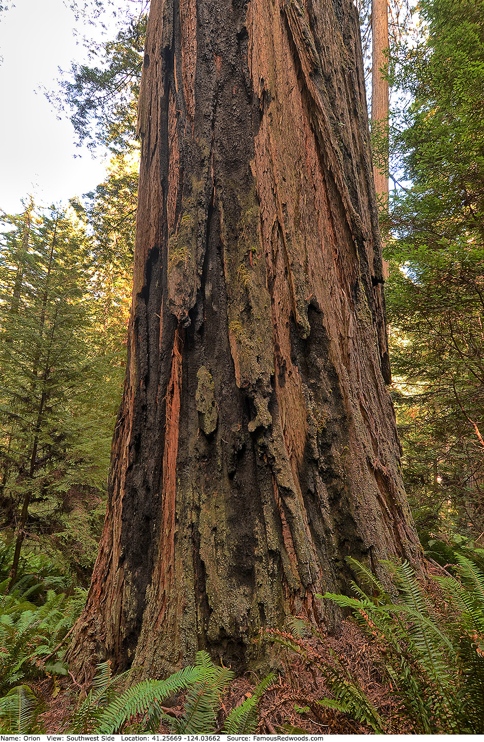
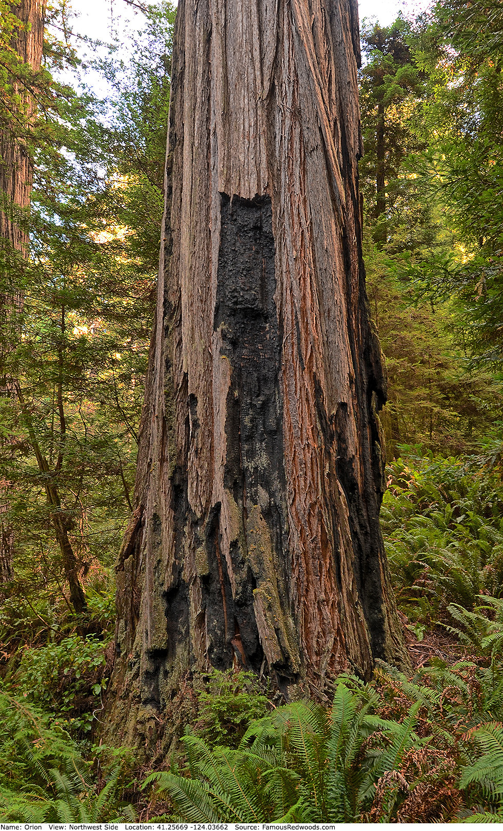
Notes: Orion, also known as TT9, is the world's 8th tallest tree, the 5th tallest and 11th largest tree in Redwood National Park, the tallest and largest tree in Orion Grove, and the tallest tree discovered by light detection and ranging (LiDAR). Cal Poly Humboldt forestry professor Stephen C. Sillett and naturalists Chris K. Atkins and Michael W. Taylor named the tree after Orion, the hunter in Greek mythology, whom the Greek Olympian Zeus placed among the stars as a constellation. Elam Creek is also known as Dry Heaves Creek.
In spring 2007, the National Park Service, the Bureau of Land Management, the California State Parks Foundation, the Nature Conservancy, and Save the Redwoods League paid Sanborn Mapping Services $183,000 to conduct an aerial LiDAR survey of Redwood National and State Parks, the Headwaters Forest Reserve, and Humboldt Redwoods State Park. Over a period of three months, Sanborn's 1968 Aero Commander 500S aircraft, carrying Leica Geosystems topographic LiDAR sensors, flew back and forth above the parks, at an altitude of 2,625 ft (800 m), while a laser, firing through a hole in the bottom of the fuselage, scanned the terrain below. The aircraft traveled more than 13,500 mi (21,726 km) during the survey while LiDAR sensors recorded the precise location, between the ground and the treetops, of 85,000 points every second to generate a three-dimensional map of the forest. After researchers processed the LiDAR data to create a list of trees taller than 348 ft (106 m) in each park, they hiked to each tree to verify its height. Although many tall redwoods detected by LiDAR, including Hyperion and Helios, were already known from earlier ground surveys, some trees, including Gulch Tower, Orion, Outlier, and Solstice, were previously undiscovered.
When Sillett climbed Orion in 2009, he determined that it was the world's 6th tallest tree. However, after Paradox and Laurelin overtook Orion in 2011 and 2012, respectively, Orion became the world's 8th tallest tree.
Orion and Gulch Tower are just fourteen trees apart.
The film In Search of the Tallest: A Redwoods Adventure includes a segment about Orion.
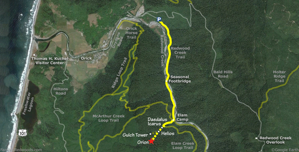
Drive: Orion is 255 mi (410 km) north of San Francisco near the community of Orick.
From U.S. Highway 101 just north of Orick, turn onto Bald Hills Road and drive 0.3 mi (0.5 km) to the Redwood Creek Trail sign. Turn right at the sign and drive 0.5 mi (0.8 km) to the Redwood Creek trailhead parking lot.
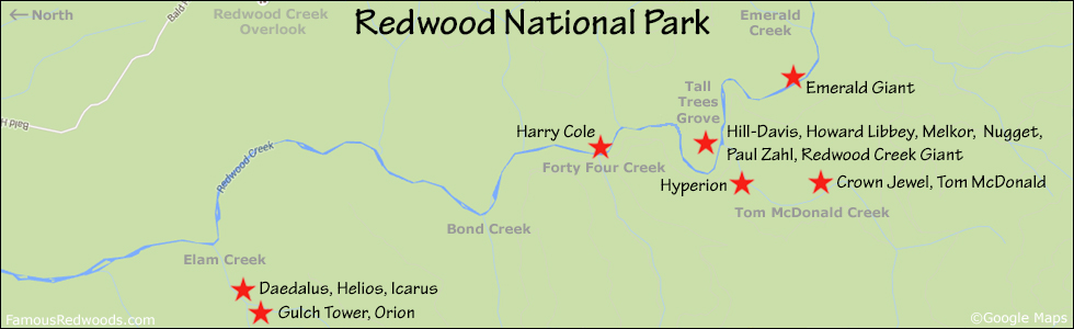
Hike: GPS-assisted navigation is recommended for this hike. From the parking lot, cross the wooden bridge at the trailhead and hike south 2.7 mi (4.3 km) along Redwood Creek Trail toward Elam Creek. Just after the trail crosses Hayes Creek, less than 1.0 mi (1.6 km) from the trailhead, you will see Redwood Creek on your right. Continue south along the trail until you reach the seasonal footbridge which crosses Redwood Creek 1.7 mi (2.7 km) from the trailhead. Cross Redwood Creek, return to the trail, and continue hiking south another 1.0 mi (1.6 km), past McArthur Creek and under a fallen tree, to Elam Creek. Just before the lower Elam Creek bridge (turn around if you reach this bridge), turn right/west at the Redwood Creek Trail sign on your left and the Orick Horse Trail sign on your right and hike west 0.1 mi (0.2 km) along the short spur trail, past Elam Camp and stable, to the junction with Elam Creek Loop Trail (also known as Overnight Loop Trail). Continue straight past the trail junction and hike west 0.2 mi (0.3 km) along the Elam Creek Loop Trail to the upper Elam Creek bridge and your first view of Daedalus and Icarus. 140 ft (43 m) past the bridge, just before you reach a small gully, exit the trail to the right and follow an old logging road southwest/uphill 350 ft (106 m). Where the logging road veers left/south (away from Elam Creek), near 41.26114 -124.03161, exit the logging road to the right and, using a GPS device, hike southwest 0.4 mi (0.6 km) off-trail, past Daedalus, Helios, and Icarus and across Elam Creek, to Orion. After visiting Orion, hike northeast 0.4 mi (0.6 km) off-trail to Daedalus and Icarus, hike north 900 ft (274 m) off-trail to Gulch Tower, or hike northeast 0.3 mi (0.5 km) off-trail to Helios.
Creek Warning: Orion is not accessible via Redwood Creek Trail when Redwood Creek has high water levels and the seasonal footbridge is not installed. It is best to visit Orion from July through October when Redwood Creek is low enough to wade across. To visit Orion whenever Redwood Creek is impassable, use the 3.1 mi (5.0 km) longer alternate route via Orick Horse Trail.
| Rating: | Difficult | One-Way Distance: | 3.5 mi | (5.6 km) | Ascent: | 997 ft | (304 m) |
| Time: | 2 hr 30 min | Off-Trail: | 0.5 mi | (0.8 km) | Descent: | 528 ft | (161 m) |
View Orion Tree location in Google Maps
Panoramas: Click panoramas to take a virtual tour of Orion Tree

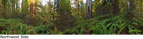
Photos: Pictures of Orion Tree taken from different sides