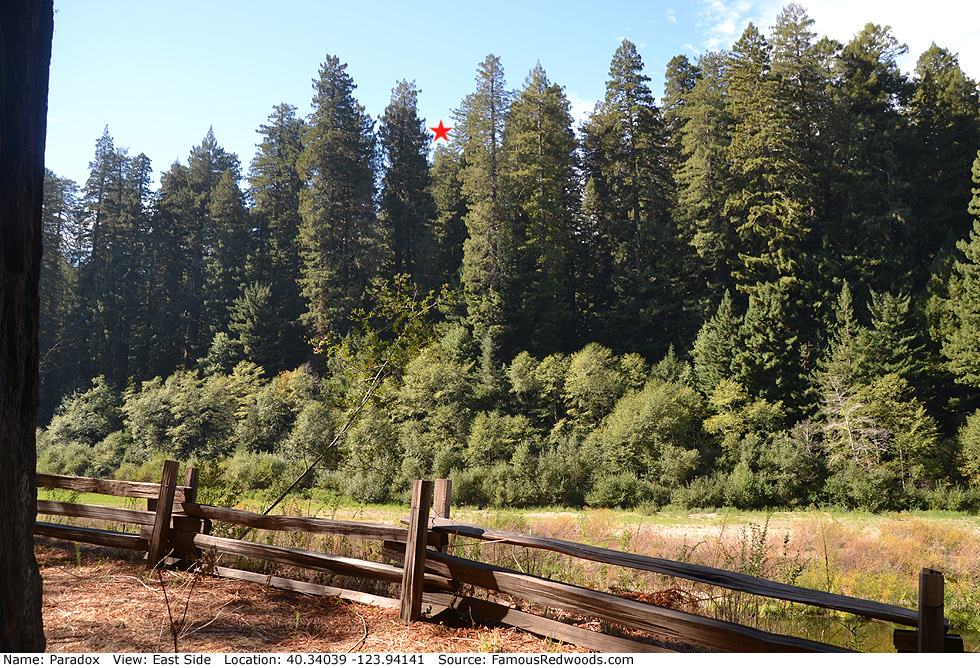
| Height: | 371.78+ ft | (113.32+ m) | Elevation: | 165 ft (50 m) | GPS Latitude: | 40.34039 |
| Volume: | 11,688 ft3 | (331 m3) | Creek: | Bull Creek | GPS Longitude: | -123.94141 |
| Width: | 12.80 ft | (3.90 m) | Grove: | Lower Bull Creek Flat | Discovery Date: | 1966 |
| Age: | 839 y | Park: | Humboldt Redwoods SP | Discovered By: | Alan G. Stangenberger | |
| Paul J. Zinke |
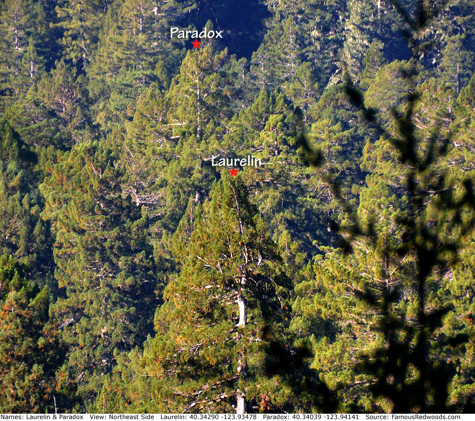
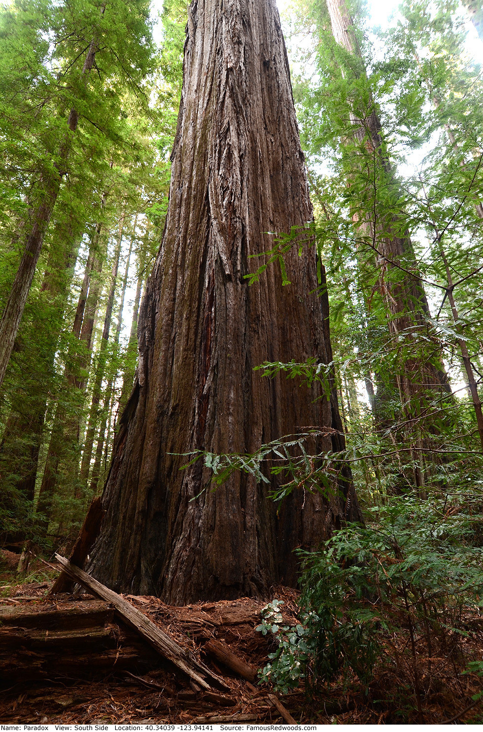
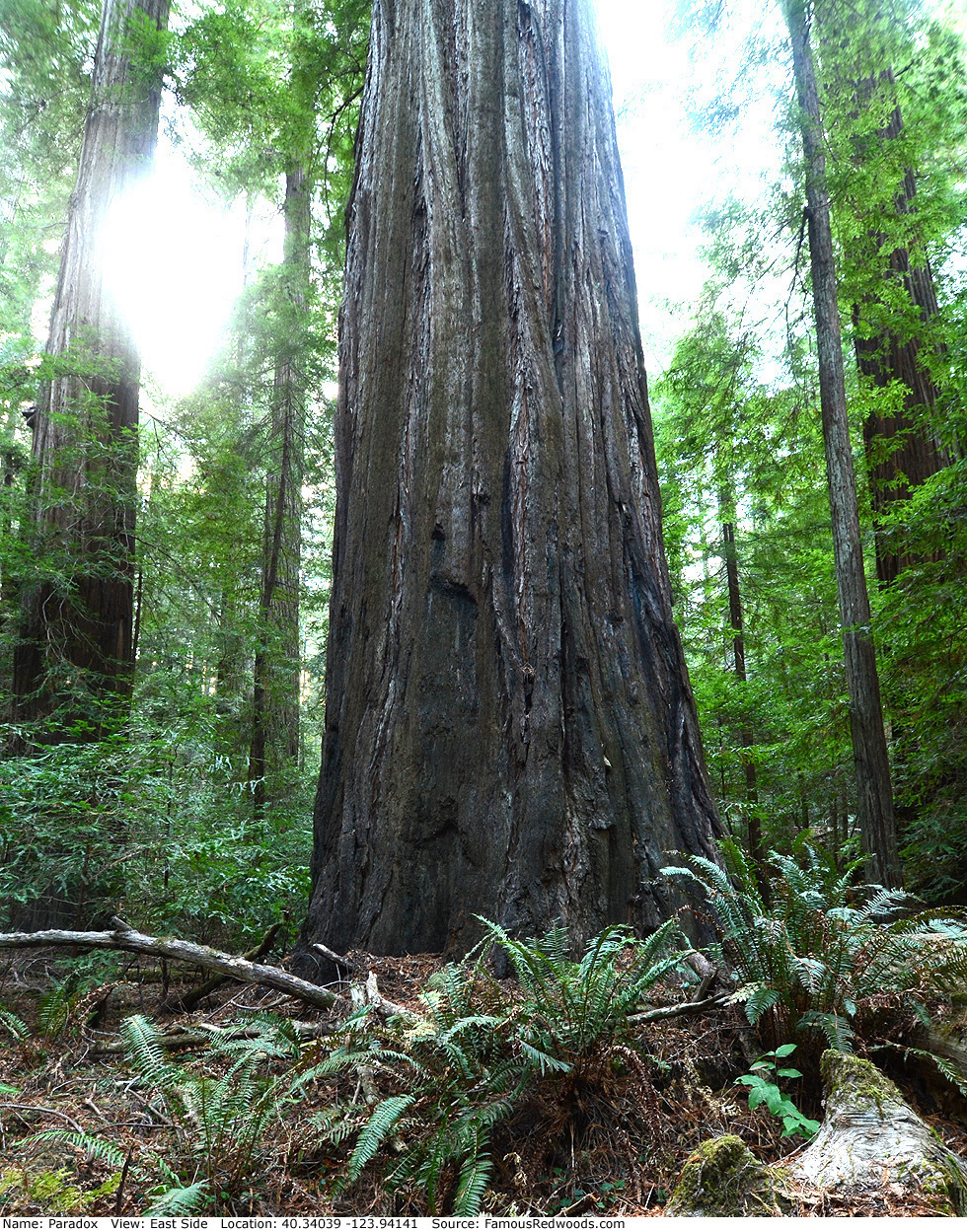
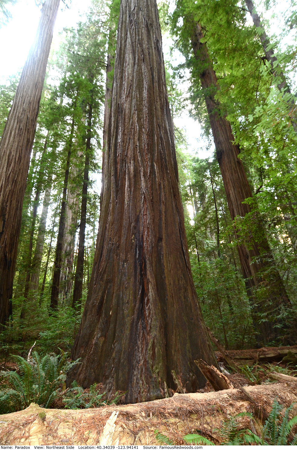
Notes: Paradox is the world's 5th tallest tree, the 2nd tallest tree in Humboldt Redwoods State Park, and the tallest tree
on Lower Bull Creek Flat. University of California at Berkeley forestry professor Paul J. Zinke and graduate student Alan G. Stangenberger
discovered Paradox from Duckett Bluff, near Dyerville, in 1966 but did
not name the tree. In February 1993, Zinke told naturalist Michael W. Taylor where to search for his Three Peas in a Pod
(then-unnamed Laurelin, Paradox, and
Telperion) which, Zinke suspected, were the world's tallest trees. When Taylor found Paradox later, he named it Paradox because he felt it had an unusually-thin trunk for such a tall tree. Paradox held the title
of world's tallest tree in 1995 until Taylor and fellow naturalist Ron Hildebrant measured Mendocino in
Montgomery Woods State Natural Reserve.
University of Washington forestry assistant professor Robert Van Pelt published an orthographic illustration of Paradox (shown at right). The film In Search of the Tallest: A Redwoods Adventure includes a segment about Paradox.
Drive: Paradox is 195 mi (314 km) north of San Francisco near the community of Weott.
Northbound: From U.S. Highway 101 just north of Weott, take exit 663 South Fork Honeydew and turn left onto California State Route 254 (Avenue of the Giants). Drive north 0.2 mi (0.3 km) on California State Route 254 (Avenue of the Giants) and turn left, under the bridge, onto Mattole Road.
Southbound: From U.S. Highway 101 just north of Weott, take exit 663 South Fork Honeydew and turn right onto Mattole Road.
Drive west 1.6 mi (2.6 km) on Mattole Road to a sign on the left/south side of the road which reads Rockefeller Forest - Lower Bull Creek Flat.
Just past the sign, turn left down a steep road toward the Lower Bull Creek Flat parking area.
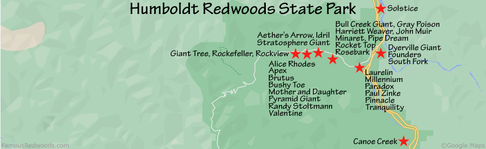
Hike: GPS-assisted navigation is recommended for this hike. From the trailhead, hike past the Bull Creek Flats Trail sign to the Rockefeller Forest Loop Trail sign approximately 120 ft (36 m) from the parking lot. Using a GPS device, hike south 500 ft (152 m) off-trail behind this sign, following a long log off to your right, toward Paradox. Veer around a set of trees and then hike between the next set of trees and over a jumble of fallen logs to Paradox.
| Rating: | Easy | One-Way Distance: | 600 ft | (183 m) | Ascent: | 0 ft | (0 m) |
| Time: | 3 min | Off-Trail: | 500 ft | (152 m) | Descent: | 3 ft | (1 m) |
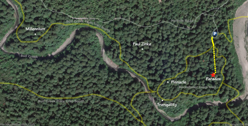
View Paradox Tree location in Google Maps
Panoramas: Click panoramas to take a virtual tour of Paradox Tree
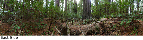
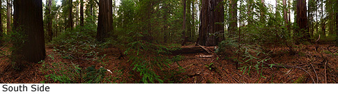
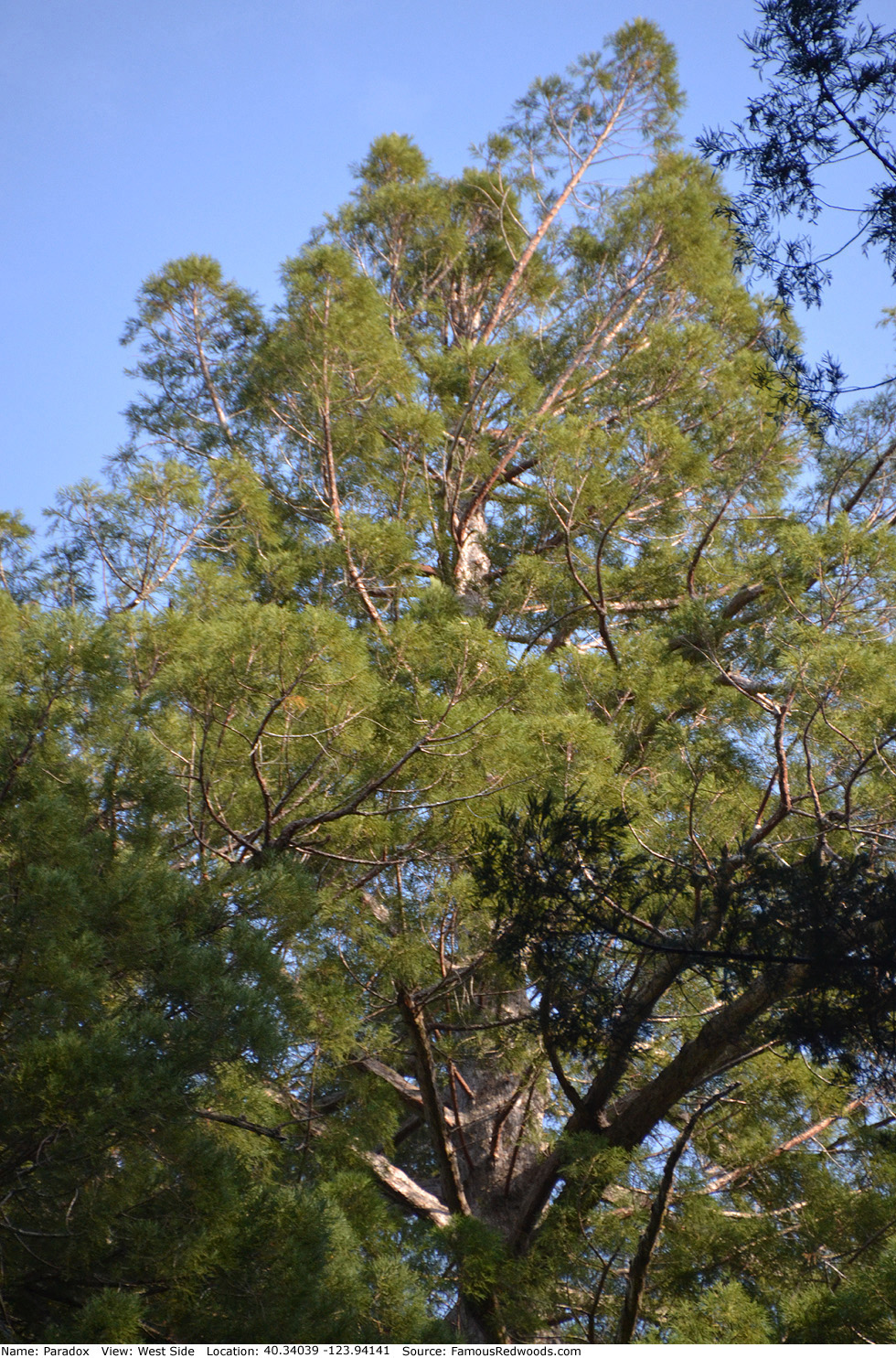
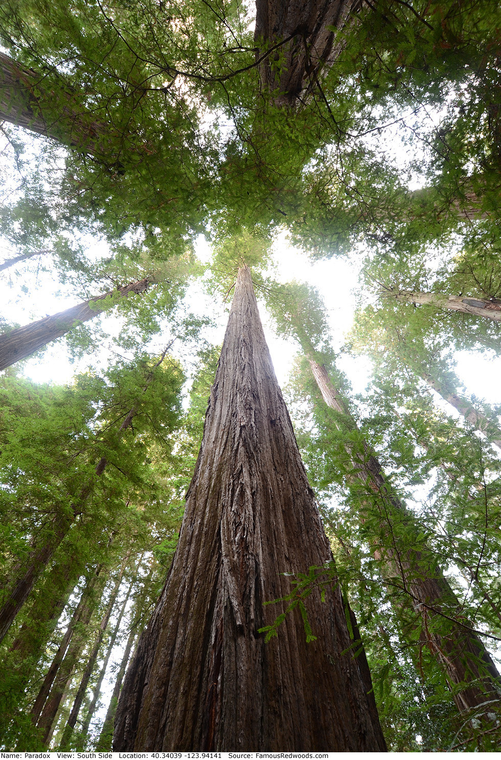
Photos: Pictures of Paradox Tree taken from different sides