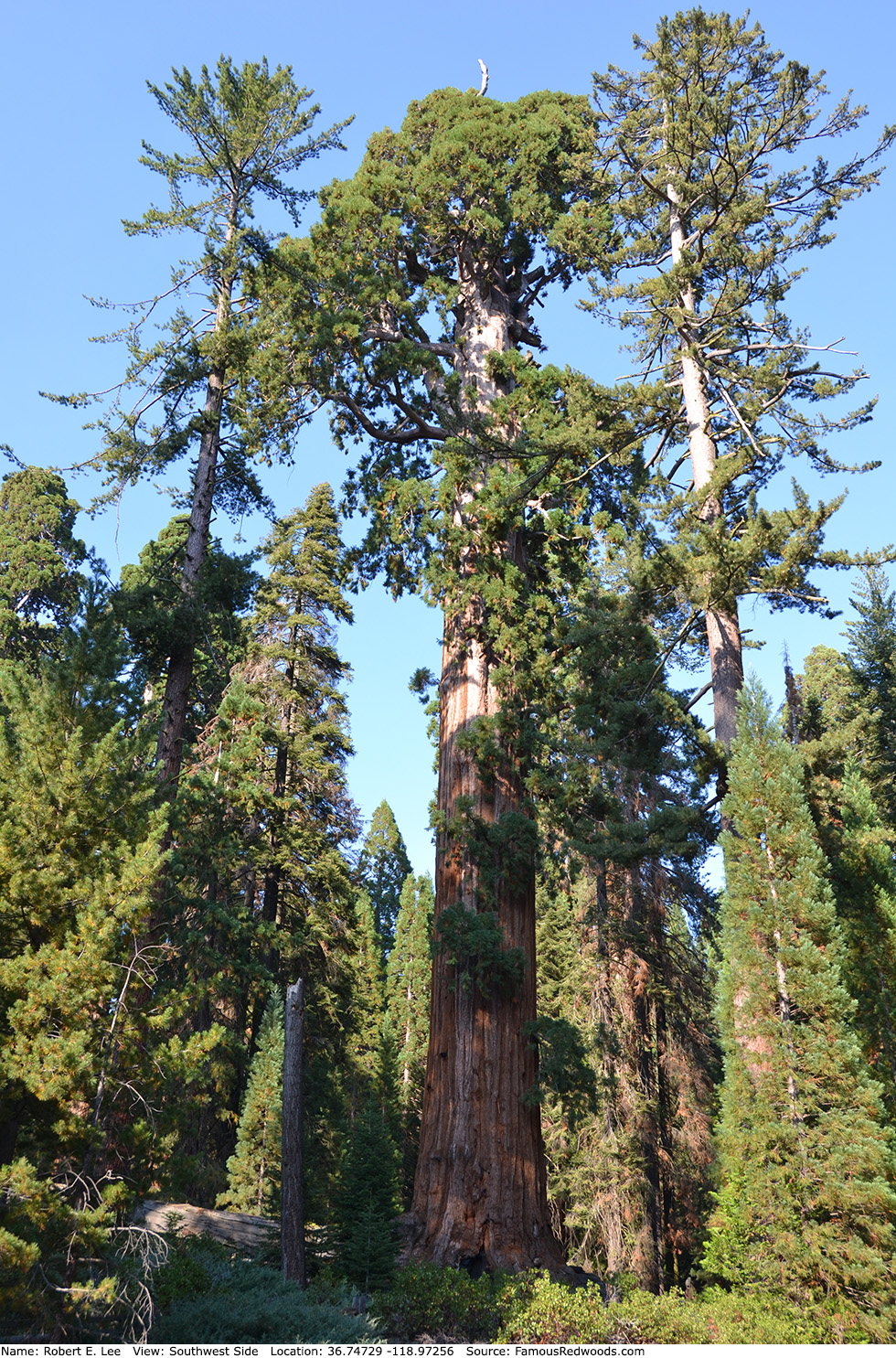
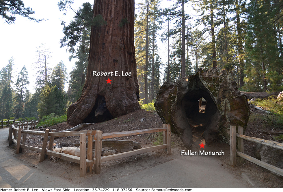
| Height: | 256.56+ ft | (78.20+ m) | Elevation: | 6,350 ft (1,935 m) | GPS Latitude: | 36.74729 |
| Volume: | 40,435 ft3 | (1,145 m3) | Creek: | Big Tree Creek | GPS Longitude: | -118.97256 |
| Width: | 24.44 ft | (7.45 m) | Grove: | General Grant Grove | Discovery Date: | |
| Age: | 2,440 y | Park: | Kings Canyon NP | Discovered By: |
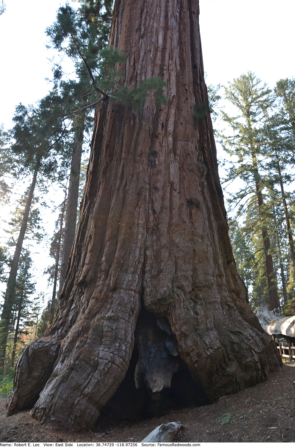
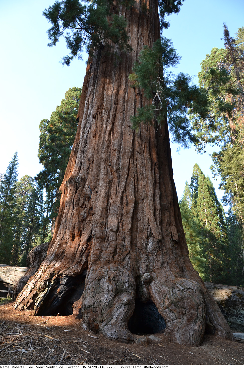
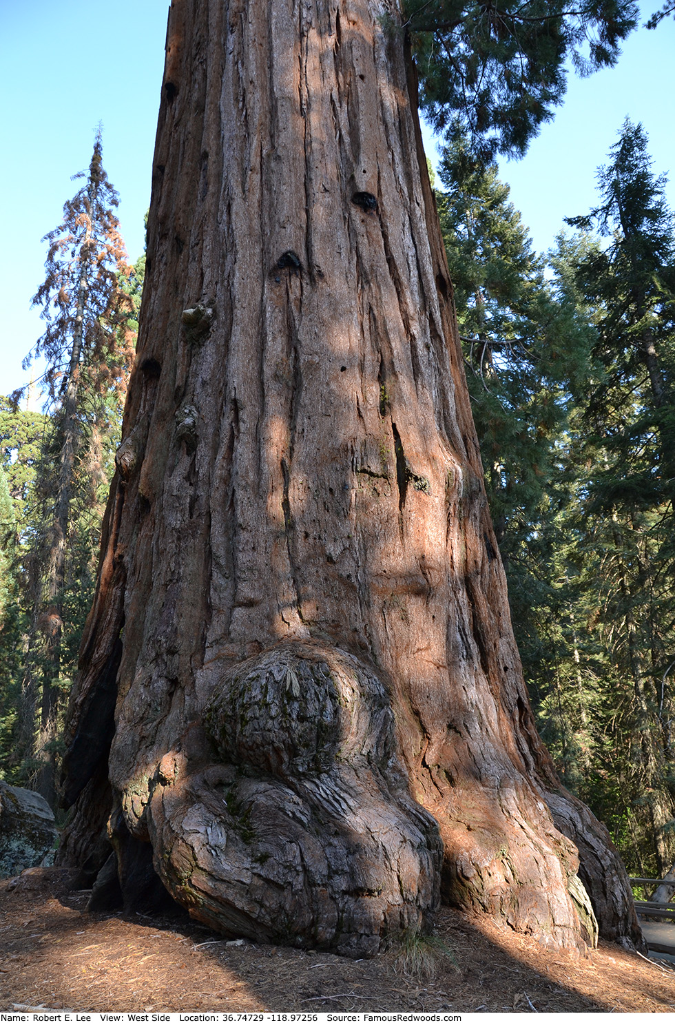
Notes: Robert E. Lee is the world's 11th largest tree, the 9th largest giant redwood, the 2nd largest tree in Kings Canyon National Park, and the 2nd largest tree in General Grant Grove. In 1875, Confederate Army Lieutenant Richard Field named the tree to honor Confederate Army General Robert E. Lee. The crown contains nearly one-and-a-half billion leaves and over twenty-three thousand cones.
Robert E. Lee should not be confused with Ghost (also known as Robert E. Lee) which grows in Packsaddle Grove in Giant Sequoia National Monument, another Robert E. Lee tree which grows in Mariposa Grove in Yosemite National Park, or General Lee which grows in Giant Forest in Sequoia National Park.
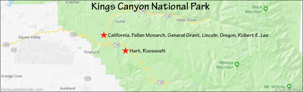
Drive: Robert E. Lee is 202 mi (325 km) southeast of San Francisco near Fresno.
Northbound: From U.S. Interstate 5 North, transfer to California State Route 99 North toward Bakersfield. Drive north 97 mi (156 km) on California State Route 99 and transfer to California State Route 198 East toward Visalia. Drive east 86 mi (138 m) on California State Route 198, past Four Guardsmen, and turn right onto California State Route 180 East toward General Grant Grove. Drive north 1.6 mi (2.6 km) on California State Route 180, past the Kings Canyon Visitor Center and General Grant Grove Cabins, and turn left onto Grant Tree Road.
Southbound: From U.S. Interstate 5 South in Sacramento, transfer to U.S. Highway 50 East toward South Lake Tahoe. Drive east 1.7 mi (2.7 km) on U.S. Highway 50 and transfer to California State Highway 99 South. Near Fresno, transfer to California State Route 180 East. Drive east 58 mi (93 km) on California State Route 180 toward General Grant Grove, past the Kings Canyon Visitor Center and General Grant Grove Cabins, and turn left onto Grant Tree Road.
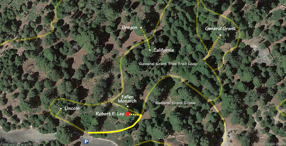
Drive west 0.8 mi (1.2 km) on Grant Tree Road to the General Grant Tree parking lot.
Hike: At the northern edge of the parking lot, turn right/northeast at the trailhead and hike east 230 ft (70 m) on the eastern half of General Grant Tree Trail Loop to Robert E. Lee which stands beside the trail on your left beside Fallen Monarch.
| Rating: | Easy | One-Way Distance: | 230 ft | (70 m) | Ascent: | 10 ft | (3 m) |
| Time: | 1 min | Off-Trail: | 0 ft | (0 m) | Descent: | 0 ft | (0 m) |
View Robert E. Lee Tree location in Google Maps
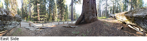
Panorama: Click panorama to take a virtual tour of Robert E. Lee Tree
Photos: Pictures of Robert E. Lee Tree taken from different sides