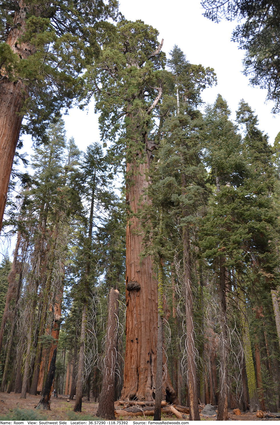
| Height: | Elevation: | 6,963 ft (2,122 m) | GPS Latitude: | 36.57290 | ||
| Volume: | Creek: | Little Deer Creek | GPS Longitude: | -118.75392 | ||
| Width: | Grove: | Giant Forest | Discovery Date: | 1901 | ||
| Age: | Park: | Sequoia NP | Discovered By: | John Broder |
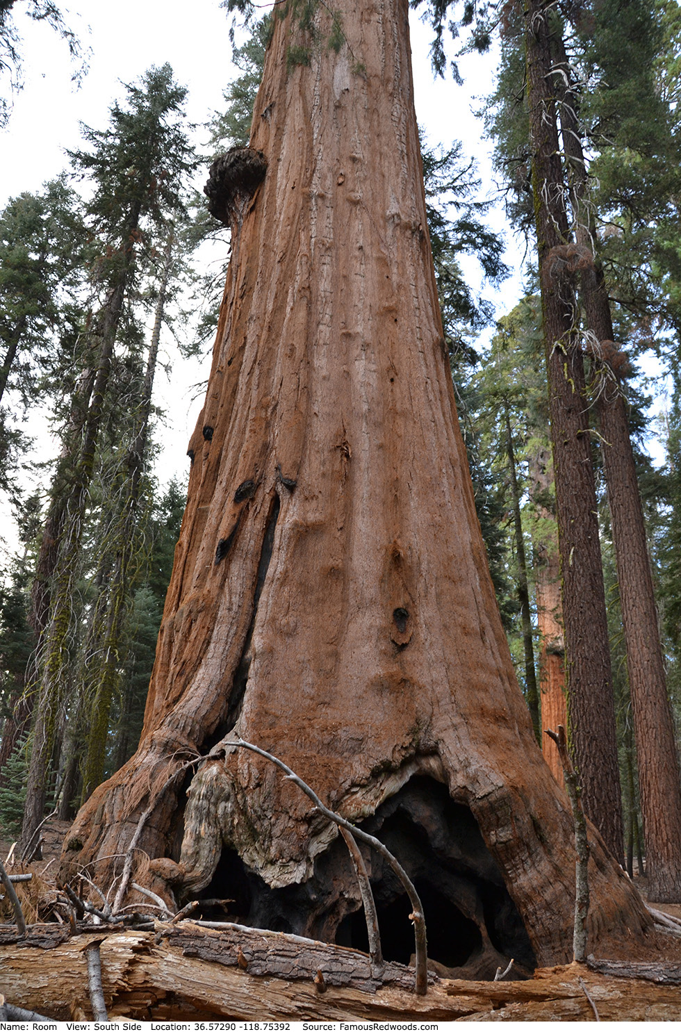
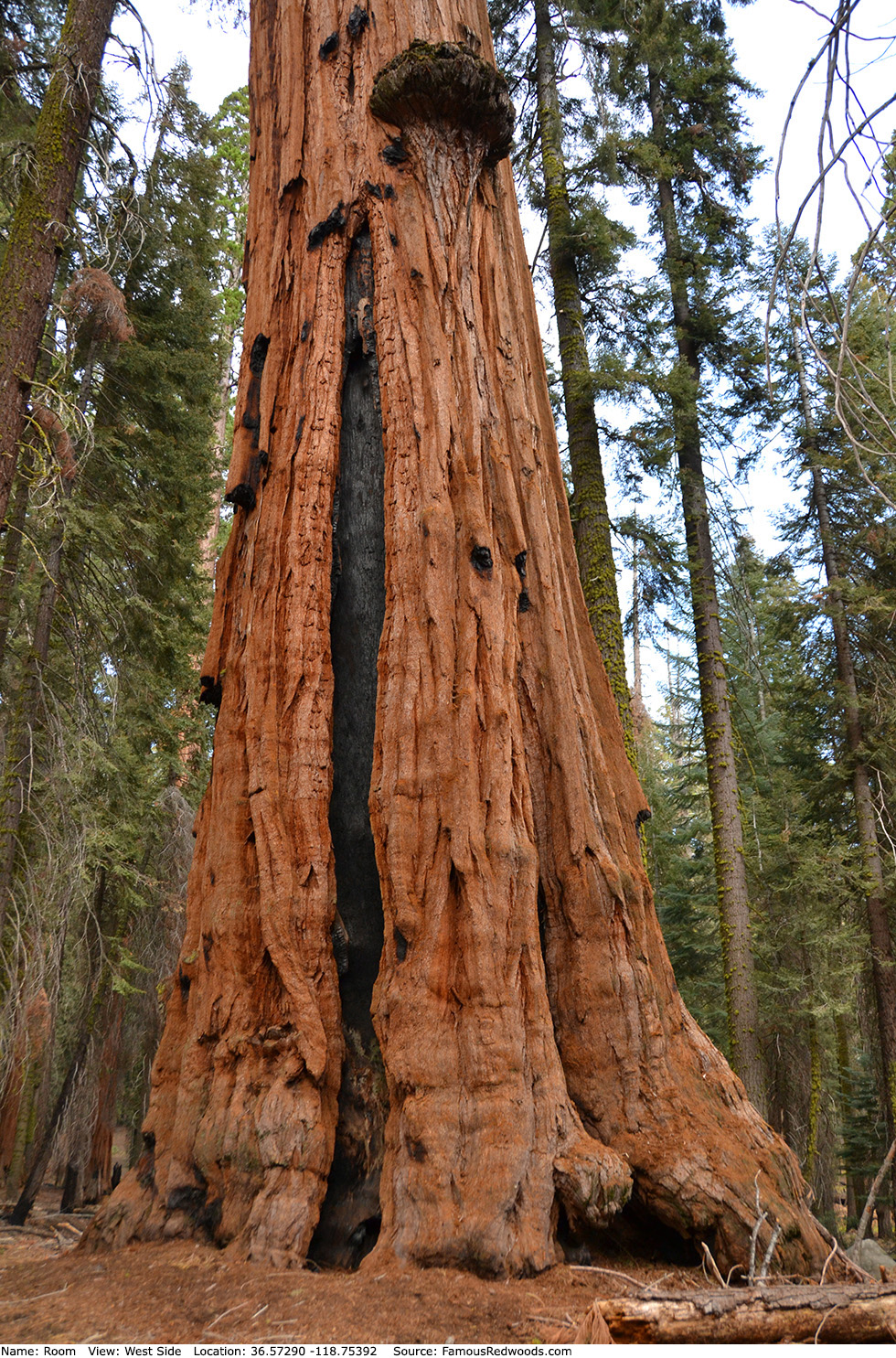
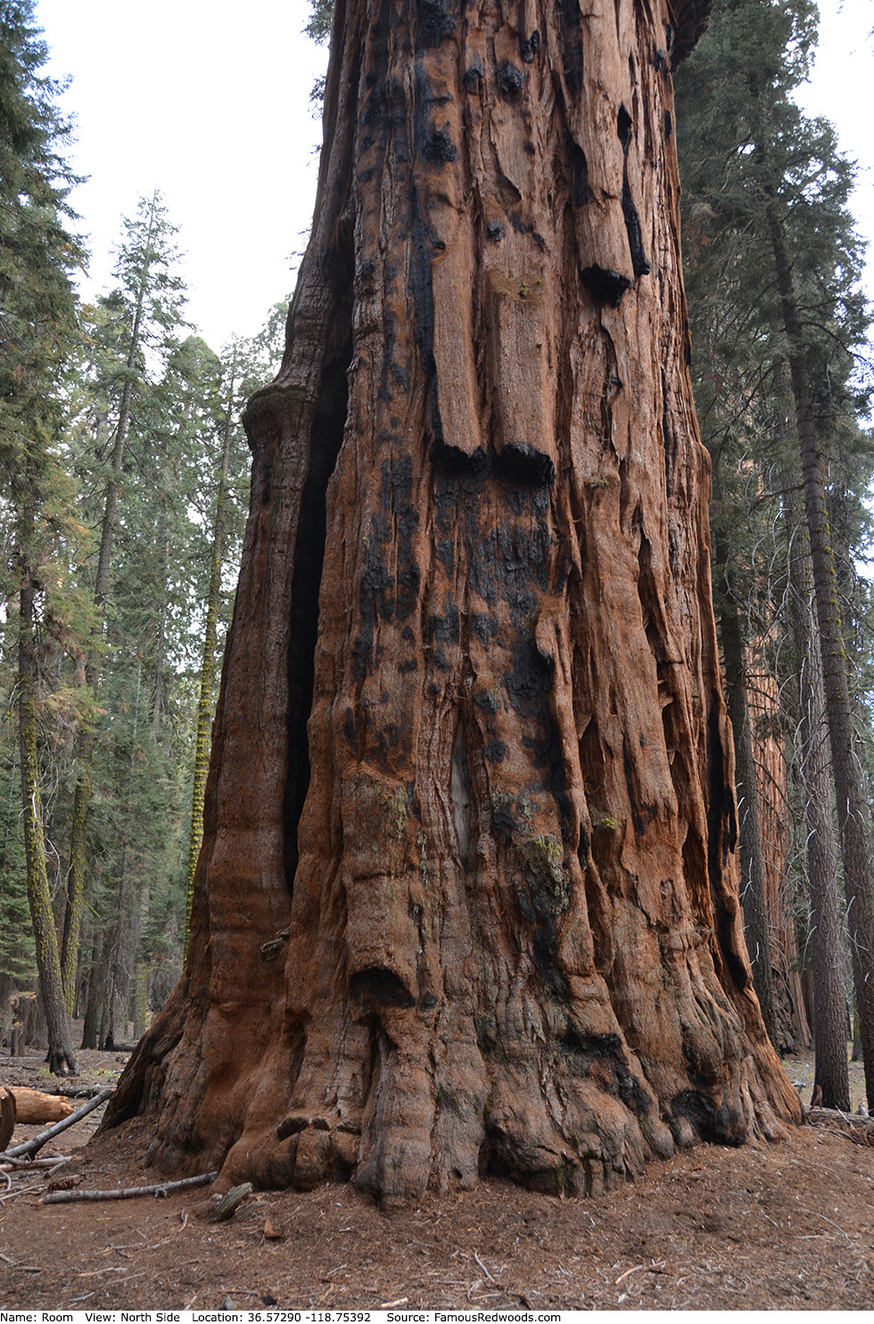
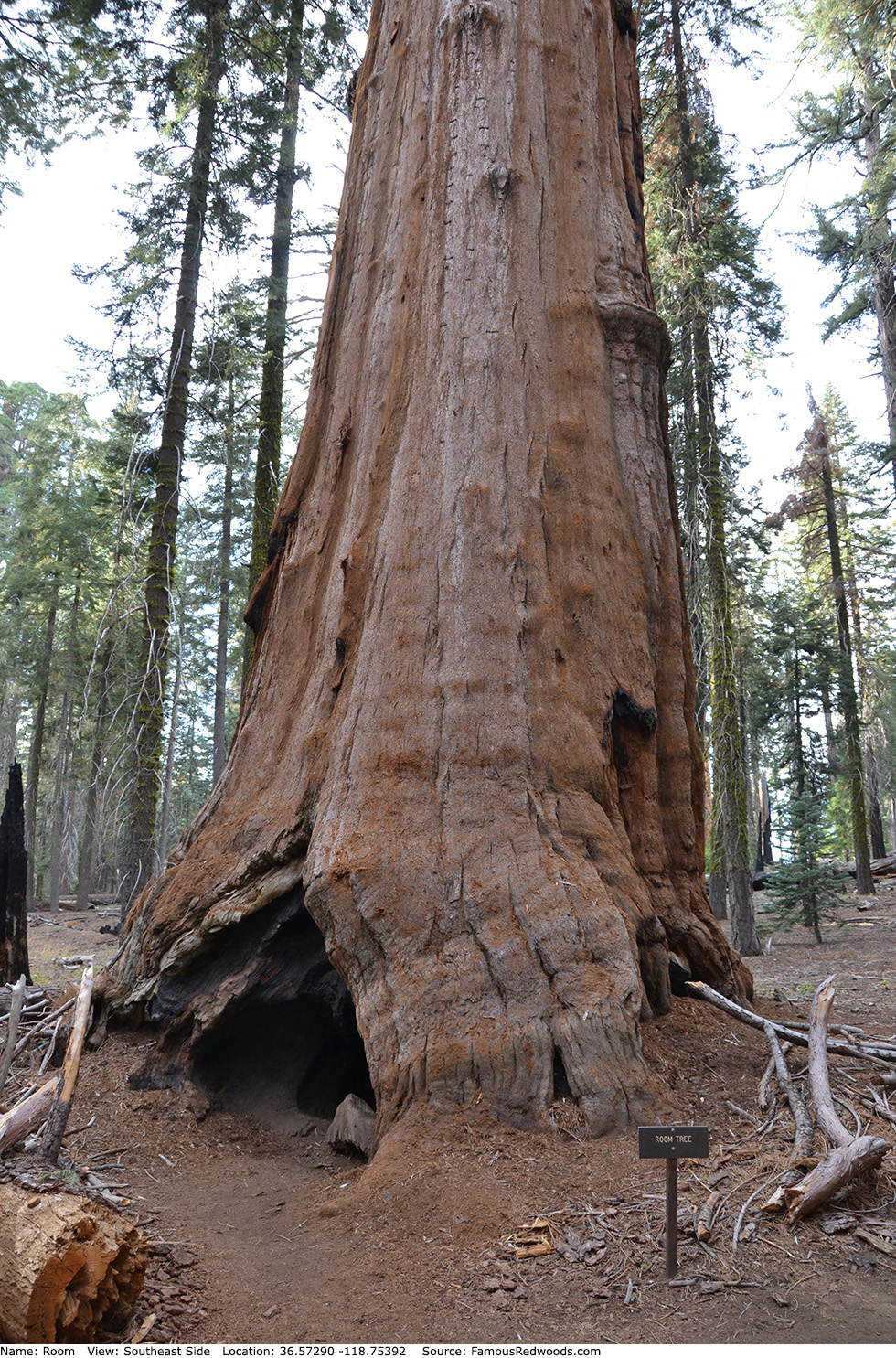
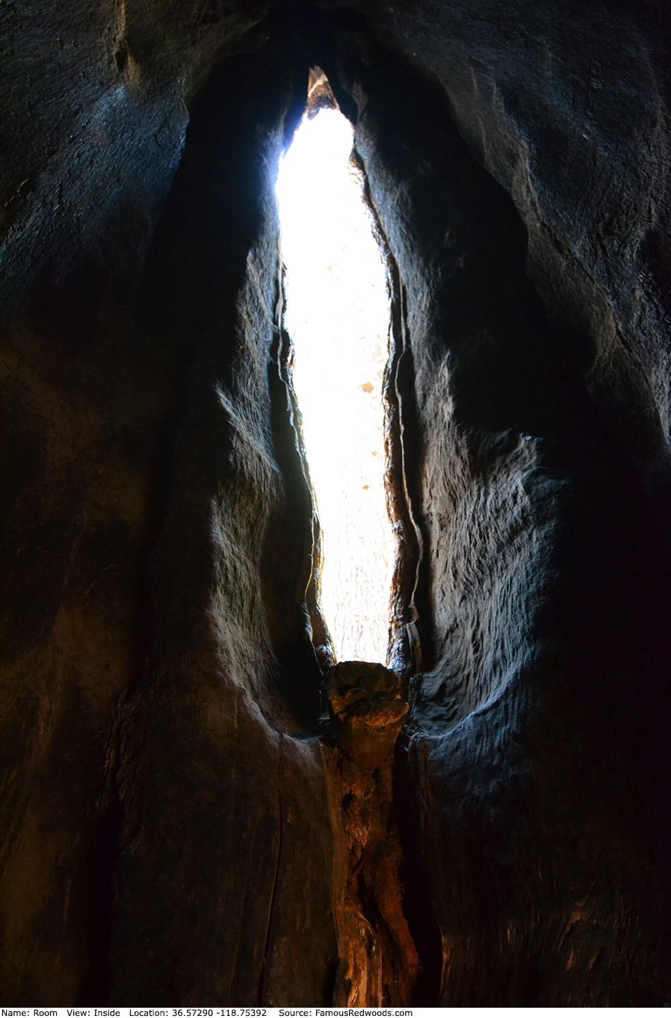
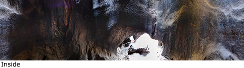
Notes: In 1901, Sequoia National Park concessionaire John Broder named the tree for the large, 40 ft (12 m) tall and 15 ft (5 m) wide, fire-hollowed room within the trunk. Ladders, once installed inside and outside the tree against the northeast side of the trunk, enabled visitors to climb through a narrow window, located 6 ft (3 m) above ground, to descend into the room, and to leave through an opening in the south side of the trunk. Sometime before 1975, the National Park Service removed the ladders for safety reasons.
In 1966, Camp Wolverton staff photographed 96 Boy Scouts, the largest gathering recorded to date, standing inside Room Tree.
Drive: Room is 218 mi (351 km) southeast of San Francisco near Fresno.
Northbound: From U.S. Interstate 5 North, transfer to California State Route 99 North toward Bakersfield. Drive north 97 mi (156 km) on California State Route 99 and transfer to California State Route 198 East toward Visalia. Drive east 58 mi (93 km) on California State Route 198 (Generals Highway), past Four Guardsmen, and turn left into the Pinewood Picnic Area parking lot.
Southbound: From U.S. Interstate 5 South in Sacramento, transfer to U.S. Highway 50 East toward South Lake Tahoe. Drive east 1.7 mi (2.7 km) on U.S. Highway 50 and transfer to California State Highway 99 South. Near Fresno, transfer to California State Route 180 East. Drive east 56 mi (90 km) on California State Route 180, and turn right onto California State Route 198 West. Drive south 28 mi (45 km) on California State Route 198 (Generals Highway) and turn right into the Pinewood Picnic Area parking lot.

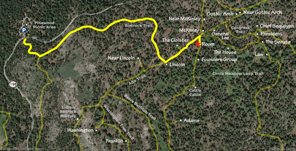
Hike: From the parking lot, walk south across California State Route 198 (Generals Highway) to an unpaved road marked
Authorized Vehicles Only.
Hike south/uphill 0.2 mi (0.3 km) on the unpaved road to the junction with Rimrock Trail. Turn left at the trail
junction and hike east 0.7 mi (1.1 km) on Rimrock Trail to Lincoln near the
junction with Alta Trail. Turn left at the trail junction and hike northeast 0.2 mi (0.3 km) on Alta Trail to
McKinley trail junction. Turn right at the trail junction and hike south 190 ft (58 m) on the western half of Circle Meadow Loop Trail to
Room which stands beside the trail on your right. Crawl through the small opening on the south side of the trunk
to explore the room inside.
| Rating: | Easy | One-Way Distance: | 1.1 mi | (1.8 km) | Ascent: | 610 ft | (186 m) |
| Time: | 30 min | Off-Trail: | 0 ft | (0 m) | Descent: | 259 ft | (79 m) |
View Room Tree location in Google Maps
Panoramas: Click panoramas to take a virtual tour of Room Tree
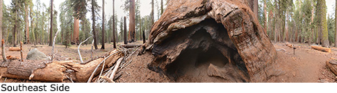
Photos: Pictures of Room Tree taken from different sides