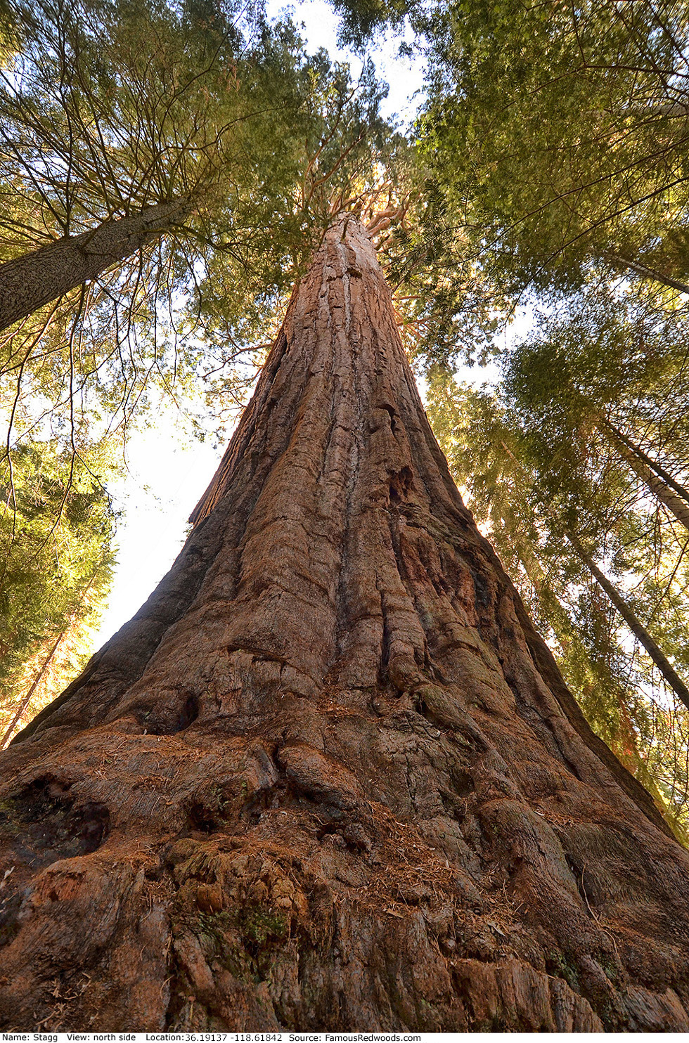
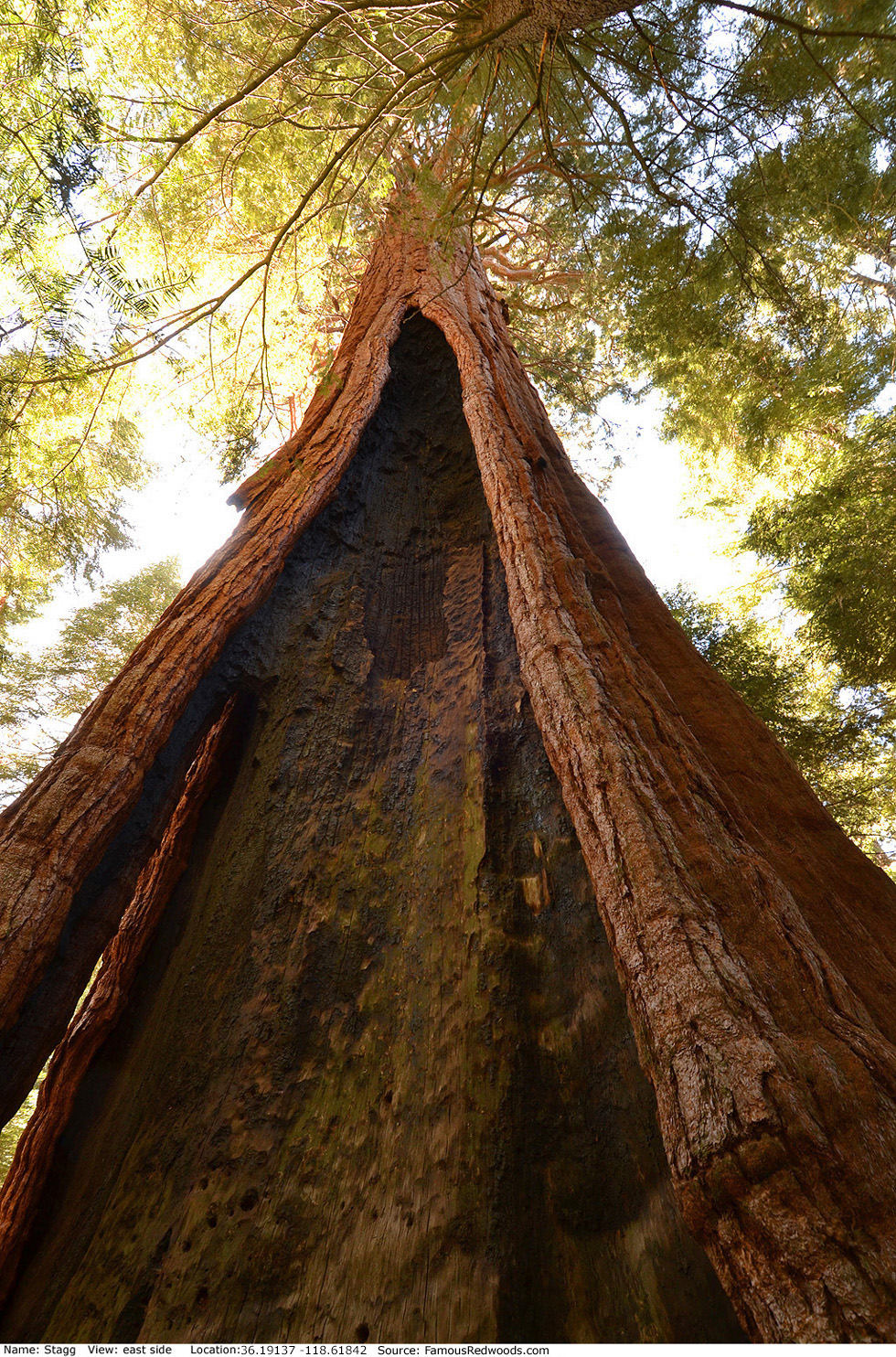
| Height: | 243.00+ ft | (74.07+ m) | Elevation: | 6,459 ft (1,969 m) | GPS Latitude: | 36.19137 |
| Volume: | 44,100 ft3 | (1,249 m3) | Creek: | South Alder Creek | GPS Longitude: | -118.61842 |
| Width: | 25.49 ft | (7.77 m) | Grove: | Alder Creek Grove | Discovery Date: | 1931 |
| Age: | 2,020 y | Park: | Giant Sequoia NM | Discovered By: | L. Day |
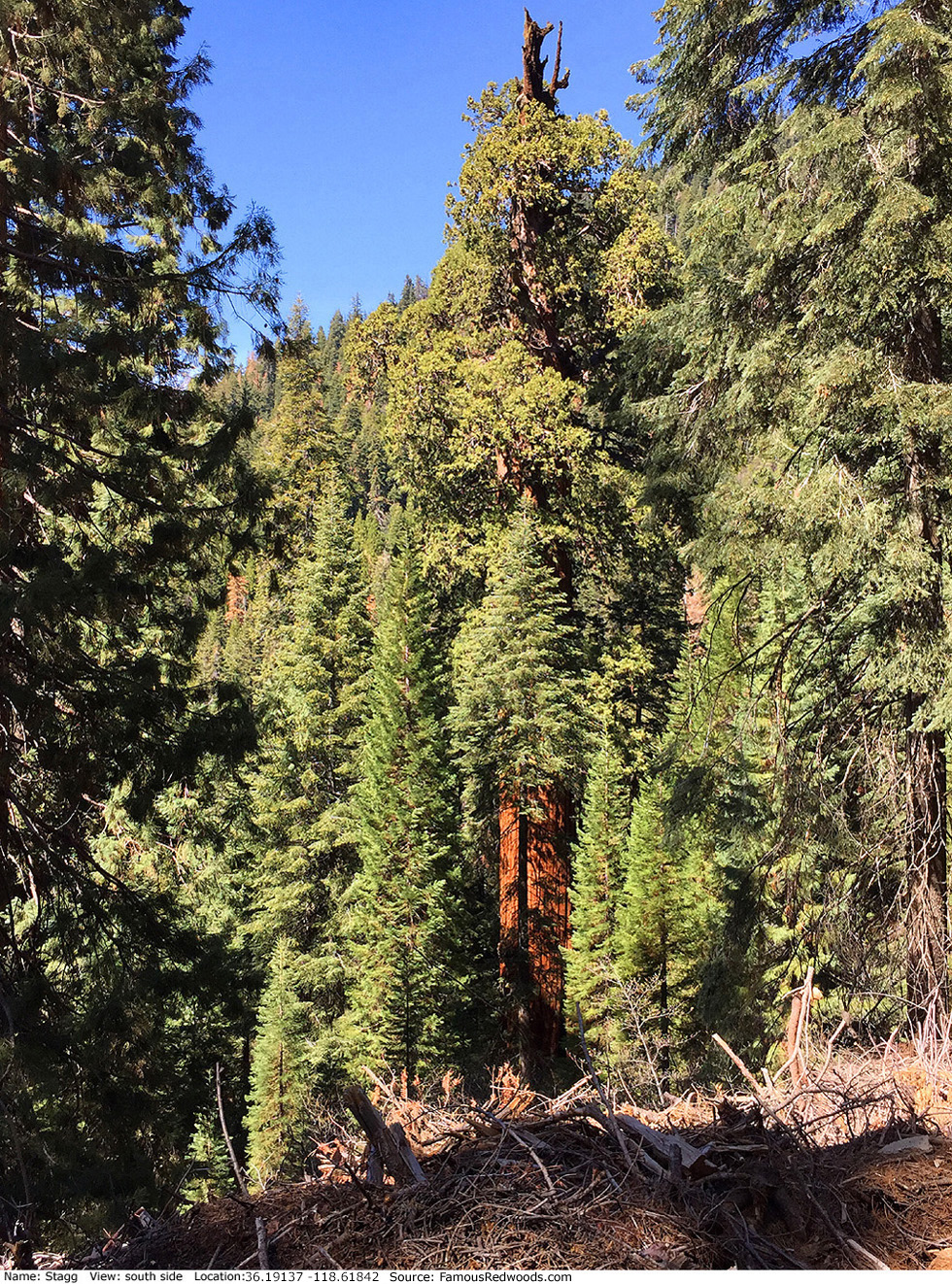
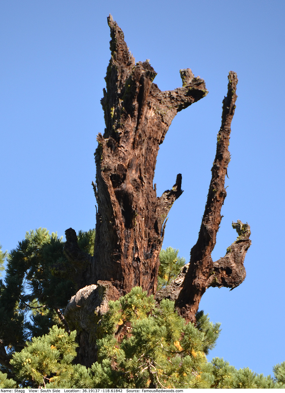
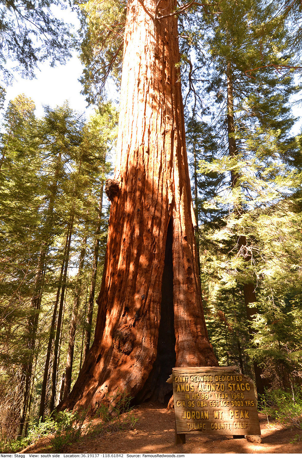
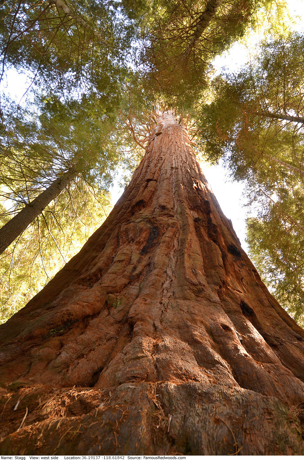
Notes: Stagg, originally known as Day Tree, is the world's 6th largest tree, the 5th largest giant redwood, and the largest tree in Giant Sequoia National Monument. On August 16, 1960, the Rouch Family, which owned the tree before Save the Redwoods League acquired Alder Creek Grove on December 30, 2019, dedicated the tree to honor Amos Alonzo Stagg, a pioneering football coach at the University of the Pacific and a College Football Hall of Fame inductee, whose innovations included the Notre Dame Box and the Statue of Liberty play.
National Geographic photographer James Balog published a composite photograph of Stagg. Save the Redwoods League and videographer Sue Cag published aerial flyovers of Stagg, the Animal Planet program Redwood Kings features aerial footage of Stagg, and The New York Times Science program Climbing Sequoias for Climate Change features a climb of Stagg.
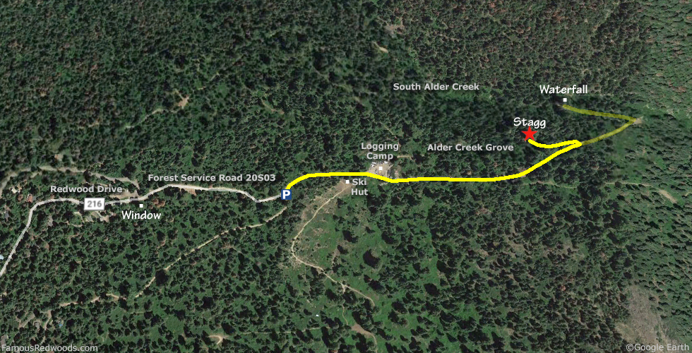
Drive: Stagg is 237 mi (381 km) southeast of San Francisco near the city of Porterville.
Northbound: From U.S. Interstate 5 North, transfer to California State Route 99 North. From California State Route 99 North just north of Bakersfield, transfer to California State Route 65 North toward Porterville. Near Porterville, transfer to California State Route 190 East.
Southbound: From U.S. Interstate 5 South in Sacramento, transfer to U.S. Highway 50 East toward South Lake Tahoe. Drive east 1.7 mi (2.7 km) on U.S. Highway 50 and transfer to California State Highway 99 South. Near Tipton, transfer to California State Route 190 East toward Porterville.
From Porterville, drive east 34 mi (55 km) on California State Route 190 toward Camp Nelson. Just past Camp Nelson, turn left onto County Road 216 (Redwood Drive) and drive north 7.3 mi (11.7 km), past Window, to the intersection with Forest Service Road 20S03. Veer right onto Forest Service Road 20S03 and drive east 0.2 mi (0.3 km) to the Stagg Tree parking area.
Navigation System Warning: About 24 mi (39 km) from Porterville on California State Route 190 East, 10 mi (16 km) before the turn onto County Road 216 (Redwood Drive), many computer, smartphone, and car navigation systems instruct you to turn left at County Road 208 (Wishon Drive), toward Camp Wishon, for the shortest route to Stagg. But those same navigation systems may not warn you that this route includes 5 mi (8 km) of steep, rugged, unpaved road (not suited for average two-wheel drive vehicles) or that the unpaved road is closed during winter. Keep driving on California State Route 190 East, past County Road 208 (Wishon Drive), toward Camp Nelson instead. Your car will appreciate it.

Hike: From the Stagg Tree parking area, walk east 0.4 mi (0.6 km) on the road past a gate, the first fork in the road, and an old logging camp. Continue straight at the second fork in the road then veer left at the third. Just past the third fork, you will spot Stagg poking up from the canyon on your left. Turn left at the next Stagg Tree sign and hike west/downhill 550 ft (168 m) to Stagg.
| Rating: | Easy | One-Way Distance: | 0.5 mi | (0.8 km) | Ascent: | 158 ft | (48 m) |
| Time: | 15 min | Off-Trail: | 0 ft | (0 m) | Descent: | 255 ft | (78 m) |
View Stagg Tree location in Google Maps
Panoramas: Click panoramas to take a virtual tour of Stagg Tree
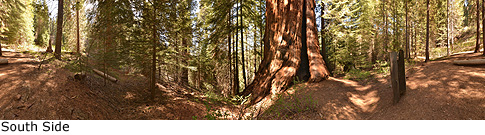
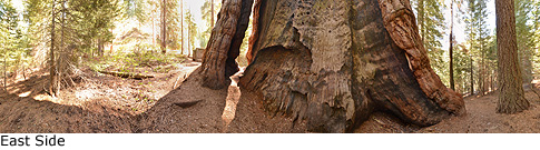
Photos: Pictures of Stagg Tree taken from different sides