| Height: | 325.00+ ft | (99.06+ m) | Elevation: | 112 ft (34 m) | GPS Latitude: | 41.79094 |
| Volume: | 21,966 ft3 | (622 m3) | Creek: | Mill Creek | GPS Longitude: | -124.08320 |
| Width: | 16.70 ft | (5.09 m) | Grove: | Stout Grove | Discovery Date: | |
| Age: | Park: | Jedediah Smith Redwoods SP | Discovered By: |
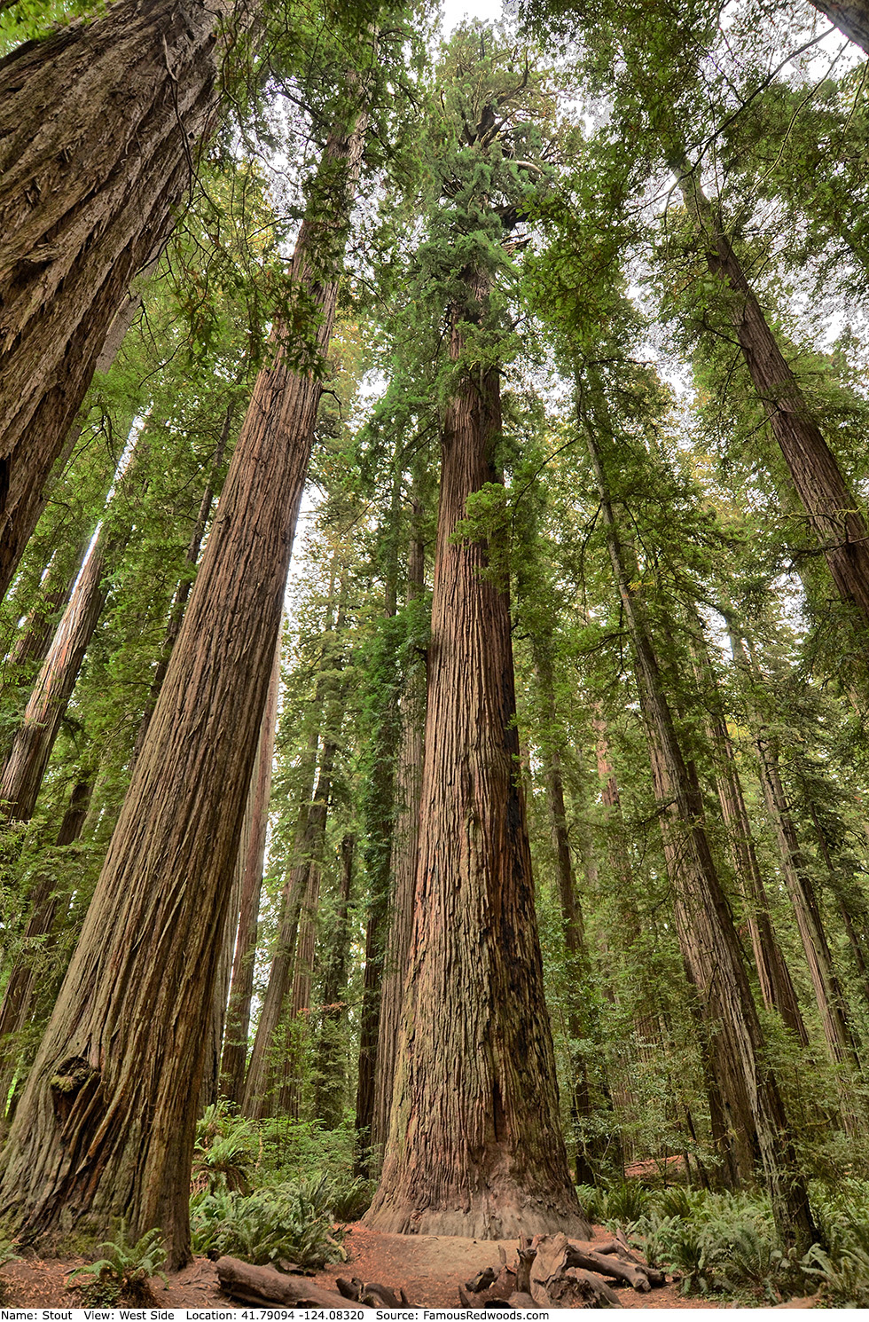
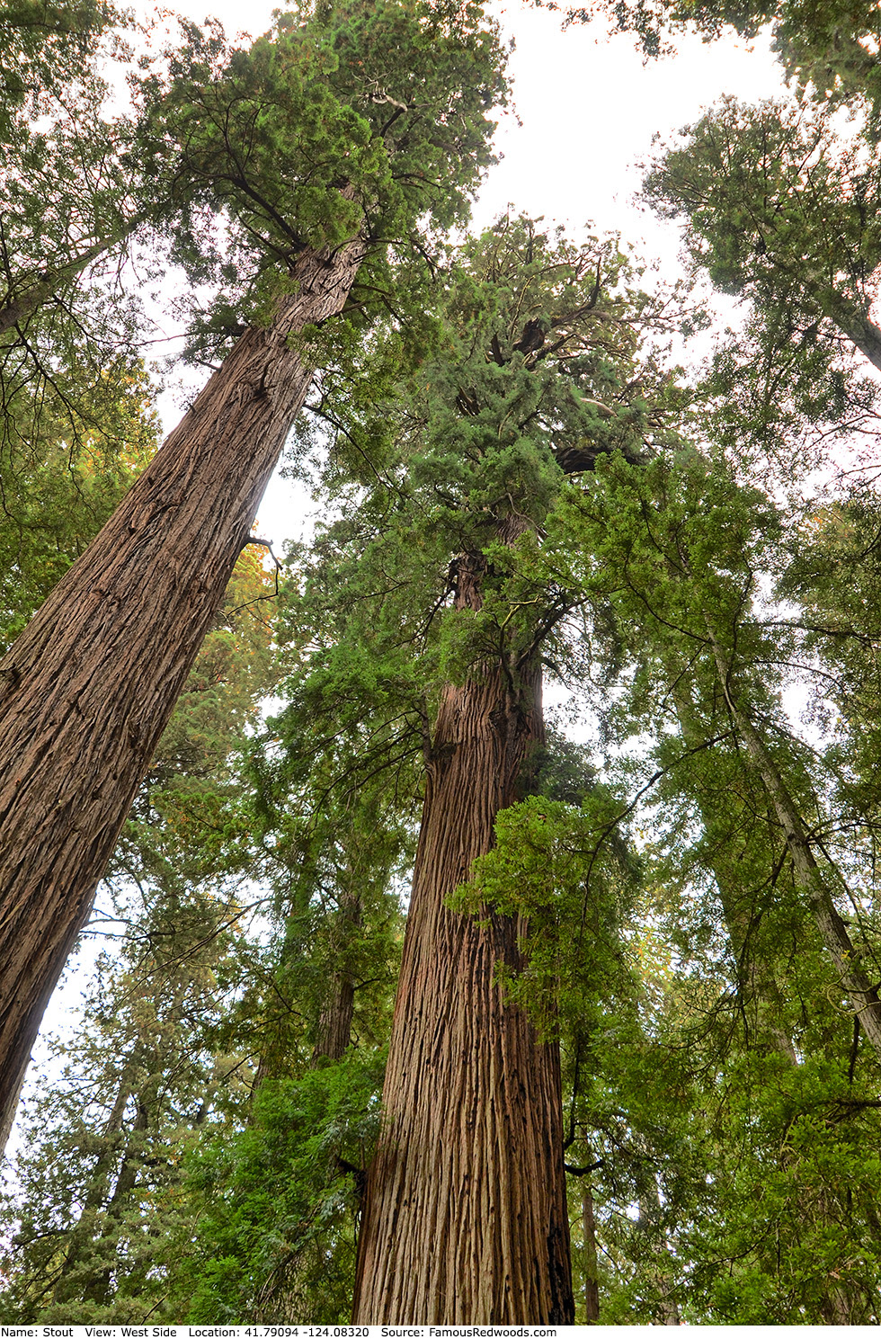
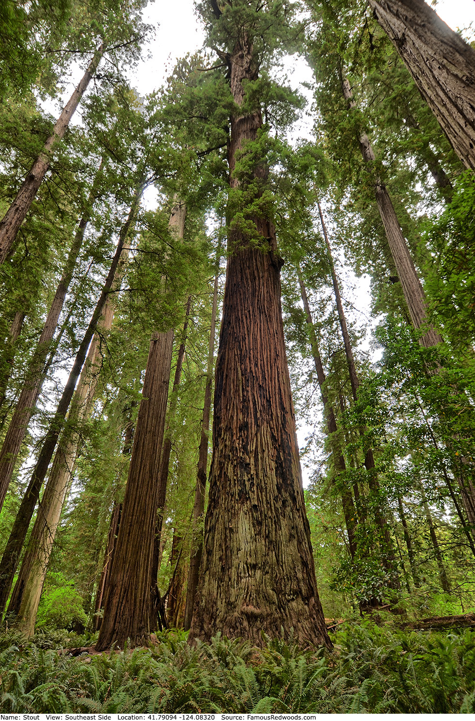
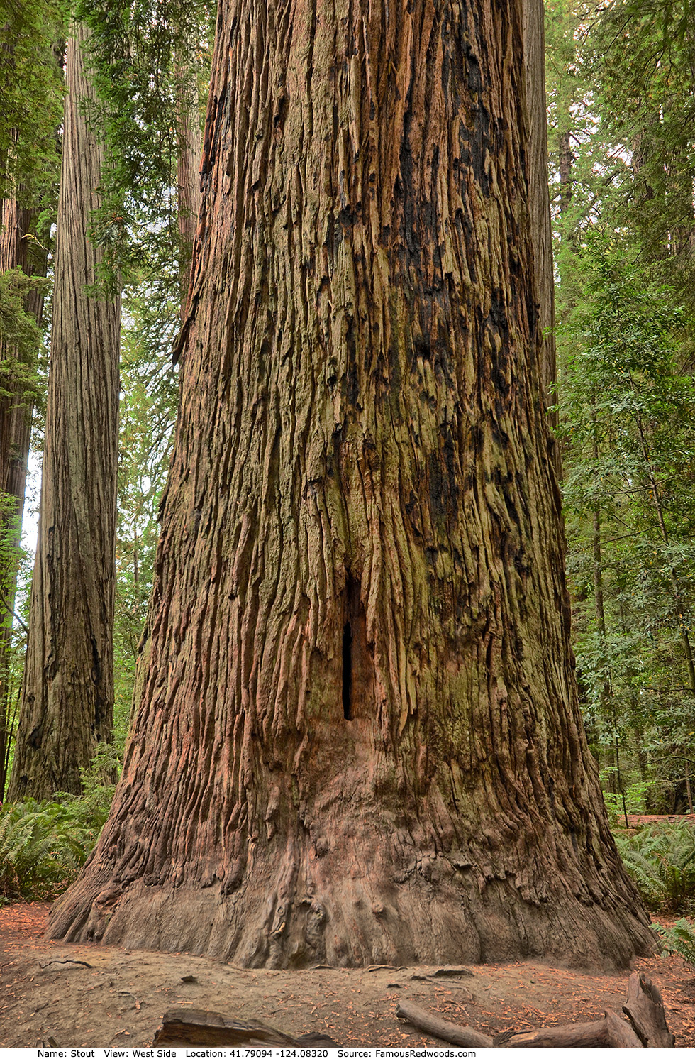
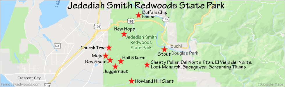
Notes: Stout Tree, also known as Big Tree (not to be confused with Big Tree in Prairie Creek Redwoods State Park) is the 9th largest tree in Jedediah Smith Redwoods State Park and the largest tree in Stout Grove. In 1929, Clara W. Stout, widow of lumberman Frank D. Stout, donated a 0.07 mi2 (0.18 km2) tract of old-growth redwood forest to Save the Redwoods League in memory of her late husband. Stout Grove became the first dedicated grove in Jedediah Smith Redwoods State Park.
Drive: Stout is 291 mi (468 km) north of San Francisco near Crescent City.
Northbound: From U.S. Highway 101, just south of Crescent City, turn right onto Humboldt Road. Drive north 1.5 mi (2.4 km) on Humboldt Road and turn right onto Howland Hill Road. Drive east 5.2 mi (8.4 km) on Howland Hill Road, past Howland Hill Giant, to the Stout Grove entrance. Turn left and drive 700 ft (213 m) to the Stout Grove parking area.
Southbound: From U.S. Highway 101, just north of Crescent City, turn left onto California State Route 197 (North Bank Road). Drive south 6.7 mi (10.8 km) on California State Route 197 (North Bank Road) and turn left onto U.S. Highway 199. Drive east 2.8 mi (4.5 km) on U.S. Highway 199 and turn right onto County Road 427 (South Fork Road). Drive south 0.5 mi (0.8 km) on County Road 427 (South Fork Road) and turn right onto Douglas Park Drive. Drive West 1.3 mi (2.1 km) on Douglas Park Drive to the intersection with Pacomo Camp Drive. Continue straight onto Howland Hill Road and drive west 1.1 mi (1.8 km) on Howland Hill Road to the Stout Grove entrance. Turn right and drive 700 ft (213 m) to the Stout Grove parking area.
 to
to
Hike: From the trailhead, walk northeast/downhill 500 ft (152 m) on the paved path toward the Stout Grove Loop Trail. Turn left/north at the trail junction and walk north 300 ft (91 m) on Stout Grove Loop Trail to Stout Tree located on the right/eastern side of the trail.
| Rating: | Easy | One-Way Distance: | 800 ft | (244 m) | Ascent: | 0 ft | (0 m) |
| Time: | 5 min | Off-Trail: | 20 ft | (6 m) | Descent: | 40 ft | (12 m) |
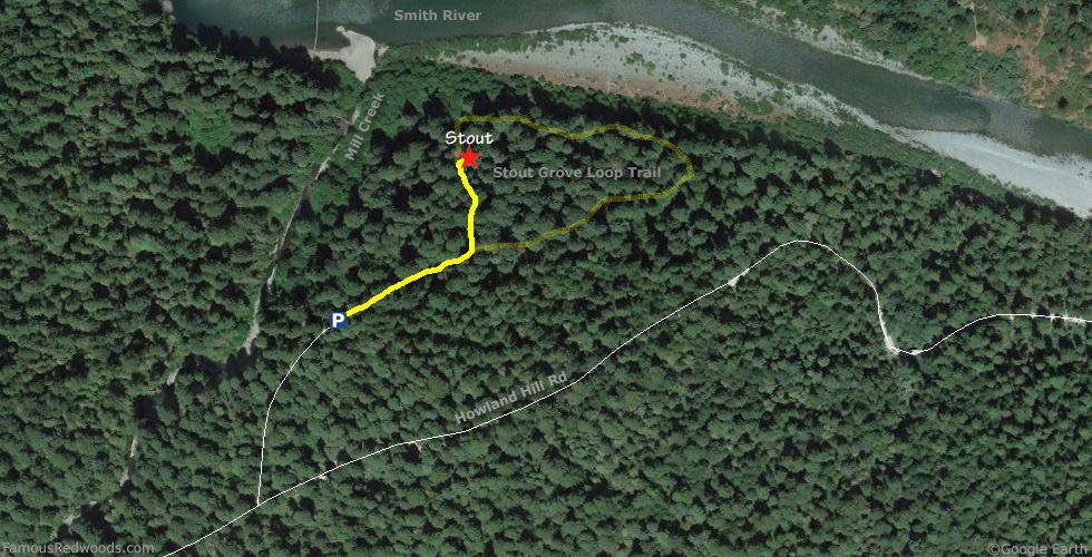
View Stout Tree location in Google Maps
Panorama: Click panorama to take a virtual tour of Stout Tree
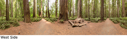
Photos: Pictures of Stout Tree taken from different sides