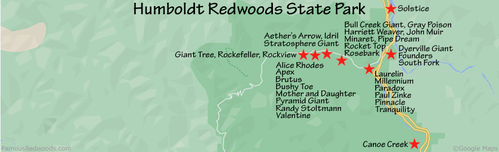
| Height: | 372.44+ ft | (113.52+ m) | Elevation: | 205 ft (62 m) | GPS Latitude: | 40.35055 |
| Volume: | 22,071 ft3 | (625 m3) | Creek: | Bull Creek | GPS Longitude: | -123.97437 |
| Width: | 17.00 ft | (5.18 m) | Grove: | Calf Creek Flat | Discovery Date: | July 30, 2000 |
| Age: | 1,281 y | Park: | Humboldt Redwoods SP | Discovered By: | Chris K. Atkins |
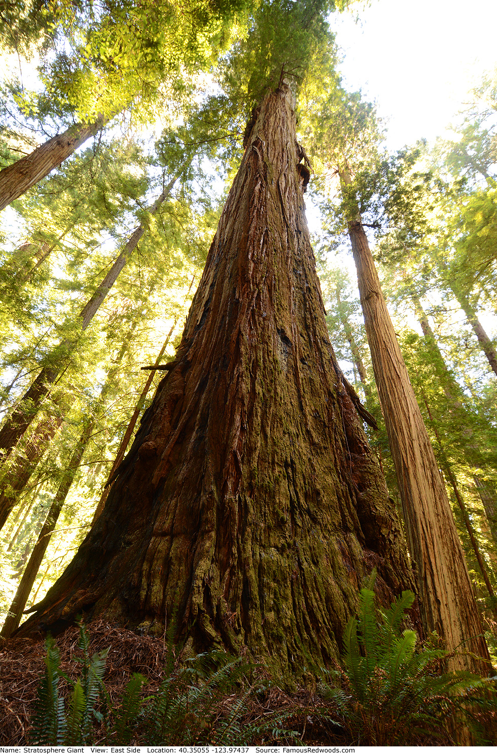
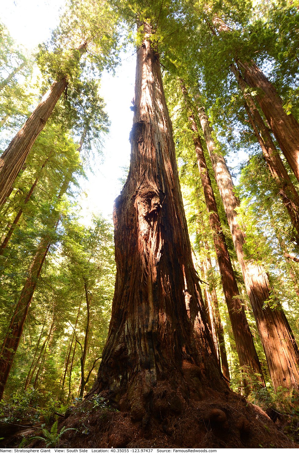
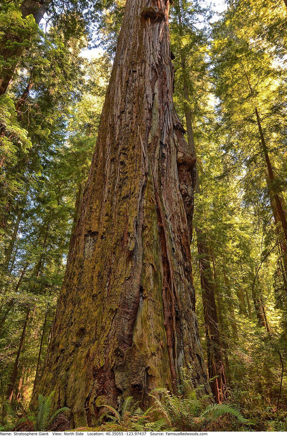
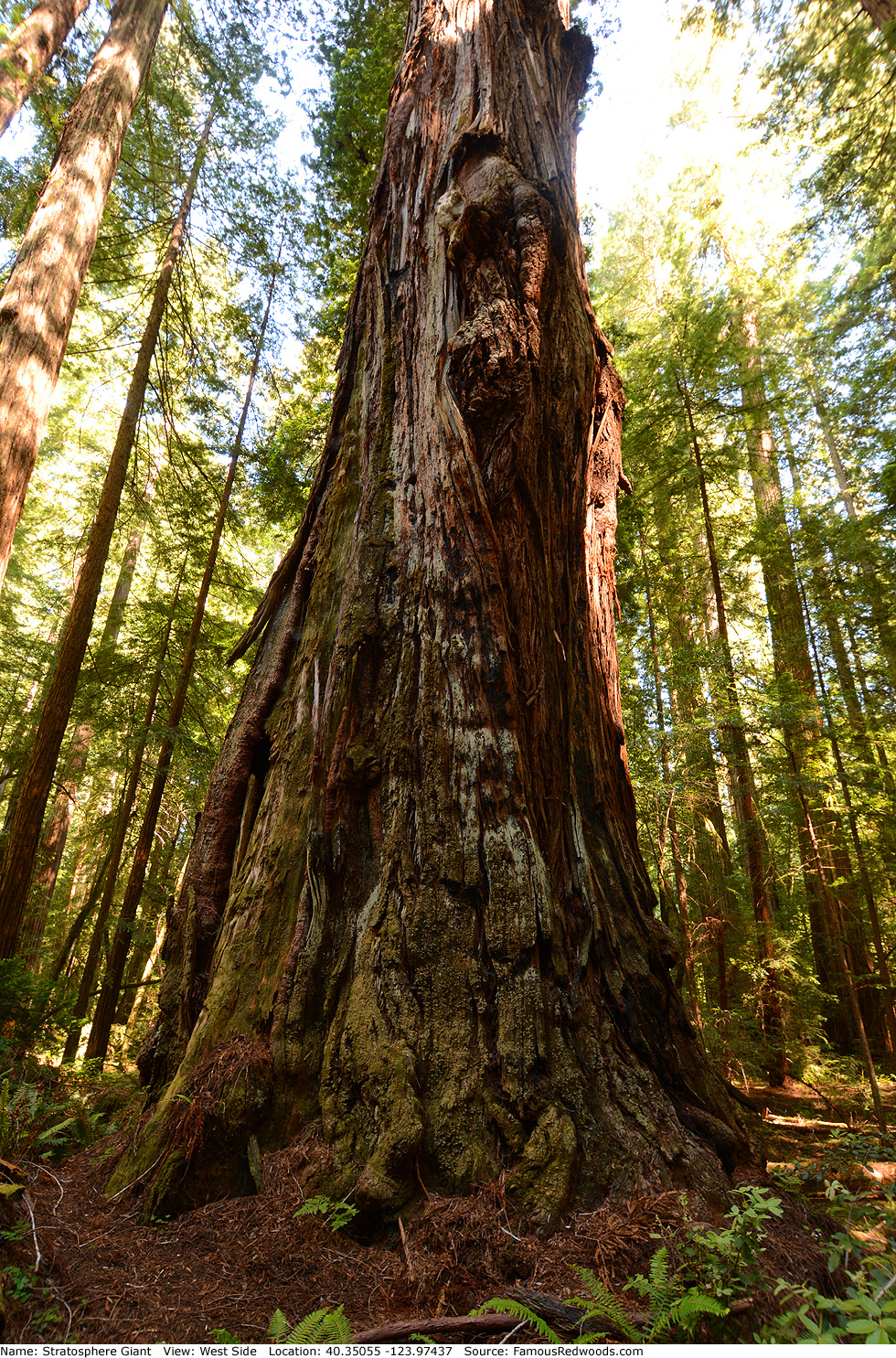
Notes: Stratosphere Giant is the world's 4th tallest tree, the tallest and 4th largest tree in Humboldt Redwoods State Park, and the tallest and largest tree on Calf Creek Flat. It held the title of world's tallest tree from July 30, 2000 until July 1, 2006 when naturalists Chris K. Atkins and Michael W. Taylor discovered Helios in Redwood National Park.
A former kiosk in the Thomas H. Kuchel Visitor Center near Orick displayed a 360-degree panorama of Bull Creek Flat taken from the top of Stratosphere Giant. Cal Poly Humboldt forestry professor Stephen C. Sillett published views from the treetop, looking east and west, and photographed the crown from a nearby tree. National Geographic photographer James Balog published a composite photograph of Stratosphere Giant. The film In Search of the Tallest: A Redwoods Adventure includes a segment about Stratosphere Giant.
Stratosphere Giant and Aether's Arrow are just nine trees apart.
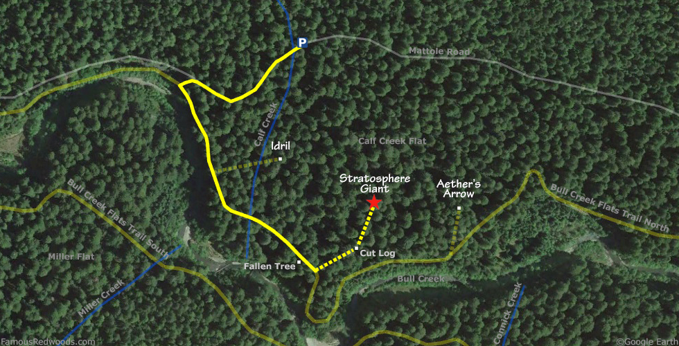
Drive: Stratosphere Giant is 196 mi (315 km) north of San Francisco near the community of Weott.
Northbound: From U.S. Highway 101 just north of Weott, take exit 663 South Fork Honeydew and turn left onto California State Route 254 (Avenue of the Giants). Drive north 0.2 mi (0.3 km) on California State Route 254 (Avenue of the Giants) and turn left, under the bridge, onto Mattole Road.
Southbound: From U.S. Highway 101 just north of Weott, take exit 663 South Fork Honeydew and turn right onto Mattole Road.
Drive west 3.5 mi (5.6 km) on Mattole Road, past Calf Creek, and park at a turnout on the left/south side of the road near 40.35248 -123.97828.
Hike: GPS-assisted navigation is recommended for this hike. From the turnout, walk west 100 ft (30 m) on Mattole Road to the trailhead on the left/south side of the road. Hike south 0.3 mi (0.5 km) on Bull Creek Flats Trail North to the trail exit point, near 40.34930 -123.97562, just past the spot where the trail passes under a fallen tree and turns right/south along Bull Creek. Leave the trail here and, using a GPS device, hike northeast 0.1 mi (0.2 km) off-trail, past a large cut log, to Stratosphere Giant. After visiting Stratosphere Giant, hike northwest 0.1 mi (0.2 km) off-trail to Idril or hike east 0.1 mi (0.2 km) off-trail to Aether's Arrow.
| Rating: | Easy | One-Way Distance: | 0.4 mi | (0.6 km) | Ascent: | 22 ft | (7 m) |
| Time: | 12 min | Off-Trail: | 0.1 mi | (0.2 km) | Descent: | 63 ft | (19 m) |
View Stratosphere Giant Tree location in Google Maps
Panoramas: Click panoramas to take a virtual tour of Stratosphere Giant Tree
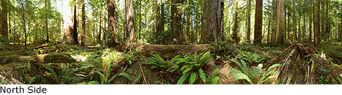
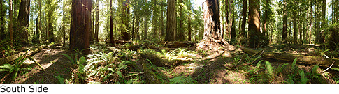
Photos: Pictures of Stratosphere Giant Tree taken from different sides