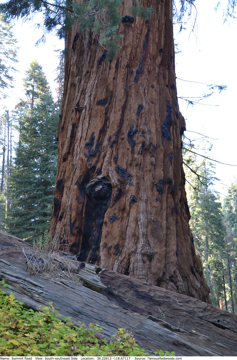
| Height: | 218.50+ ft | (66.60+ m) | Elevation: | 6,746 ft (2,056 m) | GPS Latitude: | 36.22813 |
| Volume: | 31,762 ft3 | (899 m3) | Creek: | Coburn Creek | GPS Longitude: | -118.67117 |
| Width: | 20.60 ft | (6.28 m) | Grove: | Mountain Home Grove | Discovery Date: | 1988 |
| Age: | Park: | Giant Sequoia NM | Discovered By: | Wendell D. Flint | ||
| Michael M. Law |
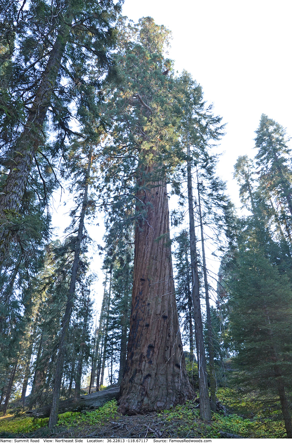
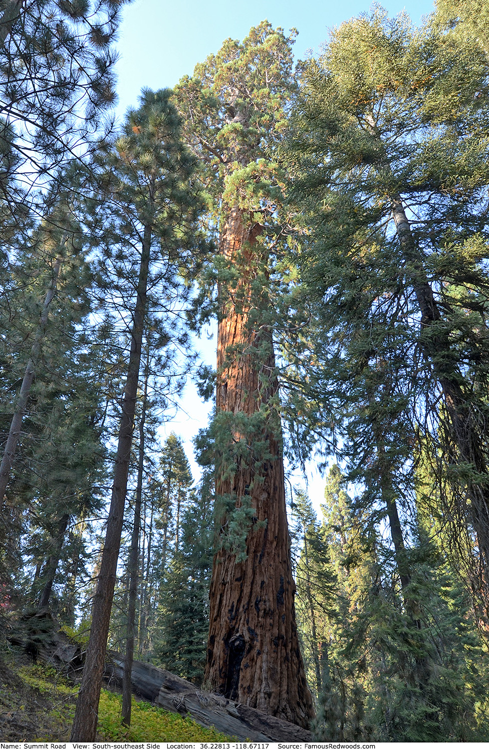
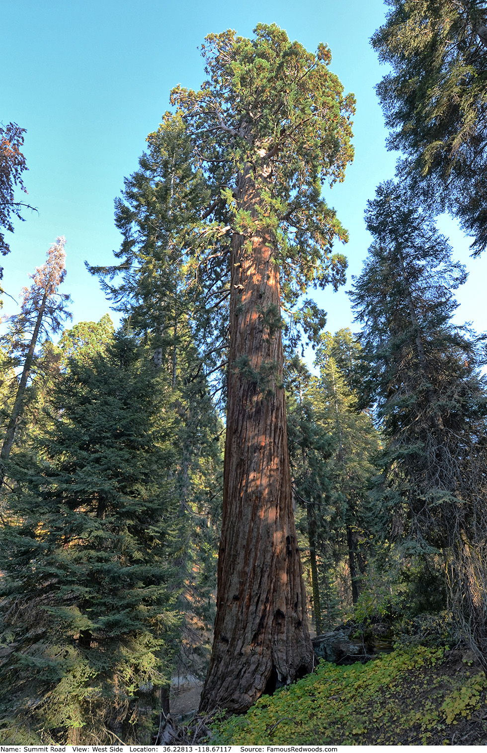
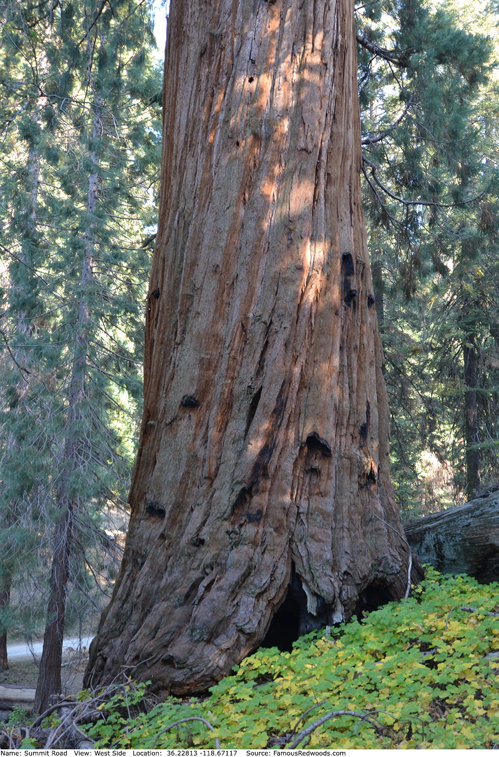
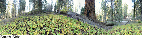
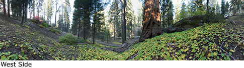
Notes: Before the 2020 Castle Fire, Summit Road, named for the road nearby, was the world's 17th largest tree, the 16th largest giant redwood, the 5th largest tree in Giant Sequoia National Monument, and the 2nd largest tree in Mountain Home Grove. The trunk lost 4,838 ft3 (137 m3) volume and 25 ft (8 m) height after it burned, and Summit Road is now the 10th largest tree in Giant Sequoia National Monument and the 5th largest tree in Mountain Home Grove.
Drive: Summit Road is 233 mi (375 km) southeast of San Francisco near the city of Porterville.
From U.S. Interstate 5 North, transfer to California State Route 99 North. From California State Route 99 North just north of Bakersfield, transfer to California State Route 65 North toward Porterville. Near Porterville, transfer to California State Route 190 East.
Southbound: From U.S. Interstate 5 South in Sacramento, transfer to U.S. Highway 50 East toward South Lake Tahoe. Drive east 1.7 mi (2.7 km) on U.S. Highway 50 and transfer to California State Highway 99 South. Near Tipton, transfer to California State Route 190 East toward Porterville.
From Porterville, drive east 17 mi (27 km) on California State Route 190 toward Springville. Just past Springfield, turn left onto Balch Park Road toward Scicon, Balch Park, and Mountain Home State Forest. Drive north 3.4 mi (5.5 km) on Balch Park Road and turn right onto Bear Creek Road toward Scicon, Balch Park, and Mountain Home Demonstration State Forest. Drive east 15 mi (24 km) on Bear Creek Road, past Methuselah Group Campground, and veer right at the next fork in the road onto Summit Road toward Shake Camp Campground. Drive north 1.6 mi (2.6 mi) on Summit Road, past Oliver Twist, to the parking spot, located at 36.22808 -118.67082, on the left/west side of the road.
Navigation System Warning: Many computer, smartphone, and car navigation systems instruct you to turn left/north onto Rancheria Fire Road (a gated, narrow, and unpaved road) from Bear Creek Road to get to Mountain Home Demonstration State Forest. Ignore those instructions and continue driving on Bear Creek Road instead. Those same navigation systems may also instruct you to bypass Bear Creek Road altogether and to take Balch Park Road to the northern entrance of Mountain Home Demonstration State Forest. Avoid that route from Springville because it adds more than 6 mi (10 km) and 25 min of driving one-way.

Hike: From the parking spot, hike west/uphill 100 ft (30 m) off-trail to Summit Road.
| Rating: | Easy | One-Way Distance: | 100 ft | (30 m) | Ascent: | 46 ft | (14 m) |
| Time: | 45 sec | Off-Trail: | 100 ft | (30 m) | Descent: | 0 ft | (0 m) |
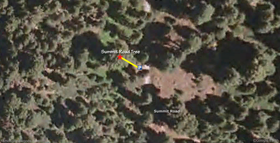
View Summit Road Tree location in Google Maps
Panoramas: Click panoramas to take a virtual tour of Summit Road Tree
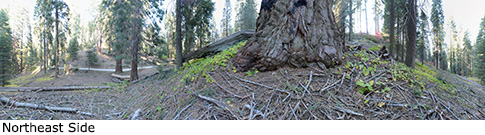
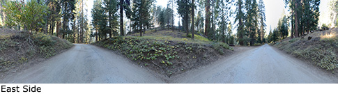
Photos: Pictures of Summit Road Tree taken from different sides