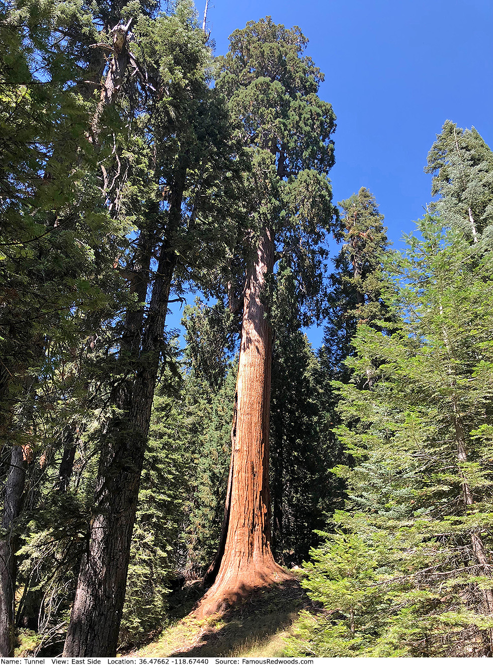
| Height: | 274.00 ft | (83.52 m) | Elevation: | 7,777 ft (2,370 m) | GPS Latitude: | 36.47662 |
| Volume: | 27,436 ft3 | (777 m3) | Creek: | Atwell Creek | GPS Longitude: | -118.67440 |
| Width: | 21.50 ft | (6.55 m) | Grove: | Atwell Mill Grove | Discovery Date: | |
| Age: | Park: | Sequoia NP | Discovered By: | Wendell D. Flint |
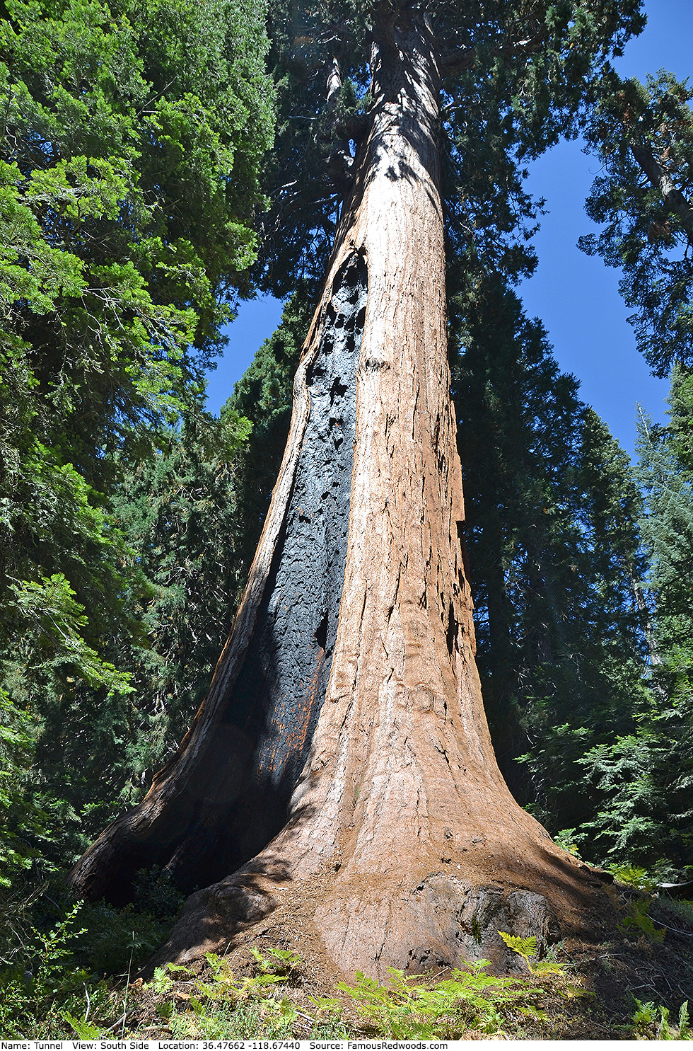
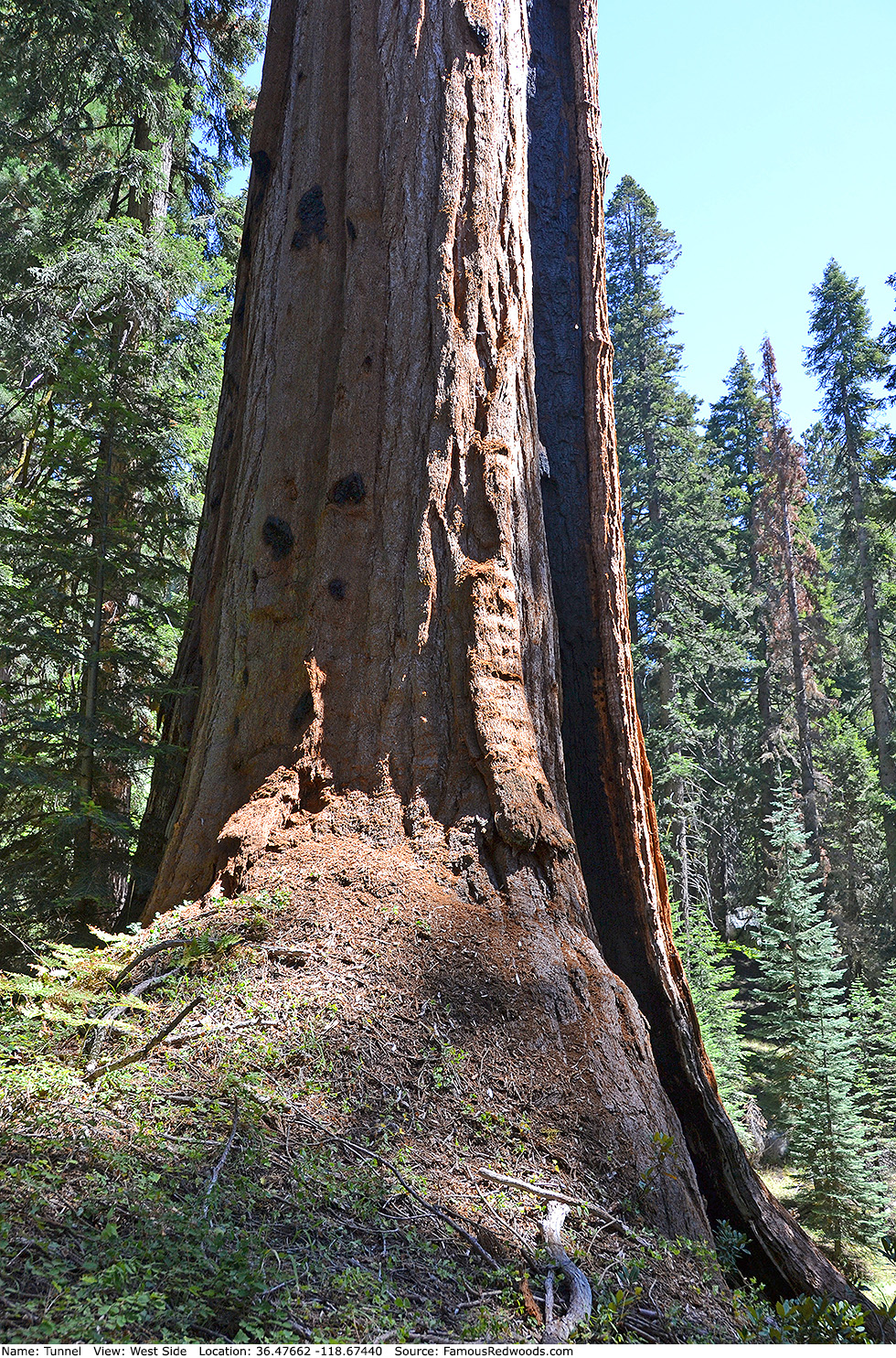
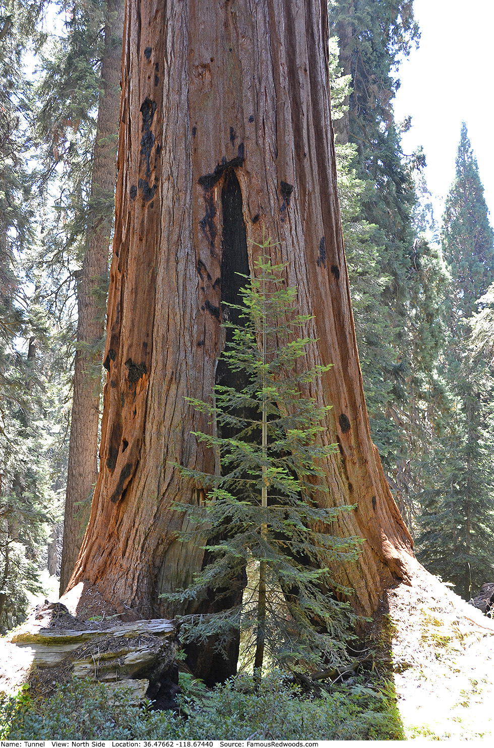
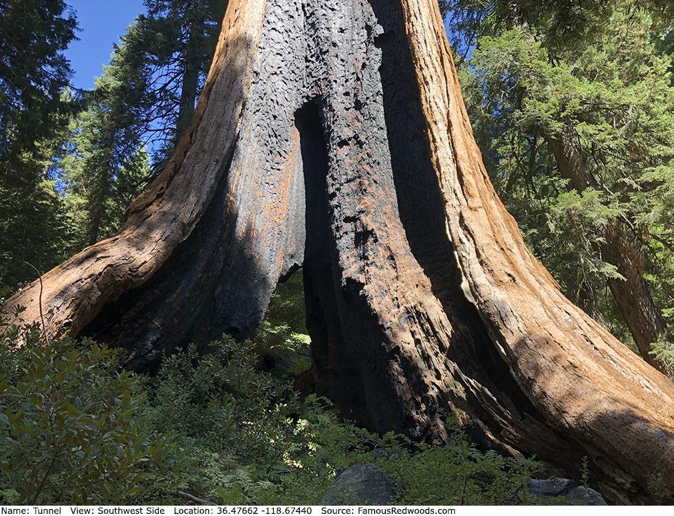
Notes: Tunnel Tree has an enormous, 57 ft (17 m) wide, flared base through which fire once burned a tunnel. Naturalist Wendell D. Flint, who discovered the tree, claimed that "three compact cars could be driven abreast halfway through it."
Tunnel should not be confused with another Tunnel tree which grows in Nelder Grove in Sierra National Forest or with Tunnel Log in Giant Forest in Sequoia National Park.
Drive: Tunnel is 225 mi (362 km) southeast of San Francisco near the community of Three Rivers.
Northbound: From U.S. Interstate 5 North, transfer to California State Route 99 North toward Bakersfield. Drive north 97 mi (156 km) on California State Route 99 and transfer to California State Route 198 East toward Visalia.
Southbound: From U.S. Interstate 5 South in Sacramento, transfer to U.S. Highway 50 East toward South Lake Tahoe. Drive east 1.7 mi (2.7 km) on U.S. Highway 50 and transfer to California State Highway 99 South. Drive south 201 mi (323 km) on California State Highway 99 South and transfer to California State Route 198 East toward Visalia.
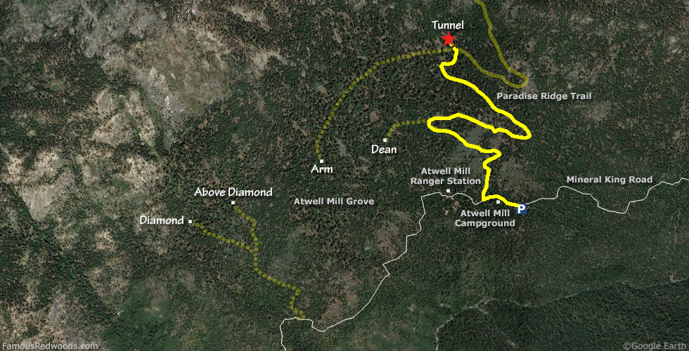
Drive east 38 mi (61 km) on California State Route 198, past Visalia and Three Rivers, and turn right onto Mineral King Road. Drive east 19 mi (31 km) on Mineral King Road, past Atwell Mill Ranger Station and Alles Cabin, and turn right into the Hockett Meadow and Paradise Trail parking lot, located at 36.46446 -118.66712, near the eastern end of Atwell Mill Campground.
Road Warning: Mineral King Road is closed (with a locked gate) during winter. Depending on weather conditions, Mineral King Road is usually open from the Wednesday before Memorial Day through the last Wednesday in October. Though paved to Silver City, Mineral King Road is narrow and winding. Oversized vehicles and trailers are not recommended.

Hike: From the parking lot, hike west 0.2 mi (0.3 km) on Mineral King Road to the Paradise Ridge trailhead, located near 36.46496 -118.67098, on the right/north side of the road. From the trailhead, hike north 2.2 mi (3.5 km) on Paradise Ridge Trail to the trail exit point near 36.47606 -118.67356. Leave the trail here and hike northwest 310 ft (94 m) off-trail to Tunnel.
| Rating: | Easy | One-Way Distance: | 2.4 mi | (3.9 km) | Ascent: | 1,275 ft | (389 m) |
| Time: | 1 hr 30 min | Off-Trail: | 310 ft | (94 m) | Descent: | 50 ft | (15 m) |
View Tunnel Tree location in Google Maps
Photos: Pictures of Tunnel Tree taken from different sides