| Height: | 115.00+ ft | (35.05+ m) | Elevation: | 6,840 ft (2,085 m) | GPS Latitude: | 36.56819 |
| Volume: | 23,818 ft3 | (674 m3) | Creek: | Little Deer Creek | GPS Longitude: | -118.76071 |
| Width: | 27.92 ft | (8.51 m) | Grove: | Giant Forest | Discovery Date: | 1905 |
| Age: | 2,822 y | Park: | Sequoia NP | Discovered By: |
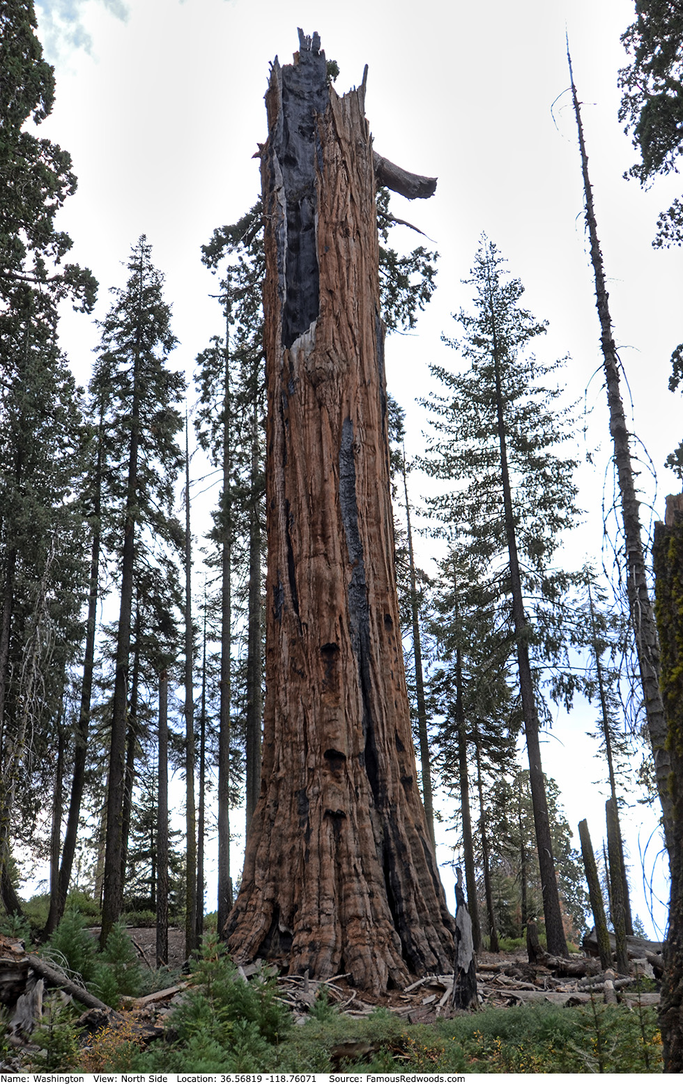
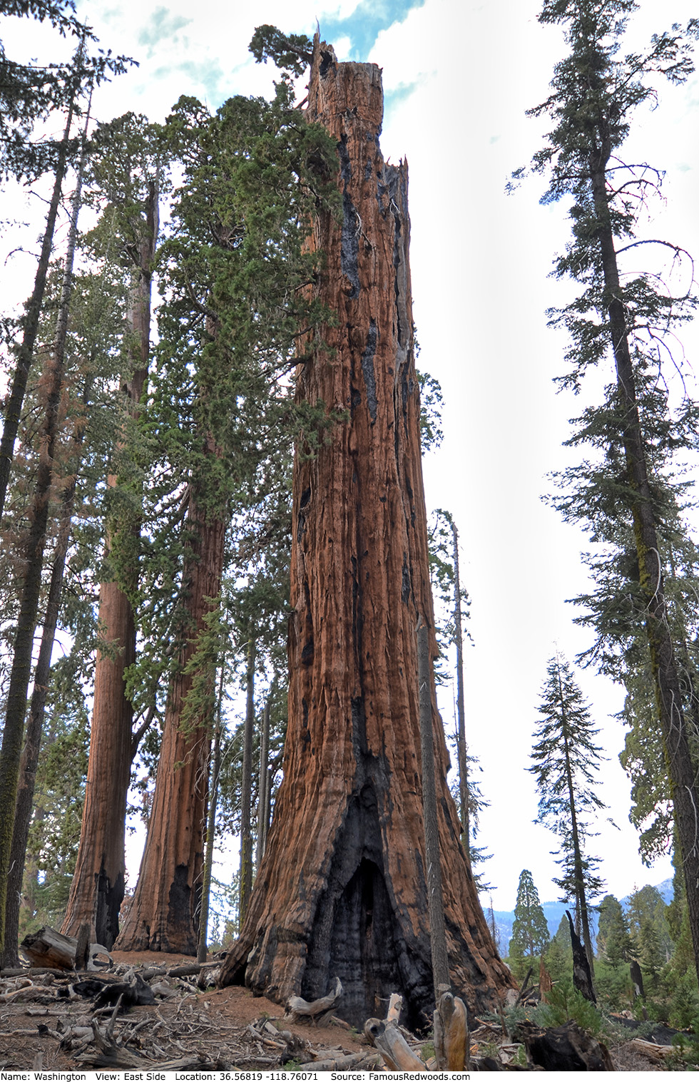
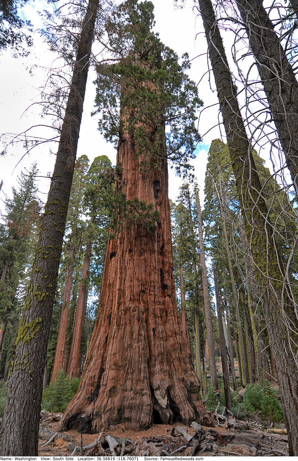
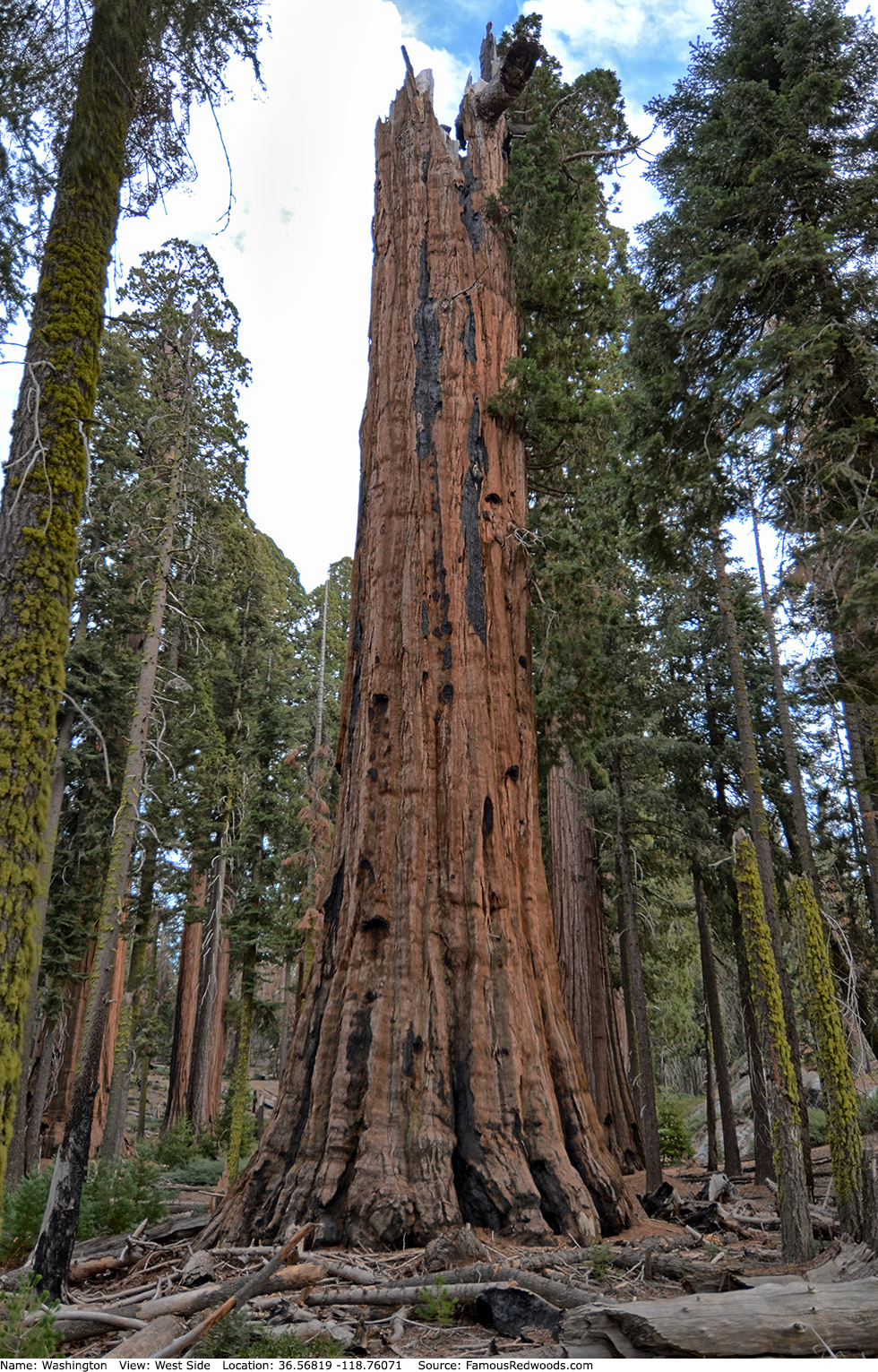
Notes: Once considered the world's 2nd largest tree, Washington, the 5th oldest living redwood, was named to honor George Washington, the 1st President of the United States. In 1999, Washington was 253.61 ft (77.30 m) tall and 27.92 ft (8.51 m) wide and contained 44,108 ft3 (1,249 m3) of wood. The crown had 46 reiterated trunks, nearly two billion leaves, and sixty-three thousand cones. The main trunk contained a hollow pit, accessible via an opening located 190 ft (58 m) above ground, approximately 6-9 ft (2-3 m) wide and 115 ft (35 m) deep. At that time, Washington was actually the world's 6th largest tree and, excluding the 4,704 ft3 (133 m3) hollow chamber, was only the world's 14th largest tree.
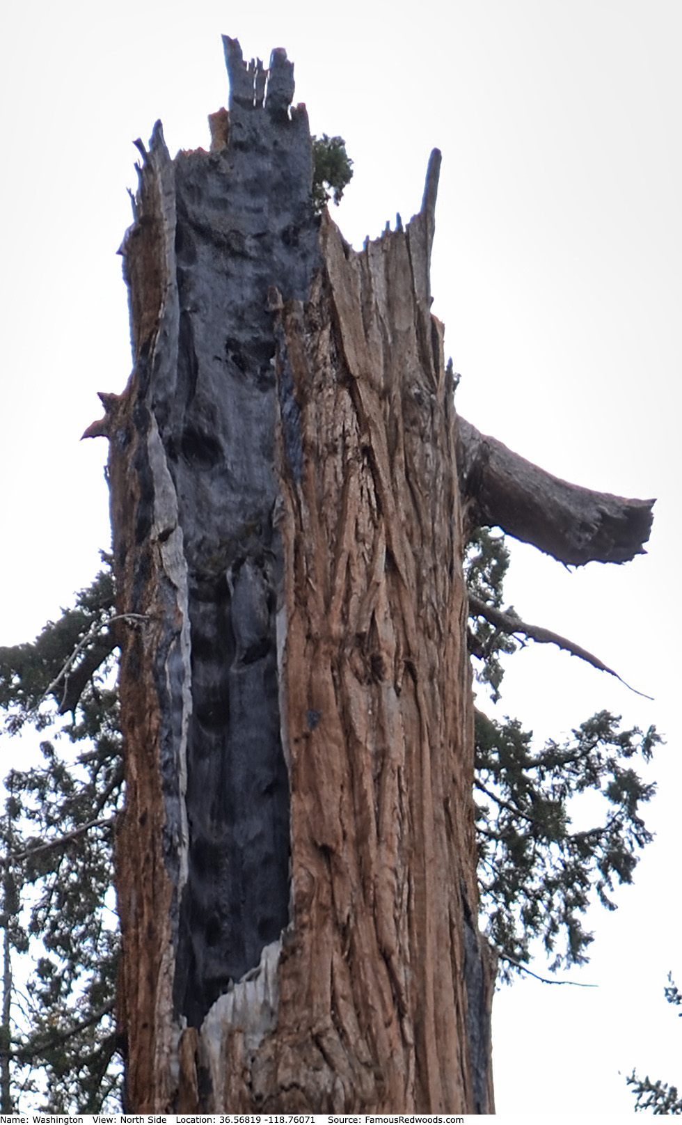
In September 2003, Washington lost more than 25 ft (8 m) in height after a lightning-induced fire burned within the crown for several days. In January 2005, weakened by fire and overburdened with snow, the crown collapsed. Although Washington lost more than half of its trunk, including the hollow pit, and nearly all of its branches, the tree survived. It remains viable but is no longer extraordinarily large. Washington now ranks as the 23rd largest tree in Sequoia National Park and the 15th largest tree in Giant Forest.
Washington should not be confused with Booker T. Washington which grows nearby in Giant Forest or with another Washington tree which grows in Mariposa Grove in Yosemite National Park.
University of Washington forestry affiliate assistant professor Robert Van Pelt published orthographic illustrations of Washington.
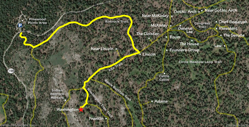
Drive: Washington is 218 mi (351 km) southeast of San Francisco near Fresno.
Northbound: From U.S. Interstate 5 North, transfer to California State Route 99 North toward Bakersfield. Drive north 97 mi (156 km) on California State Route 99 and transfer to California State Route 198 East toward Visalia. Drive east 58 mi (93 km) on California State Route 198 (Generals Highway), past Four Guardsmen, and turn left into the Pinewood Picnic Area parking lot.
Southbound: From U.S. Interstate 5 South in Sacramento, transfer to U.S. Highway 50 East toward South Lake Tahoe. Drive east 1.7 mi (2.7 km) on U.S. Highway 50 and transfer to California State Highway 99 South. Near Fresno, transfer to California State Route 180 East. Drive east 56 mi (90 km) on California State Route 180, and turn right onto California State Route 198 West. Drive south 28 mi (45 km) on California State Route 198 (Generals Highway) and turn right into the Pinewood Picnic Area parking lot.

Hike: From the parking lot, walk south across California State Route 198 (Generals Highway) to an unpaved road marked Authorized Vehicles Only.
.
Hike south/uphill 0.2 mi (0.3 km) on the unpaved road to the junction with Rimrock Trail. Turn left and hike east 0.7 mi (1.1 km) on
Rimrock Trail to Lincoln near the junction with Alta Trail. Turn right
at the trail junction and hike southwest 0.3 mi (0.5 km) on Alta Trail, past the junction to Bears Bathtub, to the
junction with Washington Tree Trail. Turn left and hike southeast 0.1 mi (0.2 km) on Washington Tree Trail to the
junction with an unnamed spur trail. Turn right and hike west 0.1 mi (0.2 km) on the unnamed spur trail to Washington.
| Rating: | Easy | One-Way Distance: | 1.3 mi | (2.0 km) | Ascent: | 647 ft | (197 m) |
| Time: | 40 min | Off-Trail: | 0 ft | (0 m | Descent: | 391 ft | (119 m) |
View Washington Tree location in Google Maps
Panorama: Click panorama to take a virtual tour of Washington Tree
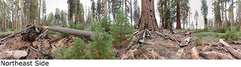
Photos: Pictures of Washington Tree taken from different sides