| Height: | 225.00+ ft | (68.58+ m) | Elevation: | 6,374 ft (1,943 m) | GPS Latitude: | 36.19209 |
| Volume: | 25,000 ft3 | (708 m3) | Creek: | South Alder Creek | GPS Longitude: | -118.61752 |
| Width: | 20.00 ft | (6.10 m) | Grove: | Alder Creek Grove | Discovery Date: | 1977 |
| Age: | Park: | Giant Sequoia NM | Discovered By: | Wendell D. Flint |
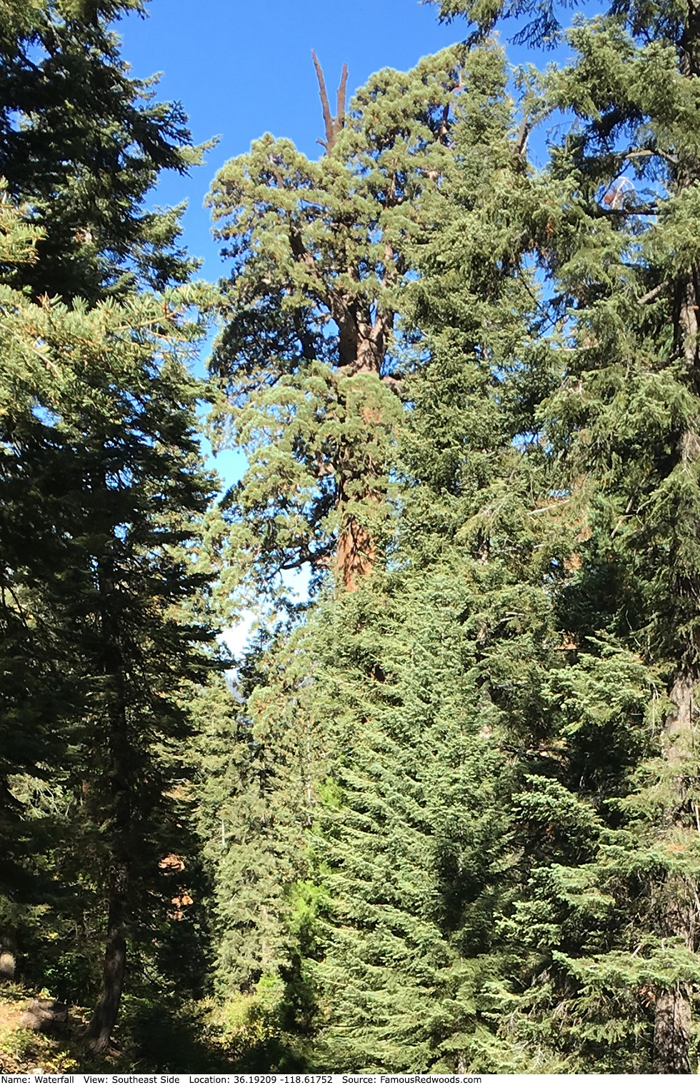
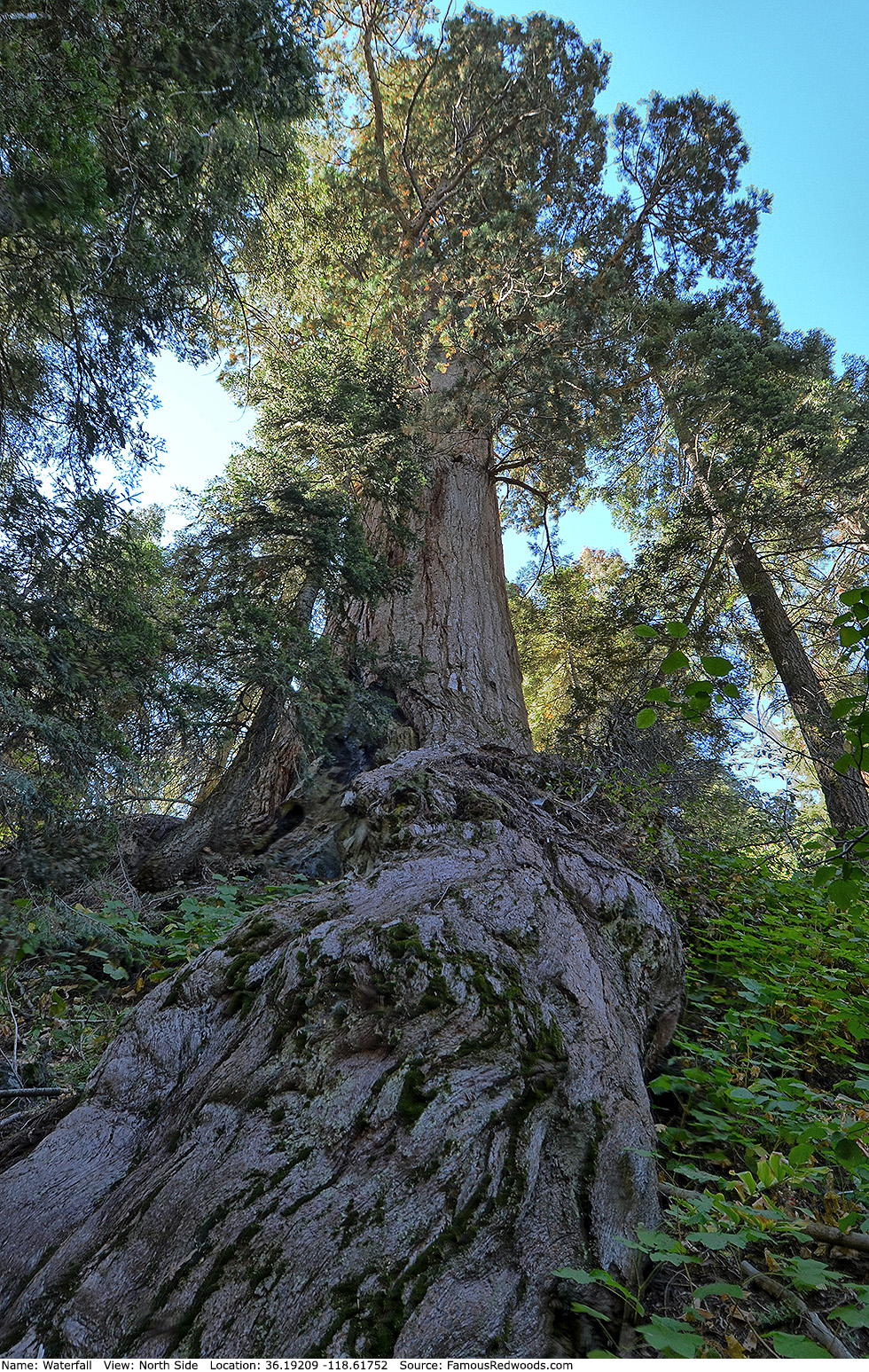
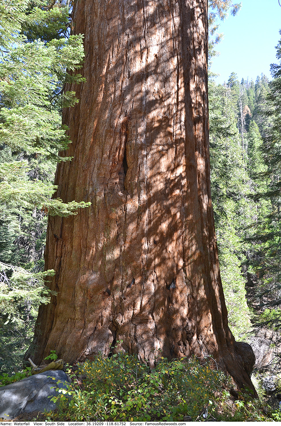
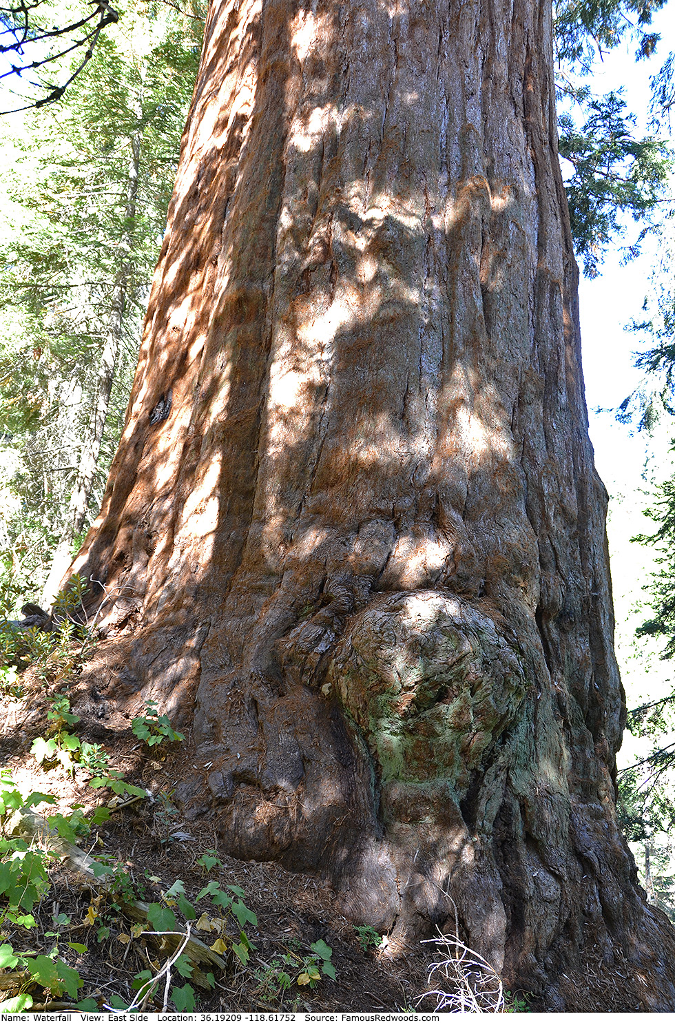
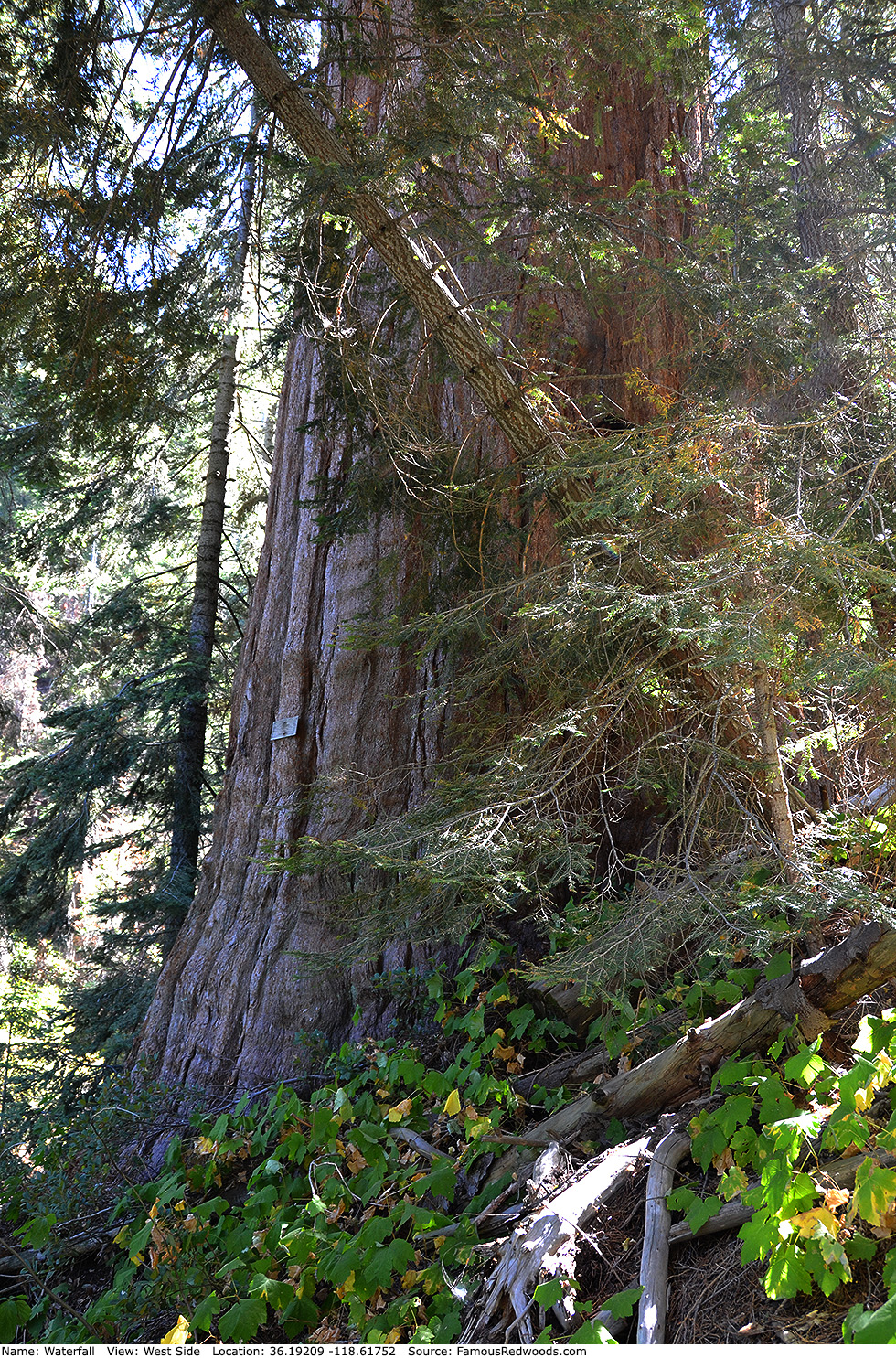
Notes: Waterfall, also known as Big Base Tree, has the largest redwood ground perimeter (140.10 ft or 42.70 m) and horizontal axis (57.00 ft or 17.37 m). The steep (greater than 45 degree or 100%) slope and large buttresses on the north/downhill side of the trunk combine to create the tree's extraordinary ground perimeter. The 2020 Castle Fire killed Waterfall.
The New York Times Science program Climbing Sequoias for Climate Change features a climb of Waterfall. Videographer Sue Cag published an aerial flyover of Waterfall.
Waterfall is directly in the path of the May 3, 2106 total solar eclipse.
Drive: Waterfall is 237 mi (381 km) southeast of San Francisco near the city of Porterville.
Northbound: From U.S. Interstate 5 North, transfer to California State Route 99 North. From California State Route 99 North just north of Bakersfield, transfer to California State Route 65 North toward Porterville. Near Porterville, transfer to California State Route 190 East.
Southbound: From U.S. Interstate 5 South in Sacramento, transfer to U.S. Highway 50 East toward South Lake Tahoe. Drive east 1.7 mi (2.7 km) on U.S. Highway 50 and transfer to California State Highway 99 South. Near Tipton, transfer to California State Route 190 East toward Porterville.
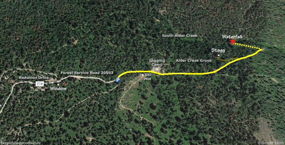
From Porterville, drive east 34 mi (55 km) on California State Route 190 toward Camp Nelson. Just past Camp Nelson, turn left onto County Road 216 (Redwood Drive) and drive north 7.3 mi (11.7 km), past Window, to the intersection with Forest Service Road 20S03. Veer right onto Forest Service Road 20S03 and drive east 0.2 mi (0.3 km) to the Stagg Tree parking area.
Navigation System Warning: About 24 mi (39 km) from Porterville on California State Route 190 East, 10 mi (16 km) before the turn onto County Road 216 (Redwood Drive), many computer, smartphone, and car navigation systems instruct you to turn left at County Road 208 (Wishon Drive), toward Camp Wishon, for the shortest route to Waterfall. But those same navigation systems may not warn you that this route includes 5 mi (8 km) of steep, rugged, unpaved road (not suited for average two-wheel drive vehicles) or that the unpaved road is closed during winter. Keep driving on California State Route 190 East, past County Road 208 (Wishon Drive), toward Camp Nelson instead. Your car will appreciate it.

Hike: From the Stagg Tree parking area, walk east 0.4 mi (0.6 km) on the road past a gate, the first fork in the road, and an old logging camp. Continue straight at the second fork in the road then veer left at the third. Just past the third fork, you will spot Stagg poking up from the canyon on your left. Veer right at the next Stagg Tree sign and hike west/downhill 0.1 mi (0.3 km) to the trail exit point near 36.19160 -118.61594. Turn left here and hike downhill/west 0.1 mi (0.2 km) on an abandoned road to Waterfall.
| Rating: | Easy | One-Way Distance: | 0.6 mi | (1.0 km) | Ascent: | 183 ft | (56 m) |
| Time: | 20 min | Off-Trail: | 0 ft | (0 m) | Descent: | 356 ft | (109 m) |
View Waterfall Tree location in Google Maps
Panorama: Click panorama to take a virtual tour of Waterfall Tree
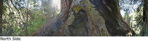
Photos: Pictures of Waterfall Tree taken from different sides