Notes: On June 30, 1864, President Abraham Lincoln signed the Yosemite Grant Act which ceded
the 'cleft' or 'gorge' in the granite peak of the Sierra Nevada mountains ... known as the Yo-Semite Valley
and the land embracing the Mariposa Big Tree Grove
to the
State of California as protected wilderness for public use, resort, and recreation.
This act marked the first time the United States government preserved land for public use and
led to the creation of America's National Park system.
On October 1, 1890, President Benjamin Harrison signed legislation which established Yosemite National Park, America's 3rd national park, and General Grant National Park (which, 50 years later, became part of Kings Canyon National Park). While the new park included the Tuolomne and Merced river watersheds, it excluded Yosemite Valley and Mariposa Grove both of which remained under state jurisdiction.
On February 7, 1905, Yosemite National Park shrank in size by 429 mi2 (1,111 km2) after President Theodore Roosevelt signed legislation which excluded land west of Lake Eleanor, Hodgdon Meadow, Crane Creek, and El Portal; east of the Sierra Crest; and southeast of the Merced-San Joaquin Divide and expanded the park's northern boundary to follow the Sierra Crest and the divide between Cherry and Eleanor, Kendrick, and Falls Creeks. On June 11, 1906, President Roosevelt signed additional legislation which returned Yosemite Valley and Mariposa Grove to the park and excluded a tract of land between Chinquapin and the South Fork Merced River including Yosemite West and Henness Ridge.
Several smaller park expansions along the western park boundary followed:
| April 16, 1914 | Land and Timber Exchange | Small tract of land west of Crane Flat added in exchange for rights to harvest timber |
| May 28, 1928 | Land Exchange | 0.5 mi2 (1.4 km2) tract between El Portal and Yosemite West added as part of a land exchange designed to protect deer along the western park boundary |
| April 14, 1930 | Rockefeller Purchase | 8.7 mi2 (22.4 km2) Rockefeller Grove added when President Herbert Hoover signed Proclamation 1904. John D. Rockefeller Jr. donated $1.65 million to purchase this grove from lumber companies |
| August 13, 1932 | Wawona Addition | 13.7 mi2 (35.5 km2) Wawona Basin added when President Herbert Hoover signed Proclamation 2005 |
| July 9, 1937 | Carl Inn Addition | 11.3 mi2 (29.1 km2) Carl Inn tract added (legal entanglements delayed the acquisition until 1939) |
Yosemite National Park expanded for the last time on September 7, 2016 when The Trust for Public Land donated the Ackerson Meadow tract, near the park's Big Oak Flat entrance, which it had purchased from private ownership for $2.3 million.
Today, Yosemite National Park encompasses 1,169 mi2 (3,027 km2) of terrain, contains 800 mi (1,287 km) of hiking trails, and receives more than 4,000,000 visitors annually.
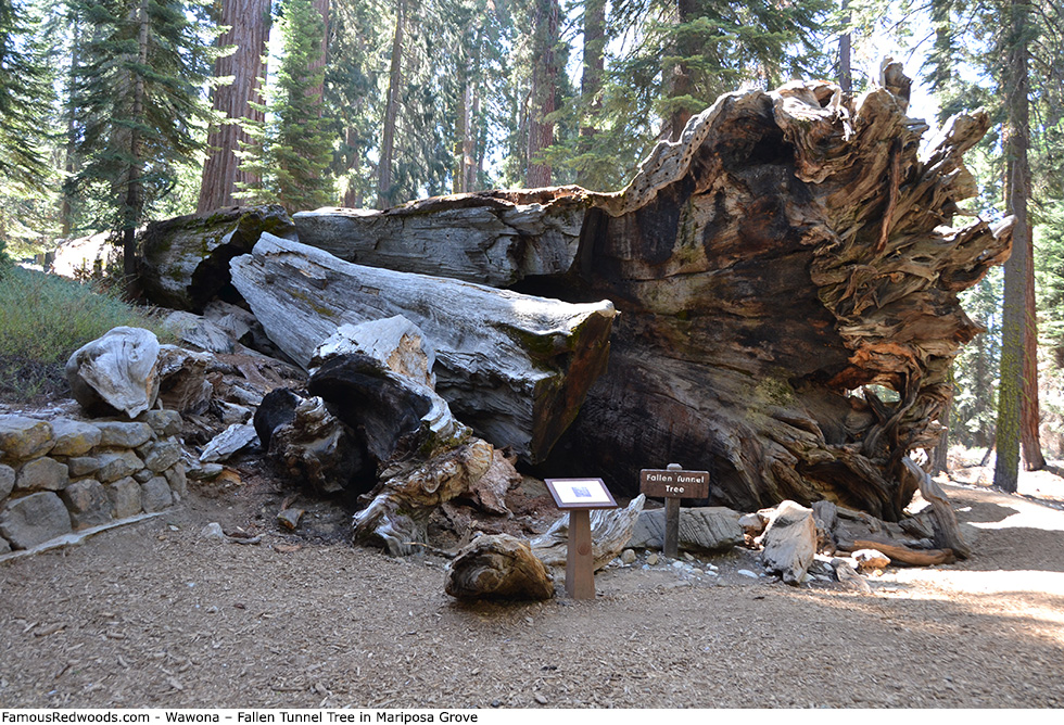
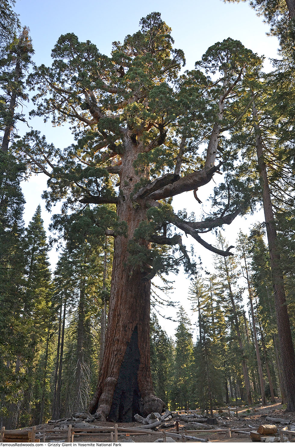
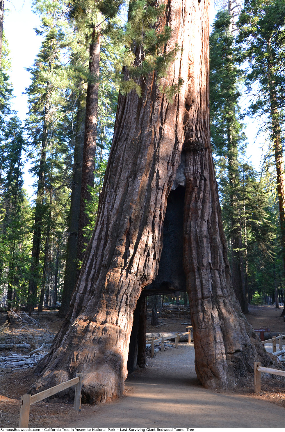
Yosemite National Park includes the 3rd oldest living redwood (Grizzly Giant), the first redwood tunnel tree (Dead Giant), and the last surviving giant redwood tunnel tree (California). The park contains 8 trees larger than 25,000 ft3 (708 m3) and 3 trees larger than 30,000 ft3 (850 m3).
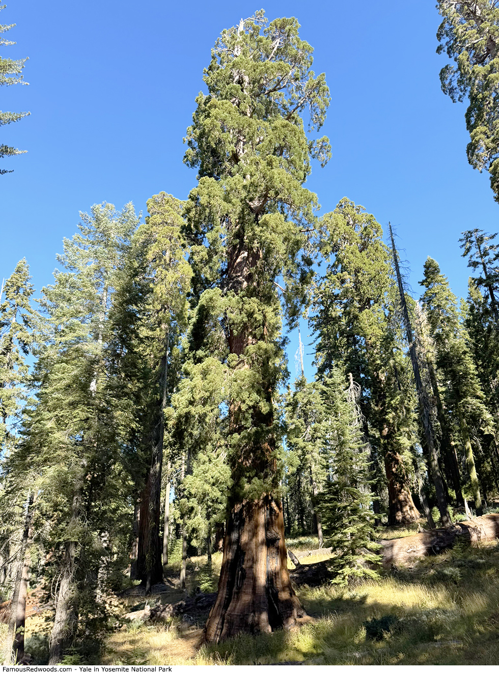
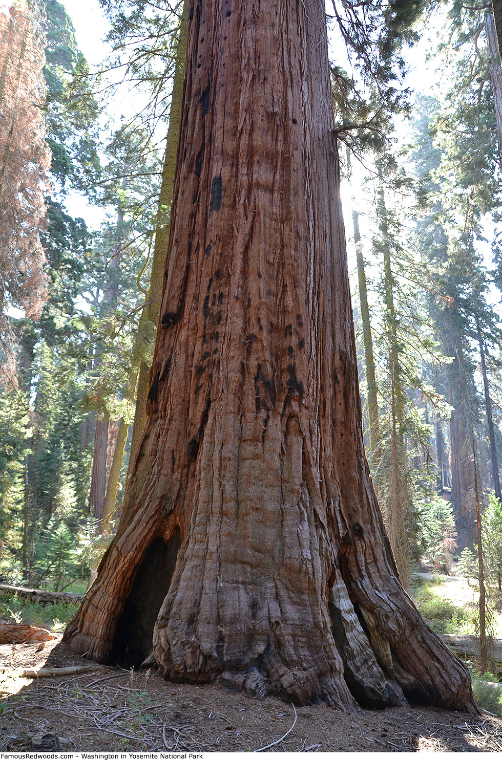
Washington is the largest tree, Yosemite Sam is the tallest tree, and Grizzly Giant is the oldest tree in Yosemite National Park.
Wawona Tree (now Wawona Log) fell in February 1969.
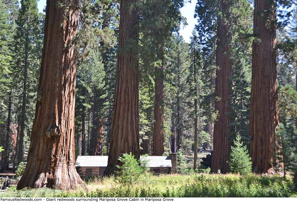
Yosemite National Park includes 3 giant redwood groves:
|
|
Yosemite National Park includes the following giant redwoods:
|
|
|
|
Visit nps.gov/yose for seasonal hours, current entrance fees, and more information.
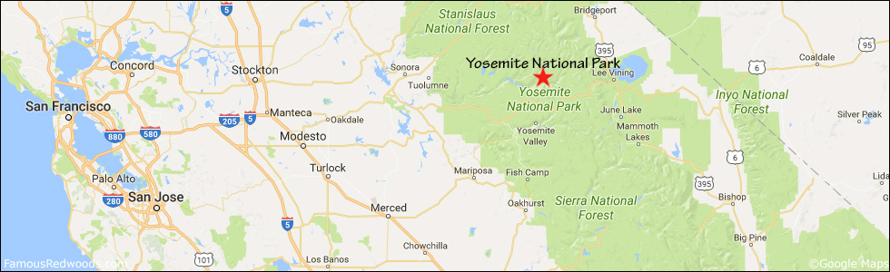
Drive: Yosemite Valley Visitor Center is located at 9035 Village Drive 155 mi (249 km) east of San Francisco near Oakhurst.
Northbound: From U.S. Interstate 5 North, transfer to California State Highway 41 North toward Kettleman City. Drive north 146 mi (235 km) on California State Highway 41, past the park entrance station (entrance fee required), to Yosemite Valley. Merge onto Southside Drive and drive east 4 mi (6 km) to Sentinel Drive.
Southbound: From U.S. Interstate 5 South in Sacramento, transfer to U.S. Highway 50 East toward South Lake Tahoe. Drive east 1.7 mi (2.7 km) on U.S. Highway 50 and transfer to California State Highway 99 South. Near Merced, transfer to California State Highway 140 East. Drive east 74 mi (119 km) on California State Highway 140, past the park entrance station (entrance fee required), to Yosemite Valley. Veer right across the bridge over Merced River, and drive east 5 mi (8 km) on Southside Drive to Sentinel Drive.
Turn left onto Sentinel Drive and drive east 0.3 mi (0.5 km) to Northside Drive. Turn right onto Northside Drive toward the Visitor Center parking area.
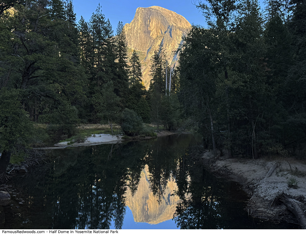
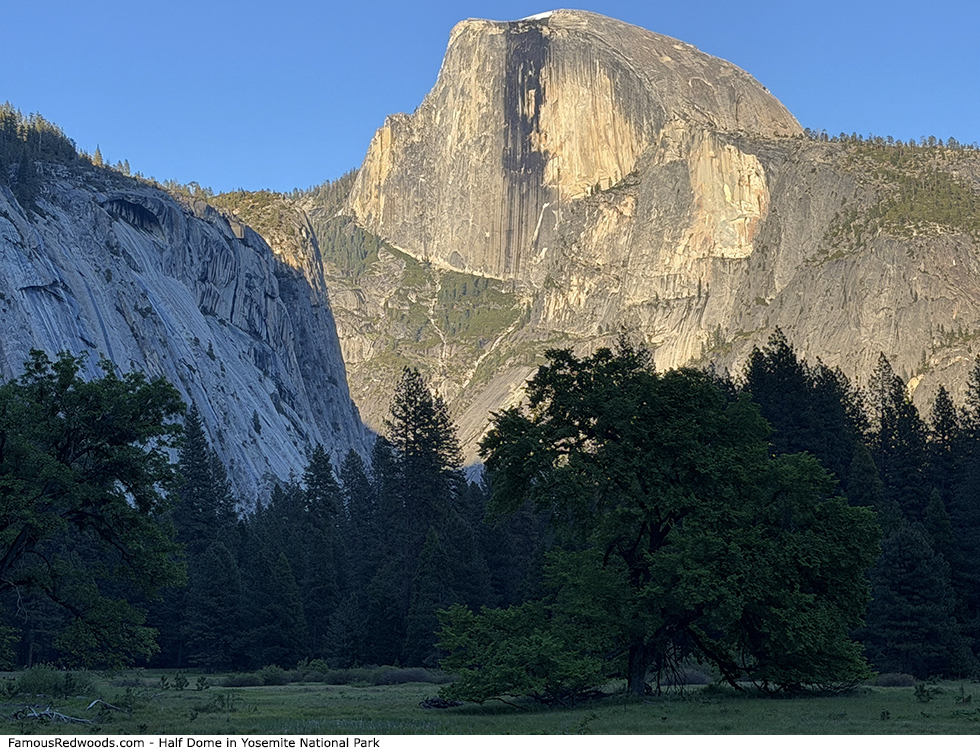
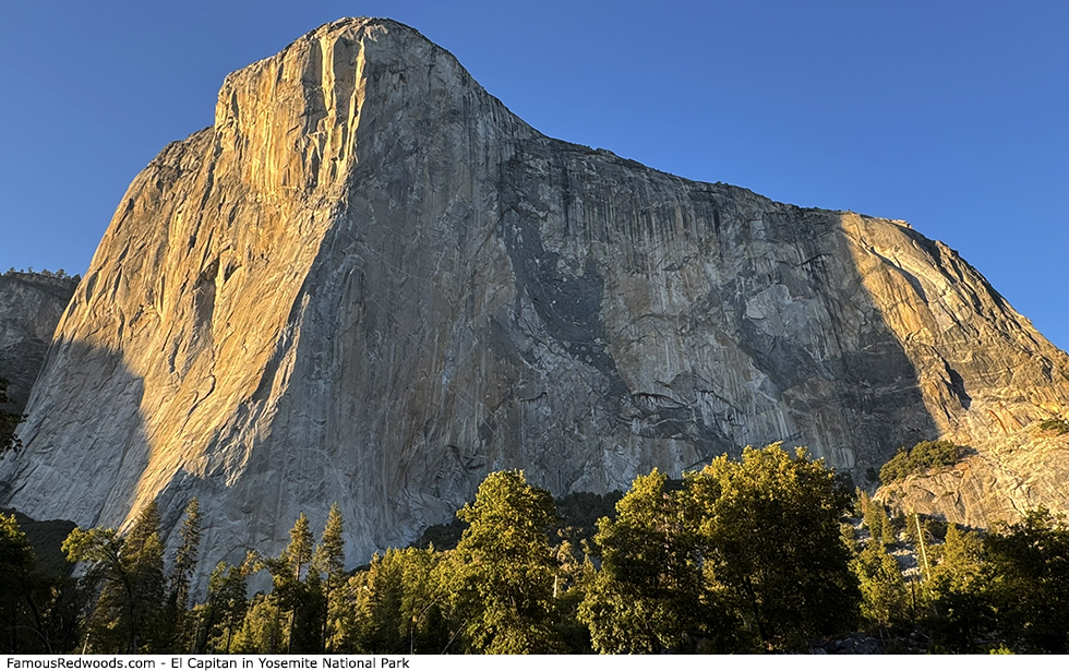
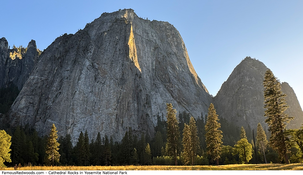
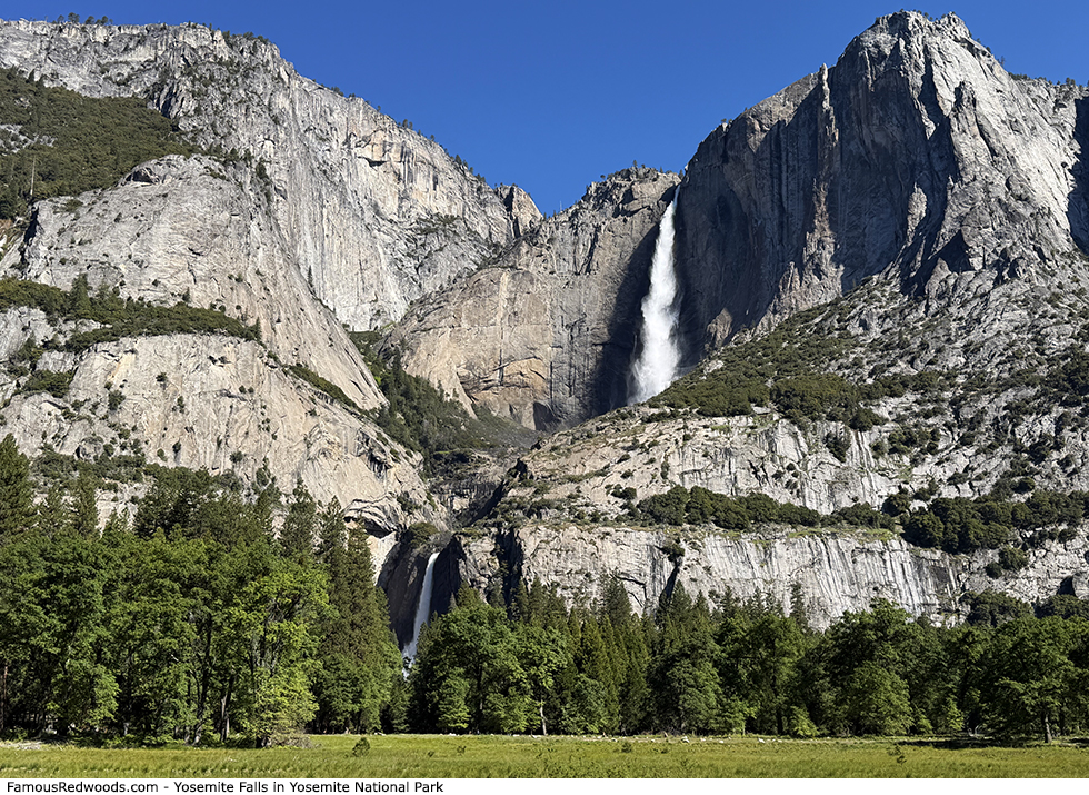
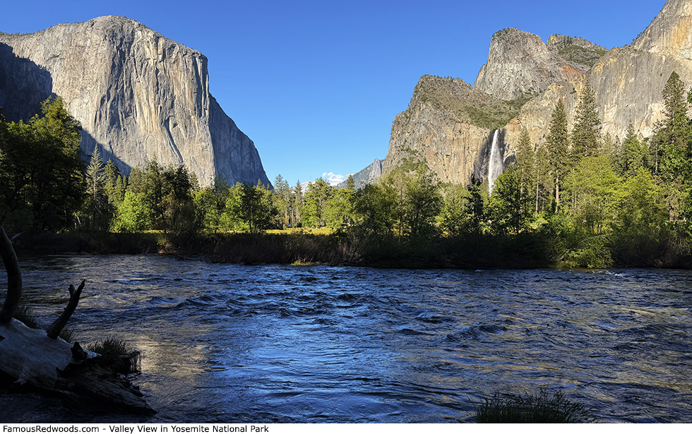
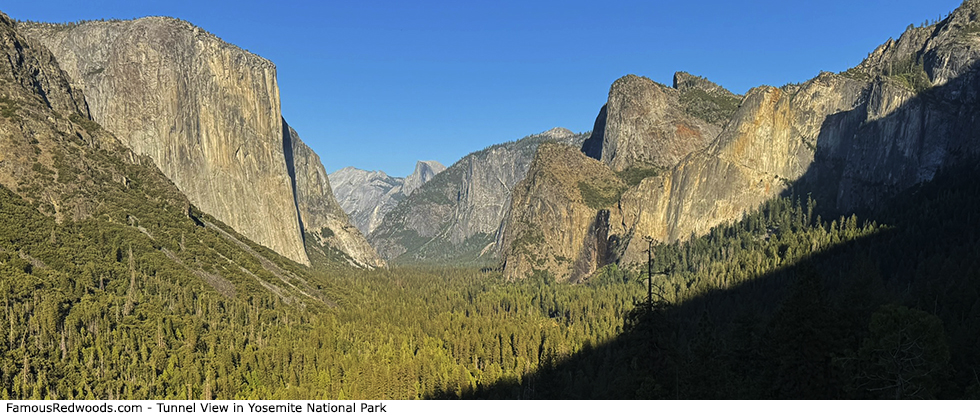
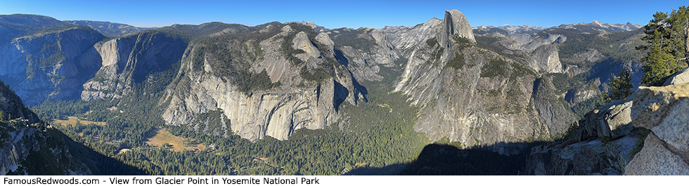
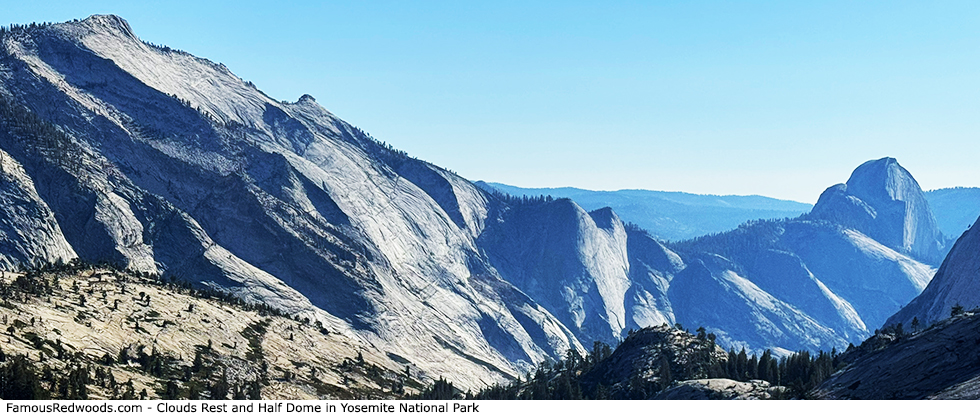
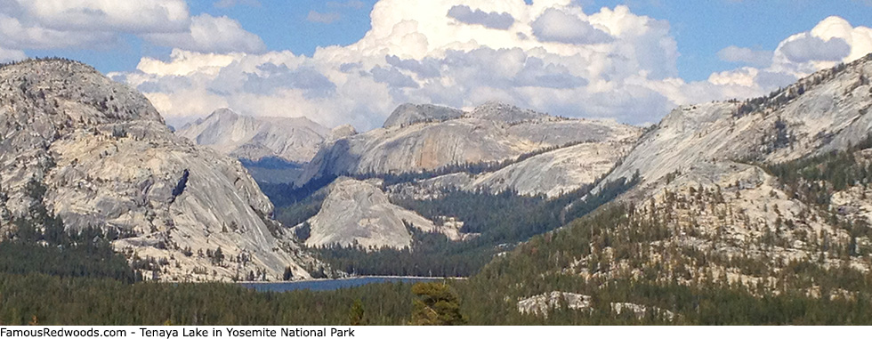
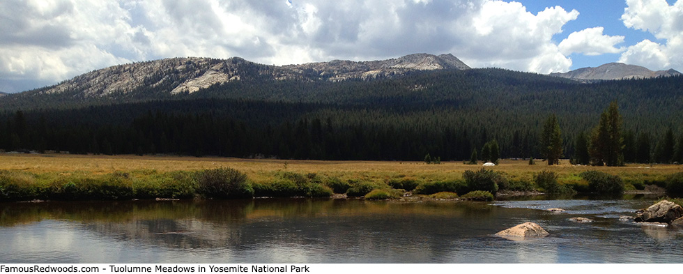
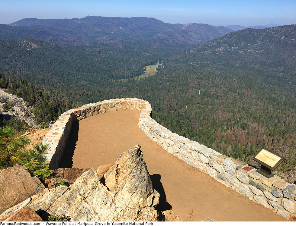
Photos: Pictures of Yosemite National Park