| Height: | 125.00+ ft | (38.10+ m) | Elevation: | 6,360 ft (1,939 m) | GPS Latitude: | 36.74735 |
| Volume: | Creek: | Big Tree Creek | GPS Longitude: | -118.97254 | ||
| Width: | Grove: | General Grant Grove | Discovery Date: | 1868 | ||
| Age: | Park: | Kings Canyon NP | Discovered By: | Israel Gamlin | ||
| Thomas Gamlin |
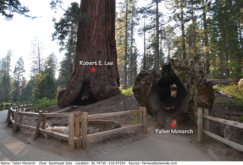
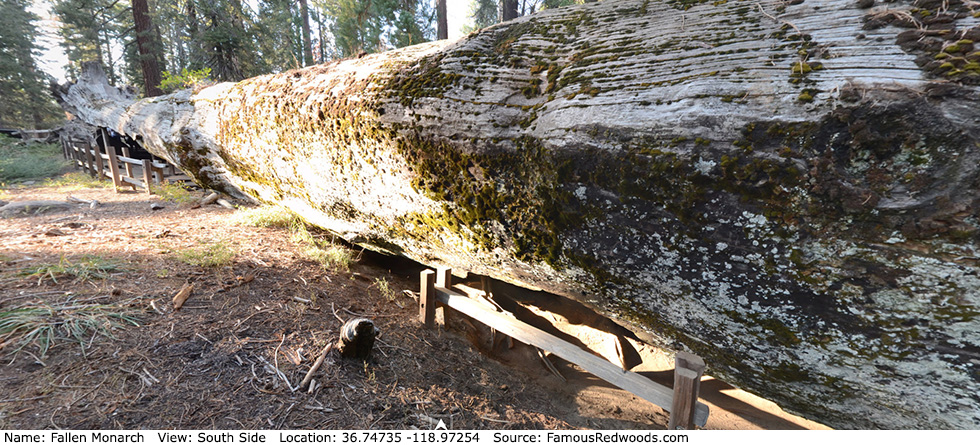
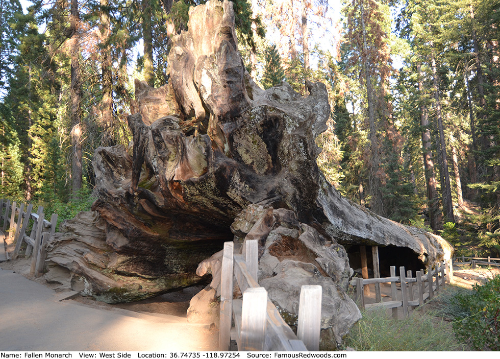
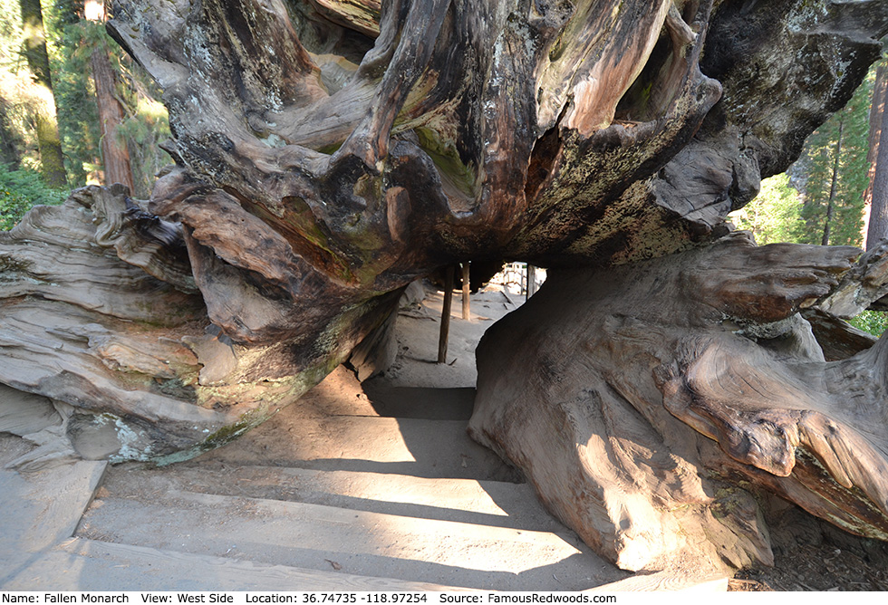
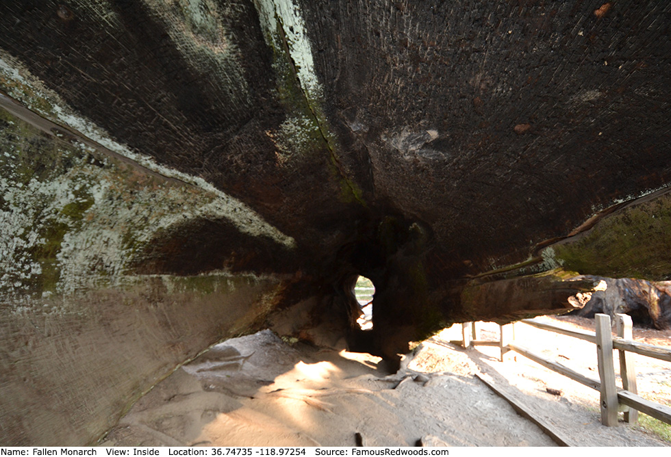
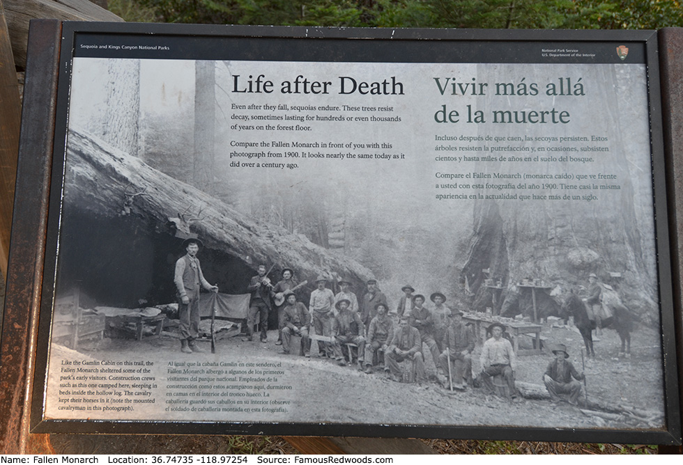
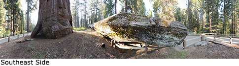
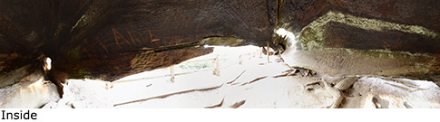
Notes: Fallen Monarch, also known as Dead Monarch, is a giant redwood log which was hollowed out by fire before it fell more than 300 years ago. Cattlemen Israel and Thomas Gamlin, who lived within General Grant Grove from 1868 to 1878, used Fallen Monarch as a temporary shelter while they built Gamlin Pioneer Cabin nearby. Later, Fallen Monarch became a local hotel and saloon and, from 1890 to 1914, served as a stable for the United States Cavalry which patrolled General Grant National Park (now part of Kings Canyon National Park) after it was established on October 1, 1890.
Fallen Monarch should not to be confused with another Fallen Monarch in Mariposa Grove in Yosemite National Park or Fallen Monarch in Nelder Grove in Sierra National Forest.
Drive: Fallen Monarch is 202 mi (325 km) southeast of San Francisco near Fresno.
Northbound: From U.S. Interstate 5 North, transfer to California State Route 99 North toward Bakersfield. Drive north 97 mi (156 km) on California State Route 99 and transfer to California State Route 198 East toward Visalia. Drive east 86 mi (138 m) on California State Route 198, past the Sequoia National Park entrance station (entrance fee required) and Four Guardsmen, and turn right onto California State Route 180 East toward General Grant Grove. Drive north 1.6 mi (2.6 km) on California State Route 180 and turn left onto Grant Tree Road.
Southbound: From U.S. Interstate 5 South in Sacramento, transfer to U.S. Highway 50 East toward South Lake Tahoe. Drive east 1.7 mi (2.7 km) on U.S. Highway 50 and transfer to California State Highway 99 South. Near Fresno, transfer to California State Route 180 East. Drive east 58 mi (93 km) on California State Route 180 toward General Grant Grove, past the Kings Canyon National Park entrance station (entrance fee required), and turn left onto Grant Tree Road.
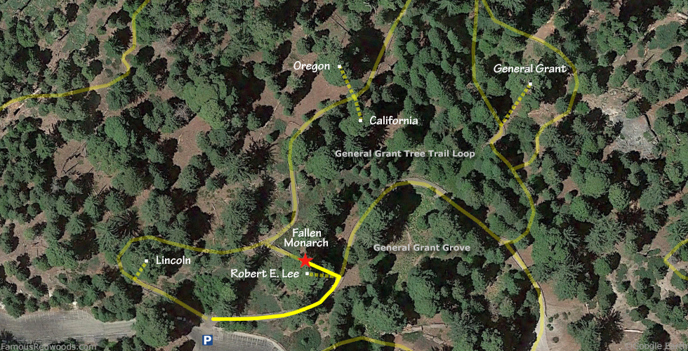
Drive west 0.8 mi (1.2 km) on Grant Tree Road to the General Grant Tree parking lot.
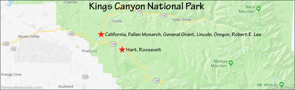
Hike: At the northern edge of the parking lot, turn right/northeast at the trailhead and hike east 230 ft (70 m) on the eastern half of General Grant Tree Trail Loop, past Robert E. Lee, to Fallen Monarch.
| Rating: | Easy | One-Way Distance: | 230 ft | (70 m) | Ascent: | 10 ft | (3 m) |
| Time: | 1 min | Off-Trail: | 0 ft | (0 m) | Descent: | 0 ft | (0 m) |
View Fallen Monarch Tree location in Google Maps
Panoramas: Click panoramas to take a virtual tour of Fallen Monarch Tree
Photos: Pictures of Fallen Monarch Tree taken from different sides