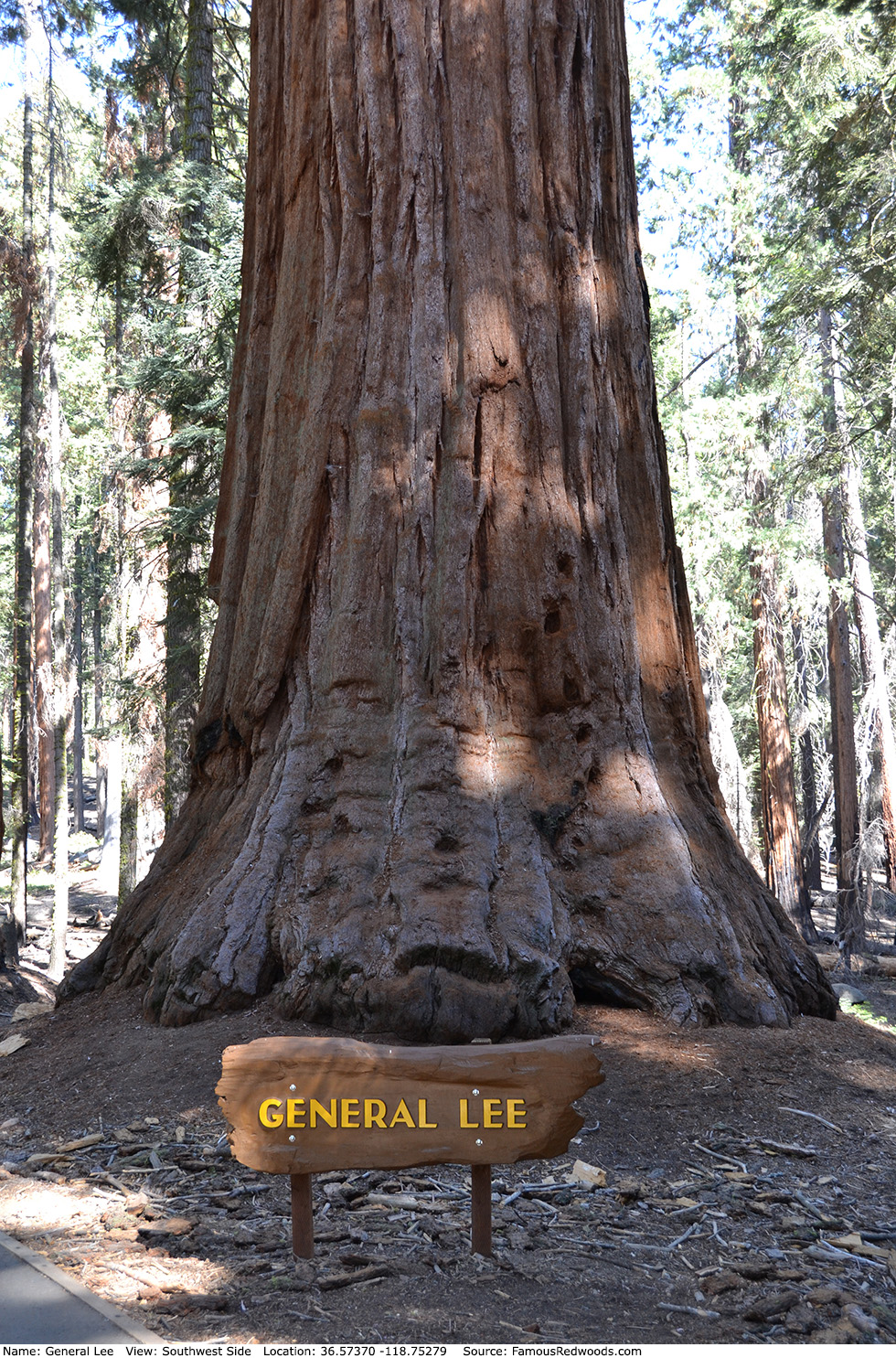
| Height: | 254.50+ ft | (77.57+ m) | Elevation: | 6,968 ft (2,124 m) | GPS Latitude: | 36.57370 |
| Volume: | 26,040 ft3 | (737 m3) | Creek: | Little Deer Creek | GPS Longitude: | -118.75279 |
| Width: | 21.1 ft | (6.43 m) | Grove: | Giant Forest | Discovery Date: | 1901 |
| Age: | Park: | Sequoia NP | Discovered By: | John Broder |
Notes: In 1901, Sequoia National Park concessionaire John Broder named the tree to honor Confederate Army General Robert E. Lee. On July 1, 1937, the United Daughters of the Confederacy formally dedicated the tree as General Lee during a ceremony beside the tree.
General Lee should not be confused with Robert E. Lee which grows in General Grant Grove in Kings Canyon National Park, another Robert E. Lee tree which grows in Mariposa Grove in Yosemite National Park, or with Ghost (also known as Robert E. Lee) which grows in Packsaddle Grove in in Giant Sequoia National Monument.
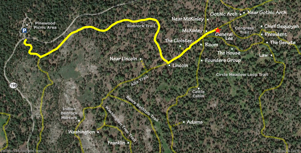
Drive: General Lee is 218 mi (351 km) southeast of San Francisco near Fresno.
Northbound: From U.S. Interstate 5 North, transfer to California State Route 99 North toward Bakersfield. Drive north 97 mi (156 km) on California State Route 99 and transfer to California State Route 198 East toward Visalia. Drive east 58 mi (93 km) on California State Route 198 (Generals Highway), past the Sequoia National Park entrance station (entrance fee required) and Four Guardsmen, and turn left into the Pinewood Picnic Area parking lot.
Southbound: From U.S. Interstate 5 South in Sacramento, transfer to U.S. Highway 50 East toward South Lake Tahoe. Drive east 1.7 mi (2.7 km) on U.S. Highway 50 and transfer to California State Highway 99 South. Near Fresno, transfer to California State Route 180 East. Drive east 56 mi (90 km) on California State Route 180, past the Kings Canyon National Park entrance station (entrance fee required), and turn right onto California State Route 198 West. Drive south 28 mi (45 km) on California State Route 198 (Generals Highway) and turn right into the Pinewood Picnic Area parking lot.

Hike: From the parking lot, walk south across California State Route 198 (Generals Highway) to an unpaved road marked
Authorized Vehicles Only.
Hike south/uphill 0.2 mi (0.3 km) on the unpaved road to the junction with Rimrock Trail. Turn left at the trail
junction and hike east 0.7 mi (1.1 km) on Rimrock Trail to Lincoln near the
junction with Alta Trail. Turn left at the trail junction and hike northeast 0.3 mi (0.5 km) on Alta Trail, through
McKinley trail junction, to General Lee which stands beside the trail on your right.
| Rating: | Easy | One-Way Distance: | 1.2 mi | (1.9 km) | Ascent: | 624 ft | (190 m) |
| Time: | 35 min | Off-Trail: | 0 ft | (0 m) | Descent: | 233 ft | (71 m) |
View General Lee Tree location in Google Maps
Panorama: Click panorama to take a virtual tour of General Lee Tree
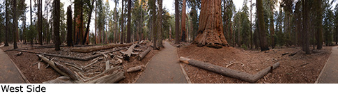
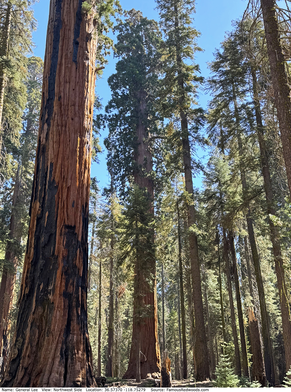
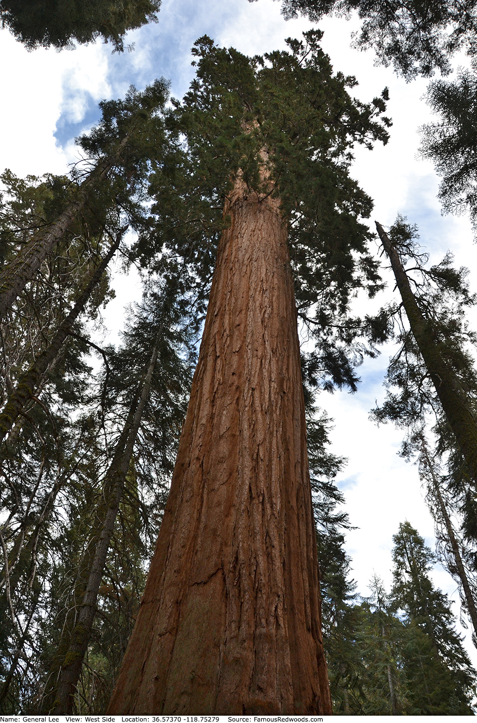
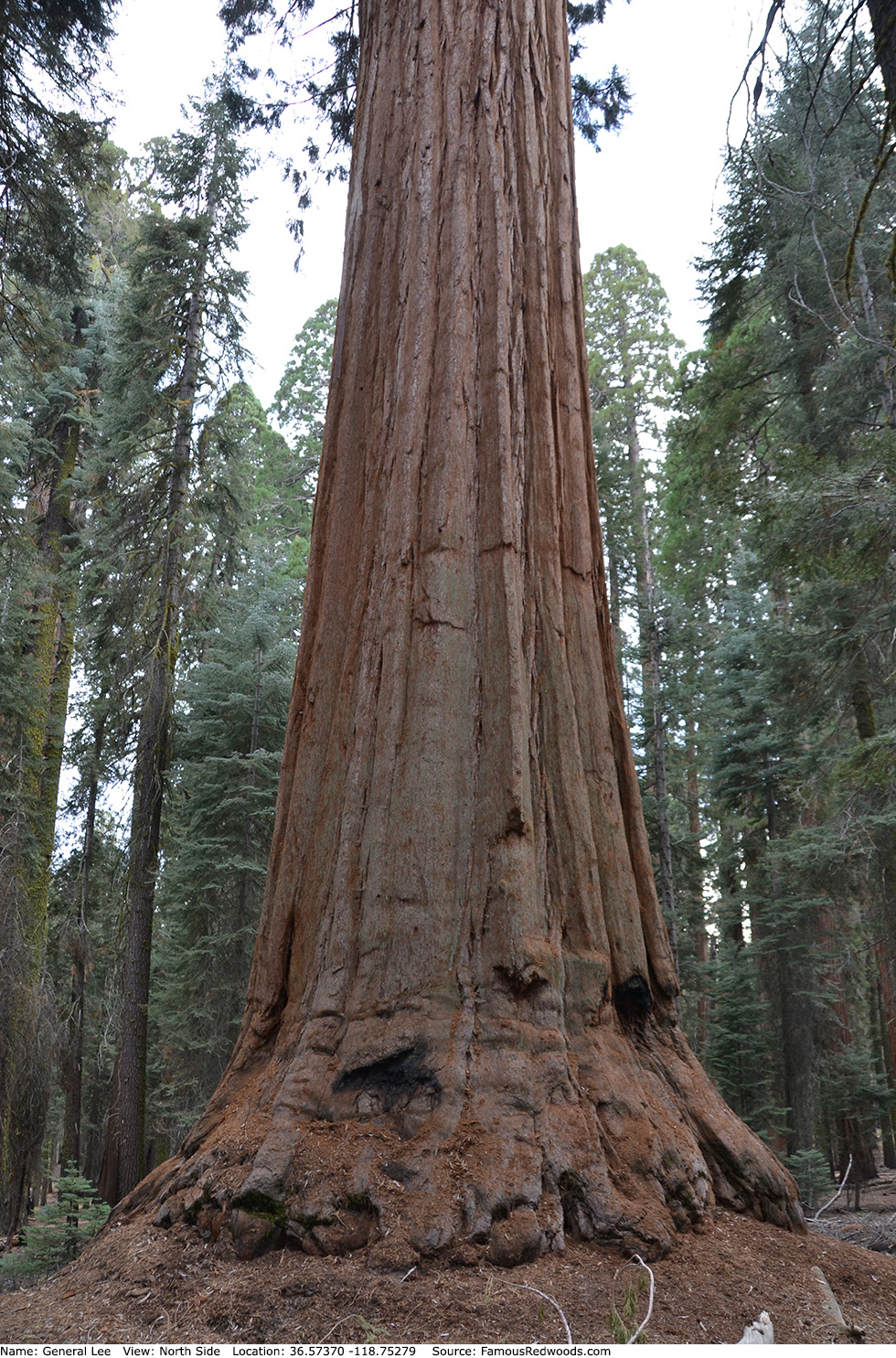
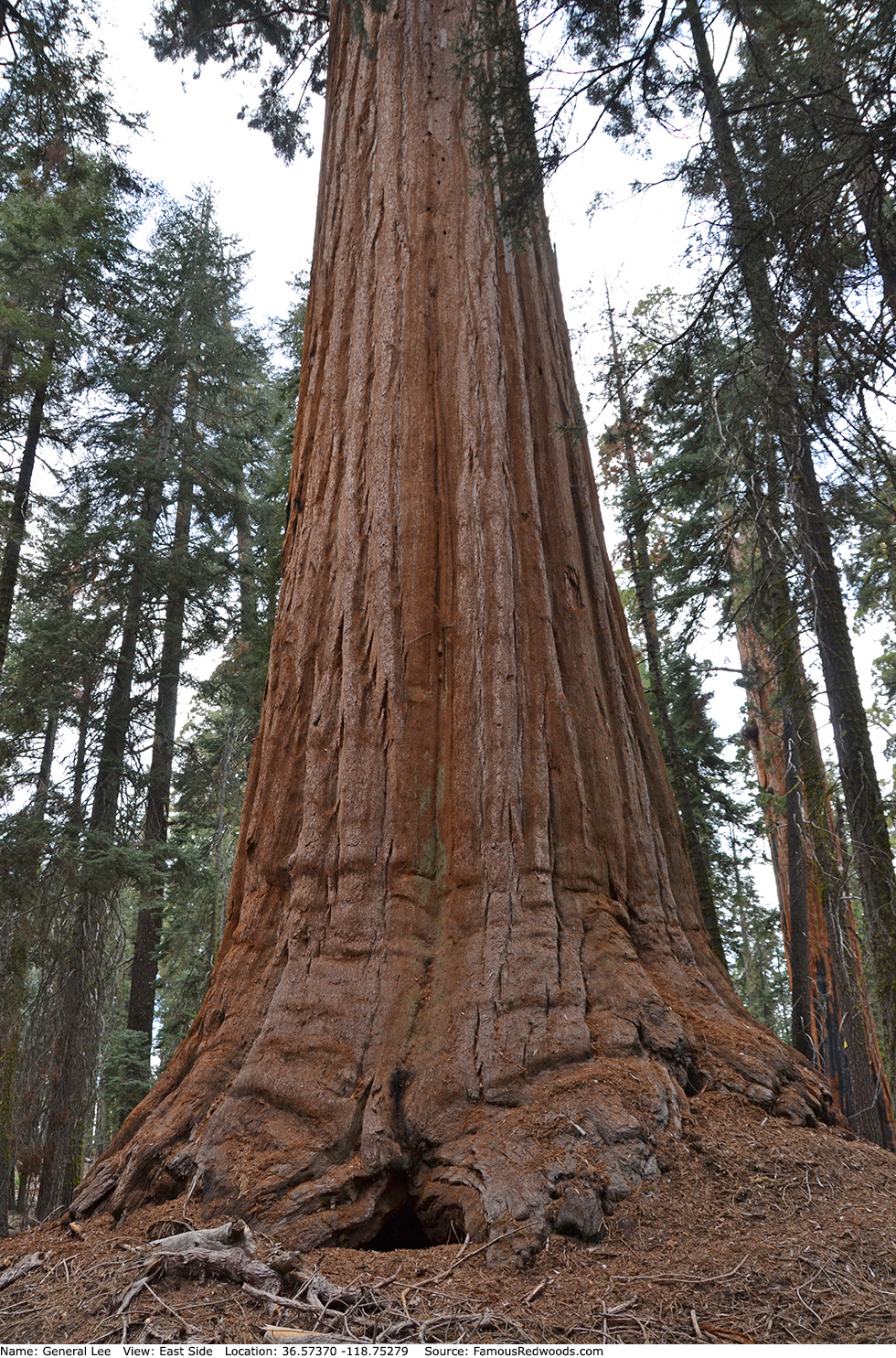
Photos: Pictures of General Lee Tree taken from different sides