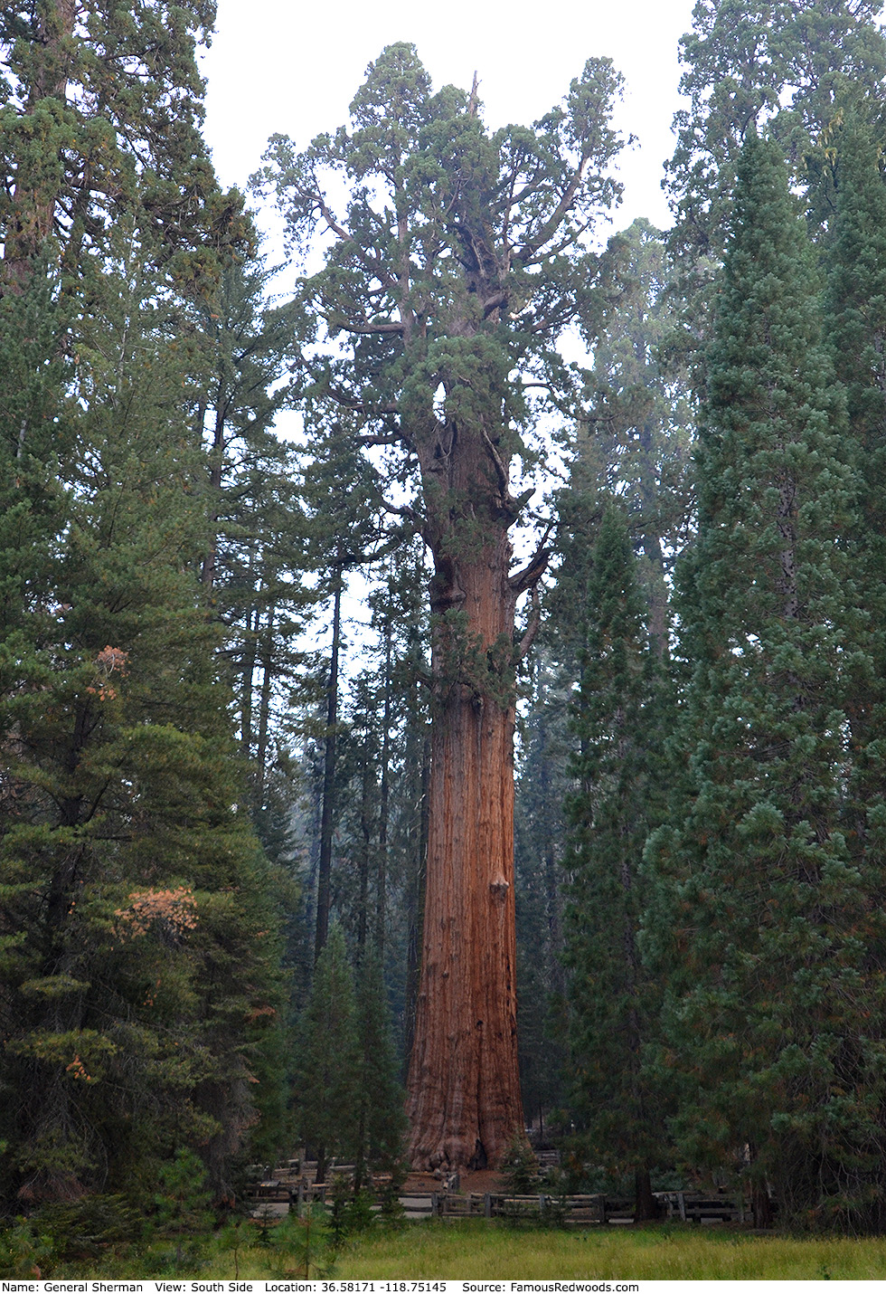
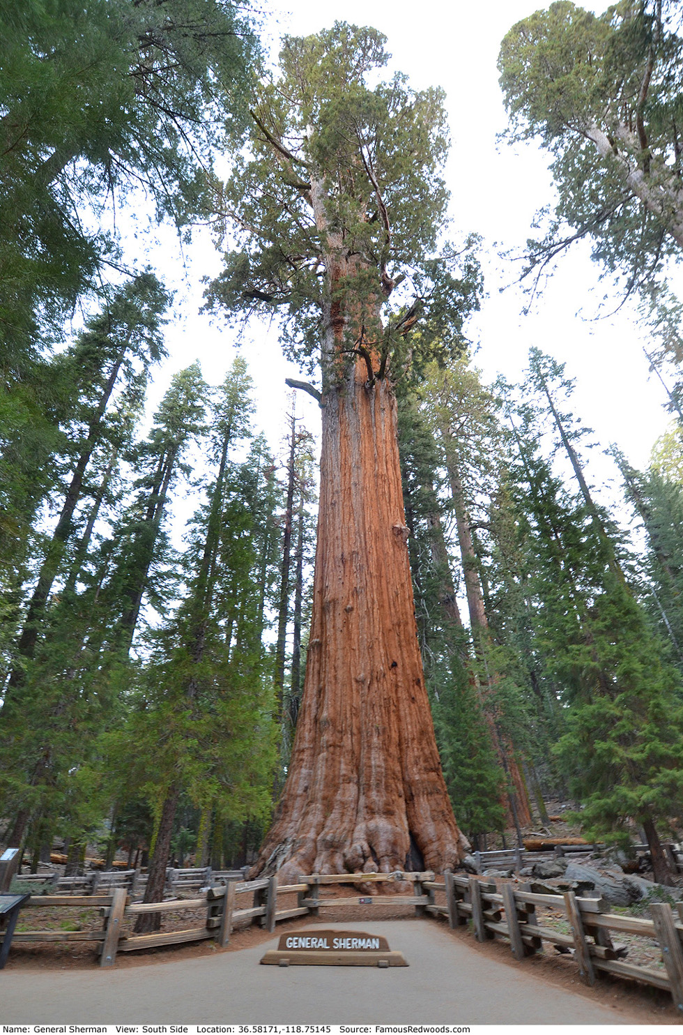
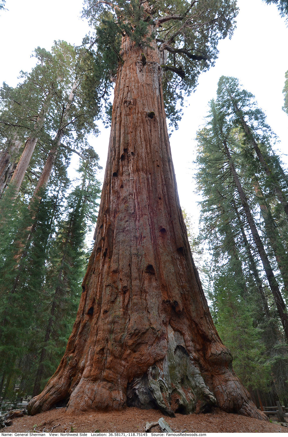
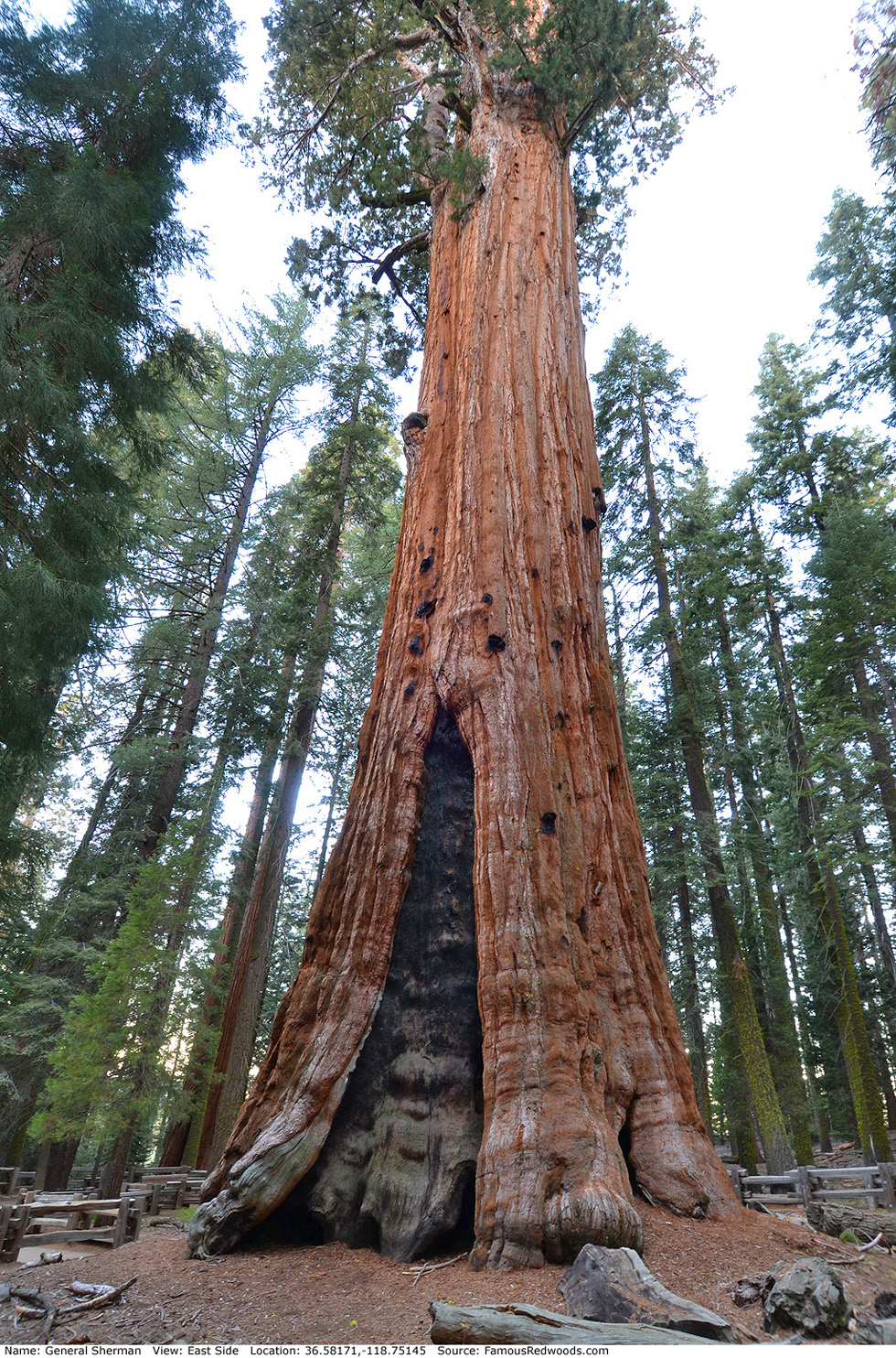
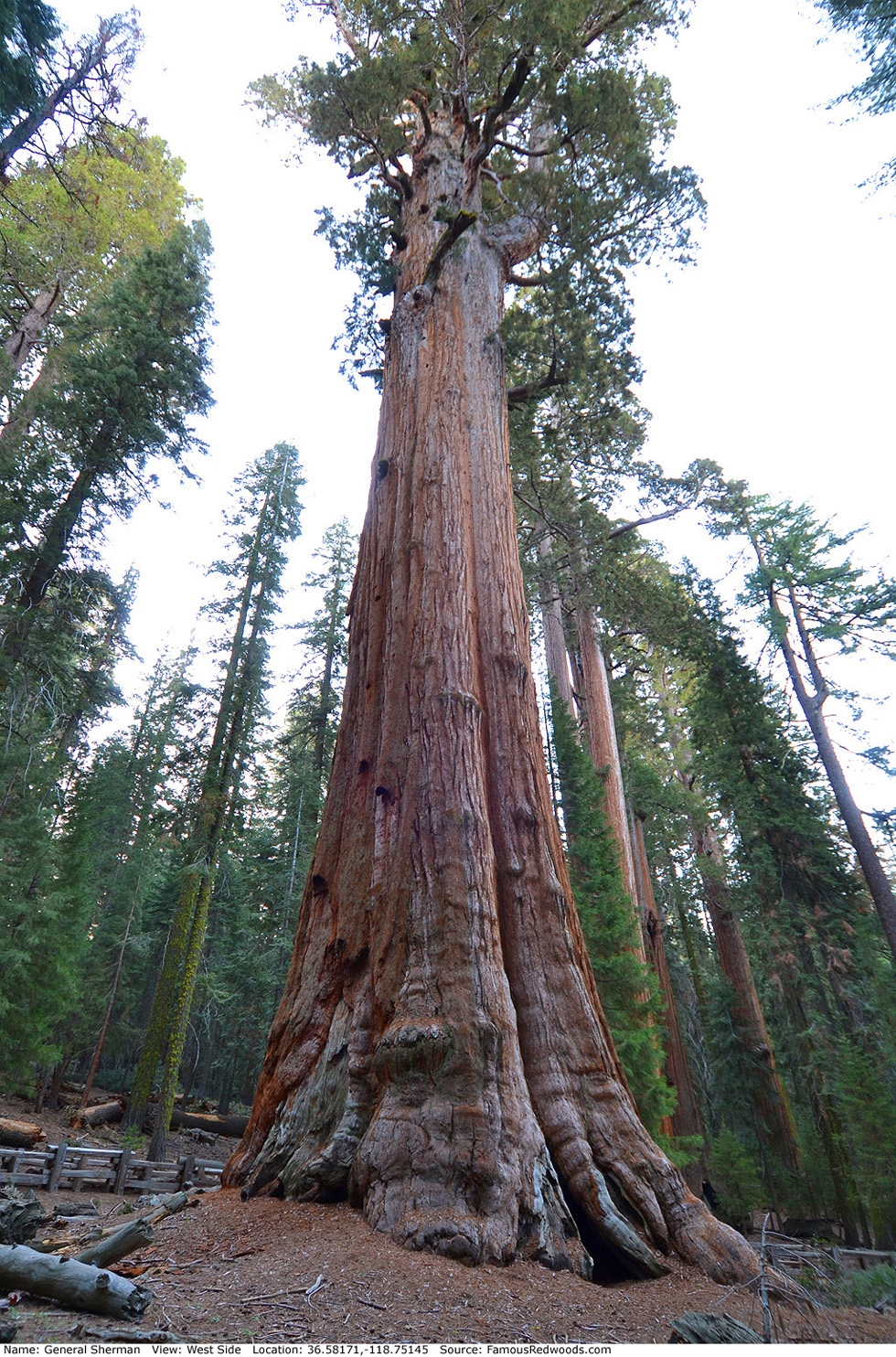
| Height: | 274.25+ ft | (83.59+ m) | Elevation: | 6,900 ft (2,103 m) | GPS Latitude: | 36.58171 |
| Volume: | 49,264 ft3 | (1,395 m3) | Creek: | Sherman Creek | GPS Longitude: | -118.75145 |
| Width: | 27.06 ft | (8.25 m) | Grove: | Giant Forest | Discovery Date: | August 7, 1879 |
| Age: | 3,117 y | Park: | Sequoia NP | Discovered By: | James Wolverton |
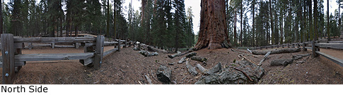
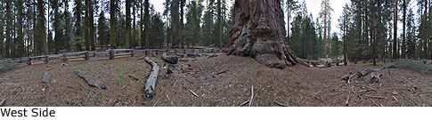
Notes: General Sherman, named to honor United States Union Army General William T. Sherman, is the largest of three trillion trees on Earth, the current national champion giant redwood (1325 points), and the 2nd oldest living redwood. It has more than two billion leaves (most of any tree yet measured) and seventy-four thousand cones and is the only known tree which has a trunk 20 ft (6 m) wide 35 ft (11 m) above ground.
General Sherman has held the title of world's largest tree since 1931 after a team of engineers, led by J. W. Jourdan of the San Joaquin Light and Power Corporation, measured the four then-largest-known redwoods (Boole, Hart, General Grant, and General Sherman) and determined that General Sherman was the true size champion.
The discovery and naming of General Sherman remain controversial. Potwisha indians led cattleman Hale Dixon Tharp to Giant Forest in September 1858. Naturalist
John Muir, who visited Tharp later, explored and named Giant Forest in 1875. Although both men may have seen General Sherman before 1879, neither claimed or received credit for its discovery. Most park sources
assert that cowboy James Wolverton, who worked for Tharp, discovered the tree on August 7, 1879 and named it after the Civil War general under whom he served. In 1885, they note, Charles F. Keller of the Kaweah
Cooperative Commonwealth, a socialist colony established along the North Fork of Kaweah River, renamed the giant redwood
Karl Marx Tree to honor the revolutionary socialist. The name then reverted to General
Sherman when the Kaweah Colony disbanded after Sequoia National Park was established on September 25, 1890. However, some suspect that Keller,
who also served under General Sherman, discovered and named the tree first, when guide Newton Tharp, Hale's son, led him to Giant Forest in September 1885, and that park officials renamed the tree afterward. The
United States Cavalry, which patrolled Sequoia National Park from 1891 to 1914, first referred to the tree as General Sherman and attached a
Gen. Sherman
sign to its trunk in 1897.
General Sherman was once known as Pin Cushion Tree when park visitors competed to determine who could pin a dart, thrown with his/her name attached, highest on the trunk.
General Sherman should not be confused with another General Sherman tree which grows in Mariposa Grove in Yosemite National Park.
Biologists Anthony R. Ambrose and Wendy L. Baxter documented the May 21, 2024 first climb of General Sherman. Videographer Tomáš Medek published an aerial flyover of General Sherman. University of Washington forestry affiliate assistant professor Robert Van Pelt published an orthographic illustration of General Sherman (shown at left).
The largest (General Sherman) and the tallest (Hyperion) trees on Earth grow 427 mi (687 km) apart, the largest giant redwood (General Sherman) and the largest coast redwood (Hail Storm) grow 460 mi (740 km) apart, and the largest (General Sherman) and the tallest (Near Sherman) giant redwoods grow 0.2 mi (0.3 km) apart.
Treefecta: The world's largest (General Sherman), tallest (Hyperion), and oldest (Methuselah) trees all grow in California.
General Sherman is directly in the path of the May 3, 2106 total solar eclipse.
Drive: General Sherman is 218 mi (351 km) southeast of San Francisco near Fresno.
Northbound: From U.S. Interstate 5 North, transfer to California State Route 99 North toward Bakersfield. Drive north 97 mi (156 km) on California State Route 99 and transfer to California State Route 198 East toward Visalia. Drive east 63 mi (101 km) on California State Route 198 (Generals Highway), past the Sequoia National Park entrance station (entrance fee required) and Four Guardsmen, and turn right onto Wolverton Road.
Southbound: From U.S. Interstate 5 South in Sacramento, transfer to U.S. Highway 50 East toward South Lake Tahoe. Drive east 1.7 mi (2.7 km) on U.S. Highway 50 and transfer to California State Highway 99 South. Near Fresno, transfer to California State Route 180 East. Drive east 56 mi (90 km) on California State Route 180, past the Kings Canyon National Park entrance station (entrance fee required), and turn right onto California State Route 198 West. Drive south 26 mi (42 km) on California State Route 198 (Generals Highway) and turn left onto Wolverton Road.
Drive east 0.6 mi (1.0 km) on Wolverton Road, turn right at a stop sign onto an unnamed road, and drive south 0.6 mi (1.0 km) to the Sherman Tree parking lot.
Shortcut: During summer (late May to early September) Sequoia Shuttle bus operations, park at the Sherman Tree parking lot and ride the free Sequoia Shuttle (Green Route 1 or Orange Route 4) from the parking lot to the General Sherman Tree Accessible Trail. Alternatively, park at a turnout, located at 36.57818 -118.75286, on the west side of California State Route 198 (Generals Highway) just south of General Sherman and walk north 0.2 mi (0.3 km) on the highway to the Sherman Tree Accessible Trail parking lot. This parking lot is available to all park visitors (including those without disability parking placards) during winter whenever the main Sherman Tree parking lot, off Wolverton Road, is closed.

Hike: From trailhead, hike south/downhill 0.5 mi (0.8 km) on Sherman Tree Trail, past the junction with Congress Trail, to General Sherman.
Shortcut: From the restrooms at the northern end of the Sherman Tree Accessible Trail parking lot, hike north 60 ft (18 m) on Sherman Tree Accessible Trail, turn right before the fallen log, and hike east another 80 ft (24 m). Veer right, hike east 70 ft (21 m), climb the stairway ahead, then turn left and hike northeast 70 ft (21 m) to the next trail junction. Veer left at the trail juction and hike northeast 200 ft (61 m) to the junction with Sherman Tree Trail. Turn left at the trail junction and hike northwest 210 ft (64 m) on Sherman Tree Trail to General Sherman.
| Rating: | Easy | One-Way Distance: | 0.5 mi | (0.8 km) | Ascent: | 83 ft | (25 m) |
| Time: | 15 min | Off-Trail: | 0 mi | (0 km) | Descent: | 301 ft | (92 m) |
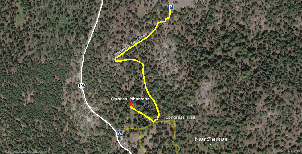
View General Sherman Tree location in Google Maps
Panoramas: Click panoramas to take a virtual tour of General Sherman Tree
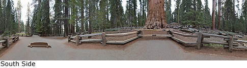
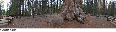
Photos: Pictures of General Sherman Tree taken from different sides