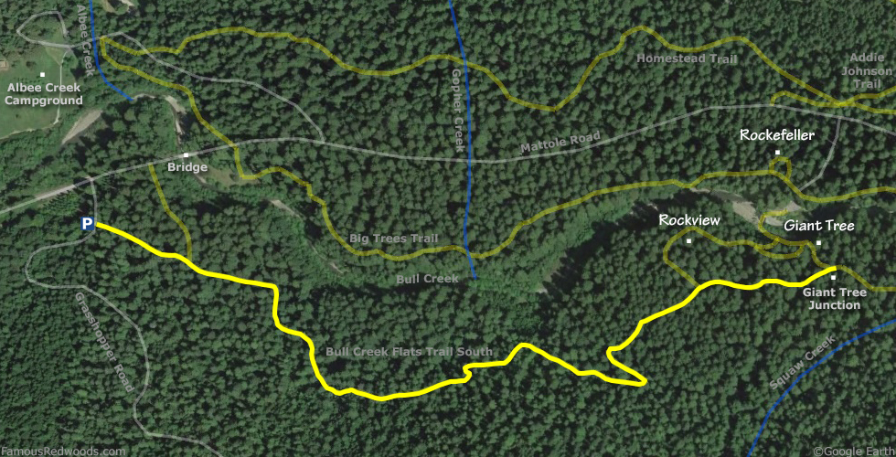
Notes: Use this alternate route to visit Randy Stoltmann whenever Bull Creek is impassable. If the seasonal footbridge over Bull Creek is installed or Bull Creek is low enough to wade across, use the 1.0 mi (1.6 km) shorter normal route to Randy Stoltmann from the Big Trees Day Use Area parking lot instead.
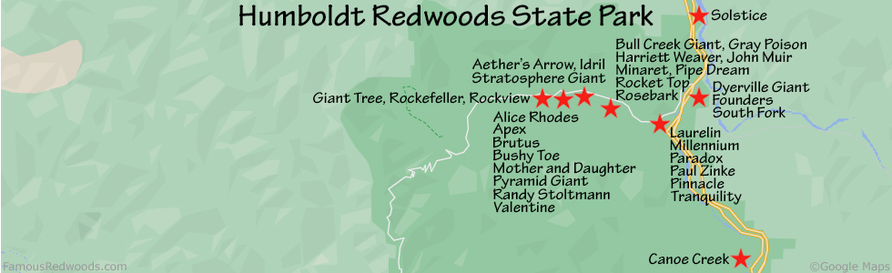
Drive: Randy Stoltmann is 196 mi (315 km) north of San Francisco near the community of Weott.
Northbound: From U.S. Highway 101 just north of Weott, take exit 663 South Fork Honeydew and turn left onto California State Route 254 (Avenue of the Giants). Drive north 0.2 mi (0.3 km) on California State Route 254 (Avenue of the Giants) and turn left, under the bridge, onto Mattole Road.
Southbound: From U.S. Highway 101 just north of Weott, take exit 663 South Fork Honeydew and turn right onto Mattole Road.
Drive west 5.2 mi (8.4 km) on Mattole Road to the bridge which crosses Bull Creek. 500 ft (152 m) past the bridge, near a small sign that reads
Fire Lookout,
turn left onto an unmarked road (also known as Grasshopper Road and Grasshopper Multi Use Trail). Drive south 250 ft (76 m)
on the unmarked road and park in a pullout on the right. The unmarked Bull Creek Flats Trail South trailhead is on your left.
Hike: GPS-assisted navigation is recommended for this hike. From the trailhead, hike east 1.2 mi (1.9 km) on Bull Creek Flats Trail South to Giant Tree Junction. Continue hiking east along Bull Creek Flats Trail South, following the normal route, from Giant Tree Junction to Randy Stoltmann.
| Rating: | Easy | One-Way Distance: | 1.6 mi | (2.6 km) | Ascent: | 200 ft | (61 m) |
| Time: | 1 hr | Off-Trail: | 0.1 mi | (0.2 km) | Descent: | 280 ft | (85 m) |
View Randy Stoltmann Tree location in Google Maps